Super Outbreak April 25-27, 2011
With 362 tornadoes over 3 days, the April 25-27, 2011 period is the largest tornado outbreak on record. 218 of those happened on the 27th alone, which holds the single day tornado record. The vast majority of the deaths occurred on the 27th, a staggering 317(of the 324 total), the most since the 1925 tri-state tornado.
This page is really just a small collection of satellite, radar and storm prediction center products from the 27th. Above is a Google Earth fly-through of the Tuscaloosa-Birmingham Alabama tornado track. Just one of the many tornadoes that were very very long-tracked. Over the 3 day period, there was some 3200 miles of tornado paths. The tornadoes were often moving 50-60 mph.
3 Day Tornado Reports - April 25-27, 2011
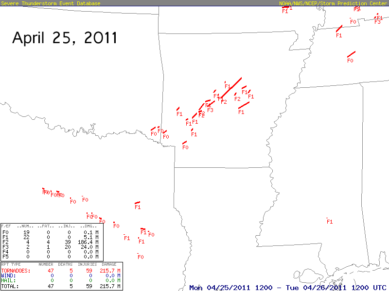
For reference here are the 3 days of tornado tracks. You can see just how much went on the two days prior, with several long tracked tornadoes.
April 27, 2011 - Storm Prediction Center Outlooks
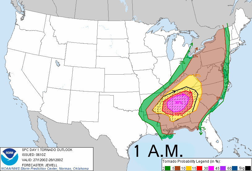
Text: 1 a.m. 8 a.m. 11:30 a.m. 3 p.m.
Here are the 4 daytime tornado probabilities issued from the SPC. The percentages are odds of a tornado within 25 miles of a point. The dashed/hatched area is outlooking the more likely regions any strong tornadoes would be. Seeing them issue 30% areas for tornadoes is pretty uncommon. 45% is very rare. I can't say I've ever seen a 60%. Remembering any 45% is difficult.
This was a very synoptically evident event. No one would know just how big, but it was obvious days in advance something big was likely.
Significant Tornado Parameter

The significant tornado parameter readily points out the most favored area, using a combination of shear, instability and lcl height. You had cool air aloft coming in on strong westerly winds, overriding a very moist low level fetch off the gulf with strong southerly flow. The combination was high enough its over the max the spc uses on their mesoanalysis graphic for it, which maxes out at 12.
Storms firing right on a cold front with such a setup may not be that prolific at producing tornadoes. But you get storms initiating off boundaries out ahead of it, in that sort of environment and it spells trouble. Everything that was forming out ahead was really just violent from birth and stayed that way in some cases crossing entire states as individual long lived supercells.
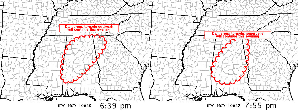
PDS(Particularly Dangerous Situation) Tornado Watches
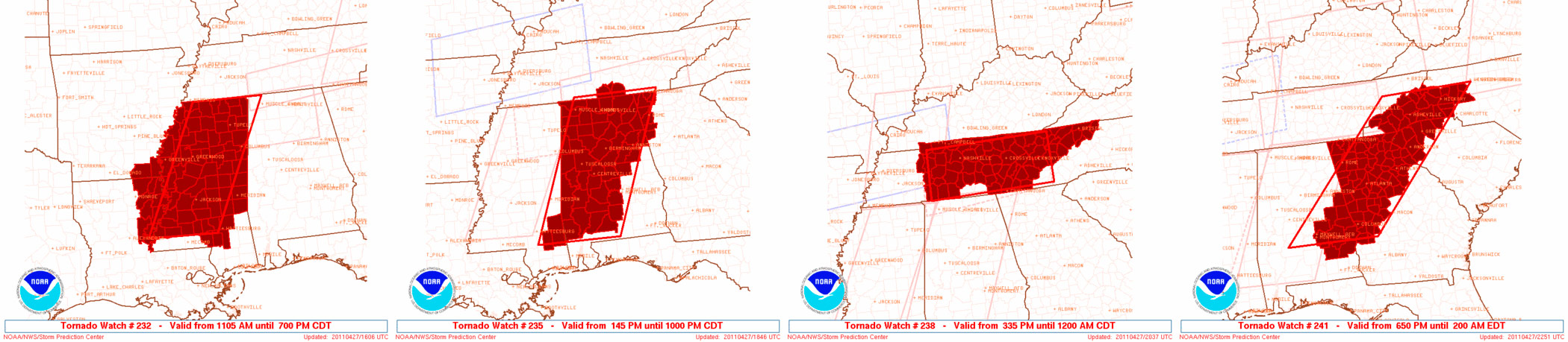
Sometimes conditions are so volatile the SPC issues PDS or Particularly Dangerous Situation highlighted tornado watches. There were 4 of them this day.
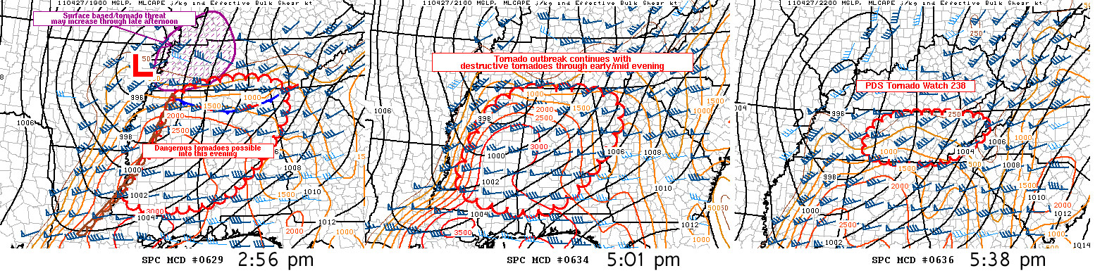
Storm Prediction Center - Pre-PDS Watch Mesoscale Discussions

Pre-PDS Watch MD Text: MD1 MD2 MD3
Here are 3 mesoscale discussions issued before watch issuance, discussing the situation for the soon to follow PDS watches.
Storm Prediction Center PDS Watch Mesoscale Discussions
Here are 3 MDs associated with their now ongoing PDS watches.
Storm Prediction Center PDS Watch Mesoscale Discussions
Even more mesoscale discussions about the ongoing situation. There were a lot of other MDs being issued for other watches that weren't PDS tornado watches.
3 Days Of Tornado Watches
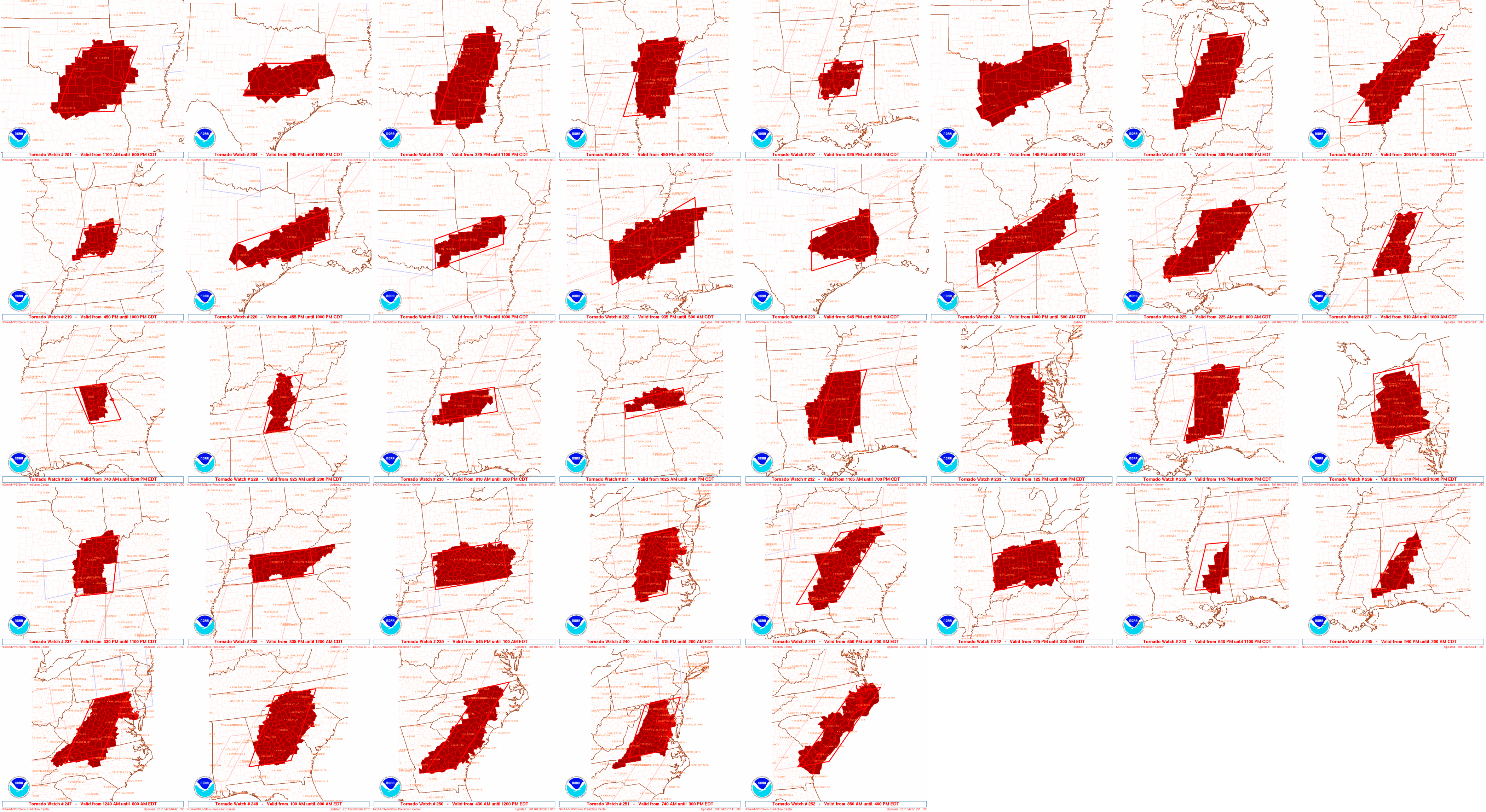
This should give a decent idea of the extent of the 3 day outbreak. These are the tornado watches issued in just those 3 days.
Wide View Satellite
Here is the upper low responsible for the severe weather on the 27th. You can also see some large fires in southern Texas and northern Mexico towards the end. Any of these video loops can be viewed full screen using the icon in the lower right on them.
Close In Satellite
Looking closer in, you can really see the general west to east flow aloft steering things and the southerly low level flow of moisture below it to the east of the front. The western edge of the cumulus forming is marking the cold front. As you can see, there is a lot of convective activity ahead of it. It's a lot more clear on radar. It's largely those storms out ahead of the cold front that are producing the long tracked tornadoes.
Radar
Here is a large radar from the event that covers most of it. It was somewhat of a task to make, given it is using several individual radars and masking them all into this one. The NWS radar site from Columbus Air Force base MS was not super res like the others. It only had lower res recombined radar. It's the one for the upper left area. The Huntsville radar goes down around 5pm, in the upper right area.
It's sort of hard to even comprehend what all is happening, because so much of it is happening at the same time from several storms. I tried to break down some of the storms below.
Supercell and Significant Tornado Tracks
Using the tornado tracks for just EF3 and above here to show the longer tracked supercells with less track clutter. Each time the radar image changes, it is an entirely different storm showing that storm at several points along its path, laid on top of the tracks.


