Moore Oklahoma Tornado - May 20, 2013
The Moore Oklahoma tornado of 2013 was an EF5 which took the lives of 24 people and became the 3rd costliest US tornado at $2 billion. Much like the Joplin tornado, this formed from a brand new storm that had just popped up, doing so right on the city's edge. It was also roughly a mile wide, with a 6 block or so wide main damage path width. Like many tornadoes it started out clearly visible but became rain-wrapped through its later stages.
The tornado didn't move that quickly across town and was on the ground for a lengthy period of time. The weather service says around 40 minutes, but it seems closer to 50 minutes to me. At least by overlaying the damage path with the radar. That is such a long time to spend crossing a city. A point of reference on time could be using the 30 minute evening news. Imagine something on the ground in a city that whole time and then some. This one however was in the mid-afternoon, in the 3pm timeframe.
In Moore basements are truly rare. In Oklahoma severe weather coverage is probably as good as it gets though. As soon as the tornado watch was issued, several stations go wall to wall coverage. It sounds like many people simply left and drove out of the path. Some even drove home to grab family and take them out of the path.
Before And After
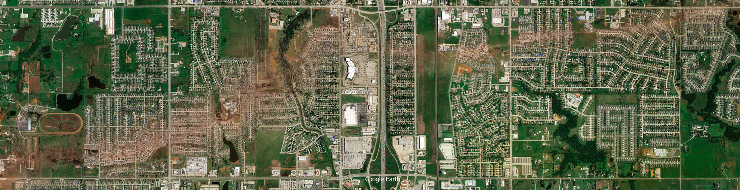
Here is a large before and after image made draggable with a toggle button. The dragging option may not kick in till both images have fully loaded.
Moore Area History
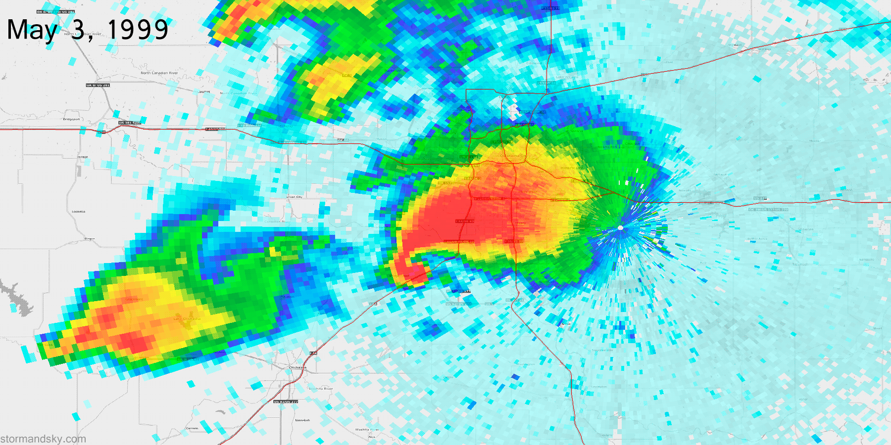
That area around Moore is probably the most frequently visited significant tornado region in the US, at least recently anyway. Here are just a few. The May 3, 1999 Moore F5. Then the May 8, 2003 F4. The very next night, May 9, 2003 a supercell tracks across northern Oklahoma City producing several tornadoes, including an F3. May 10, 2010 an EF4 starts in south Moore. May 24, 2011 there's an EF5 that skims northwest Oklahoma City and then there's a pair of EF4 producing storms to the south, one of which ends its track towards southwest Moore. May 19, 2013, the night before this Moore tornado, an EF4 starts just outside of Moore and moves northeast. Then May 20, 2013, this EF5 happens. May 6, 2015 a supercell produces an EF3 tornado that ends just before entering Moore. A few hours later another EF3 happens in southeast Oklahoma City. Then there's the whole fact the El Reno EF5 happened less than 2 weeks after this Moore tornado, just west of town.
Storm Prediction Center Outlooks
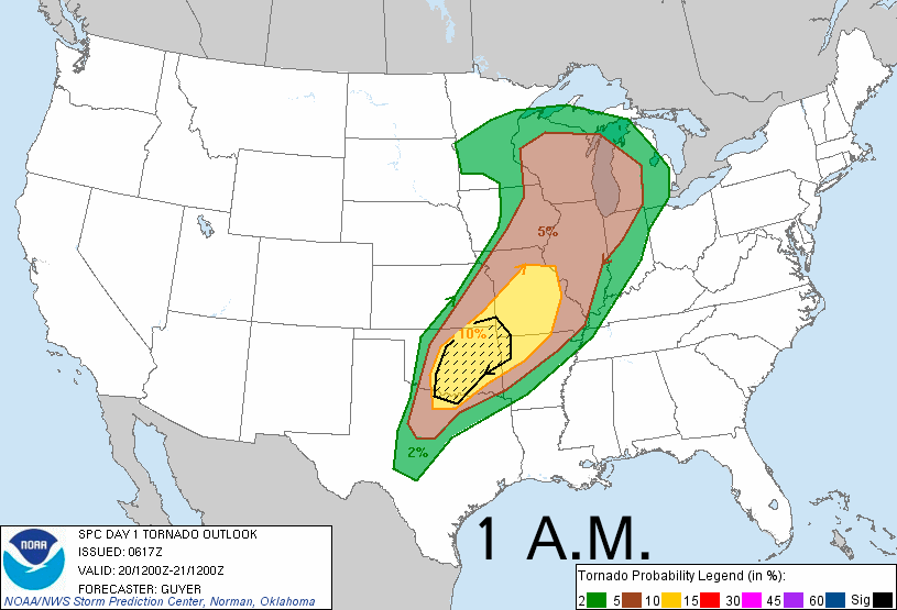
Text: 1 a.m. 8 a.m. 11:30 a.m. 3 p.m.
Here are the 4 daytime tornado probabilities issued from the SPC. The percentages are odds of a tornado within 25 miles of a point. The dashed/hatched area is outlooking the more likely regions any strong tornadoes would be.
Tornado Reports
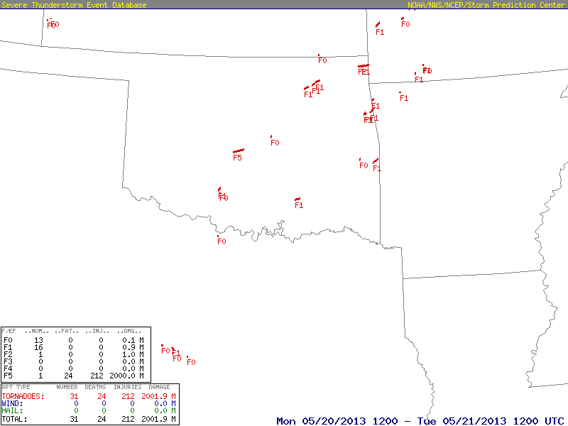
Here are the tornado tracks and ratings from the event. They line up quite well with the 10% area from the SPC.
Storm Prediction Center Tornado Watch - 1:10 p.m.
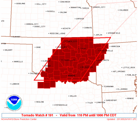
Text: Tornado Watch
A rather early tornado watch gets issued at 1:10 pm, noting expected storm development and tornado chances ramping up towards early evening. In only an hour and a half the Moore tornado would be forming.
Storm Prediction Center Mesoscale Discussions
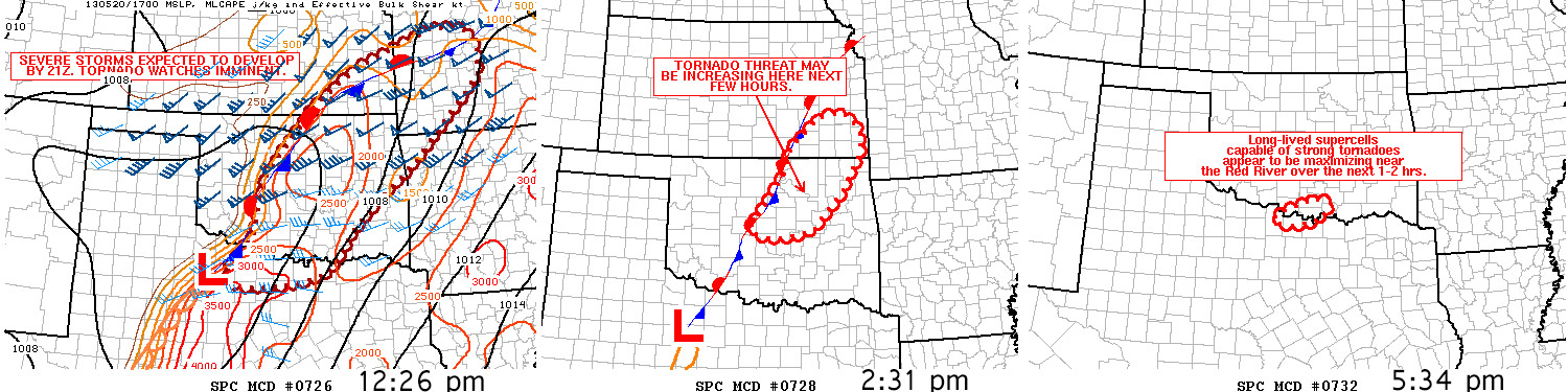
Here are 3 MDs associated with this area, one before the tornado watch, another after but before the tornado and then a 3rd for the south threat.
Satellite
Here is the upper low responsible for the severe weather this day. Might be hard to see on this wider view, but you can make out the stalling front in southeast Kansas stretching down into central Oklahoma and then the dry line arcing south from it in southern Oklahoma into Texas. This storm forms very near the intersection of that dry line and the stalling front. Typically a surface low is forming in this area and it ends up a fairly favored location with attempts at backing surface winds northeast of that surface low.
Close In Satellite
Looking close you can see how to the southwest of that red arrow just a bit, the orientation to the boundaries change. The more north south section being the dry line, with the stalling front to the northeast of it. The arrow then points at the Moore storm as it pops up and quickly turns right.
Significant Tornado Parameter
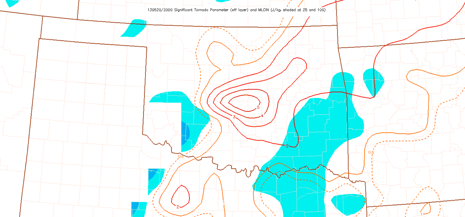
Another case where the significant tornado parameter readily points out the most favored area using a combination of shear, instability and lcl height.
Radar
This radar loop shows the two boundaries really well. The stalling boundary stretching northeast-southwest, intersecting the dry line lined up more north-south. Like Joplin but with less stuff around it at the time, that is extremely rapid violent formation. In no time it forms, turns right and produces a violent tornado. Storms do this often enough, just usually not also on cities.
Close In Radar
At 2:40, roughly the beginning of this loop, the tornado forms and a tornado warning is issued. At 3:01 pm a tornado emergency warning is issued for Moore.
I overlaid the damage track with the radar, then took the times right off the radar, to get the time after forming as it progresses across town. I really believe everyone that has a smart phone should have a good radar app on it. With just a few frames in one should be able to get a decent heading on this hook to avoid it if they are out and about.
Typically as a tornado first forms it is the most visible. Then quite often it progressively gets wrapped in rain. So while being near the start of it, radar might not be timely enough, at least very often the tornado is still quite visible then. That was the case with this one.


