May 12, 2022 Rising City Nebraska Extreme Haboob

So this was something else. I'd never seen a legit Haboob before. Well, close a few times, but this ended up next level. Mostly just various intense squalls with fair amounts of dust. This was just a big time Haboob.
I don't remember much expectation. I do remember it being quite hot and dry the days before. Near 100 if I remember right. Also the fields being recently tilled up. This mix, combined with fairly strong winds lead to this rare central plains event. It's been a couple decades since anything close in the area. And that time I don't remember hearing about widespread DARKNESS inside it.
At the same time as this one, another was going on ne into SD, doing the same thing there. I had chased the beginnings of that one closer to Norfolk NE before letting it go and dropping south for this. This started in far south central NE, going right over Hastings radar. It had rather high velocities showing and I just hurried to get into the middle of it. The base was silly high and no real tornado risk involved.
As I drove back west on highway 92 to try to get into its apex. I did not think there was any dust. It looked like really crappy rain. An almost invisible base and just a wall of what I thought was rain.
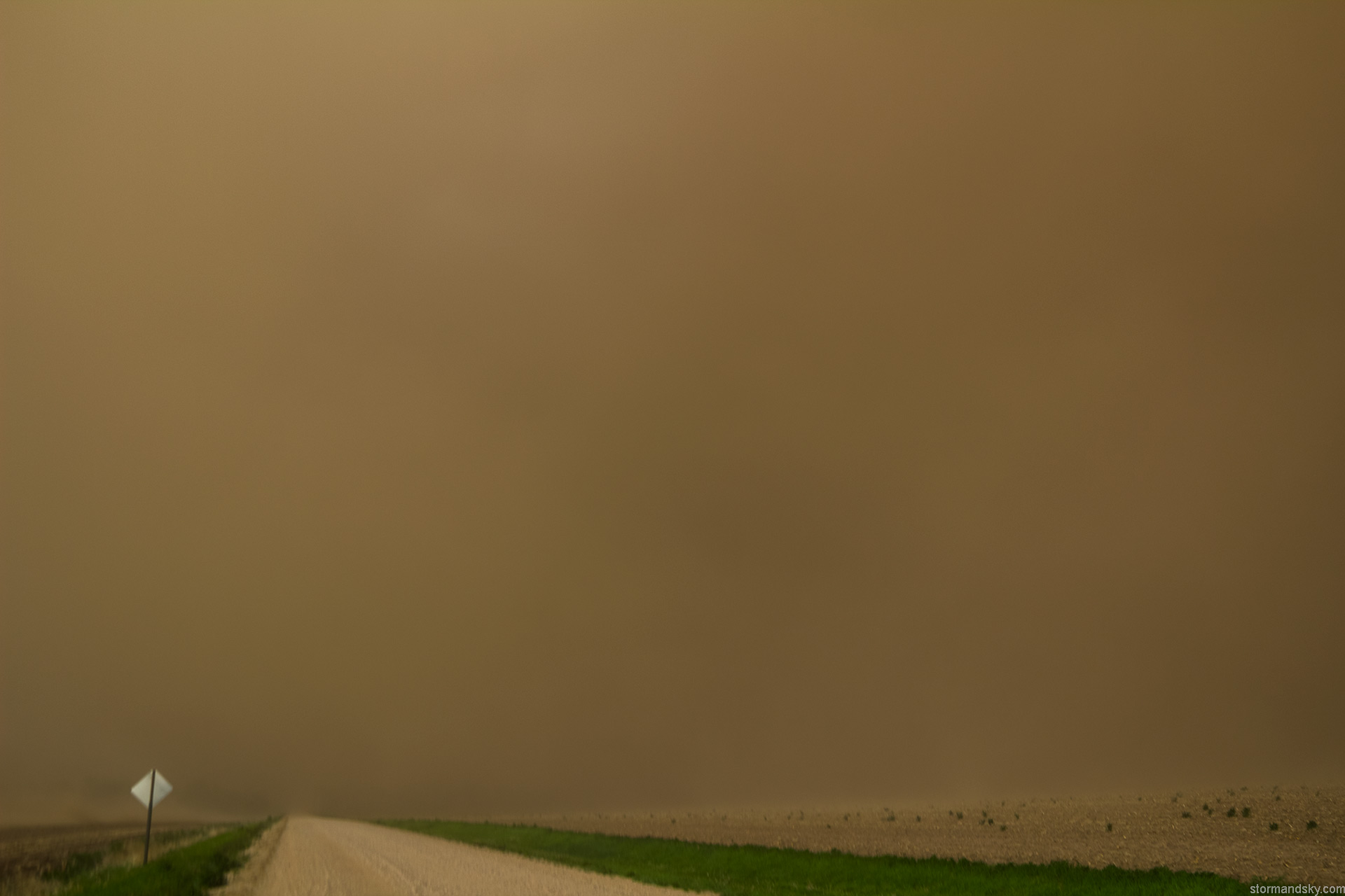
At Rising City I turned north onto a gravel road to pull over and watch it approach. It was not far away at all. I wanted another mile or so west, but it was simply too close now to even do that. There was like 3-4 minutes after pulling over till it hit. And even so, as I initially stopped, I just thought it was a weak rain shaft that would have wind with it. But after like 1 minute I was like, that's not rain, it's a wall of dust. Still figured thin. Then another minute it was just like, oh boy it's a massive wall of thick dust.
Look at this first picture at the very top of the dirt. There was barely a damn base with this convection. As utterly not impressive of a storm base as you get if you take away the dirt. Meanwhile the most insanely deep thick wall of dirt was with this. I still at this time would have no idea just how DARK it was about to get.

First picture the road runs due south. This one is looking more to the southwest. When I pulled over I did not think anything visually interesting was going to happen. So I wasn't ready or even getting ready to shoot. And in a couple minutes it would be completely dark. But right now at this stage, I had a gimbaled video camera in one hand and my still cam going in the other.

Look at this picture and realize only about 40 seconds passes between it and the very brown one a few down.

A couple pano shots. So if you watch the included YouTube video down the page, the still frames for these panos was happening while that video was being recorded with the other hand lol.

Just enough time to get another sequence of stills for a pano.

Having never seen it go completely dark like it's about to, such a thing was still not in my mind. I thought maybe it was about to get extremely windy but darker than night was not entering my thoughts. Night has city lights off clouds or stars in the lack of clouds scenario....this would get darker than either. All with sunset being a couple hours away yet.
Now would have been a great time to remember I did have masks in the back of my car.

Looking north as the wave of dirt overtakes me from the southwest.

Looking east same time. Shortly before hopping back in the car. Still had no idea it was going to get so much worse. I mean I've been to this stage a few times.

Say what! It wasn't scary at all. It was rather amazing. It's very much daytime. It wasn't even raining yet. Think of the level and height of dirt moving over you to block out all the light. It wasn't like it was zero visibility though. It was just dark. So that says much about the height of the dirt. The winds were like 60mph. It had to be mostly that it had been so dry and recently tilled. Plus it was hot. So what got tilled up rapidly dried out too. I've chased 24 years at this point and had yet to come across this here.

This is 30 seconds of time. Most of the sudden darkness going down in 10 seconds.

Right under the red arrow on the reflectivity on the left you can see a fine line that marks the gust front/outflow leading the storm. The wall of dust starting with that. But then note the gap before rain. All just dust in that gap. The base radar scan in the software shows it's about 3700 feet there. So kind of assuming the dust wasn't extending up quite that high, as I kind think it'd be picked up then. Unsure though.

Yeah after a few minutes and still before much rain, it lightened up and it doesn't look exactly that tall.

The one thing I wish I had considered as I shot video with my windows down the whole time. I was breathing in a ton of field dirt with who knows what with it. Chest felt screwed up for the rest of the night and into the next day a bit.
Video of the event is a lot more telling than the stills probably.


