June 16, 2017 Meadow Grove Nebraska Supercell Plus Mammatus Over Omaha
So it's been awhile sicne I've had a chase account. This has been the slowest year I remember. 2 days in TX that had single storm big tornado producers, a high risk in Oklahoma that didn't produce much, then a decent day in the NE panhandle I should have chased. Ain't chased much and yet still don't have any massive regrets.
I was up on this storm near Neligh as it got going. I set up a time lapse in some grass off a gravel road, a narrow one. In a damn rural area. No one had been around at all. A truck pulling a trailer turns off the highway. I get in my car and pull it off the gravel completely, so they'd have all the room in the world. This before they are even getting to me. There was gravel, a sharp dirt slope, then grass. I watch as they not only drive down the dirt but into the grass, on the side my tripod was set up full extended. I start flailing my arms from the car seat, to no avail. They just missed it with the vehicle but the trailer nails it. Tripod and lens end up broken. Great start lol. A couple days later I end up fixing the lens at least. Thankfully, as it's really my only good lens now.
As far as this chase was concerned, I was now down to a scratched 14mm lens. I was like, welp I guess my strategy now is to just get really close all day. Left right away and drove closer to it, as it was now getting more interesting anyway.
I have views and get right by it during that first tornado report there north of Meadow Grove, northwest of Norfolk. The first image will start there. I then get ahead of it again near Madison, where at least something one could barely call a tornado goes down and is reported there. I have a feeling the most legit tornado took place northeast of Norfolk. Just has that look. All of this and later stuff going down in a severe watch. It's the 8th or maybe 9th time in the last year there have been tornadoes near Omaha in severe watches. This stat is weird to me. Yeah they happen but it's really frequent. Oh and I have severe warnings turned off for this video, just to declutter it some while still having the tornado warnings.

Went north of Tilden for a second before realizing jumping further east made the most sense.
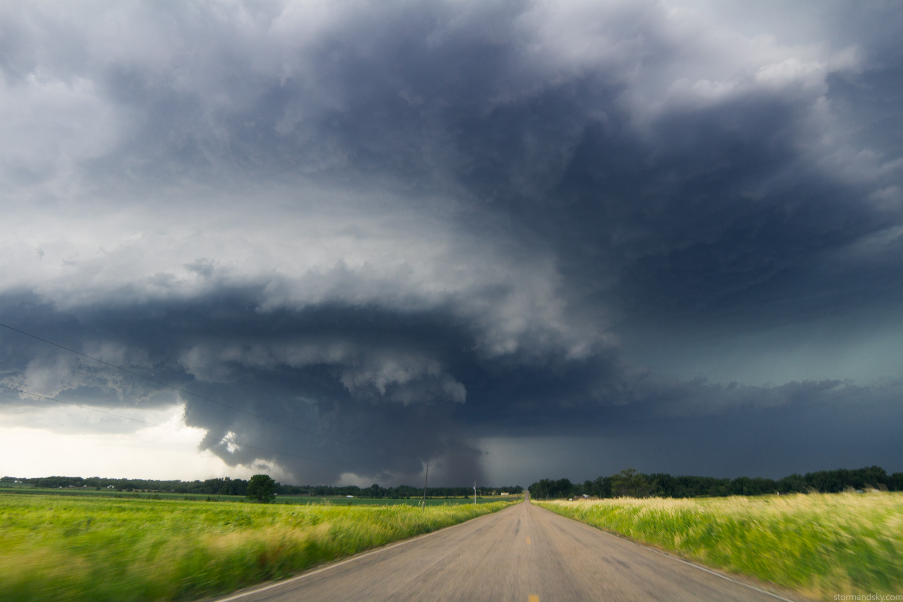
Going north of Meadow Grove now. Looks like a tornado under there but from closer inspection it was just a rather lazy lowered area. Those happen a lot. Think that was the second report.
It sure seemed like it was going to torando in there. Had the perfect structure to do so. But it just wasn't getting it done.
The rfd was pretty energetic now.
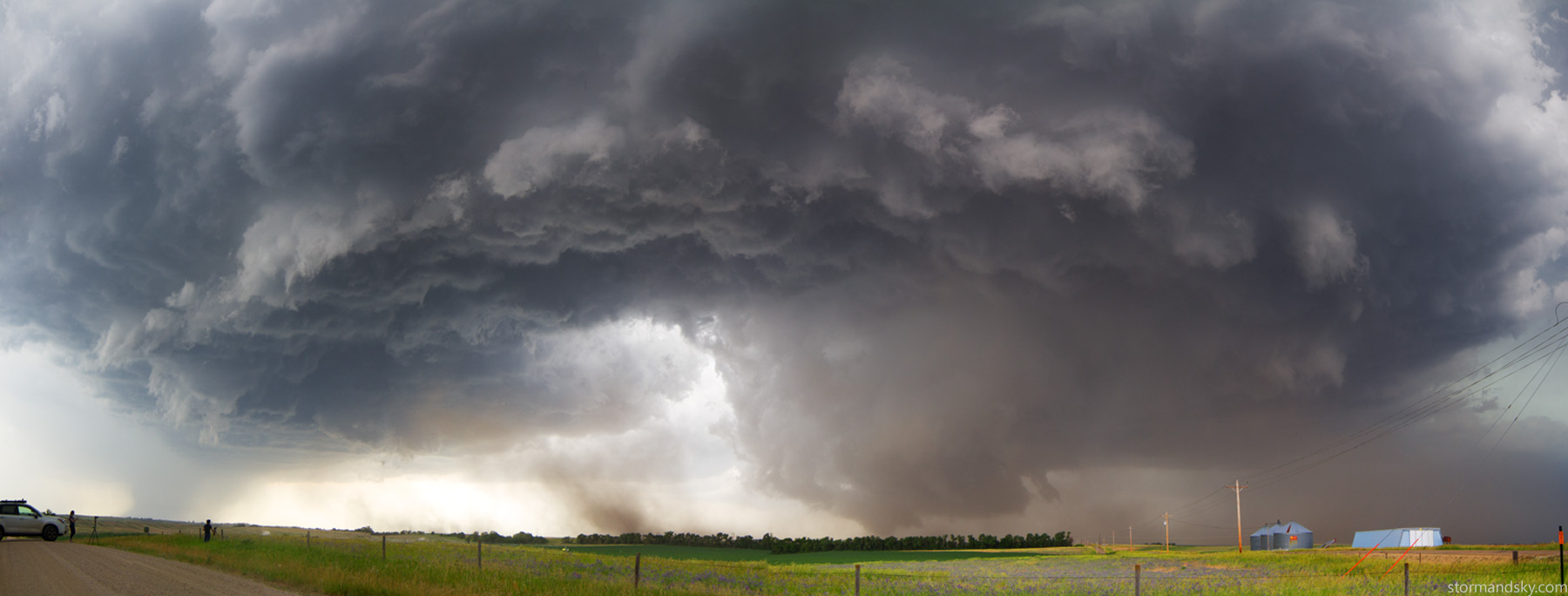
I moved south and east through Madison then south again. I watch it try to spin up there. The structure was nice and the lightning going on now was sort of nuts.
Short time lapse through this portion. A weak tornado did happen in there just left of the road towards the end as seen by some other chasers. Wasn't much or for long.
It was getting nuts how packed 3 storms were and staying supercellular as long as they were. That would continue even on through Omaha really.
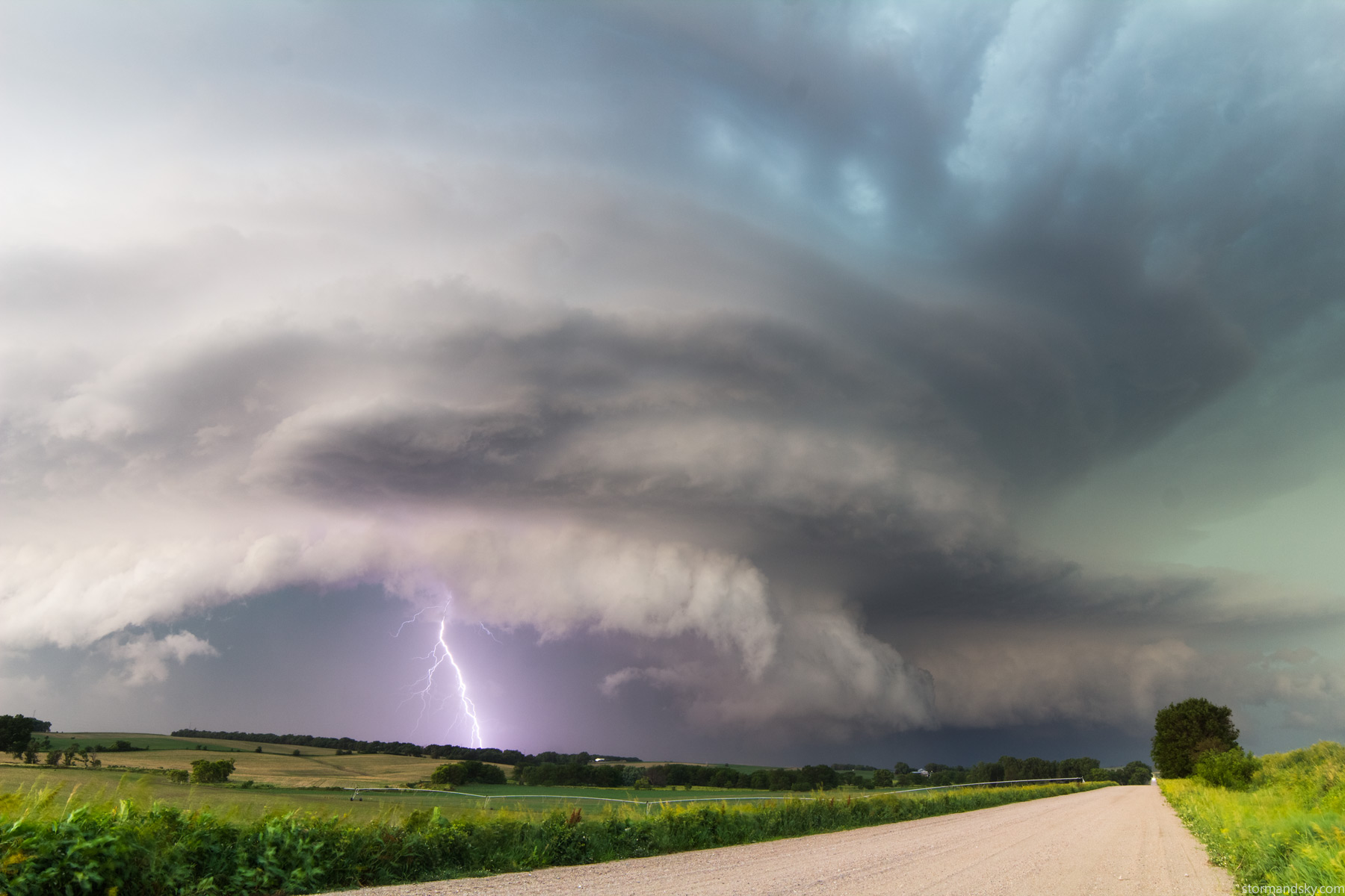
I had a feeling mammatus would put on a show. After barely getting through some wind damaged areas I reached this old school house west of town and set up another time lapse. I wished my lens hadn't been busted right now and after dark, as I bet this continued lit up by Omaha for a long time. But F2.8 on my crop sensor wasn't really cutting it like the F1.4 would. I eventually fix that lens by just squeezing real hard. Suddenly the joint that had bent out and seperated on one side snapped back flat. And it seems fine.

This radar is just before I shot the mammatus. It's basically where the really high winds kicked off. There are a few things to note. Look how big the yellow severe warning box is. But look at the velocity image on the right. It's really a much smaller area one should be concerned with winds. The storm was still rather supercellular. Look at the hook circled on the left. The high winds focused on the back side of the hook and are rather weak elsewhere. The initial warning was for 60mph. The radar started showing over 100mph in there and at this distance that is only 1000 feet off the ground. At one point in there there was a bin showing 129 knots next to one showing 136 knots at about 1100 feet. That's over 150mph. Who knows how legit those are, but there was a widespread area of 100 knots. The warning got bumped up to 70mph there.
I'm sure on this surge it was at its max right in there. Part of that swept out and the Valley office at the radar circle on there recorded an 88mph gust. It seemed quite likely winds were over 100 before that.
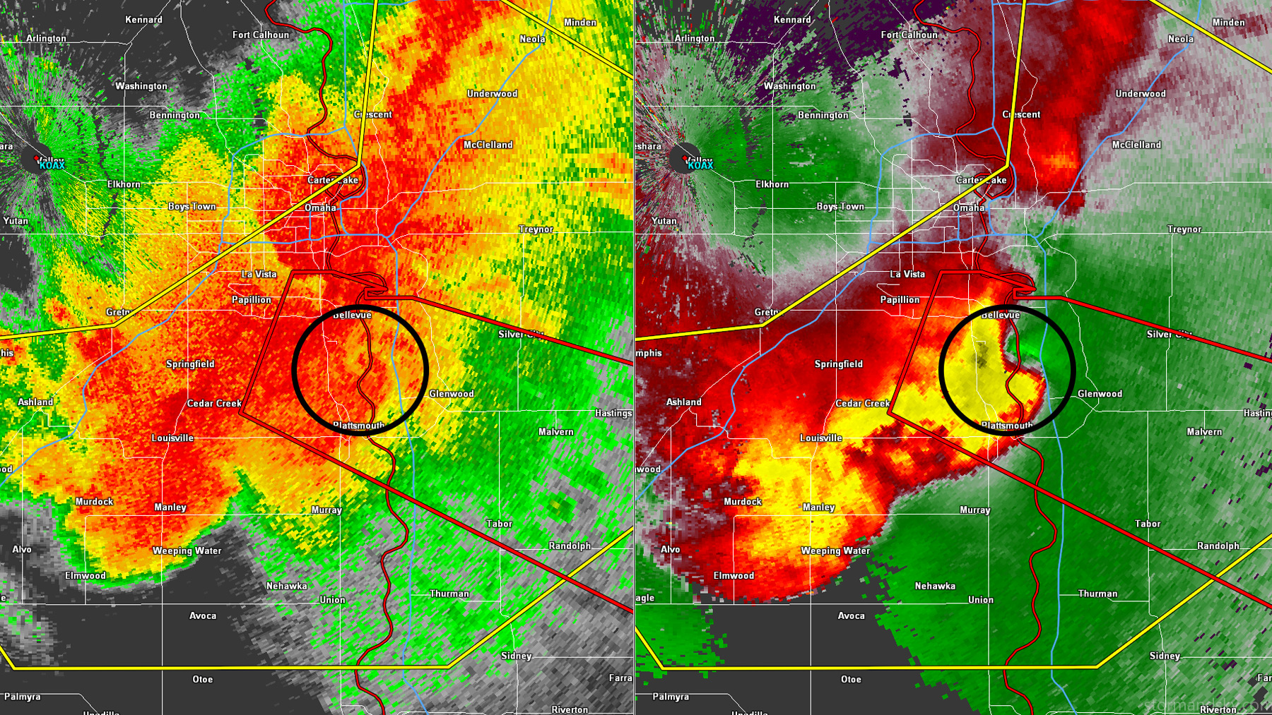
Then came that part that moved through south Omaha and Bellevue. Look another hook formed there, getting a tornado warning this time. Also the strongest winds on the back side of that hook. Readings got as high as 121 knots but a bit higher above the ground now around 1800 feet. This time on the right side of the hook there's even some inbounds. An EF2 tornado was found there by NWS damage survey.


