August 9, 2014 Arnold Nebraska Supercell
This chase day only looked so-so. Mid and upper-levels were on the weak side, but at least the surface winds were backed along an outflow boundary/warm front. The uppers were also wsw and the boundary would likely guide a storm southeast. Some supercell structure seemed likely. I did not want to drive way out west again though. I went earlier in the weak for garbage. This looked to be north of North Platte or west yet and fairly early, around 2 was the thought. That all went down rather well. I got to Thedford to towers initiating just west of town around 2.
Once I was west of Taylor the data was highly sparse. There was a little at Dunning, then not much till Thedford and what was at Thedford wasn't very solid, due to the large sandhills. I had no data at the gas station there. Finally figured out to go up the hill north towards Valentine. 4 bars like a mile up there. Sat up there and watched the anvil blow off the storm of the day. Thought I was pretty set. There were a couple small blips to the south too, which I hoped would not do much.
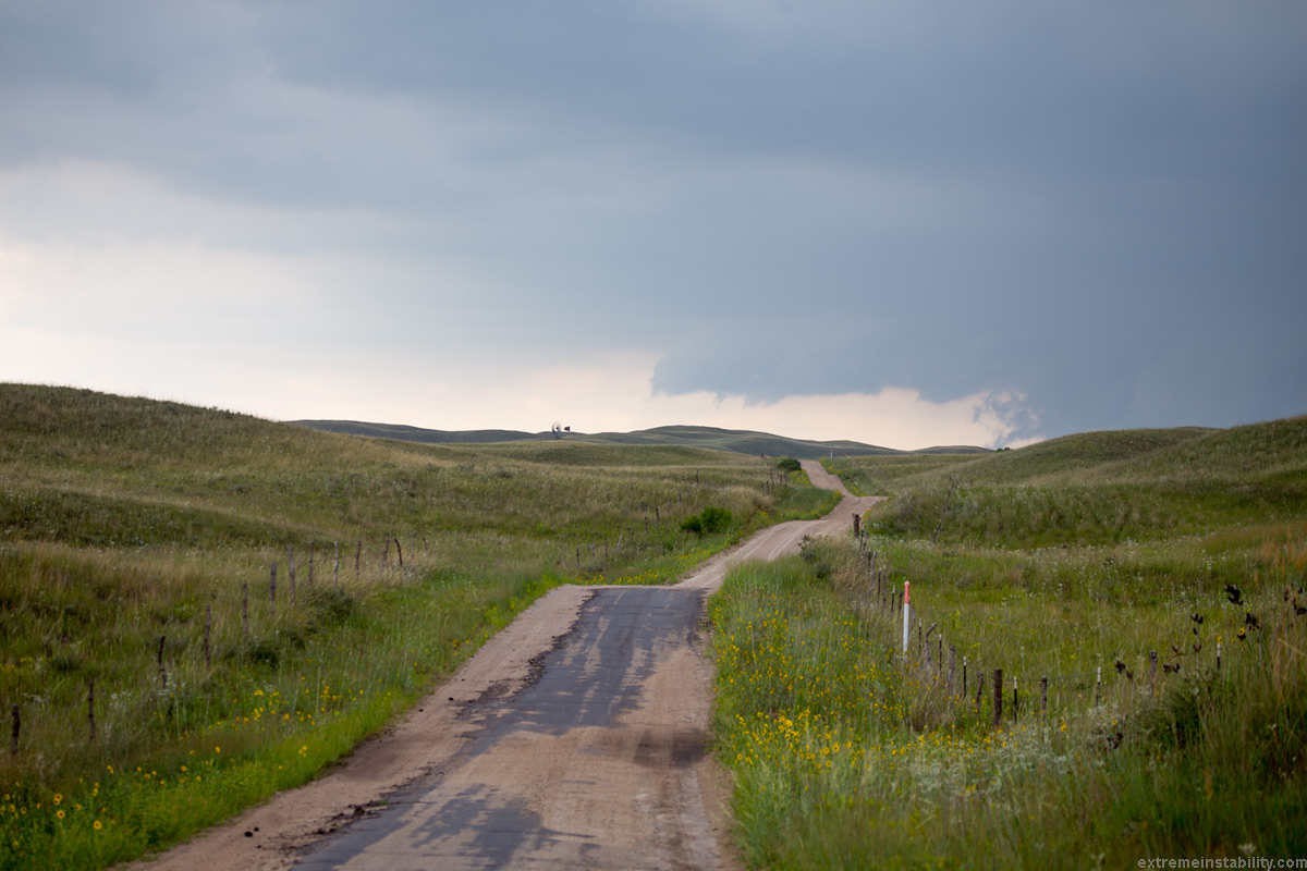
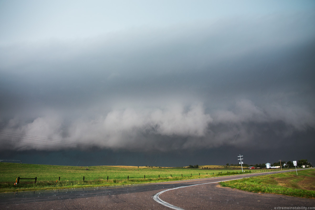
I head south out of Thedford, figuring it was likely the road I'd need to take anyway, as it was doubtful the storm would go east so much to use highway 2. Right away I ran out of data again. Perhaps a bigger problem out there is simply finding views. The sandhills can be fairly tall. It seems you are always close to them and they are always taller to the west. The other issue is a complete lack road options. Just very few, spaced well away from one another. Most are often sand roads you do not want to take. Others are like this one I took west pictured above. Not great.
I kept going on this road, as I couldn't see the storm well yet. I'd look ahead and think, surely that is more open up there. Continue on and still always hills in the way. Did that until I found insane washboards. There was no driving on those in my car. I turned around and going under 5mph felt like I was going to break something. I was fine with this view anyway. Well the one I drove back east to here. Storm was still young and needed some time. The thing was, it wasn't moving much at all. I also had no data to see if the southern things were doing anything, though I was pretty sure what I could see from there with my eyes said they weren't. They weren't. Just this storm.
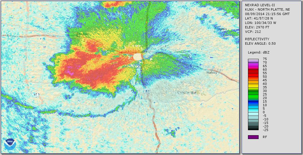
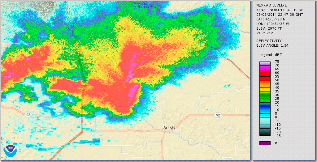
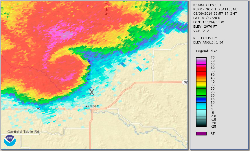
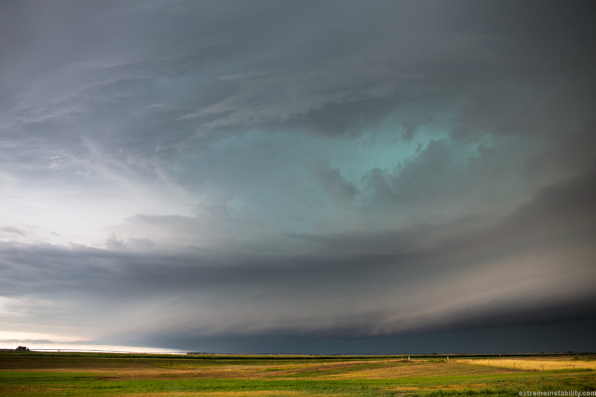
Visually the storm seemed it would continue to get better. Then it just stopped and went rather blah and stayed that way there. By the time I'm further south again and get data, my radar view looked something like above. Gah! Once the outflow comes off a storm much, it's not common for the storm to catch back up and tap the good air again. There's a reason it came off afterall. I thought, man I should have stayed home, as this one likely has a fork in it already. You couldn't really see this yet in person, but you'd feel it if you were closer to that outflow boundary. The storm would still be to your west and you'd be hit with cool outflow winds. Then you'd know. But seeing the radar works too. I'm not even posting pictures of it as it got to highway 83. Just not worth it.
So I dropped south, as I had to anyway. There was no going east for a while. Some new storms could be seen going up near North Platte. This highway would go right to the tower I could see visually and the early signs of it I could see on the radar. By the time I hit the east option highway that split off this, I still didn't really know which to pick. The thing is, so often the lead storm on a boundary will find a way. This storm still had the ese winds along the boundary it would ride southeast. There was nothing out there screwing up that air. It would simply take one new plume out there, in that good air at the tip of that outflow boundary, to try to get interesting again. Meanwhile the North Platte thing had southerly winds and would fairly soon have to contend with this outflow pushing south. Within about the last 100 feet of highway I decided to go east and stick with this one.
I'm north of Arnold now. Went north a bit first and came back here for a while. First off, this is the Arnold-Dunning highway. I asked a fellow chaser earlier via e-mail if that was for sure paved, incase I needed it later. I was pretty sure it was. He answers yes it was and that today was also the day they do the Sandhills Open Road Race. Tons of people bring really nice cars and do timed races on this highway. Lambos, Vets, Vipers, etc. They had ended right when I got there basically, I guess. But anyway, remember that I was thinking about road options enough to ask that earlier. Gives an idea how fast this all went down here in a bit.
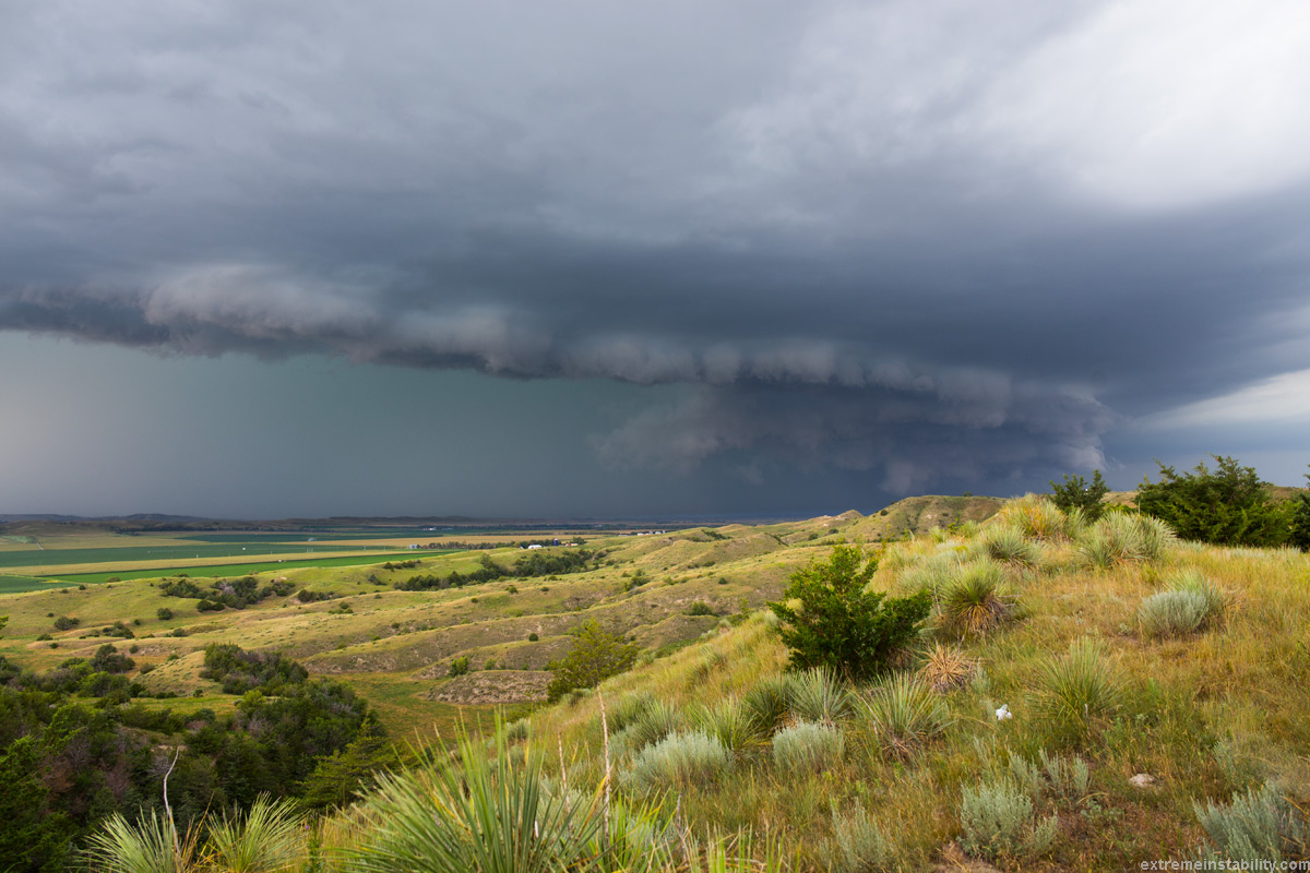
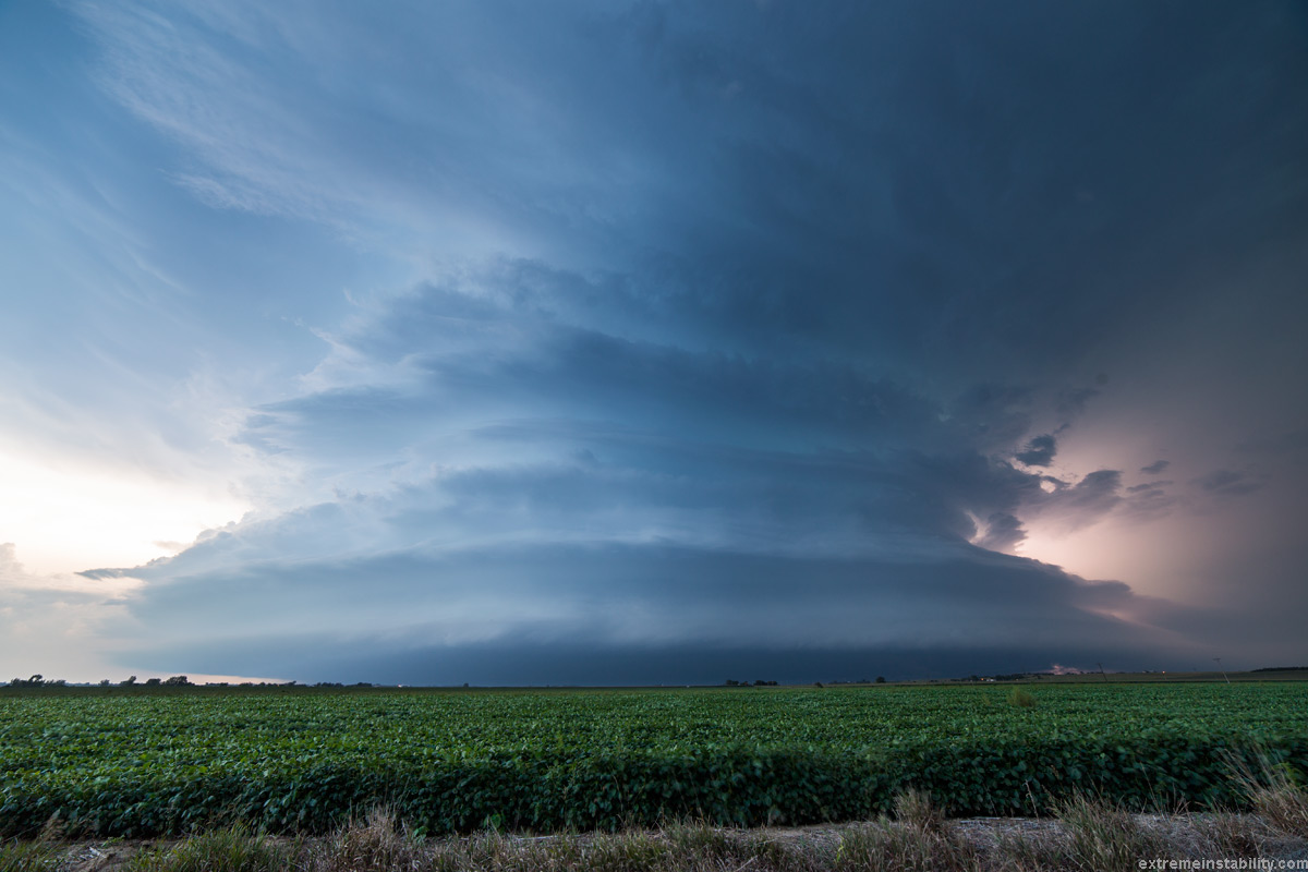
I went north a ways and it just wasn't much to bother with. I thought, I may as well drop back south and watch it from the cool high view area I saw going north. It all looked really lame but I thought maybe a decent gust front structure view from high up. I then began to see a lot of lower grunge(low clouds not really grunge) form in the old area of interest. The area the supercell would keep tracking and where the outflow boundary from the storm curled around to the outflow boundary/warm front it was riding down. You could tell by how that was changing it must have tapped some better air again. Didn't need any radar data to convince me to drive back north.
I get back up there and am like, dang it is really wrapping up right now and might be able to produce a tornado. Such a fast fast change from how it had been. But it was now almost on this highway and I wasn't having much luck at finding a real view where I could pull over. I thought, well crap, I'll just shoot back south to that same viewing area and let the southern "cell" slam me. It looked like it had hail in it and now velocity was ramping way up. That location would be south of where this would track, or so I had thought. I just wanted to let the area south of the hook up here get me. There was hardly any hook on radar yet and it was quite linear for a ways south. I just wanted down there and let that get me. It is absolutely nuts what happens with this and how it eats and wraps up that whole southern "cell"...line.
See here is what I mean. Note the first frame in this. That is my radar view and storm view at the time. I had the area to the north that was wrapping up and then the continuation of the line south of that. As that was moving over the highway I simply thought, I will drive back to that spot and let that southern portion nail me. No wrapping tornado risk there and judging by velocity and high reflectivity it looked like I'd get slammed with wind driven hail. Something I really want to get well after not getting the Blair storm at home in June and that insanity. Seemed a perfect op for that and it did not seem I'd see anything with the wrapping deal or that it would even do anything. But then it goes nutz.
Here is the whole evolution. Watch how much that thing drops south when it wraps up and how it wrapped right on through the line south of it. Yet another storm thing to learn from and take note about what can happen. What happened was the last thing I'd expect in that deal and I've chased a lot for a while now.
Velocity.
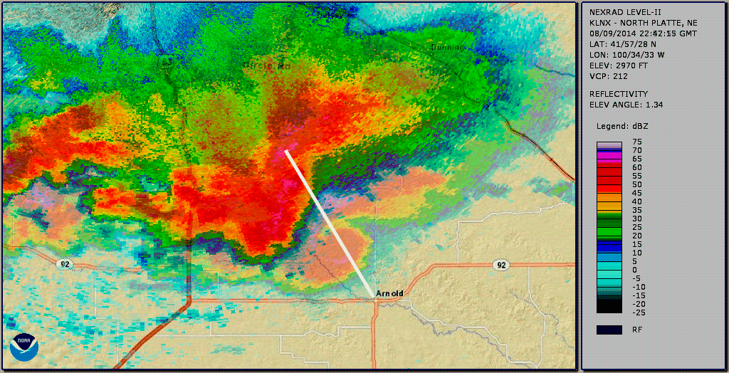
I took all those frames and picked the turn point and the points prior to draw a couple lines that show the storm direction and how much of a change that wrap up takes.
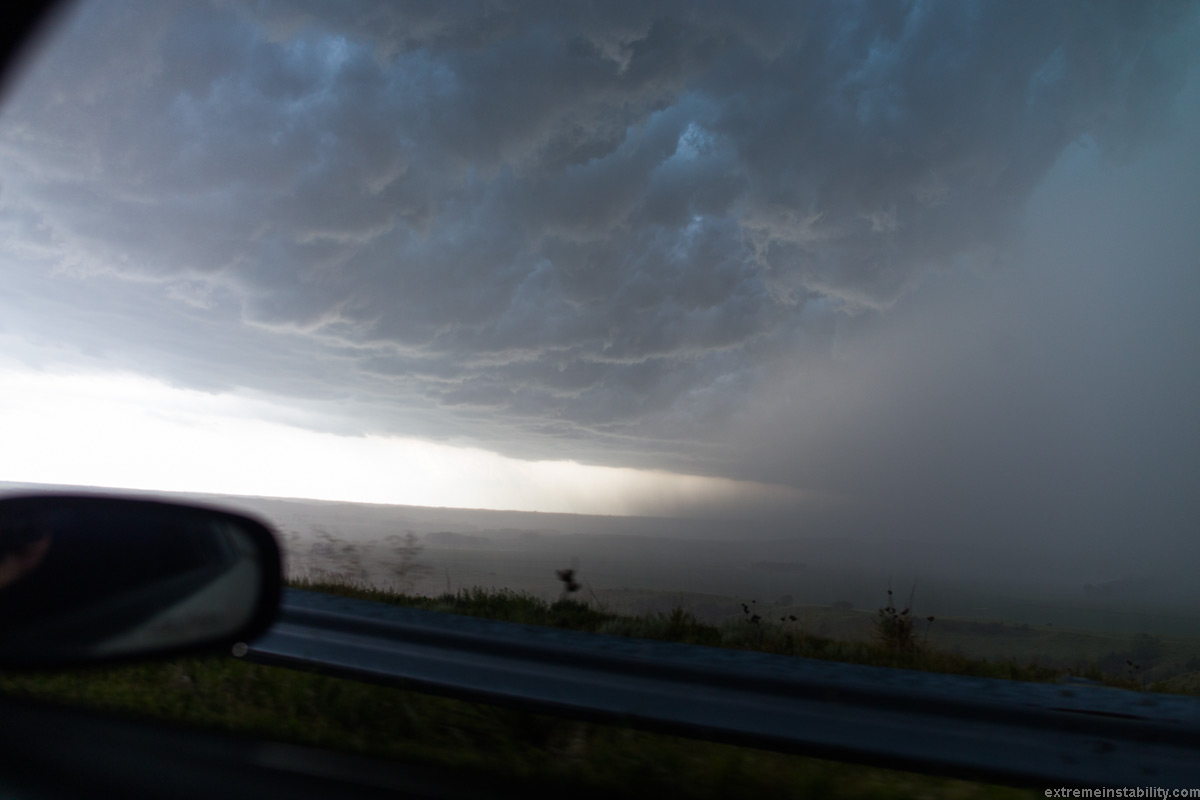
So I'm parked at that overlook thing where that X is. The precip is already hitting me though...as I'm there past that radar time/image. But that is the image I looked over and saw on my radar ap. I couldn't tell any of this was going down, as that whole gust front had already pushed over the highway to my north. I mean I knew the area up there was wrapping up. I'd have never thought it would wrap up and back and down like this thing does. I about crap when I see it on the radar. Here are my words on video the moment I see what it is doing. As hail is already popping the side of the car at the location of the X...."Could be insane wind driven hail about to happen"(contently).....pause......"whoa, scary hook, I'm getting out of here."
This is 5 minutes after that previous radar image, as I race out of there. It looked crazy to my west, looked so dense and like fog. Seeing the big velocity on the back side of the hook and how coiled in the hook was, heading right over me, I was crapping a hair right now. The rare time you'll see a bit of a whales mouth to the structure and rightfully be fearful.
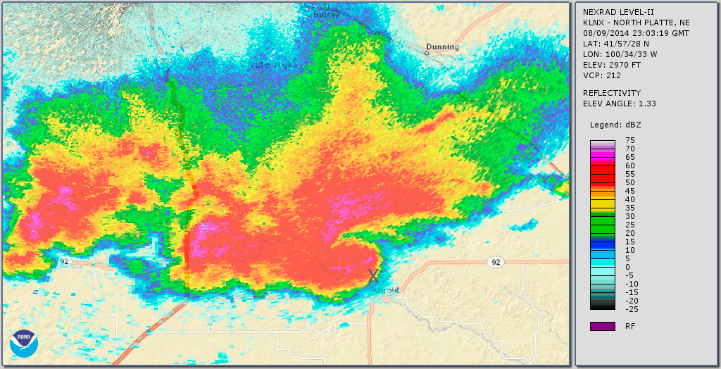
This radar would be rather in line with my leaving that spot, though I would still be seeing a frame ago at the time...or 2.
Here's the crazy thing. I never had a clue there was a highway south from Arnold, until getting this radar data days later. I was like, holy hell there was a south option! I race down into Arnold with this tornado warned crazy hook moving into town. There were still a lot of people from the race thing. And way too many tall trees. There was no wind in Arnold, but I was just in high wind coming off that hill, barely north of town. I knew that wind was coming into town any second. The velocity image at the time was rather scary. Especially being close to the radar. So my first fear was those trees. I wanted away from those over anything else. But of course, no one has a clue about this and that they should get the hell moving. No tornado siren that I could hear. I think they started to get it off the radio though, as you could tell by how people were driving a bit of panic set in.
I hit highway 92 and in my head at the time only knew that as an option, east or west. It all happened so last second and in oh hell crap fashion, I never took a second to think, maybe there's another option. It might be because a lot of what I'd been in all afternoon had so few between towns for a long ways. I just left/got off the south option to North Platte too. I guess I never thought there might be one south here already too. I don't know how I never noticed on google maps at the time. I may have never had it opened. I don't know, but figure I thought far enough ahead on roads earlier that I checked this Dunning-Arnold thing out 4 hours prior to now lol. So pretend there is no south option, because in my head at the time of hitting the intersection, there wasn't.
So I hit the highway 92 intersection in Arnold with this moving in on me. Utterly shocked what had been a lame storm had now done this super crazy move. All rather very very last second to me. I'm behind the one truck that drove me utterly insane coming through town. I'm thinking, ok which way is most out of where the tornado may be in there. West felt slightly better. West would be right into that back of hook velocity max, but I didn't care about that. The way it looked on radar, I was fairly sure a tornado(possibly substantial) could be heading right into town, right this moment. I floor it west and hell hits right away.
Video out my front windshield barely out of town going west. That velocity max was slamming me. Winds would rage out of the northwest. They'd slam you and you'd think, crap crap I hope nothing is in here. I mean because if there were, that's how it would go. One of these big gusting sessions would just be the edge of the tornado overtaking you. So when you have that sort of hook coming down on you and the winds doing that, eh whether or not anything is actually in there you are fearful it is. You just don't know. I assume the worst. The first instinct when a bout of those winds ramp up like that is to slow down. But yeah just ignore that and get the hell out of there. That is what I was doing for a few miles down that highway.
Put me in some crazy linear line event with 130 mph winds or more, if that could happen, and I'd be parked having a complete blast.......away from structures. I'd want it to blow harder. But put me in this situation with a crazy hook moving over and well 80 mph winds will scare the bejesus out of me. Can't see anything and the hook is "off the hook" crazy. There was no point I enjoyed that drive west. The exception was as I was pulling over once I knew I was far enough. I was really excited then. Thinking, holy hell how did that just happen and glad I'm fine. No fun in rain near potential tornadic areas Zero. Ziltch. Perhaps if you were driving up behind a tornado and rain wrapped around and you knew where the tornado was and was going away. Directly in the path though no, no fun.
I can't believe there was a south option. Here is how much I was blind to that for whatever reason. I let the hook clear Arnold before heading back east. I then went east/northeast and down to Broken Bow. Then raced southwest from there to Oconto to beat the storm again. I didn't have a damn clue there was a south highway at Arnold, even as I went back east through town! I think I just had the mapping off most of the time and had it in my head there was just the east option. There was even a southeast paved thing I found later too lol. I need to work on planning ahead better. But this case there was never any desire to. No need. It had been so lame until that very last moment when I saw the crazy thing it had done on radar and what was now going to overtake me, instead of what I had been planning on. It's an eye opener on another way to "screw up" out there. Often the "surprise" is a tornado hooking well left at the end of its life. Though that shouldn't be, as that is fairly typical. This was like the storm turning highly right while at the same time going extremely left with a hook. And from what hadn't been threatening at all. In like 2-3 scans it does that crazy move. Right on the road, after it's fairly hidden itself visually.
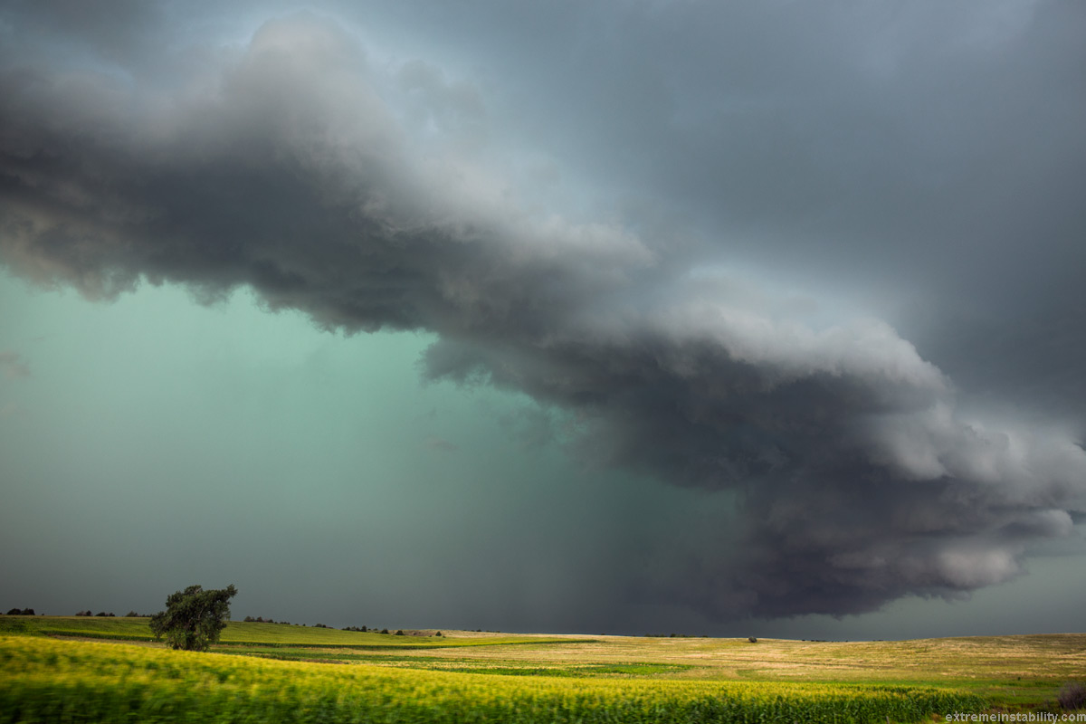
I get to Broken Bow after a hellish drive back east on the north side of the storm. I see a window to beat it to Oconto, instead of continuing on home. Radar said no way I beat it. But I could see the storm. I kept pondering bailing back north on that move, as I really didn't want to repeat the previous fun at all. The radar was like, you aren't going to beat it and if this does that same move again, it will be right on you at Oconto probably. Velocity was saying that. But I could see the storm lol. So I kept going. Turned out there was just plenty of rain ahead of the storm, so radar was making it seem a bit further along than it was. I'm at the turn there now above I think. It feels good to be ahead of things with an open highway away from it.
It was trying to be a cool shelf but also trying to hold supercell characteristics at times. You can really see it on the time lapse below.
Just west of Kearney now, thinking, heck yeah this works. I was glad to still be chasing, as this is at least fairly worth it image wise. Nothing else so far had been and that was hell lol.
August 9, 2014 Kearney Nebraska
Half second shutters for the first bit. Full frame Canon 6D and Samyang 14mm ultrawide. I should have gotten the reaming ditch out of the shot. But honestly lightning had me paranoid here. I'm surprised I even stayed out of the car. Just the very rare anvil bolt or two saying get back in the car. So it felt safer keeping the tripod 10 feet closer to the car lol. As I for sure thought about putting the setup right on the field edge. Remember 14mm full frame is really wide so the storm isn't that far off. And it only takes one anvil bolt to the dome to ruin your day. I saw the first one reflect off my lcd as I held the camera adjusting settings, as I first setup. Thought, damn it.


