May 10, 2010 Wakita Oklahoma Multi-vortex Tornado
I left Nebraska around 7 a.m., after little sleep as usual. Got to Wellington KS on the OK border around 1pm. Sat there till about 2pm trying to figure out when to be on storms. Trouble this day was storms would move 50 mph or more. They'd also take a while to get organized. The other issue was the warm sector wasn't overly wide, especially to the north. I was holding off until I saw a TVS marker pop up on GR3 for the storm sw of Cherokee Oklahoma. Then went west and southwest towards Medford. Before reaching Medford I saw a chaser going northeast, then I saw the TIV(Tornado Intercept Vehicle) going northeast as well. I was like, is my radar screwed up and real old or something. You could tell it wanted to turn more right as it rebuilt on the south side, while the split went north off it. But it had been going mostly northeast in a hurry so figured they were just positioning. Still to this day I hate seeing chasers going another direction. You question what you are doing. I kept going, hoping the storm was where the radar showed it and its speed and bit of lag on the radar didn't mean I'd be putting myself too far south. I think anyone going northeast then just had to be thinking it wasn't going to turn more right. It turned right nicely.

I went west of the Wakita exit a ways, pretty much to the storm, passing a million chasers on that highway. I then thought, yeah this thing isn't ready just yet and thought with the extremely fast storm motion, I'd better lead it more, till it was ready. A spot south of Wakita was sounding real nice at this time, just looking at the storm. I fly back east, and see a pointy cone arc out to my sw. So I chose that Wakita option thinking, perfect, it starts now and it will be a mature violent tornado as it passes near me. This was a high risk day by the way, with strong long track tornadoes likely. The shear was simply ridiculous today. 0-1km storm relative helicity in the 500 area on some storms. I believe like 925mb, a bit off the ground, was due south at 45 knots or so. Then figure a mid-level jet around 80 knots out of the wsw forcing the storm east quickly. So you have 45 knots of flow just off the deck going north, plus the storm is ramming into it at 50 mph or so. Storm relative inflow and shear just gets off the charts. And you had strong instability today. And a nicely timed vortmax. Today screamed strong tornadoes for many days out.
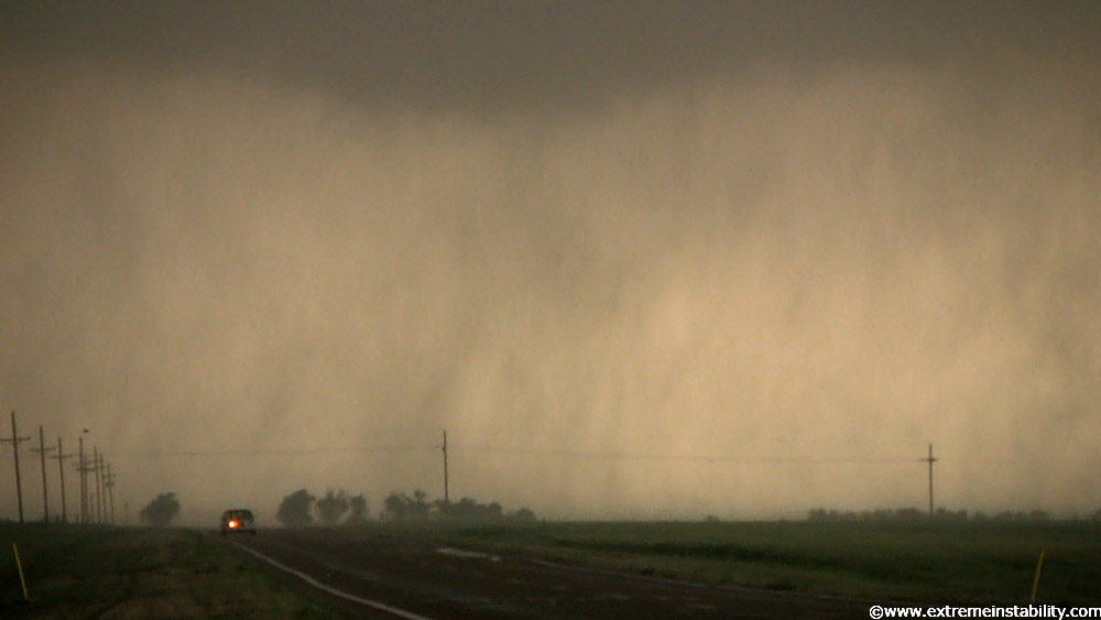
Anyway, as I flew east I saw the other tornado intercept vehicle, Timmer's "Dominator" flying west. I'd seen them parked as I first went west, before coming back east. They were flying west for the pointy cone I saw out my back window. Looks like they got a nice little intercept of what was to come on that highway. I was thinking a bit down the road and also being able to shoot for a while from one location. Plan worked out well enough, but damn if it messed around with vortices before finally maturing to my east. The good part about this was, those vortices(multi-vortex tornado) and the area anywhere near them, put on an amazing show of extreme motion. The image above is as I drove north a bit towards Wakita. Nice visual vault region north of the base now.
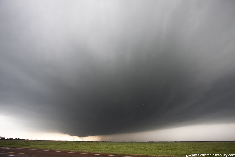
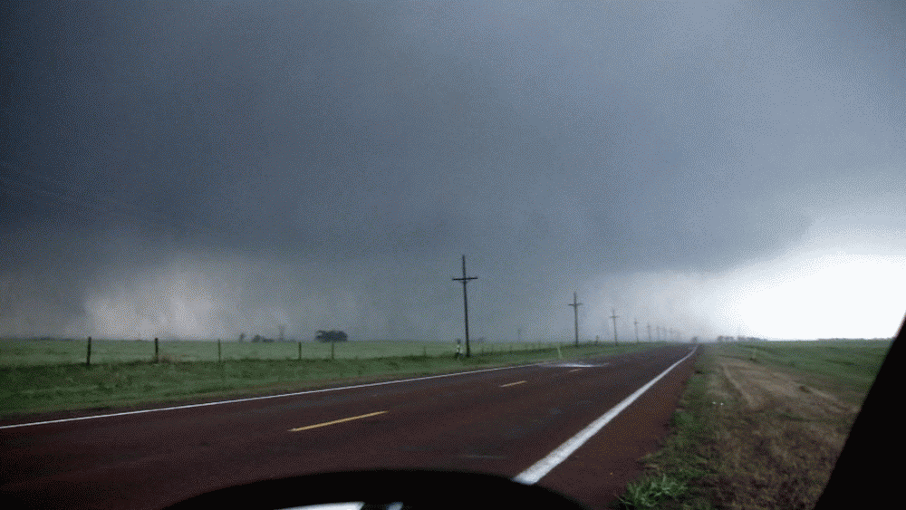
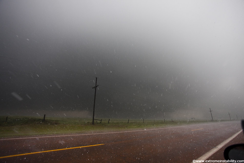
These are ultra-wide angle stills. I'm just north of highway 11 just south of Wakita. You know what Wakita is? The town the move Twister was based in lol. Felt a little funny at the time. I'm like, I'm in Oklahoma on a high risk day, watching intense multi-vortex action, and to my north I can see cops apparently blocking traffic on the south side of Wakita. Highway 11 just south of me was extremely filled with chasers. It was like a whole nother world here where I was. Like I was in the damn twilight zone. Nothing coming south cause it looked blocked by cops. But at the same time it looked like a lot of people on the south side of town watching. So that right there it looked like I was down somewhere I wasn't supposed to be. If indeed they were stopping anyone from coming south. Pretty sure they were. Then looking back to my south, not a freaking soul. I think maybe 2 locals went by me here heading north into town. Biggest reason no one was up here was surely hail, as I was near the core's track and just barely north of the tornado track. You can barely see a vorticy under the storm now. Hail stone in the air as well. Probably one of my later monsterous stones here.
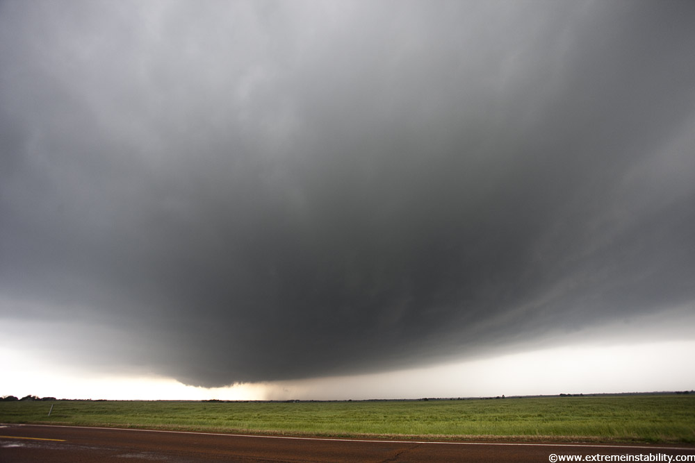
Stills didn't do much for me here now. Even with the ultra-wide on I couldn't get the structure now with the low clouds moving over.
These will be video captures now for a bit. There's just no way for me to convey the motion and going ons here. Kinda like the intensity in the end of a cracking whip with these things.
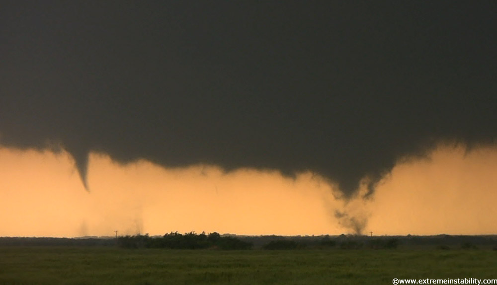
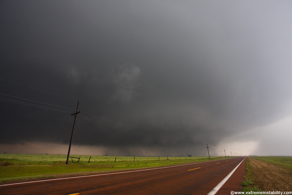
I guess the one on the right would be the main area, with the one on the left more of a satellite.
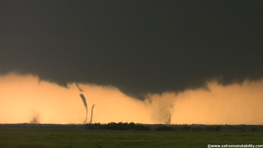
That left one quickly split into more. Keep in mind the shear this storm was working in was violent. And it was hauling ass east. The motion was just unreal.
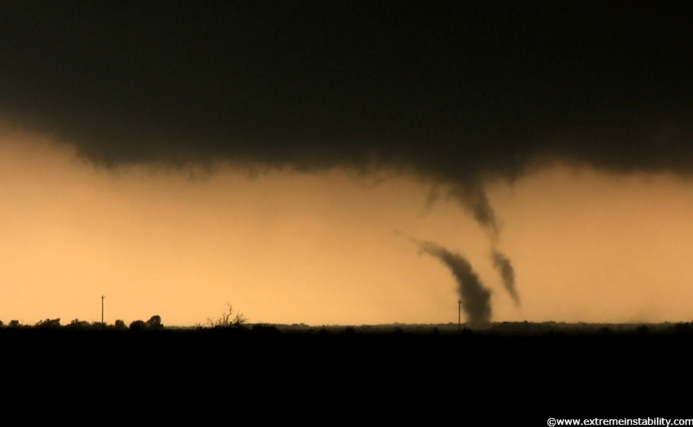
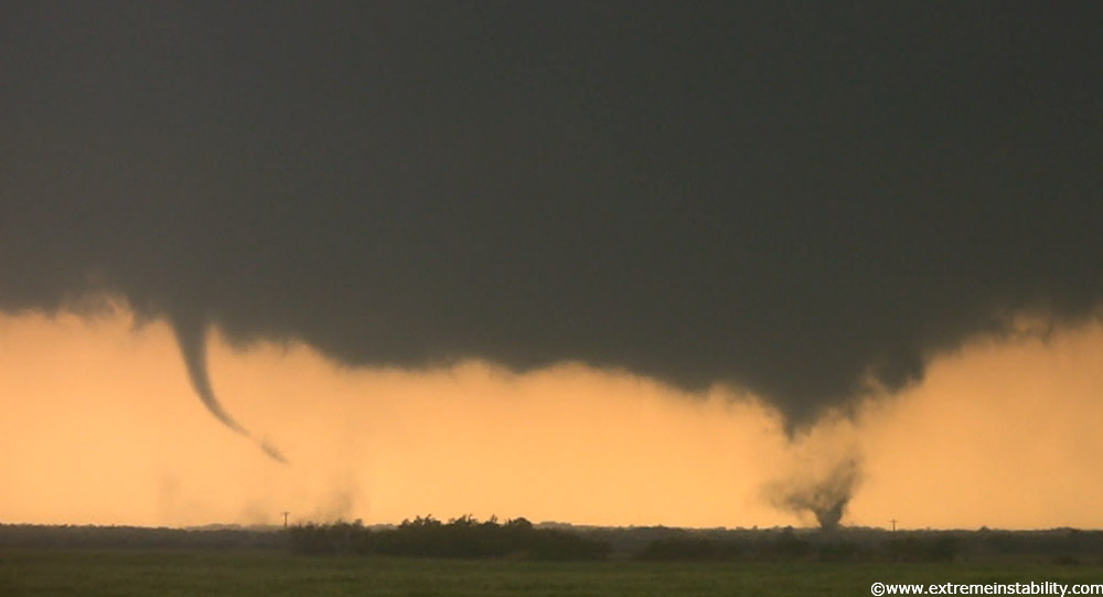
This is cool on video. That dark lower stuff, that looked like a bomb went off above it and was forcing it downward very rapidly. Just the eastward motion to it all was absurd. Fastest motion I've ever seen.
See if my plan had been working out, this would have been a mature tornado at this point, not far south of me at all. Could have drove down there and got crazy video or stills of it on the north side of it. But at least the motion in it was awesome. Should have been more than a pointy cone at this point though.
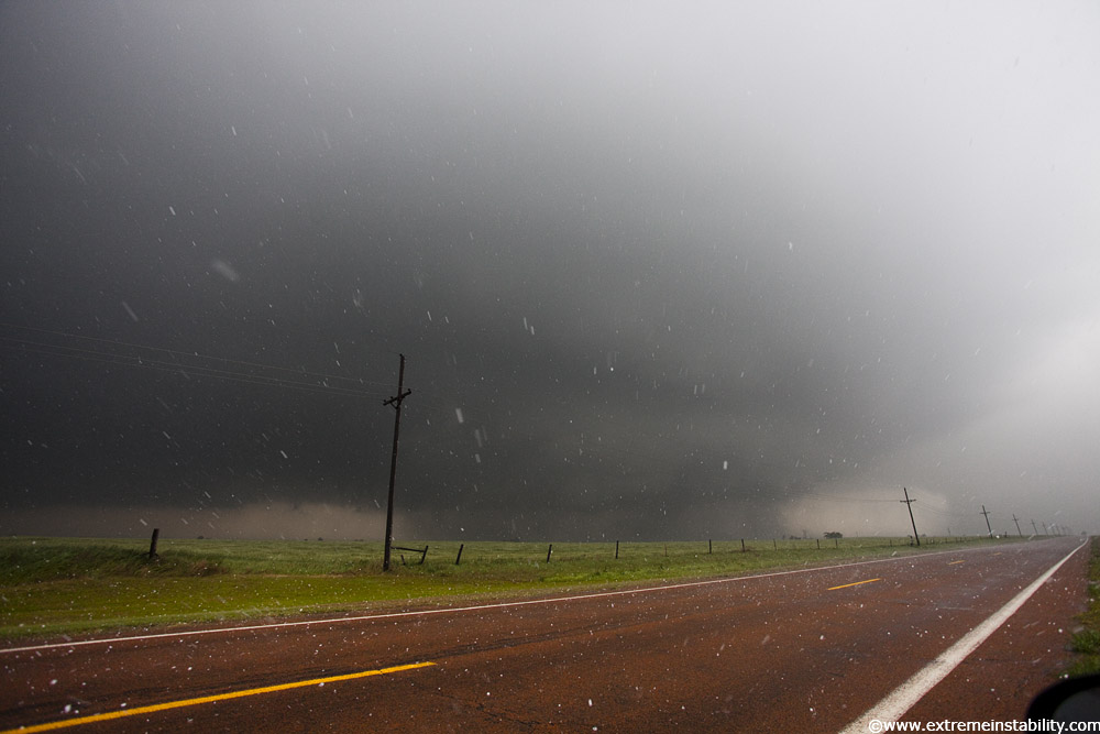
Looked like a local going north, or some chaser that felt like driving right through the circulation on the highway. But beyond that person heading to Wakita, look, there's not a soul here on this highway. It was quite an odd feeling, considering the majority of the chasers were on this storm today. Line of cars going east after this was probably 10 miles long lol. I felt a bit sorry for the locals that would have to deal with that for a short bit. But maybe it's interesting to some of them and not a drag.
I'm in the same exact spot, just pulled across the highway to tape to my southeast as it races by. This is a 3 frame gif of simply massive stones hitting. Might have to let it load. This was quite strange. For an extremely short time frame, ungodly sized stones could be seen falling from the sky. I can't imagine them being under 5 inches in diameter. A visual impression to try and give would be seeing a white bowling ball falling in the sky very randomly. The size of the white streak was just scary as hell. Shitty part is that I know I did not get the ones I am talking about on video. They were seconds before these still huge ones. They looked larger than the streaks of these. Heck probably only saw 5 max of the things. This is the perfect location for the biggest of the big stones. North or northwest side of the hook/wrap/meso. These on video here, just look how much area whites out and there's still a clump smashing in the middle. And crazy part is after they hit, pretty much zero sign of any part of them. They were not soft either. Just big hitting real hard.
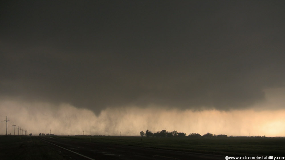
Wide angle stills again. This is like 10mm on a crop sensor cam, the 17mm on my 5D II. See the heavy rain shaft on the far right. Go left of that and up and that first cloud base is out there on the flanking line. That goes left ahead of where you can see on here. Clear left and then back around this way, then back around and right in the meso/bowl you see. That is the bottom of the massive updraft above. Where I am is going to be the skinny part of the hook on radar. Massive stones love to fall back here. And even to the east of me near the updraft base but north of it.

I had my vid cam mounted on the window here too. I think the time lapse of this bowl moving east and the visibility going bye bye in the hail will be cool.
More normal sized stones lol.
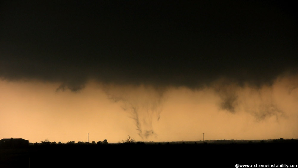
These are ultra-wide angle too. It was now starting to form the wedge'ish tornado that would race off to the northeast at warp speed. Figures, I lead it to give it at least some time to produce a mature tornado, causing me to miss the action right on the highway I'd just come from....only for it to take even longer to really organize. Not one bit mad on this one though. Video is still wild and looks like too many chasers in the tornado to been close anyway.
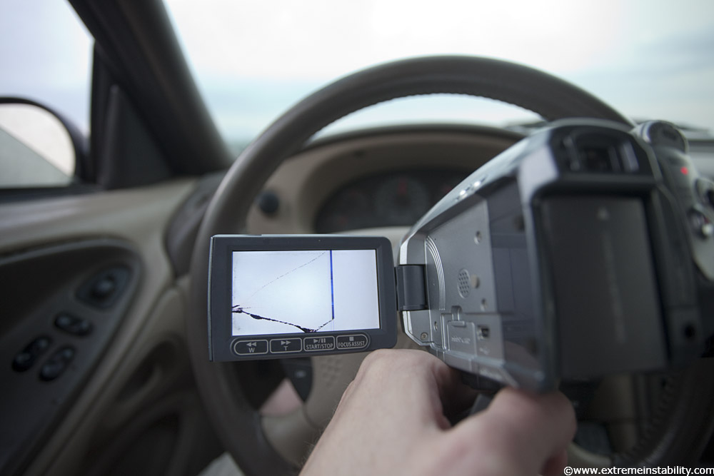
Casualty of mounting my vid cam on the window in a hail storm. That really sucks, I already have to get a new laptop because I broke the lcd in the corner and that area on it is now growing. So thanks to LCDs breaking there are two things I need that I can't afford right now.
Got home around 2 a.m. after being in the car driving like a madman for 19 hours(that is like driving for an 8 hour work day, then driving for 11 more hours lol).


