July 24th 2000 N. Central Nebraska Tornadoes(Long lived Supercell, 6+ hours)
This day started out with a small moderate risk over northeast NE and southeast SD. I had to work and only had 1/2 day of personal time left I could take. I took it. I had managed to not catch one tornado all year and figured maybe this could be the day. I got off work at noon and the chase mode began. A low was deepening over northwest NE with a warm front arching east-southeast. My target area was near Yankton SD. I knew any good storms would be southeast movers. I didn't want to cross the river and have to find a route back across it if I could avoid it. I decided to stay in Nebraska and wait till storms at least went up. I grabbed all my equipment and left Blair around 1:30.
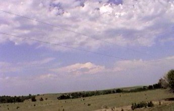
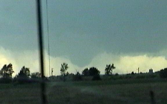
As I drove north out of Norfolk, NE I pulled out of the area of showers that had been moving southeast. I was greeted to a more unstable environment to the north. I figured at the least I would have to move 50 miles or so north incase storms formed, because anything that formed near this area would quickly move into this more stable air. I pulled over and shot some video of the developing warm front to the north. The storms trying to form on the warm front were extremely mushy. The air this far east wasn't very unstable.
Finally I noticed some high level clouds from a likely anvil to the distant west. I then moved west along the NE/SD border, then west some more, and west some more. This was a work day and I had to work the next day and I was getting further and further from home with nothing but hope. After I was about a 3 hour drive from home I caught a message on the radio of 3 counties included in a tornado watch. I figured they only listed 3 counties because they were the only ones in the listening area of the station. I was in one of the counties. I figured the watch had to stretch west, sure enough it did. I kept moving west as the base of a storm finally came into view. It even looked as though it had some inflow coming into the southern side.
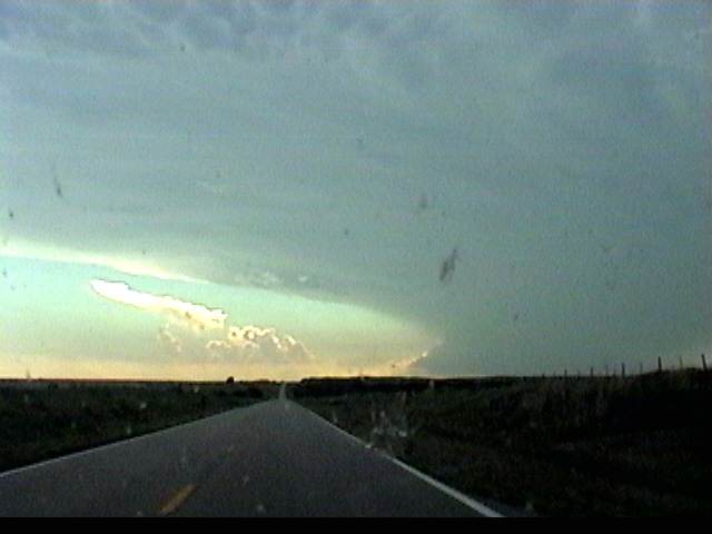
I drove and drove and drove towards this storm and for some reason it didn't seem I was getting any closer. I don't know if it's the lonely plains out there or the flatness that makes it seem closer than it is. All I know is this is the longest I can remember driving towards one lonely storm.
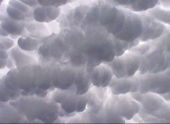
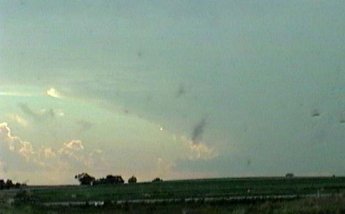
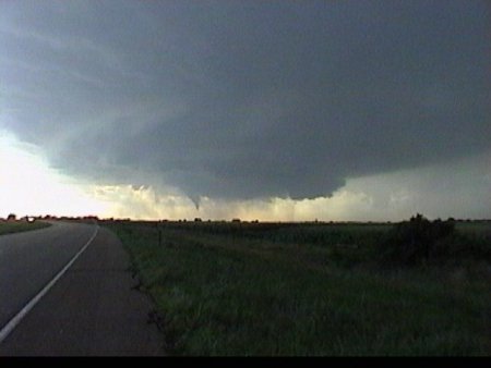
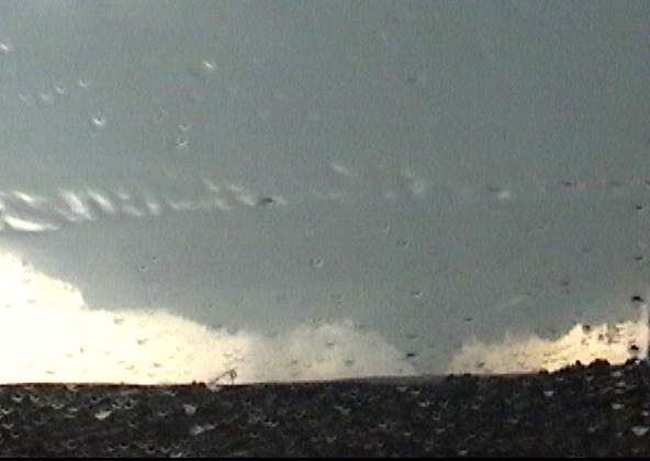
The mammatus out in front of this storm were making it look very promising. Their coverage was very extensive and quite defined.
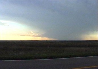
At the time of this picture it was around 7:00. I decided to pull over on a north-south highway to shoot some video and decide whether or not I wanted to drive west some more, further from home. I was now about a 4 hour drive from home and I had to work the next day. The thought of a bust on this long of trip with an early morning coming up the next day was getting to me. Then finally something promising comes across the scanner. North Platte issued a tornado warning with this storm. Now it's an easy choice. I've driven this far, I might as well go a bit further.
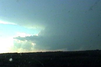
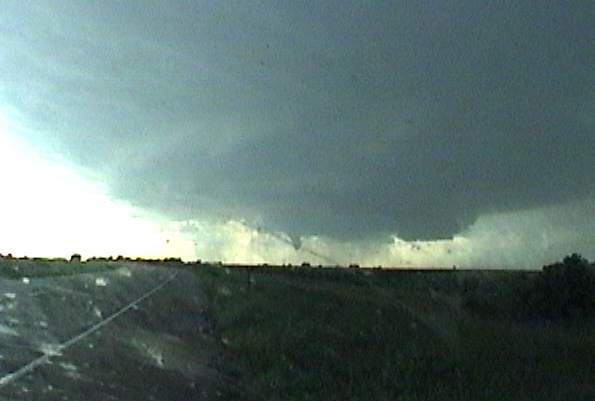
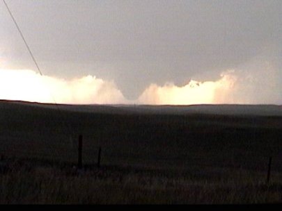
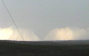
Finally the storm started to appear as if I was actually getting closer to it. As I approached the east side of Ainsworth I noticed a fairly large wall cloud to the north of town. This storm had already put a tornado down across the border into South Dakota. The storm was moving due south at about 20 mph.
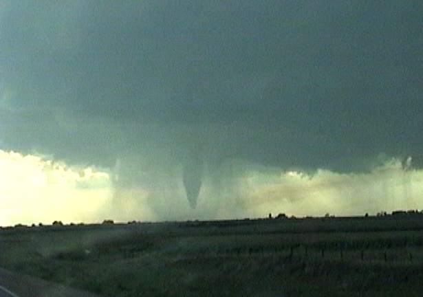
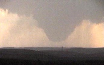
Thanks to the slow speed I had time to cut in front of it. As I was driving into Ainsworth I could see the wall cloud becoming more or less a large funnel. I knew it was about to put down a tornado. I had to hurry very quickly or I would miss it. My only problem was a curve, the people I couldn't pass in front of me, and the fact that I had to drive though a town yet.
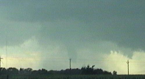
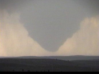
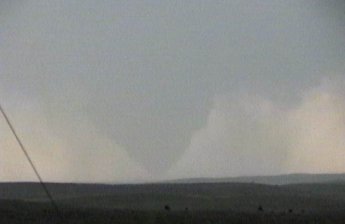
As I was exiting Ainsworth, thankfully a very small town, I could see it had tightened up and was trying to reach down.
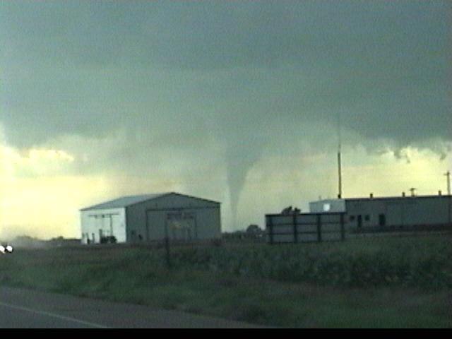
Just outside of town it touched down quickly. Timing here couldn't have been any later or I would have missed it.
It was only on the ground for maybe 15 seconds then it started to lift.
I hadn't even had a chance to pull over yet and it was off the ground. The highway I'm on was an east-west highway and the storm was moving due south. My dilemma here was do I move further west to get up close and personal or do I find a road south for possible later tornadoes.
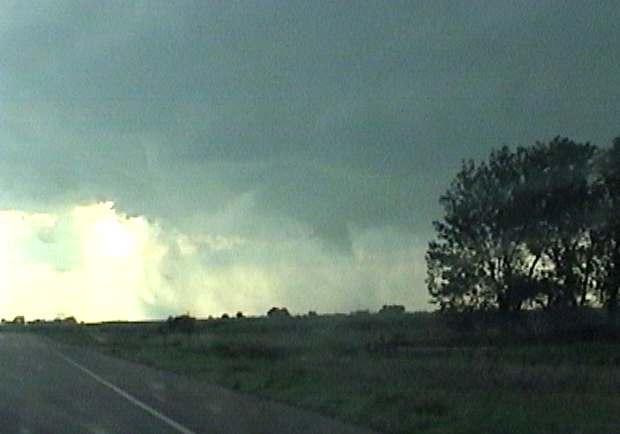
Since it was moving so slowly I had time to pull over and video it for a bit. The only problem since it was a southward moving supercell was that I would soon be in either hail or heavy rain. It was kind of cool how the rain curtains blew outward as the tornado dissipated. All at once instead of them being pulled inward they were released or pushed outward.
I decided to get out, somewhat trying to disregard the CG's coming down just to my north, to get some video of a supercell wrapping up. After the first tornado dissipated it seemed to really wrap up. A beaver tail quickly formed to the east of the wall cloud.
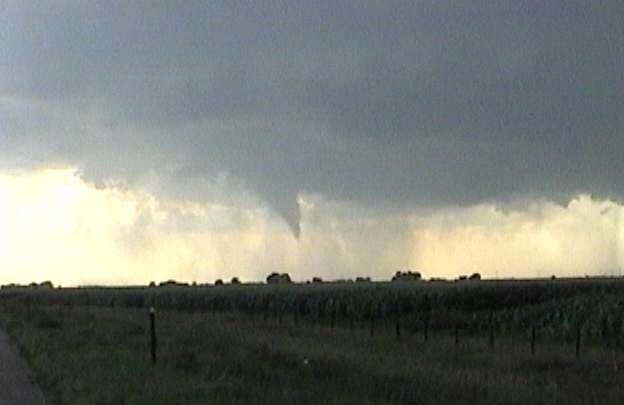
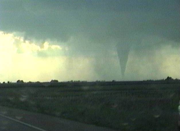
Then about 30 seconds after noticing how quickly the beaver tail was forming, another funnel began reaching down.
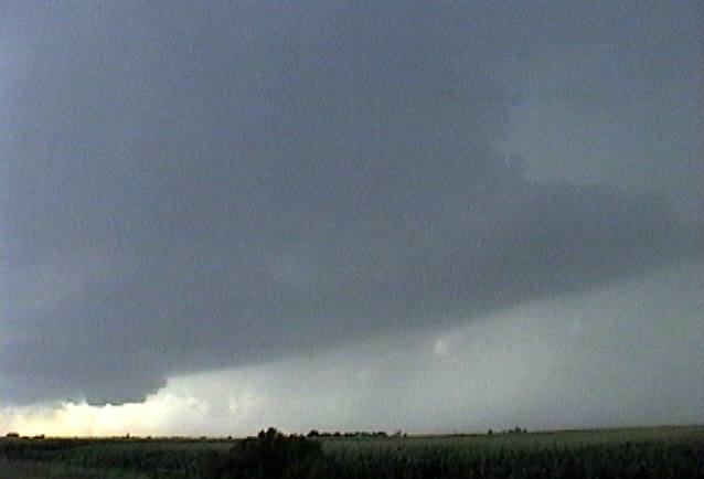
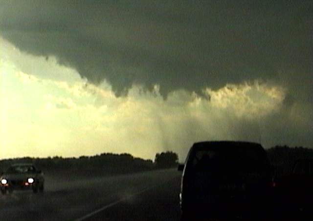
In this pic you can see how the storm was really wrapping up. I'm standing outside my truck and the hail and rain is beginning to fall. Small hail was hitting me in the back and bouncing down the road toward the storm. You gotta love the feeling of the inflow rushing by you into the storm. Keep in mind this is late July.
After maybe a minute in the rain and hail I get back into my truck with bug splattered windows. My bad, I should have cleaned them while refueling. Anyway, the funnel begins to lift and I decide to head a bit further west down the road, just incase.
I decided to get as close as I could. The cloud tags of the wall cloud were still rotating along with the rain as it passed over the highway. Police had been observing this storm throughout and yet they decided not to stop traffic as it moved over the highway. Cars were driving through the circulation. Luckily the next tornado waited a bit.
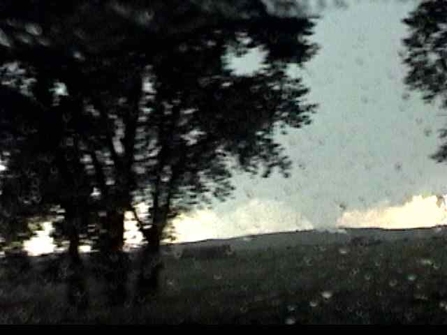
Now that the storm is moving south, my only option is to drive back east to Ainsworth and go south on the only highway around. I noticed my gas tank was just below half a tank as I pass through Ainsworth. I never thought it would be a problem finding gas with that much left so I head south in pursuit of tornado number 2. About 5 miles south of Ainsworth I drive back out from under the rain and hail and see the wall cloud paralleling me to the west. While driving south I was keeping my eye on the wall cloud through some trees, when I noticed it was turning into a large tornado very quickly. There were no shoulders to pull over on and a long area of hills with trees running along it.
It's too bad there were so little road options out here, yet still so good that this tornado was at least this close. I had about a 50 mile stretch of highway to just go south on with no options. I get a better view of the tornado here before going behind a hill. After the hill I notice a police car pulled over with its lights on watching the tornado.
I pull over next to the police car and video the tornado for 6 or so minutes before it totally wraps in rain. Damage reports put this tornado between 10 and 12 miles to my west in Cherry county Nebraska.
My guess on distance was very very much off.
The tornado was in very steady state throughout. You couldn't tell at this point with the rain and lack of debris to pick up how much was going on underneath. I'm sure by the size of it, that there was some kind of circulation going on underneath.
Now the rain-wrap factor begins. It didn't take but 30-60 seconds before it was totally obscured.
It quickly disappears into the rain. You know it's still in there, because of the size and if anything it was beginning to fully touch down again, but you can't see it. This is when it becomes the most dangerous. I was certain that it would keep moving south and if anything hook southwest so I had little to worry about, especially if I stay ahead of it. My biggest concern was gas and the fact that it was almost 9:00 and I was a good 4+ hours from home. I decided to call it a chase and look for gas. I became very concerned on the gas issue.
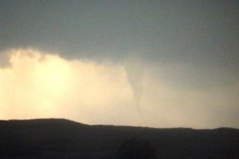
After about 20 minutes of driving quickly south I notice this to my west-northwest. It was either the rope stage of the earlier tornado or a new one. I'm guessing it was the rope out of the older one.
Now I get back into gas mode. There was a town about 30 more miles down the road and to the east that appeared as a larger dot on my map. As I pulled into town the pop. sign said 22. Of course there would be no gas here. Next town another 30 miles and it was a smaller dot, not good. I was now approaching an 1/8 of a tank. It was also getting later, so I worried about finding one after they had closed. I began making phone calls back home asking to find a way to locate gas in this area. My parents just happened to be sitting outside with a guy who was familiar with this area. He said the next town would have gas on the east side of town. Sure enough it did. I'm not sure when I was more excited, seeing the first tornado or seeing that gas station. It was so rural out there that when they would say the tornado locations over the radio they would say stuff like, "The tornado is 2 miles west of the Craig Smith residence". They did this at least 4 times that I remember.


