April 29-30, 2000 Texas Chase
This chase was going to be my first full blown chase vacation. April 29th 2000 is the day I had been waiting for. I'd been waiting half a year for the vacation to start. During the week prior to my vacation I began pinning down my target area. There was a large low across the 4 corners region. This low would move extremely slow. It ends up taking an entire week to move form western New Mexico to eastern Texas. On the 29th a dryline was forecast to move east into western Texas during the afternoon. On the 30th the low was forecast a bit more east and would set up shop over northwest Texas. This was looking like a good chase vacation.
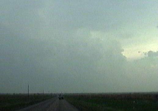
Friday night (April 28th) I figured my target area would be the Guymon Oklahoma area. Early the next morning, before leaving Nebraska I changed my target area to a bit east of the Lubbock area. I needed to make good time to make it from near Omaha to near Lubbock by afternoon. I left Blair Nebraska just before 6:00 AM. Around 12:30 I was just north of Oklahoma City. It was mostly cloudy with scattered sprinkles. This was the reminents of overnight storms. The storms of the day would fire up on an outflow boundary left by these storms. As I moved west of Oklahoma City the clouds slowly broke up. By the time I was on the Texas/Oklahoma border it was wall to wall sunshine and becoming quite humid.
Nothing much happened on the 29th worth noting. But the next day was one I won't soon forget.
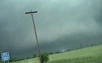
Heading south behind Project MOCISE from the NSSL to the supercell of the day(30th). I chased a mess before this and was now in intercept mode further south. One lone violent supercell was now alive and well heading towards Olney.
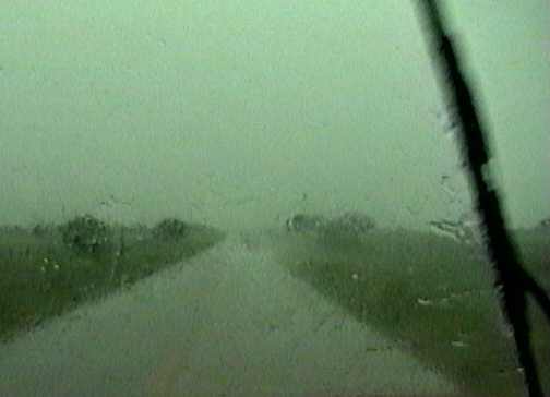
As I began to corepunch from the west I begin to become a little concerned. They are reporting a large tornado on the ground with this storm. Hail and rain was pounding the truck going high speeds and they kept broadcasting that they had trained spotters watching a half mile wide multi-vortex tornado on the ground with this storm.
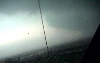
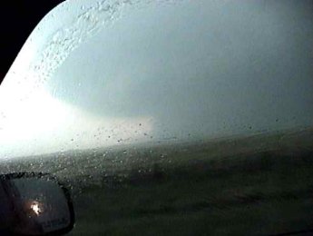
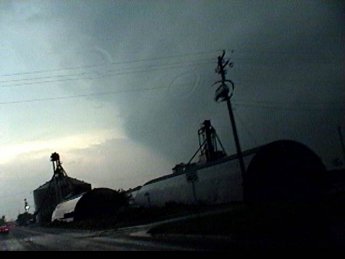
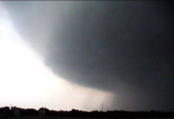
CG's were coming down like crazy just to my south. By the strength of the rain and hail I knew I had to be close to the meso. As I finally come out from under the rain and hail I could see I was very close to it. There was a large tornado wrapped in rain under the meso during this picture. I was somewhat relaxed at this point, because I could now see.
It was quite a sight, seeing something so powerful. You couldn't see the tornado, but you could see the area it likely was. If you've ever seen a hook on radar, well this is what it looks like in person. I'm coming out from underneath the precip area(the clouds above) and to my south is the tip of the hook(mesocyclone).
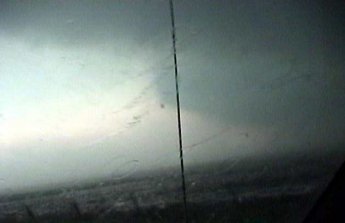
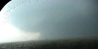
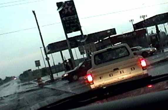
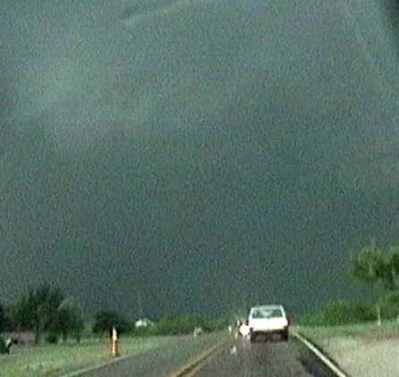
I'm on highway 114 heading east towards the town of Olney Texas and this is what is directly south of me heading northeast, the meso of a large HP supercell with a large rain-wrapped tornado. Chasers were converging on this storm from all sorts of different routes. I've found that most everyone did the same thing on this day. They drove to the Crowell storm just to turn around and head to Olney, too late. A few chasers get video of the large tornado before it gets to Olney.
The wind was pretty strong at this distance. The water was blowing from the highway straight towards the storm.
I made a quick stop on the highway before I entered the town of Olney. I tried to see if I could see any tornado but I couldn't. They announced on the radio that they still had that tornado on the ground 2 miles southwest of Olney Texas heading northeast.

Now I'm heading east through Olney just trying to get out of the way. Notice the hail smashing on the left side of the windshield. Wasn't a lot of rain falling here, just hail from time to time. The sirens were sounding in the town at this time.
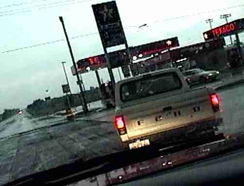
Here I'm waiting to turn south behind someone who obviously couldn't hear the sirens and realize what was going on, because he wasn't in any hurry. Notice that the power is on at the Texaco in this capture. It went out as I was making this turn.
The power is now off.
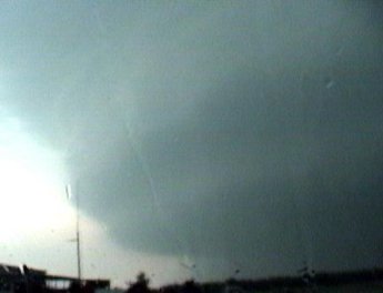
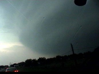
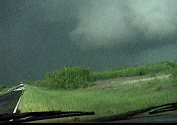
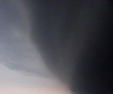
This is my view southwest as I turn on a south road. What a meso!
Some people just don't know when to drive a little quicker.
If I would have taken the fork in the road to the south-southeast I would have thee best video of a mesocyclone ever, but no, I had to turn to the right, wanting to see a rain-wrapped tornado that couldn't be seen.
Shortly after turning the corner to the west I decided that I had better stop. I noticed several of these power flashes to my west. That power flash is only 1/4 mile or less south of the road I came into town on a couple minutes ago.
These Channel 3 chasers pass me and head in the direction the NSSL probes were heading.
This is them about 10 seconds later deciding that maybe they didn't want to head over that little hill. They pulled clear into the grass and spun a big cookie to head back the other direction. By the time they got back to where I was turning, I think they were doing about 50. They must have seen something I didn't. After reading other chase reports from this storm I learned there was a smaller tornado that formed under these whitish inflow clouds, just after the power flashes, heading south. It was moving in towards the large tornado wrapped in rain. I head back to that fork in the road and take the southeast road for about a block.
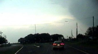
This is that southeast road I should have taken right after that fork in the road. I pull over here with about 4 other chasers. Again I should have headed south at this time. The one chaser said, "I was thinking about going that way, but I don't know" as he pointed down this road. As I looked back down it, rain curtains rotating under the mesocyclone were blowing across it rapidly. It was actually pretty frightening. That happens after these last few captures
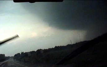
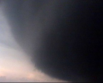
Picture as I was talking with those chasers. The meso was so huge and full of rain you didn't really know where the tornado would be.
I can't explain this sight. The motion of these clouds making up the side of the mesocyclone was awesome. I've never seen clouds screaming around a mesocyclone like this. I wish I had captured the motion on video.
Being under something so big and spinning so quickly can make a person awestruck. These captures and my video suck. I would have given anything to have been a little further east with some time and a tri-pod.
I end up driving east toward Jacksboro just in time to get popped with hail from a new meso that formed se of this one. As I pulled into Jacksboro they began reporting a tornado heading into the city of Jacksboro. Every storm was the HP variety so you couldn't see much. Tornado reports for the town you are in from an HP isn't all that fun. All I could do is pull into a car wash and wait for the hail to pass. Turns out this new meso produced a brief tornado near Graham and was then cut off by the developing line. I end up in Fort Worth before I find a motel room and about an hour ahead of the squall line.
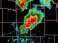
Radar of this tornadic supercell.


