July 8, 2009 Local Storms
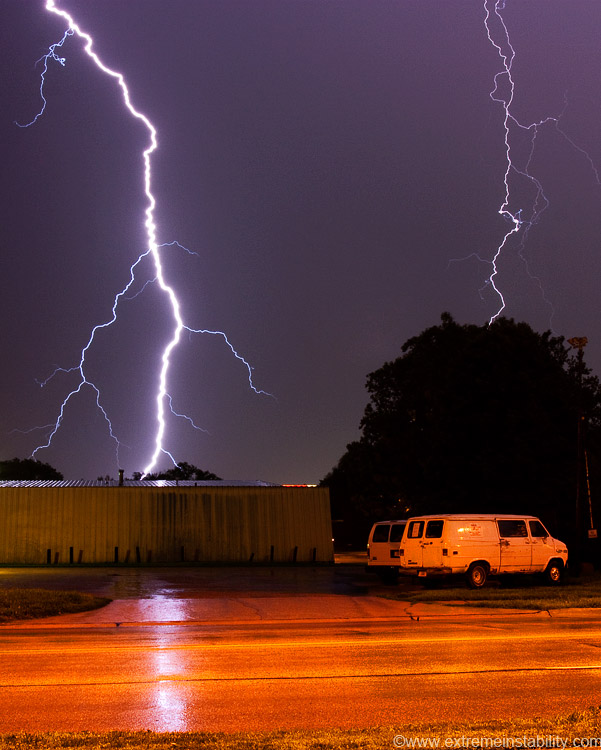
Some storms formed to the north and were dropping south towards town. I leave early and head into Iowa to see what they were doing. They looked pathetic with infrequent and in cloud lightning way north, so I drove back home and gave up on that idea. The line hits town, blows a bit, but no CGs. Then a ways behind that gust front, heavy rain kicks in, still no CGs. Back edge of the rain arrives and CG madness begins. Wonderful I thought, as I'd brought all my stuff back in from the car and already taken my contacts out. Hell I didn't even have a tripod in the apartment. So my camera is setting on an upside down, emptied dirty clothes basket...as I shoot out my limited view window. Several were smashing away in view on the east side of town. I was also seeing a lot of bright flashes above that I figured were CGs hitting south, north, or west of me out of view somewhere. Lines are normally horrible CG producers and instead produce mostly all CC(cloud to cloud) bolts. The line was mostly falling apart as the outflow was ahead of it as it passed through. Guessing that helped with CGs, as less discharging was able to happen between uprafts in a line now.
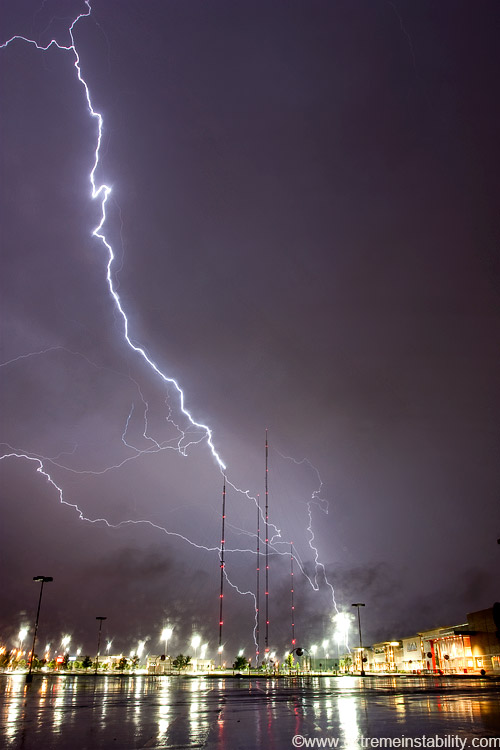
As I sat at home, I kept kicking myself for thinking these storms were going to suck for lightning and not heading to Omaha for better ops like the TV towers. Finally I said screw it, threw my contacts back in and flew to Omaha. This at like almost 2 a.m. I think it was. Of course like always, get behind a line of storms and you can get bolts hitting or coming off the TV towers(though this anvil was poorly developed or wide here), but usually the wind is out away from the storms, so southerly here. It changes a lot actually, so getting it to work so you can open a car window isn't easy...especially a Mustang where the top of the window is well in from the bottom. This above was taken through my hazy, grungy windshield, as my car idled with wipers going, around 10 mm. I did not think the tower was even involved in this. I saw the bolt hit well south, but apparently at the same moment one came off the left TV tower. I quickly decide to look for a spot south of these towers. I find a great spot for a wide angle lens during south wind with rain, but the show was over.
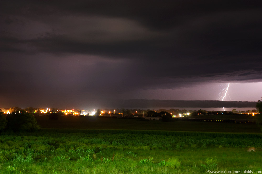
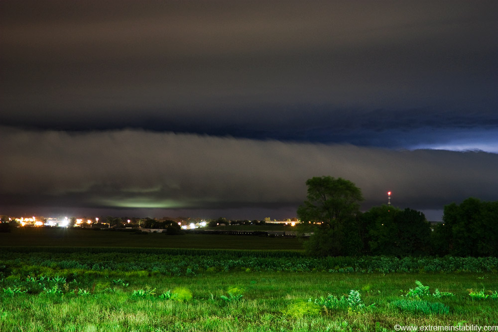
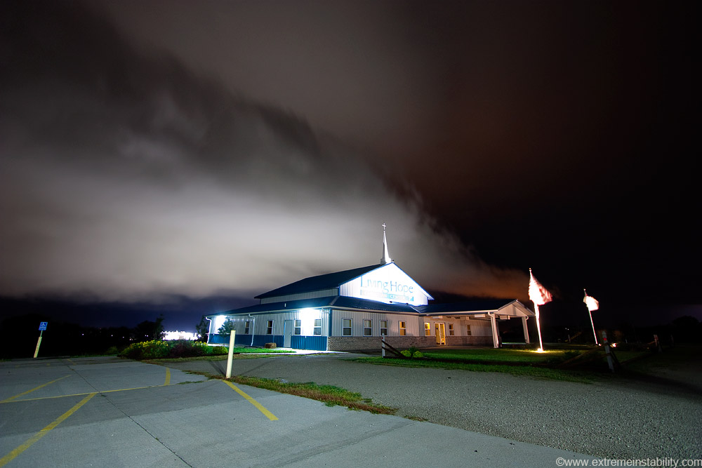
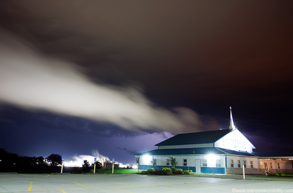
Well the show wasn't quite over. More storms fired to the north again, just on the east side of the Missouri River. I shoot these storms till about 6 a.m. from a church parking lot just south of Blair. The lights of the parking lot are lighting up the foreground. A really large Cargil plant is just to the east/right of this shot. It, along with Blair, really light up the storms from here as they move over town. My focus wasn't exactly right yet on this shot, so at full size it's rather soft. Figures as I doubt I'll get such a combo again. Notice on the lower right there's a deer! Two actually moved through there pretty fast, stopping to eat just a bit and move along. Getting a CG out of this stuff now was rare. Notice the roll cloud out there. Rain cooled air pushes out and forms the cloud as it meets warmer air. This roll cloud/outflow boundary is slowly pushing to the sw away from the storms and moves over me eventually.
Figures, where the tree is! That line of trees is annoying as it blocks some of Cargil's steam here too.

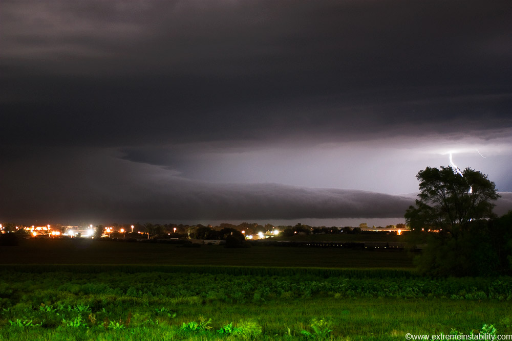
Roll cloud entering town. Time lapse of this with a high quality video camera would be pretty amazing. As it got closer the thing was shifting back and forth, left and right. I was like, that is crazy. It'd be moving left for a bit, abruptly stop and begin shifting right, then do it again.
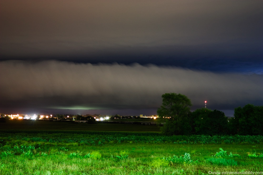
The light hitting the bottom of it I think is coming from the high school parking lot and/or ball diamonds/tennis court over there. It was cool when that started as you then knew how close it was.
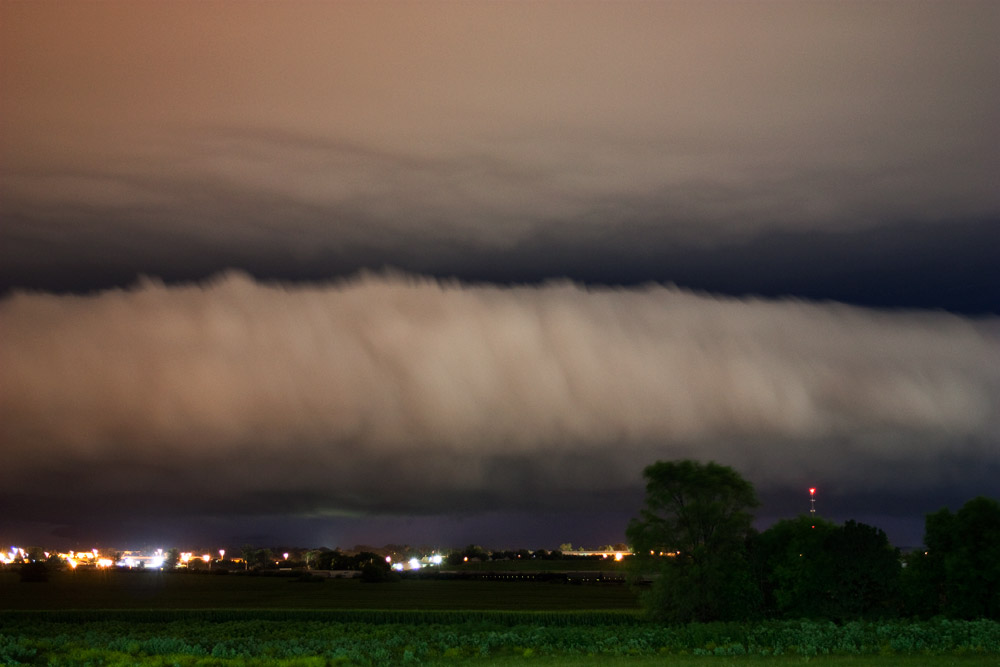
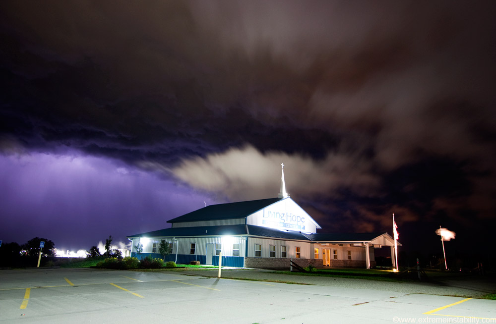
It's now clearly entering an area where it gets a lot of light help from Cargil off to the right of the shot and the majority of Blair forward and left.
On the far right those detached clouds are actually steam from Cargil now blowing south down low, but then lifting up and over the top of the roll cloud. I wish I had thought of that sooner and been pointed that direction more.
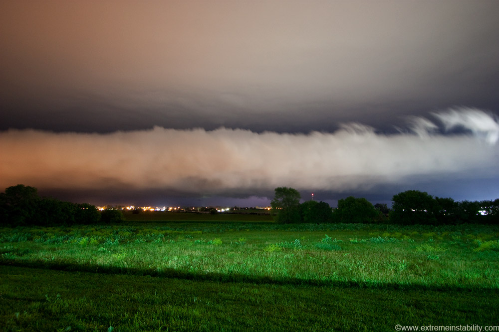
Cargil is behind that church now. To the right of Cargil are more red lights, those are coming from the Ft. Calhoun nuclear power plant not far away. I think I'm ISO'd up to 400 here for oh 2-4 seconds guessing.

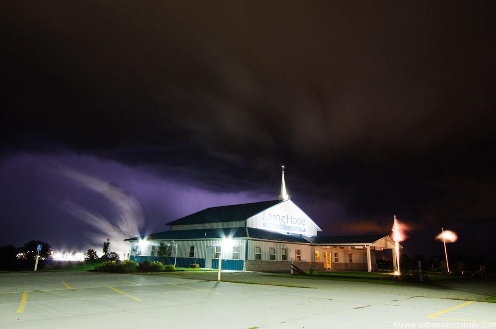
Probably back to 100 ISO now trying to get a CG....longer shutter allowed with the lower ISO. I moved a bit too. You can now see more of Cargil and steam back there.
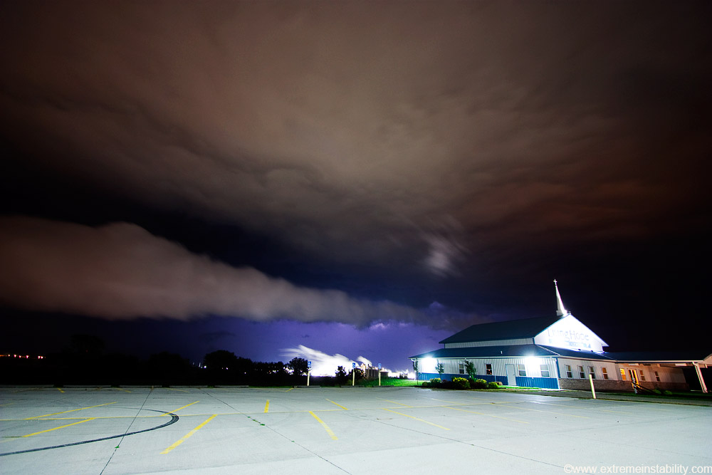
That first roll cloud appeared to stall overhead or wash out, then another cloud formed thanks to more rain cooled air pushing sw of these storms flanking the river.
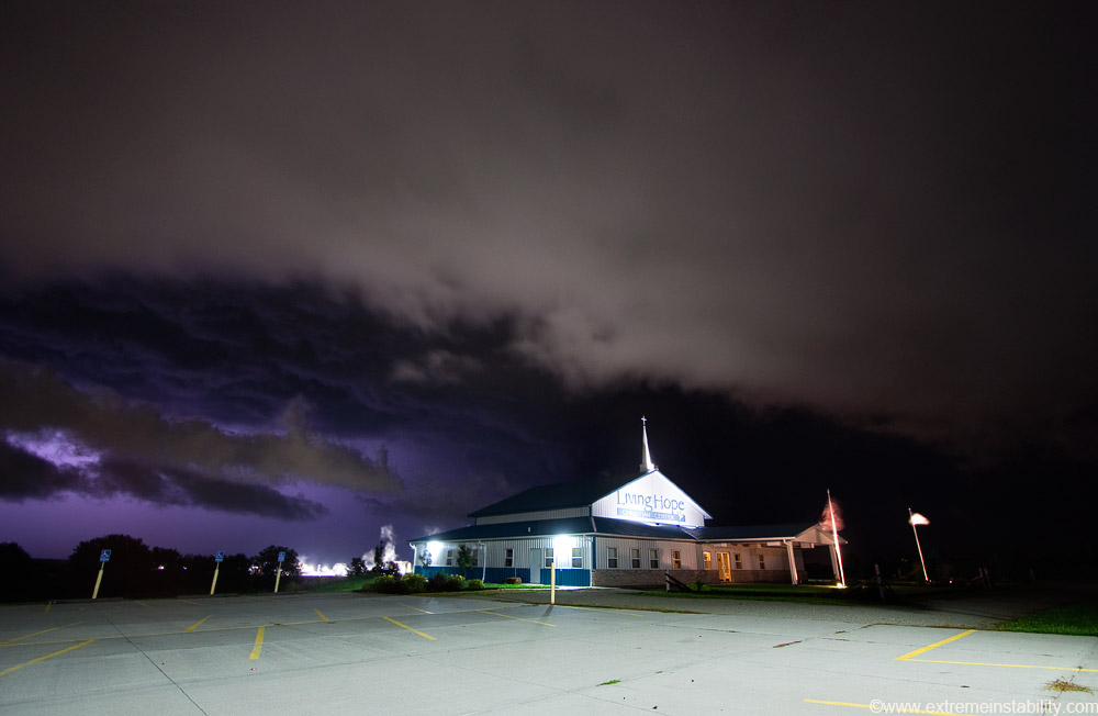
It looked really cool at times now. If you could get the right flash of lightning, it would light up some ugliness above and left of the church. To capture it well you'd need to ISO up to about 400 again, so then you'd only get 4 seconds or so before the church starts to blow out. So here I'm just firing off 4 or 5 second shots one after another till I'd get a decent flash. I never did get a really good one, but this one is close.
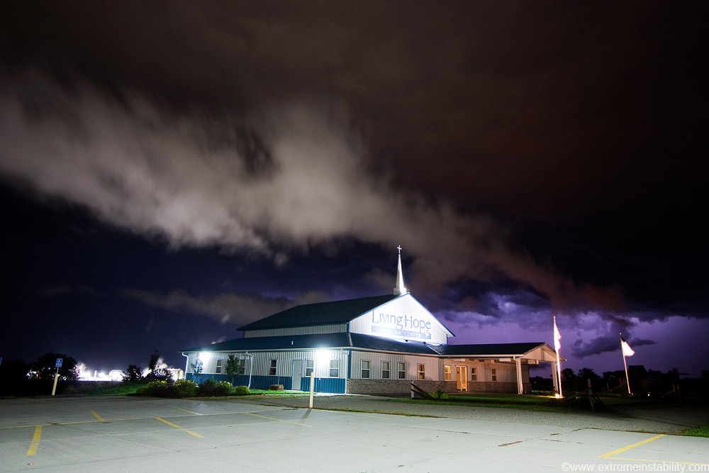
I was tempted to not post any of these and instead wait until I get a better storm here, one producing cloud to ground bolts. Oh well I guess, I can still post the same setting with a better storm later. Obviously there is some amazing storm photography potential here with the church, plus the unique lighting offered by the city lights combined with the very bright Cargil lighting.
Boy was I hoping for better CG action to start now. Weak one, of course behind the church.
This one shows the steam from the plant well. Just a bit after this I actually began getting a fair amount of CGs behind there and right. Problem was I was now getting rained on from new storms flanking this stuff. South winds again so I move over by those flags. One little storm was mow moving directly at me as I shot it from over there, shooting it to the nw. I was getting wet in my car with the window down, but I was able to keep the lens just dry enough thanks to southerly winds and me looking north. The 10mm would get the whole church in from there, filling about half the frame and the storm. Boy was I frustrated all that thing would do was flicker away above me. I guess not getting what you want leaves you more reasons to go back out. I just kept thinking, what if a cg were to hit that steeple as I'm parked here. I sure as hell wouldn't want to miss that! I convince myself stuff like this is possible and will do anything to get it, even if it means getting soaked while not getting ANY cg's. The potential seemed there with it passing right overhead, but it wasn't to be. Surely something one would want on video as well, if just for the doubters of a still image.


