July 13, 2009 Kadoka SD to Valentine NE Supercell
Well this chase turned into what I'd guess to be my favorite storm. It's really difficult to ever come to that conclusion on one storm, after hundreds. They all have their own things going for them. This just had so many going for it, it's hard not to be a favorite, at least to me. For the most part it completely lacked tornadoes too. I did not see any. What it had going for it was everything else you could want with a storm. It was a long-lived supercell going from essentially Rapid City SD, all the way through Valentine NE. It could not have taken a route with better roads, or rather the fact it took a route right along paved highways, where they are lacking. 2 great things right there. The lightning being produced by this storm at Kadoka and again at Valentine was unlike anything I've seen, especially the surreal display as it neared Kadoka. Fast and concentrated CGs in a high based occluded area, for an extended period of time. Just did not seem possible it could be doing this in the same location that quickly for that long. So it had that going for it. As evening progressed, inflow winds increased, into an increasingly structure supercell. They would get to a point I'm not sure I've seen before on a storm. This as the vault, or near vault region of the supercell would become amazingly structured...as close to overhead as it could...without going too far overhead and past the only highway option at that point, 83 south of Valentine. Just jaw dropping features in your face. This as the lowest, nastiest beavertail/pseudo tail cloud forms and flat out races west into the beast. Just before that, the second intense cg barrage is peppering north of Valentine. So for having so many tops for myself, it must be the favorite. Might be one time stills don't do it justice either. One almost has to see the video to get it and that always comes second to stills anyway. But I have around 2 hours or so of video. Just wasn't always panning as I took stills.
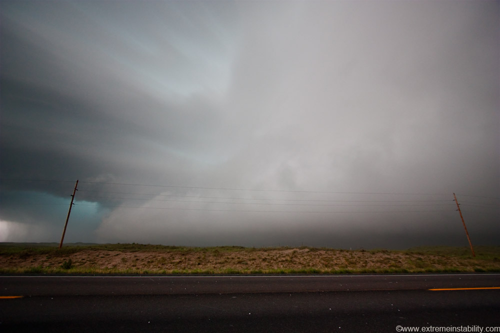
The day didn't begin so nicely. I decided to intercept a storm going north of Pierre SD. I took a paved road west of the lake, to the nw and watched it approach. It was near the warm front and was early in the day. I wanted to go west to the Black Hills but didn't want to mess up by letting this go early. The storm never looked great but teased me none-the-less. I thought the second I leave, things always go nuts on me. At the same time I thought, staying too long here is going to cost me back west as stuff fired near the Black Hills. I finally decide to give up on that storm before it nears Pierre. The storm of the day was likely becoming a supercell at this point near Rapid City. So back to the se I had to go, to get back on the highway west out of Pierre. This was going to be a couple hours agonizing drive, watching the Black Hills storm on radar do whatever it would do early, without me there yet. And would it die or turn to garbage in the time it'd take me to get there? It was looking better and better on radar and I was quickly kicking myself for giving this early storm as much of a chance as I did. Then right off the bat, into my drive west, I see the "cone zone". I stop at the flag person just a couple cars back. Yay, I just missed the pilot car. I turn off the engine and sit and sit and agonize at what I was seeing on radar way west. Blood begins to boil as I knew I again screwed up a chase day. You feel so helpless not being able to go anywhere, when you already needed to go fast. After an eternity the pilot car and traffic come back and we go. Well we almost go. I notice a semi turn around and go in front of the pilot car. The road we pull onto is mostly dirt. We then come to a stop and are not moving. I soon see why. A big loader is filling that semi on the road ahead of us! Nooooooooo! I could not believe we now had to wait for that to fill. After more forever we get going slowly, barely into what would be a loooooong mess of these areas. We get back on pavement, still following a pilot car, nothing wrong with the highway. Speed signs saying 45...us going....25...on and on. Unreal I thought. It just seemed sooooooooo stupid we were doing 25 there. Pilot car has no reason to hurry or do something more than half the speed limit. I'll just say this section of highway is to be avoided. It goes on a long ways and is just a mess. Once I got out of it and passed the cars ahead of me....I covered some ground. The storm was heading right for the freaking badlands park, with a tornado warning. I realize I can't beat it to the park and want to die. Thought for sure, I was going to miss a dream shot/intercept. I had even e-mailed with someone the night before saying, "Hell, I should just go right to the badlands park." Figuring storms fire off the Black Hills and are steered se. I was sarcastically yelling/repeating this to myself the whole drive there....frustrated that I hadn't already done exactly that.
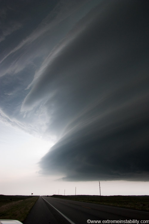
Turns out it went north of the park, but not by much. I intercept it nw of Kadoka.
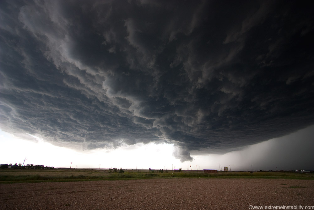
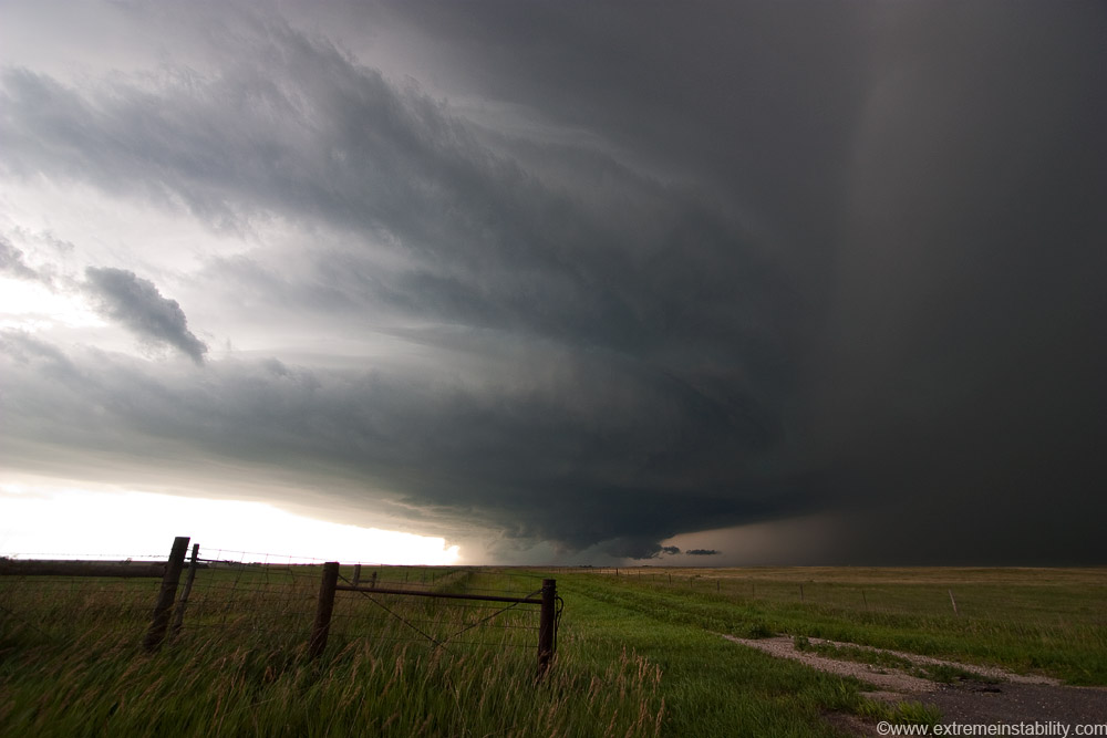
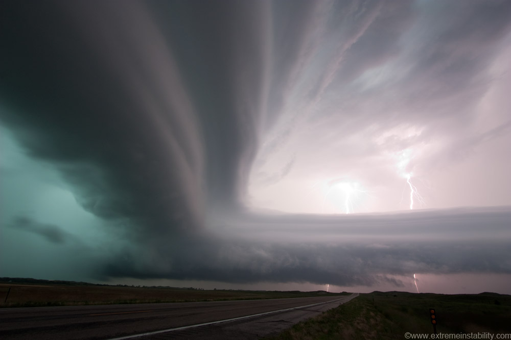
In the above I'm actually in Kadoka now. I'd been on it for a while nw of town. It was over there where it was going bonkers with the lightning madness. It was still going pretty mad with lightning here. Before here though, simply ridiculous. See the little lowered area behind/north of a rfd slot? It had one before but a lot more wrapped in there. It was in that localized area it was doing something beyond crazy with CGs before here. I'd say a similar area as the above from the lowering, to the right where that taller billboard is. An area that size was continuously throwing down CGs. On and on. I was like, how can it be recharging that fast like this there. Think of a CG then 1/2 second later a different one...then 1 second after that another. It was doing stuff like that in that same local spot. 100% certain I've never seen another storm doing what it was doing there. Seem some crazy CG barrages but not like that.
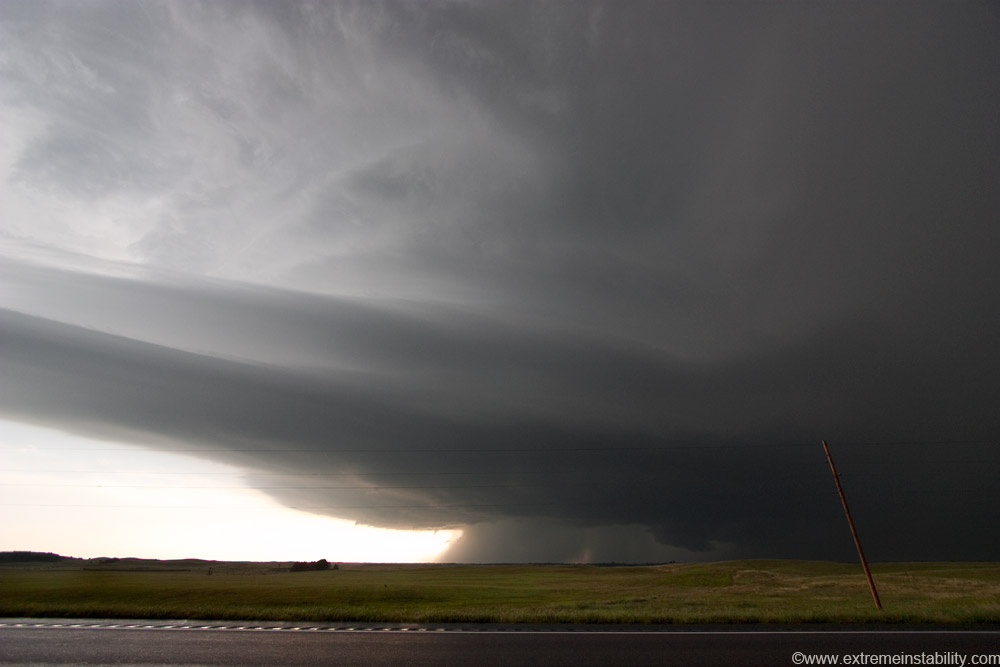
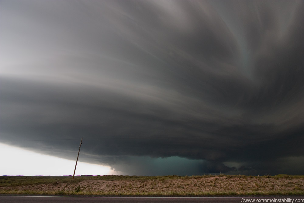
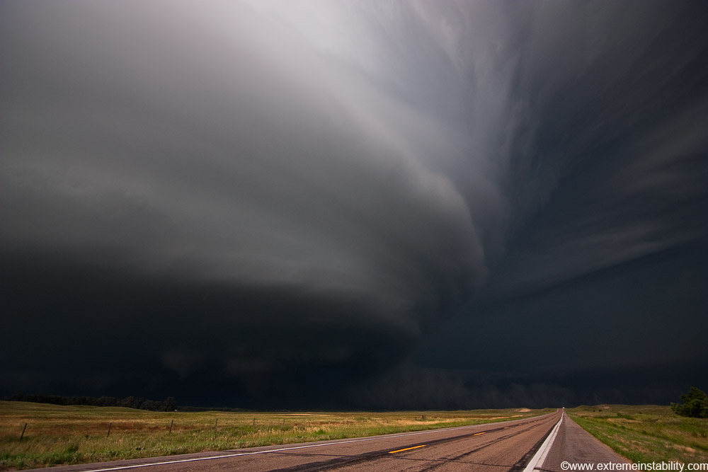
Lots of fast-forwarding now. I'm now west of Mission SD getting more east of the storm for structure. Big wall cloud in the middle now.
Finally some good structure.
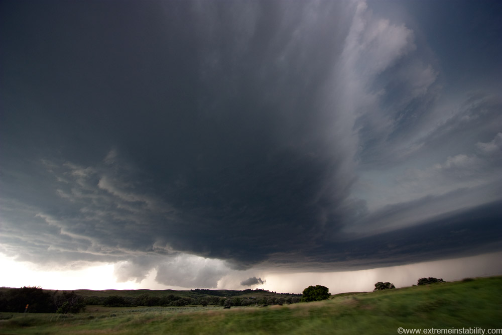
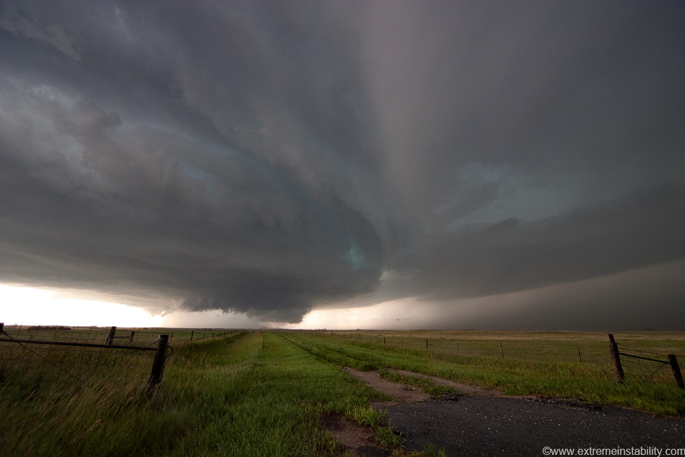
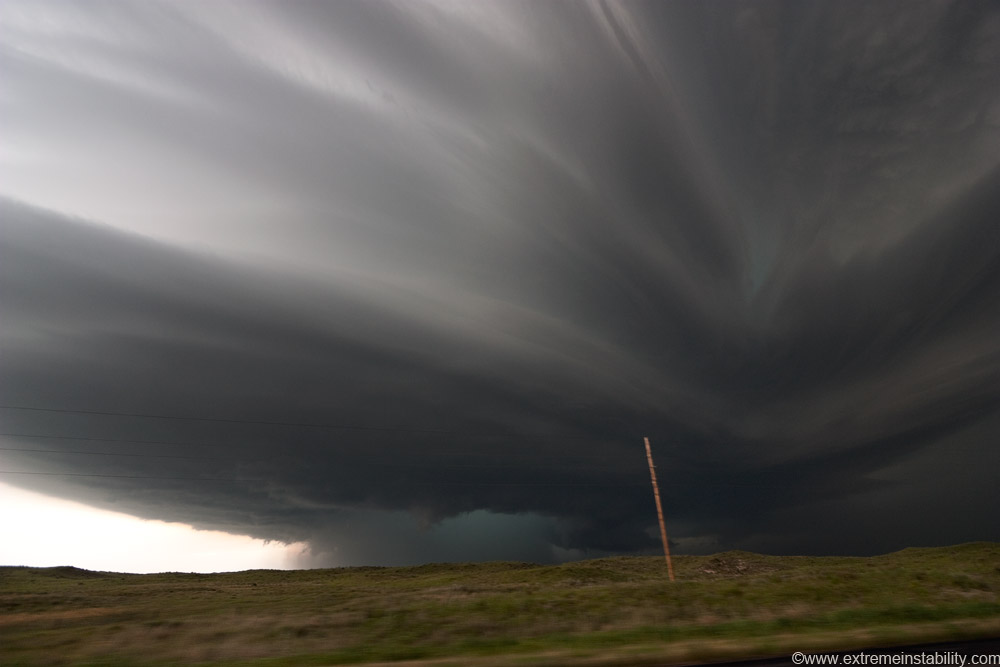
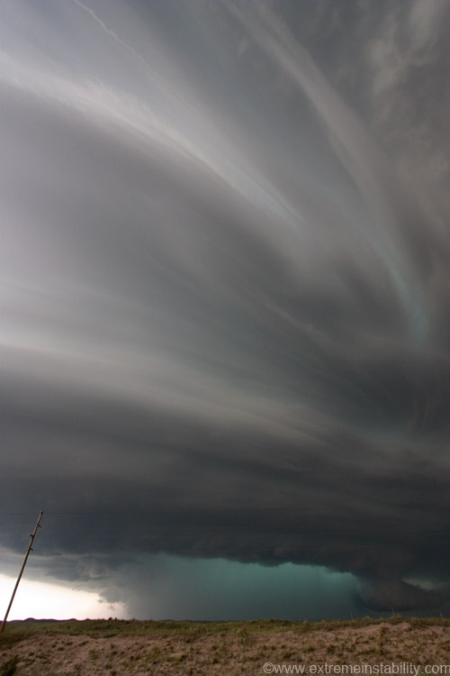
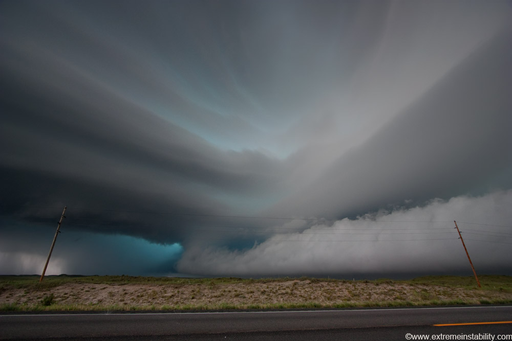
South of Mission now. Long inflow cloud with big upside down convection/mammatus ahead of the storm.
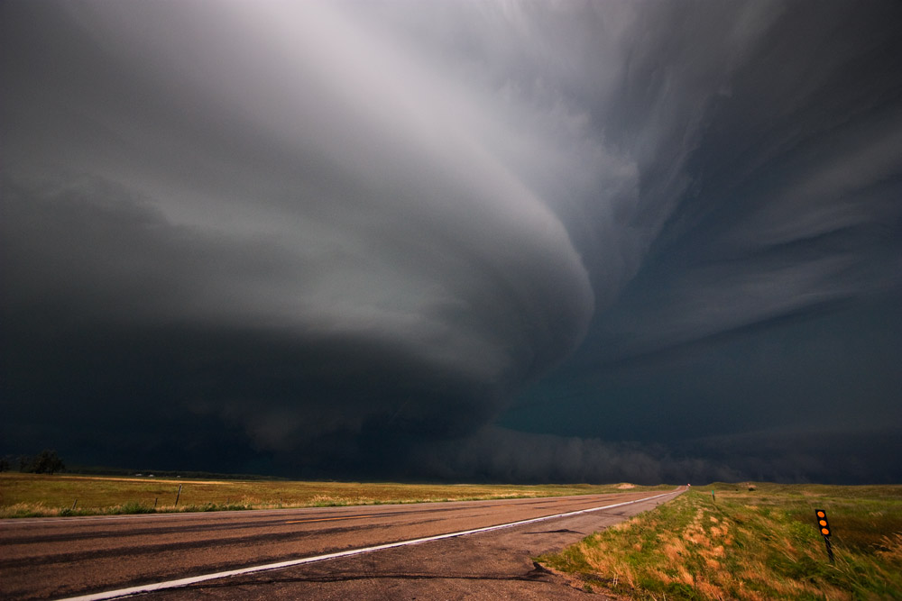
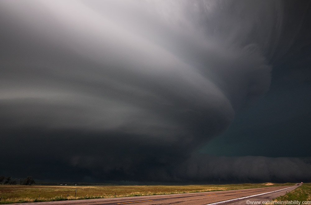
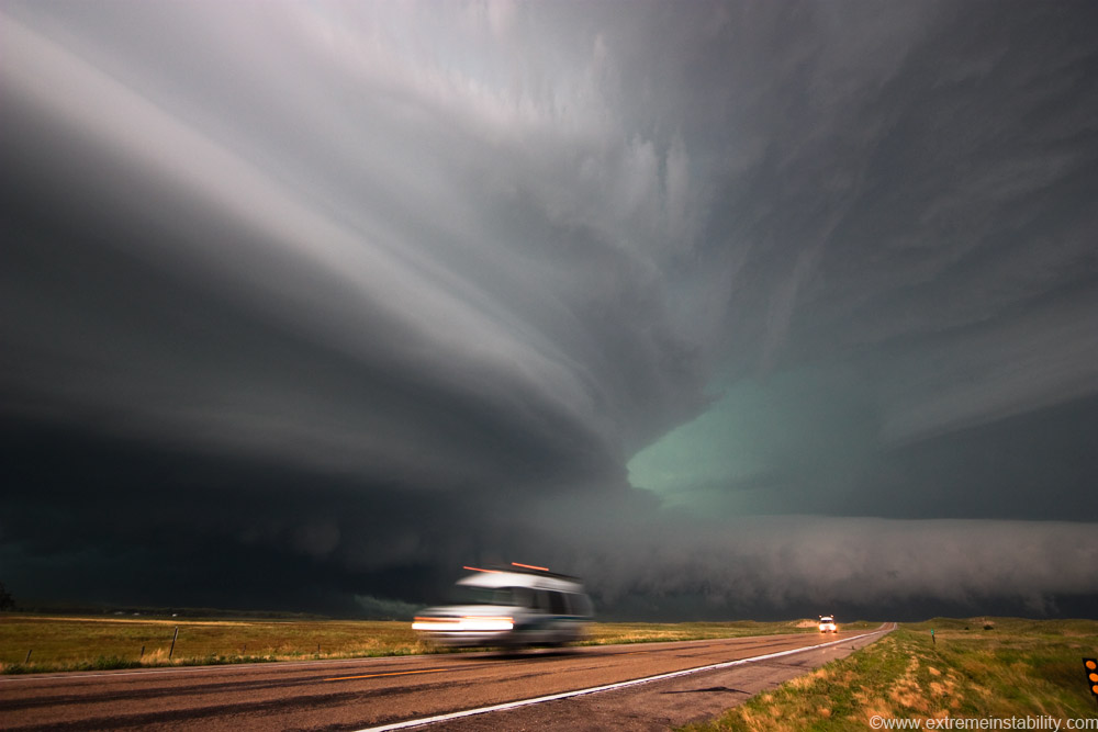
I was able to sit here quite awhile. After Kadoka there had not been much time to sit anywhere. There is a tail cloud on the right, left of that in the middle of the storm was a lowering, sometimes pointed, with a lot of dirt kicking up around it.
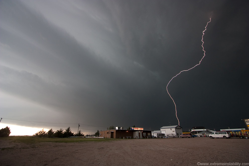
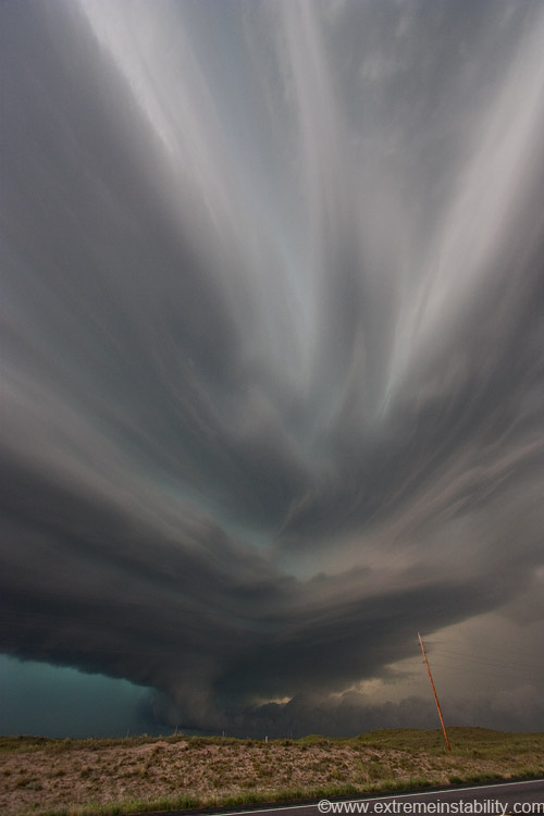
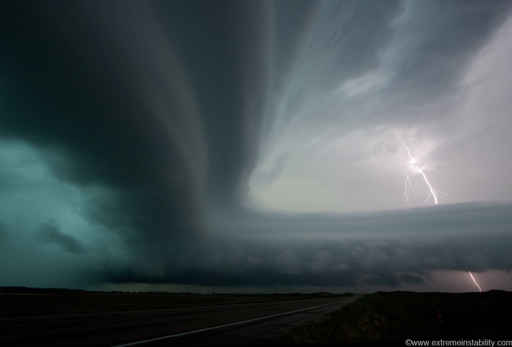
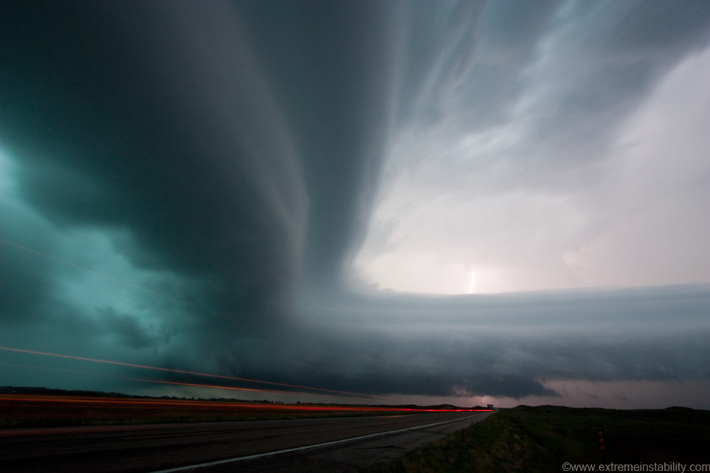
I'm now on the se side of Valentine. This was just after a crazy cg barrage but there were still a lot of CGs happening. Enough CGs I got this while taking a still of the storm.
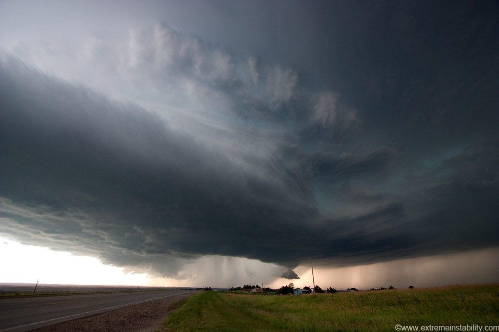
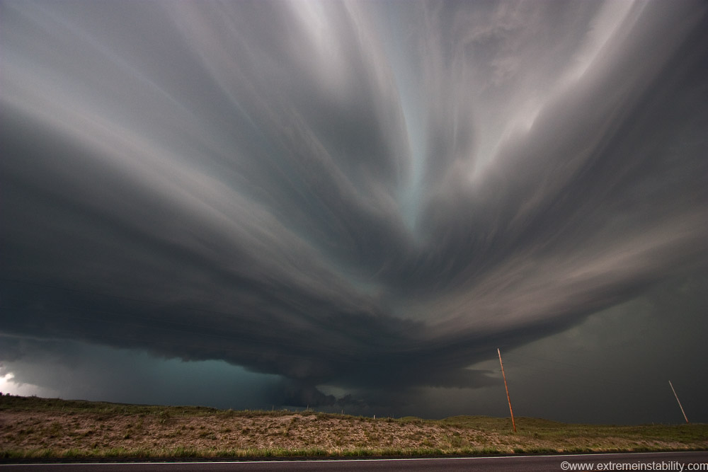
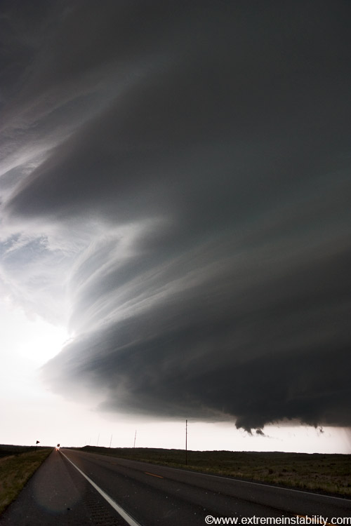
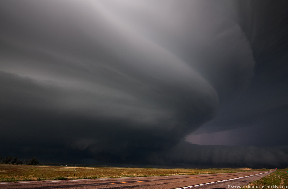
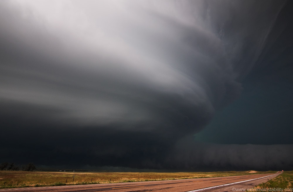
This storm was a flying eagle on radar with the core going se. It was almost on highway 20 to Ainsworth. Still moving in a se direction. So at Valentine there was a huge question mark on to go south or go ese. If you go ese it's 45 miles to Ainsworth and a south highway. You'd be in the core most of that. If you go south it looked to cross highway 83 really soon, leaving you behind the storm with what, a 50+ mile drive south with no options. The storm was becoming a beast.....aarrrgghhh what to do. Would you be able to do anything to stay with it well. Sure didn't seem so at the time. I opt south just to get what I could before it crossed 83 and for that outside chance it turns right/south. For some reason storms sure love to make that south turn in this area. What does this one do? Turns south hard and slows down a lot. Soon it's hardly moving, JUST west of the only highway around(this is Cherry County).
And now...it's time for the storm to crank and go into wild realms. Once it slowed and turned south, as late as it was, the storm decided strong inflow wasn't enough. You now had an isolated supercell in a cape/shear environment few storms ever see, and it just turned right into that environment. The significant tornado index was an 11 here. You had an increasing low level jet, probably 40 knots out of the south now with I think 30-40 knots wnw at 500mb and 60+ nw flow upstairs. The surface low was deepening quickly now as well. Good times seemed a sure bet, but this got crazy.
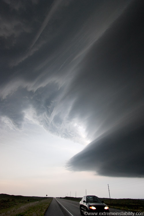
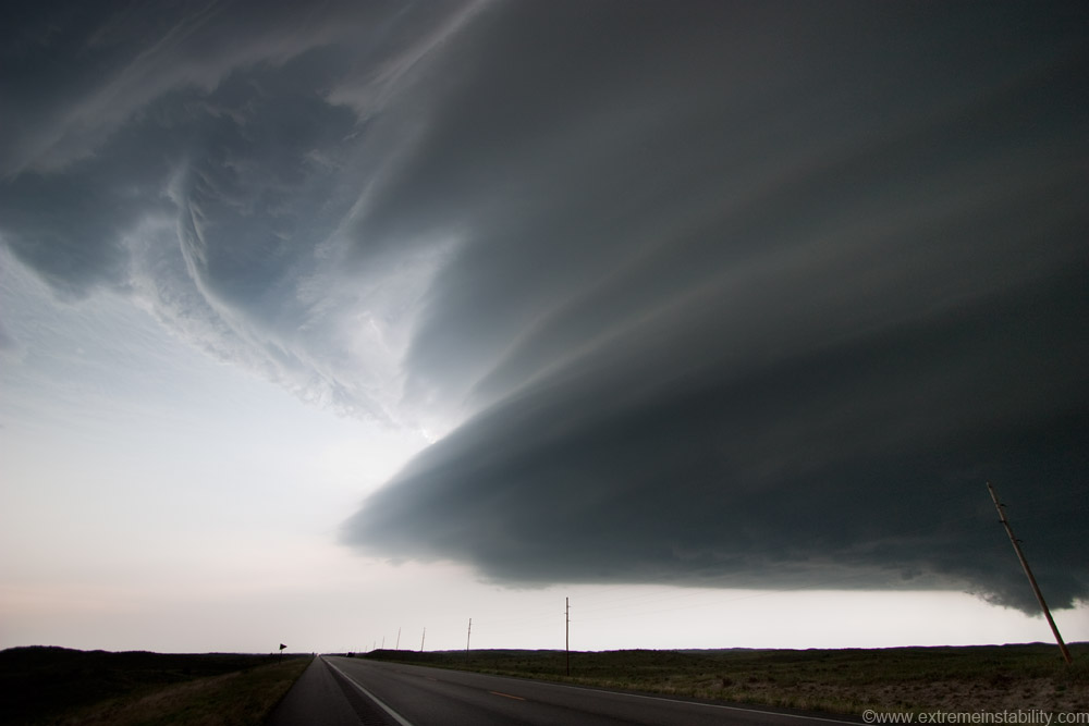
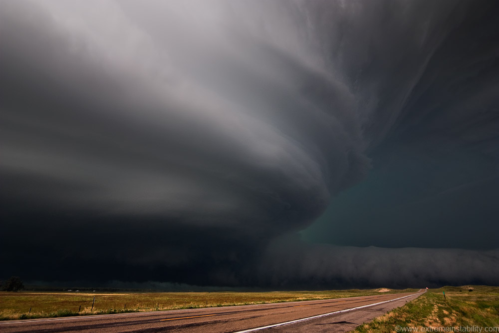
These are 10mm wide angle stills. They don't tell the story. By the way the sand hills might be void of view blocking trees, but they are not void of big hills, always bigger to the west. You can drive a long ways with zero options off the highway. The time you find *something*(simply no highways for 50+ miles) it is likely sand. Not careful with the sand THIS can happen. And that road was gravel with sand on the sides well east of this area. Several of these were just sand, or mostly sand. I started on some and was like, nope. There was nothing to get off on here to get the power poles out of the shot, while staying north near the vault region. With the lightning going on and winds begin to gust over 60mph into the storm, I sure wasn't going to go run up that hill just for a couple poles. It was pretty hard to look out the west window, so much sand in the air filtering back in after racing west over the car. Eyes got very filled with that stuff.
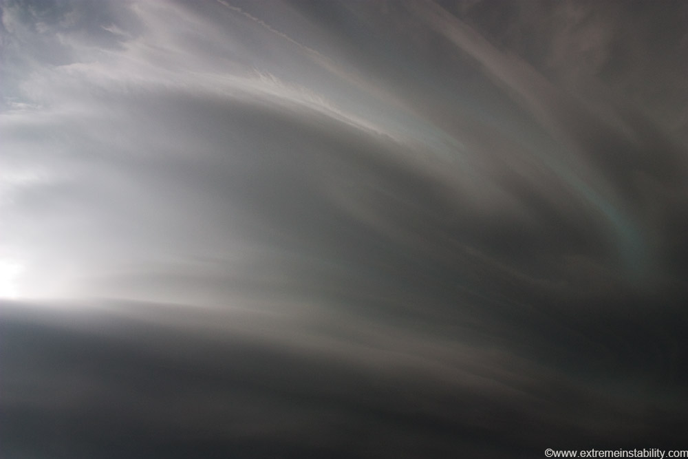
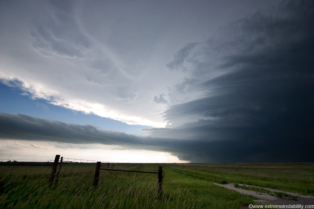
The sight above at the time is hard to describe. Amazing. All this wild flow into the same area of the storm.
These don't even show the structure you had on the south side curling around west.
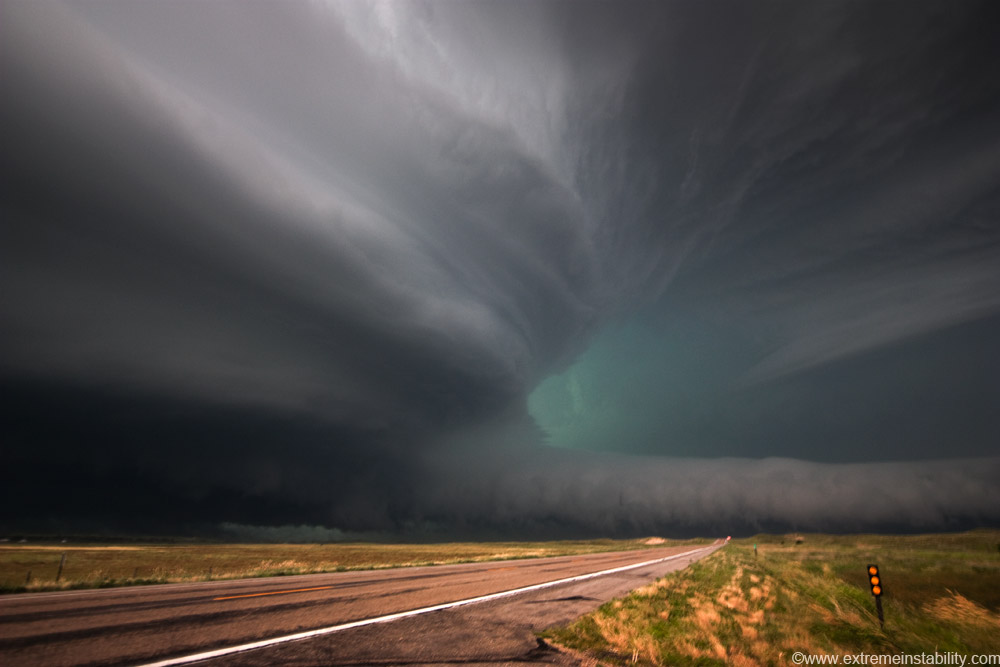
This is pretty cool on video, the way that nasty beaver tail deal begins to form. Just did not look like happy times over there at the moment. Consider this is 10mm. 10mm on my camera gives me 107 degree view the long way. The clouds on top of this image are directly overhead, as in you have to tilt your head and look straight up to see that. Stills just do not convey the sight that was there now.
Looking south.
There were even some mid-level bands arcing out.
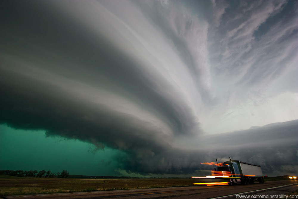
Hail falling now. Ground hugging inflow cloud forming fast now. The striated structure goes left of image, around over the highway I'm on and back west. It's always amazing to see the storm from this location.
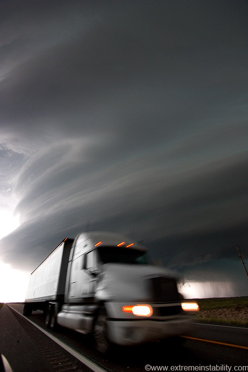
Looking south again. Dean Cosgrove has this same semi I think. It's a wal-mart truck too. He had a funny term, saying something like you really can find wal-mart everywhere and here was them deploying a truck.
I get my skull smacked with a stone around now. Enough I had a lump for a good day. The video pans at this point are pretty wild.
It's messed up how fast the clouds at the top of this inflow wall were moving west. It's hard to see them on video, but you see them just enough to think, "Those aren't moving that fast are they!" Then all the sudden you can see cloud pieces around you moving that fast west. I was toying with the idea of sampling this core now. Once I saw that though, I was like, nope, not sampling this now. I'm all for huge hail window busters, but not ones moving horizontally. I later learn the tornado warning that came out said this, "In addition to the tornado, this storm is capable of producing baseball sized hail with winds in excess of 100 MPH." It's not every day warning text says that.
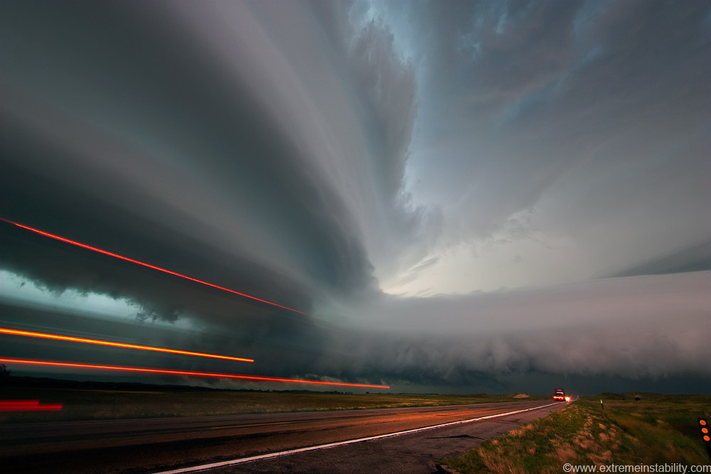
I leave the beavertail-o-fun and head south more. Inflow winds were now peaking. The impression I got from the trees near me here was that the storm wanted them. Not just some leaves or a branch, but the whole tree. The storm was now ready to show off, as if it hadn't been.
Jupiter's red spot has nothing on this storm now.
Look closely at the center of the storm just about to curl around behind, and just above that inflow cloud and you can make out a train of kelvin helmholtz waves. I've seen them before on storms a couple times, but never changing as fast as these were. Just a train of waves curling and crashing in real time.
I put this one on here to try and show how windy it was. My car is pointing ene, winds are screaming out of the ese. I'm fairly well pointed into the wind but not quite. You should be able to hand hold 1/10th a second at 10mm like here. My camera is firmly attached to my window. Problem was the wind rocking my car so bad! Look how blurry that post is and the moving grass. All thanks to wind rocking my car. I had to keep trying to time the gusts to get something somewhat sharp. I was already using 400 ISO to get me to 1/10th 1/13th. The video here is pretty wild, though mine suffers once light gets low to a point.
COD(College of Dupage) team coming south. I'd always wondered who drove those ugly vans lol.
Trying to get lightning now as light lowers further, before the storm overtakes me. I saw this one later and was like, how did that happen to the semi. Light streaks because it is moving obviously. Truck itself should have been transparent like the front looks to the left. A lightning flash had to illuminate it at the start of the exposure.
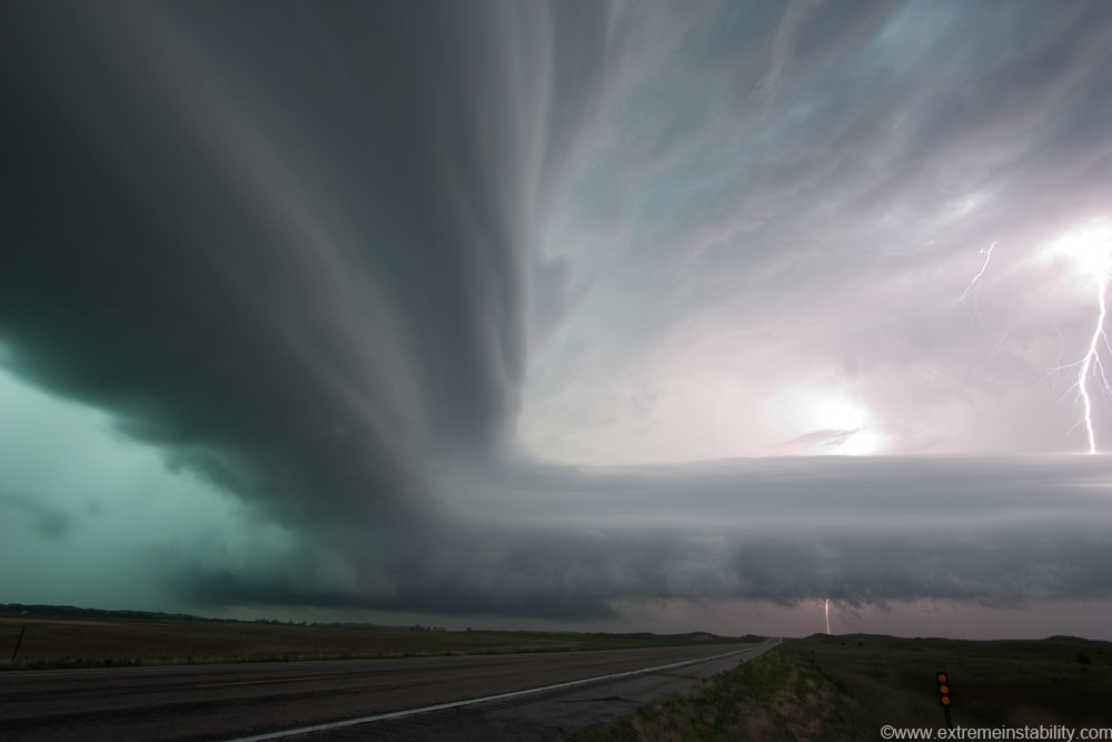
Took me a bit to get settings dialed in to not blow the bolts out. Stopping down now though just meant blurry storm shots and I still wanted structure images.
The storm had been happy west of the highway for so long. Not now. I head south, too late. RFD/gust front was now racing east. 5 or so minutes of driving fast in rain and I get back out. Head to Thedford and get a room at the Roadside Inn, which was wrongly named. Railside Inn would have been better. Nothing beats 30 minute train wake up calls all night.
If you want to see video of this, you'll probably have to buy the dvd this fall lol. Image accounts are already too time consuming as it is.


