June 7, 2009 Oregon Missouri Monster Hailer
Not a lot to type on this one. An early storm near Pawnee City Nebraska showed some hope, with a long tail cloud and supercell structure. The updraft just looked rather string beany/skinny. Lowerings looked a bit pushed south/outflowy. Meanwhile another similar looking storm was gaining some strength to the southeast in far northeast Kansas heading towards Falls City Nebraska(it would soon have a crazy mushroom bomb updraft however, something I probably should have got a video grab of....just a serious boomer as it neared Oregon MO). The storm was in the inflow trajectory of the Pawnee City storm. Also this northwest storm was heading for a crappy river crossing option. I decided to bail on the Pawnee City storm early, in hopes to hit the southeastern storm before the chaser masses got over there. Heart of chase season, with a very localized target area, the number of chasers was unlike any I had seen before. Quite possibly the biggest convergence in chase history to this point. I blast south from Humboldt NE and see a massive line of chasers going north, along with lots of chasers parked along that highway. I could see on spotter network there were a ton west yet, on the east-south highway I was about to. I hoped to beat most of those on the jump east. Soon as I go east I see tons and tons of chasers parked off the highway there and many more in front of me pulling over to park and watch the NE storm. So I get east of that and am now ahead of the mass going north/parked on the north-south highway, the mass of chasers west yet moving east, and the big group I just went by going east(3 different sections each with a ton of chasers). We're talking 100 cars or more. Pretty much the majority just about ready to blast east as well. Anyway, got a pretty big jump on all that and really the whole drive to Falls City it was just me and a couple other cars(though crossing the Missouri River there was now a long line behind us). Of course there were some chasers that were already over in MO, that were never on that other NE storm. All I knew was I didn't want to stop again and get behind that mess. I thought about posting some images of the first storm but it really wasn't worth it.
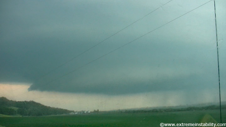
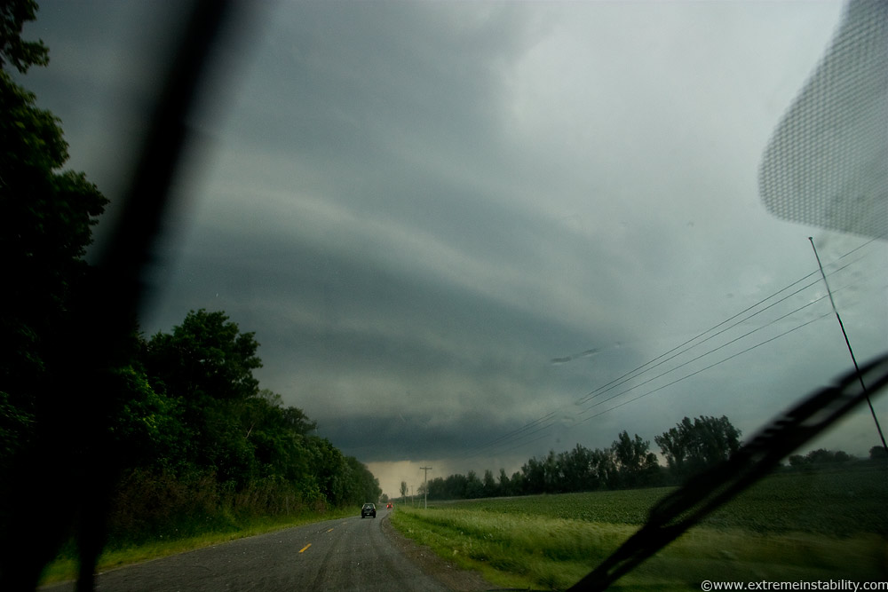
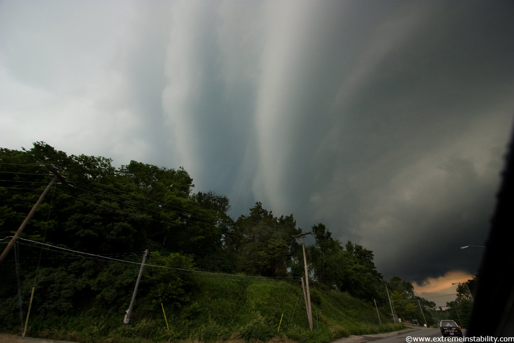
Here is the initial views of the now beast, tornado warned supercell near Forrest City Missouri. I'd just cleared some rain and smaller hail. The stones would just get bigger and bigger going east, trying to punch the storm.
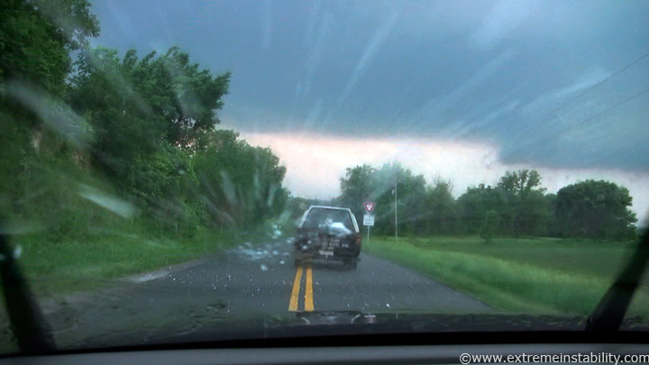
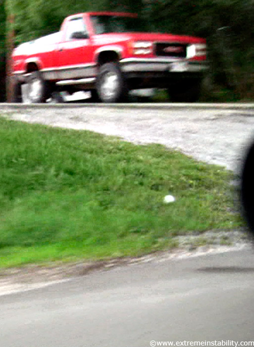
Behind the "Outlaw Chasers" as it reads on the back of that truck. Just one car ahead of us, it going slow of course. Thankfully it pulls over here and we can again fly. Drive fast in big hail for 5 minutes or drive slow in it for 30.....hummm. The monster stones were highly sporadic here so just going fast was wisest.
Wide angle still held out my window as I drive. You can see some streaks/hail. About now all you had falling were the big stones.
For reference, chasers measured a stone 5 and 1/4 inch in diameter here...that from a very short grab, as stones were still falling as they stopped. So that is the type of sporadic stuff plunging to Earth here right now. I saw 3 guys running back to a car up here holding huge stones. Whoever they were, they were nuts. 5+ inch diameter stones in the mix, would....well.....knock a person out for a long long time I'm thinking. I was like, what in the hell are you doing running back to a car right now. Of course I'm super pissed I never stopped long enough to get some.
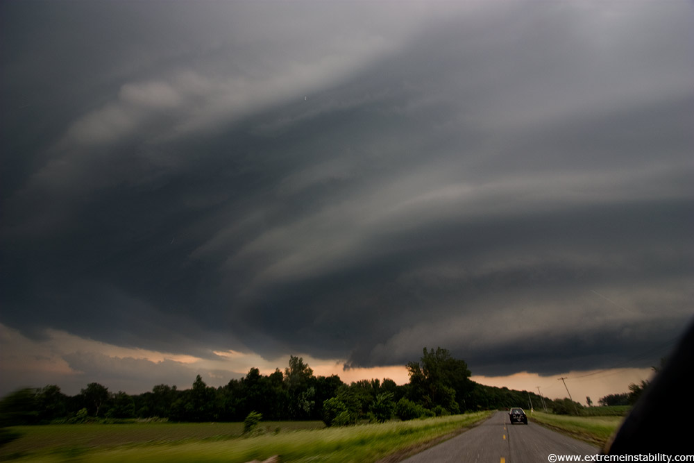
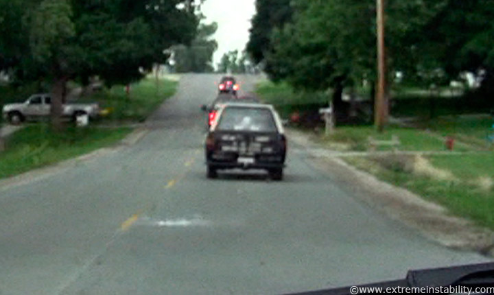
Road to Forrest City, backside of the supercell.
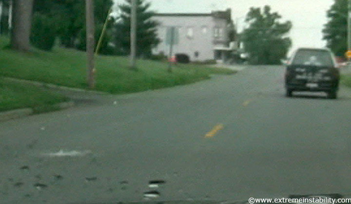
Going through one of those two towns, huge stone laying there. That is just a crop from a high def video grab as I drove by. Tornado sirens were blaring now, with a massive curl overhead to an area of interest just south of town.
Another video grab crop. Hard to see here but all that white is from one stone that just smashed down ahead of me. Literally the frame of video in which it is hitting. Twice similar sized stones smashed his camper shell. This was really loud even back in my car.
Another big impact that just hit over on the left. The monster hail in Oregon MO was just getting underway. I'm glad I didn't get through here any slower or later. Also glad I did not take that other east route to I29 through the heavier core region and get pummeled by non-sporadic baseballs. Lots of cars on I29 lost their windows. As it was, it was somewhat surreal driving through here now and seeing those come down and burst. You just drive, with the repeating thought in your head going "don't hit my window, don't hit my window...get east get east." LOL it had to be strange for any locals out walking around town as I could imagine this starting with just huge hail stones and nothing else. Joe Public - "Lalala out meandering around town.......BAM gorrila hail stone bounces nearby." I mean that is how it was now, pretty much nothing coming down but these spordic monster stones.
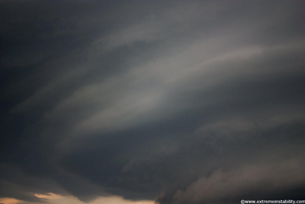
Spaceship saucer structure above. I got ahead of it at Savannah MO but went south and tried to go east on a paved option, but that was closed. Structure was not as impressive then and as I came back north I decided to let it move east of me and see if it was cool in the back yet. It was not. I let it go then, not sure what option I'd take east then and not thrilled with its structure or messing with it with as many chasers that were on it too.

Sunset on way home.


