June 17, 2009 Aurora Nebraska Tornadic Supercell
Well, I left for this chase as the storms blew up on the NE/KS border. By the time I get to Lincoln, the western one is tornado warned and just south of Beatrice at that point. What to do, as I wanted to target west later. These choices can make or break a day. Often if you don't bite you get bit. But given it was due south of me and I was 45 miles or so north of it, I decided not to try and play catch up. This turned out to be a good choice, as by the time I would have gotten ahead of it, it would have been winding down.
I sit in York for a while then head to Grand Island. I sit there for a bit and soon find myself chatting with J.B. Dixon. Wasn't long and towers were firing on an outflow boundary off those eastern storms. Problem was maybe they'd cross it and not like the somewhat drier air on the other side. First storm did that, then one formed nw of that near Kearney. We bit on that one right away. We watched it south of Ravenna NE for a good while. Soon a new base formed to the east of the old one and rapidly took over. Time to move east, but there was a 7 mile stretch of no east connectors. Go north 3 miles to one or south 4 miles to one. 3 north appeared to put us in the core and there didn't appear to be a huge reason to do that yet. So we drop south and go east. Soon as we are going east we see it produce the first tornado. I didn't even bother putting that on here, since we were so far south. We go east a few miles then start to blast back north. Another different tornado rapidly forms to our northwest. We'd get over a hill and see we were still too low and needed to go another mile to get over the next hill to another east option. Above was making that drive.
Finally we get closer to it, just in time for it to already start roping out. Neither of these 2 tornadoes lasted very long.
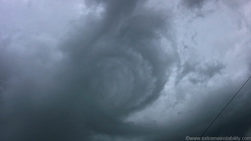
I'll skip a bunch of time here as nothing crazy happened for a while. Just west of Grand Island the storm looks like it is rapidly vanishing. I was tempted to bail on it and head west to another supercell. Then I start getting hit by some rather strong winds. I soon see this strange thing right behind the storm. On the right side is the backside of the updrafts making up the gust front. The motion was going left and carving out that "hole"/vortex. It was quickly spiraling and spiraling like that. As I was watching it above me and to the east a bit I kept thinking, why is it so damn windy now. Just pretty cool I guess.
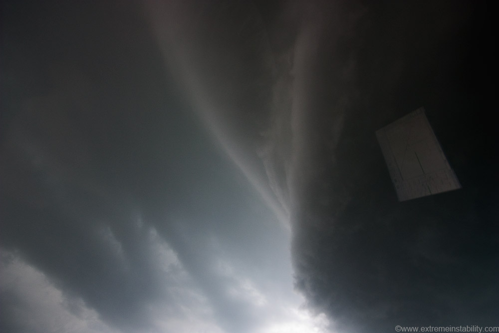
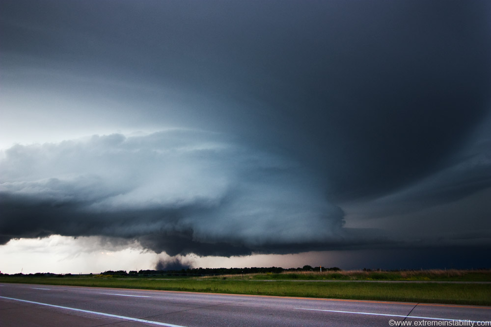
It was soon apparent the storm was not done yet. Out of nowhere it begins to crank and organize rapidly. Met up with Steve Peterson around here. We are going east, west of Grand Island yet and this is above us, the north side of the new forming meso.
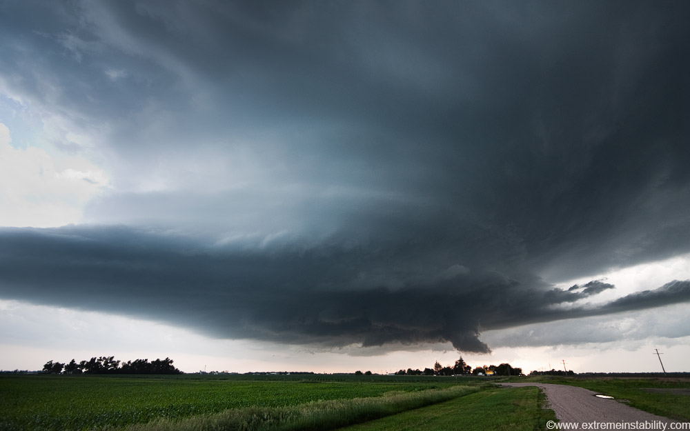
Structure! Just crossed highway 30.
Game on.

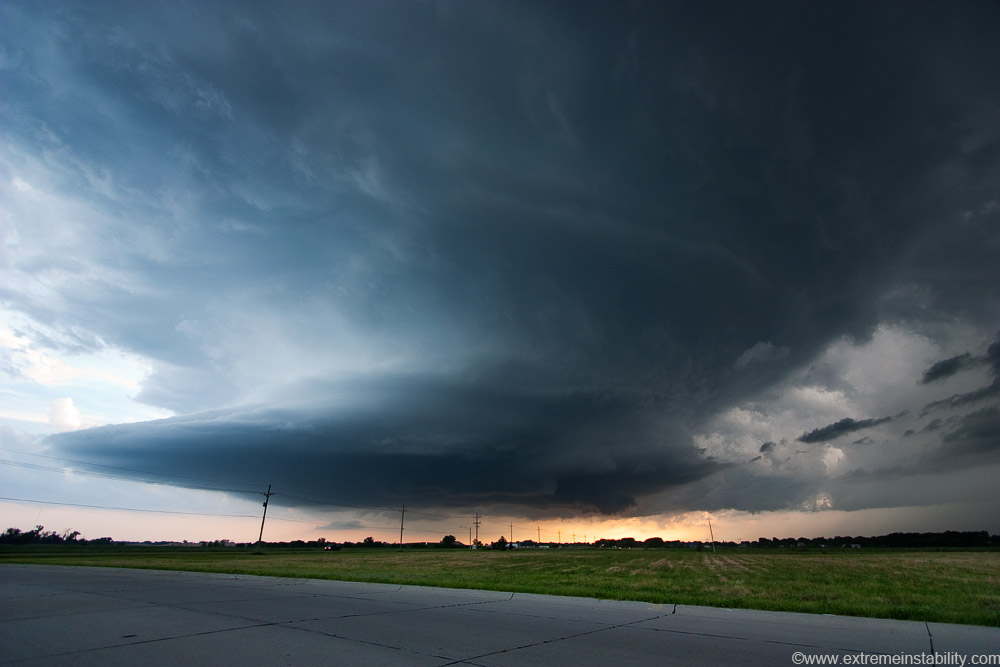
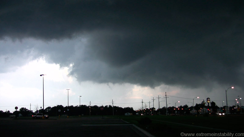
East on 34 now, se Grand Island. Ominous view coming into the city.
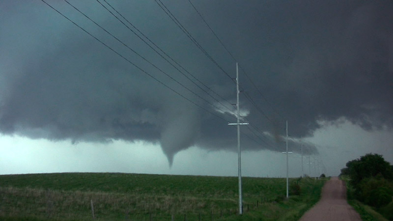
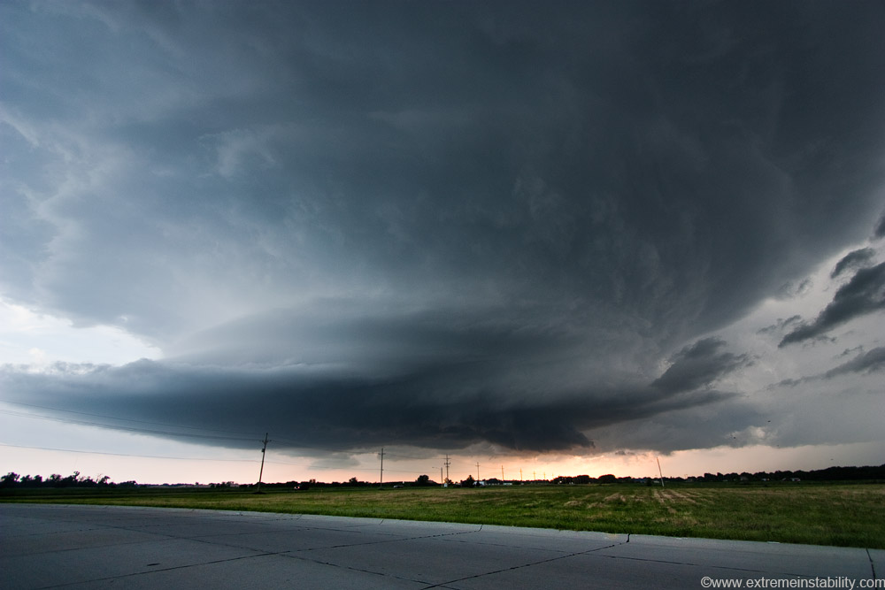
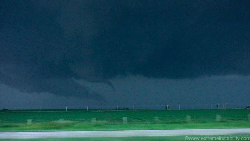
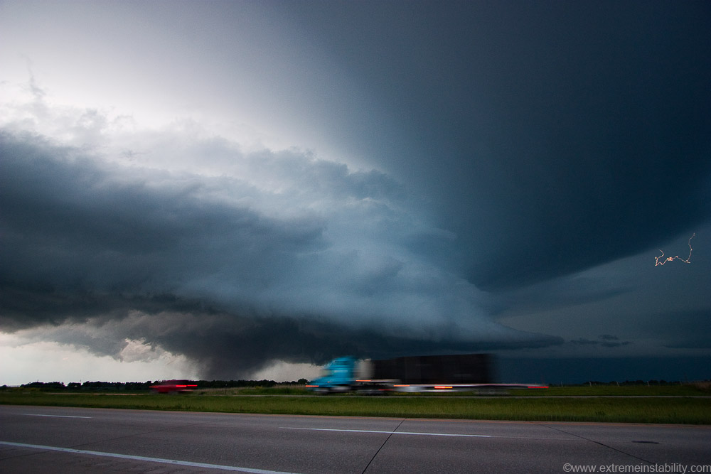
Still in se Grand Island. RFD cutting into the storm, initiating some rapid rotation in the wall cloud. It appeared a significant tornado was quite possibly ready to develop in the city.
A brief tornado did touch down near 281 at some point while I was filming(other chasers saw it). I was digging around in my car looking for my second window clamp for much of this lol. This was the best cone shape I saw. But it had so much rotation forming in new areas over and over, who knows which one it was. I did notice leaves falling from the sky somewhere in this part.
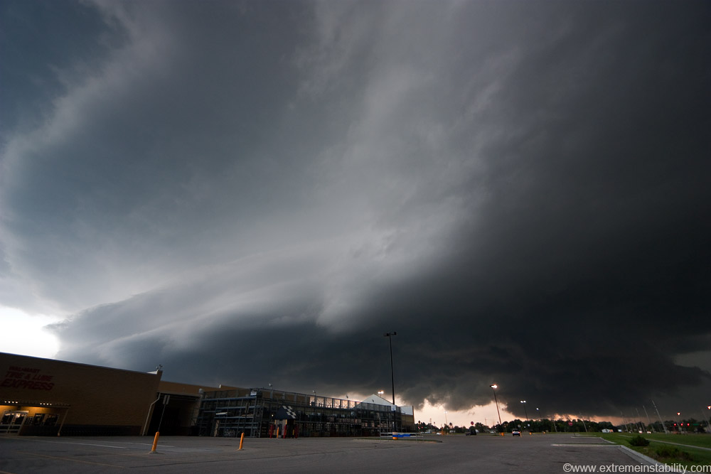
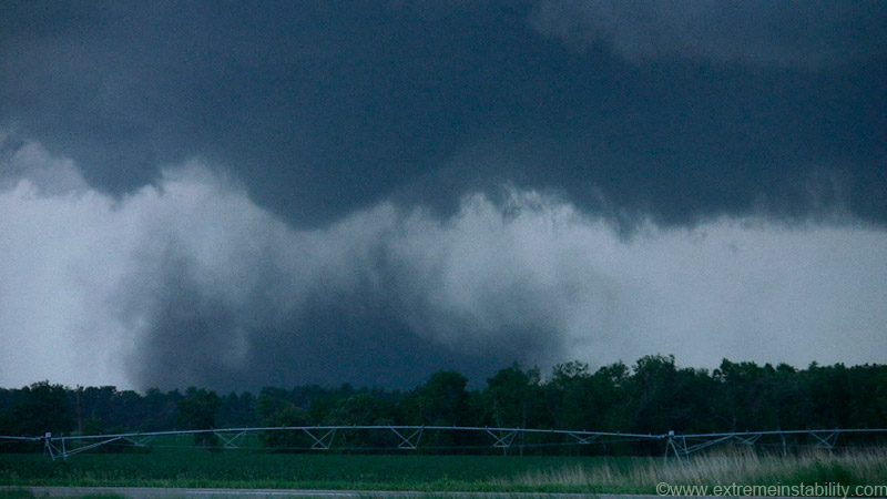
Soon the wind began blasting the area as the rfd notch moved overhead and "the area of interest" moved closer. The motion in the clouds on the backside of the gust front were as wicked as I've ever seen, and I've seen that stuff quite a bit now. Looked like you had 100+ mph winds up there moving them around...moving right overhead here. I wish I had shot more video of that. Anyway, the video here is fairly interesting to watch.
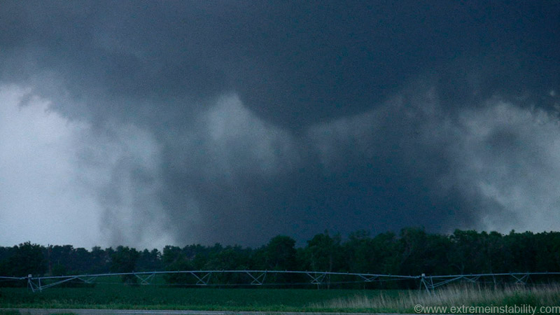
After it gets close and doesn't produce any significant tornado, I drive east to get ahead of the newest area. See, when I stick out the occluded area it doesn't do much, unlike the very last chase before this...sigh(for not sticking it out last time). But this was very good for Grand Island in this case!
So here is my mental position now. The two early tornadoes really weren't much to write home about, and were shor-lived. The storm about vanished. It reforms with great structure, then fails again at producing a significant tornado and the one it does doesn't even have condensation to the ground. It was the definition of brief. This after it had a huge area all wrapped back in there spinning around. Chaser numbers were readily increasing now too. I thought, get east for structure. So I go east, having to pass two slow cars/chasers on highway 34 right from the get go. I then see a lot more way up ahead. At the same time I notice an exit to get on I80 3 miles south of me. I thought, I can blast to I80 on this and then get east real fast for structure. So I take the exit to I80. I mean c'mon, it's a meager 3 miles south to get on it and go fast.
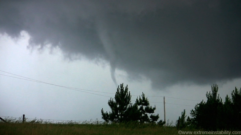
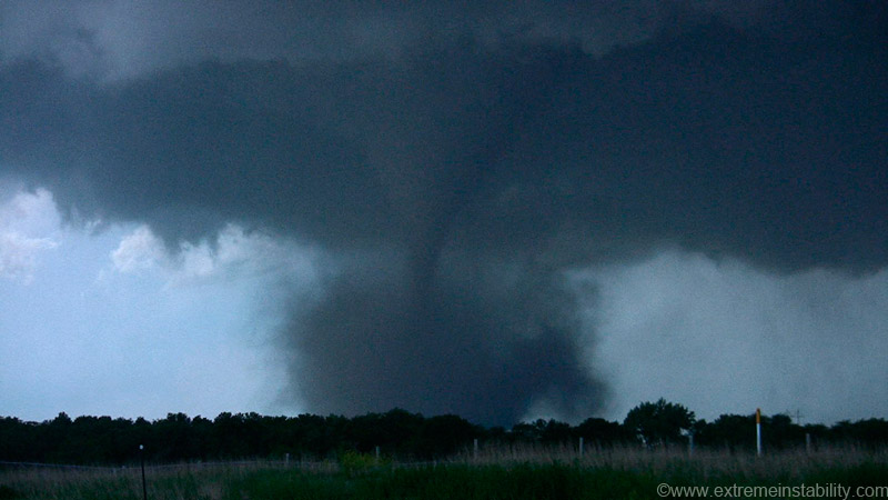
Then this happens as I go east on I80! First thought.....that thing is right on highway 34 I just left! I film it as I go east. It quickly dies.
As I'm southeast of it it produces a significant tornado. Grreeeaaatt I'm stuck on the damn interstate. Aurora was about 7 miles east yet. Should I drive that whole time, then north, then west and hope it's still going or stop and get what I can here? I stopped. Got some "great" semi-filled video of this. Then yesterday I'm looking at accounts online and see Jeff Snyder posted he got on I80 too...but he had great shots! I thought, he didn't get those from I80. I then see his map of the path he took. There was an exit right freaking by me that I had no idea was there! Saw that on his gps map and about crapped. Evidently I had just passed it while filming the first deal and somehow never managed to take note of it when looking at the GPS. I would have used a no u-turn thing on I80 to flip around and get back to that exit if I did(it'd have been worth it and easy enough to do safely). Chasers on 34 got the show of a lifetime with this fairly long-lived tornado. I got next to nothing. To top it off, I still hadn't found my second window clamp. It was getting hard to handhold still images even with 400 ISO and at wider angle.
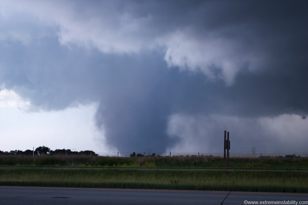
One of the handheld wide angle shots.
Another. The tornado appeared to change here/weaken.
It then turned into this.
Finally I get out and set the tripod up for stills, something I didn't really want to do from the interstate. I was pulled way off the shoulder onto the grass. It turns into a dust bomb tornado by the time I'm set up. It eventually weakens(hindsight I had time to go to Aurora and back west too...."yipee" for not doing that). If it is tornadoing I'm screwing up at that point. It's really amazing how this happens. I'd just sat there close at Grand Island for any tornadoes. The entire day I'd been right ahead of it in the path, ready to pounce...at least following the fast early ones. Just like the damn last tornado near Hastings. This time I wasn't letting gravel get in my way though. My best catch of all my chases now was sitting on the highway I JUST freaking got off of. Been on that eastward road network forever till then, ready. Bam, storm sees that I'm just barely leaving it and voila.....tornado travels right down a damn highway...slowly. And that exit I had no idea was near me is like salt in the wound. There is nothing to blame but the desire to get out and get structure quickly. If all I cared about was tornadoes it would have been simple to just stay on that highway, as there was tons of time to get back under there. As best I can guess I'd have been about 1/2 mile ahead of the first one if I just went east. I'm seriously one of the worst tornado interceptors on the planet and again, a good chunk of that is trying to get structure when I don't think there's a tornado to miss. What is just extra dumb about this whole deal is I'd have been able to get the structure in nearly the identical amount of time and I really knew that when I turned south. I just thought, if there's no tornado I'm not messing with a bunch of chasers as I try to get ahead of things. There'd be no reason to. But then bam, the storm that really couldn't all night....could! I mean really, watch the videos of the first couple...like pulling teeth for the storm to get it done. But what is super funny, is what I told myself after screwing up the occluded to hell June 15th large tornado(saw it from 7 miles east or so after being RIGHT where it was). I said, next chase/s I'm being a strictly tornado chaser and making decisions based on solely getting good close tornado video for once(not even saying the 20 feet away video....just even somewhat close!). Anyway, yet another chase that will annoy me more than please me. At least through this point of it, it got a little better for me later.
Oh yeah I go to leave here and no keys! I thought, where in the hell did I set those as I got out and set up the tripod(in front of my car in the grass well off the shoulder). Dug and dug around the car looking for them. I was getting good at digging around my gear and garbage filled car. No second window clamp found and no keys found. I do have another set of car keys with me in my pocket so it wasn't a major deal, but it had my others on that one so I wanted to find it. Digging around I at least finally found the second window clamp, not that I needed it now. Still no keys though. I go and look in the grass, nothing. Try the car again, nothing. Try the grass one last time, after about taking off and nothing. Then as I go to leave, I catch them out of the corner of my eye on my hood LOL. Using the pocket must have been that difficult at the time.
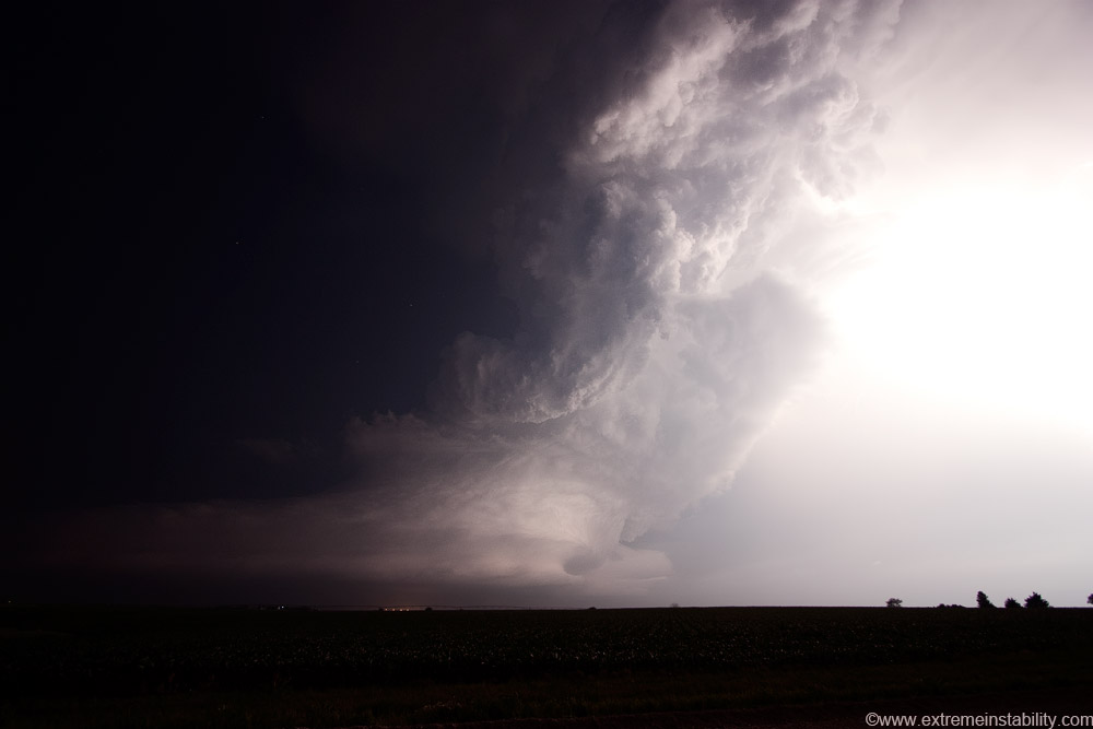
Now...tornado-less chases....I can handle. It was done producing tornadoes now as it leaves the Aurora area...but very far from done being worthy. The rest of this all at least tries to make up for what I missed out on being on I80.

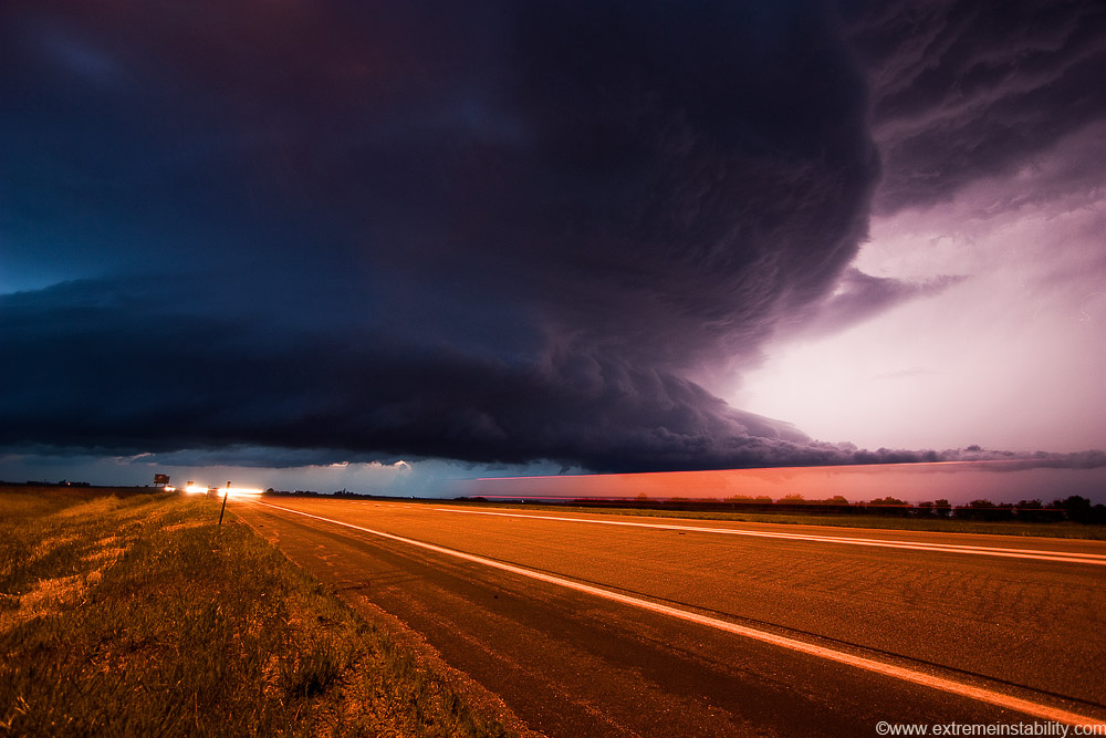
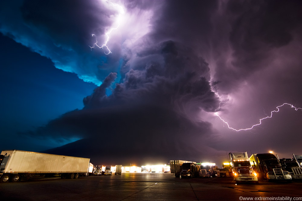
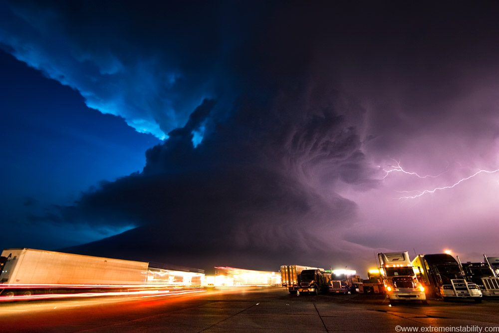
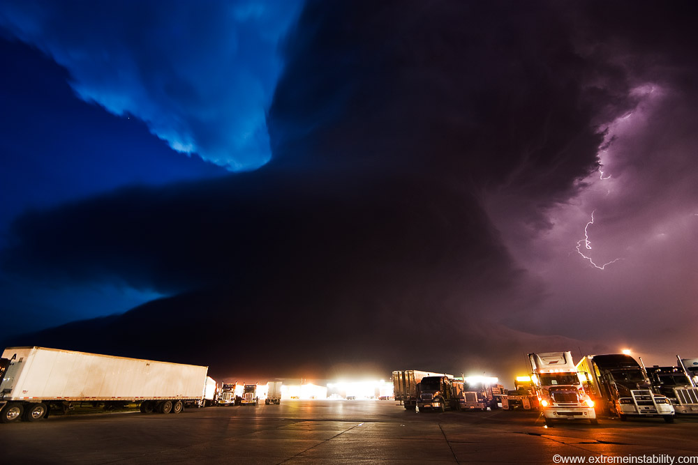
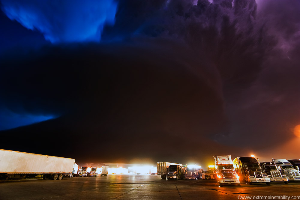
Mother nature making me feel better lol. At the truck stop at York NE. Twilight madness ensuing.
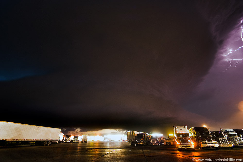
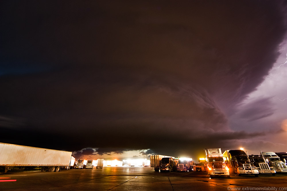
The supercell that "couldn't"...then could..........still can! At least as far as putting on a great show. It seemed the atmosphere wanted this storm to start to die now, as it got a bit smaller on radar. This storm though said to hell with that, I'm going to spin and spin and spin.
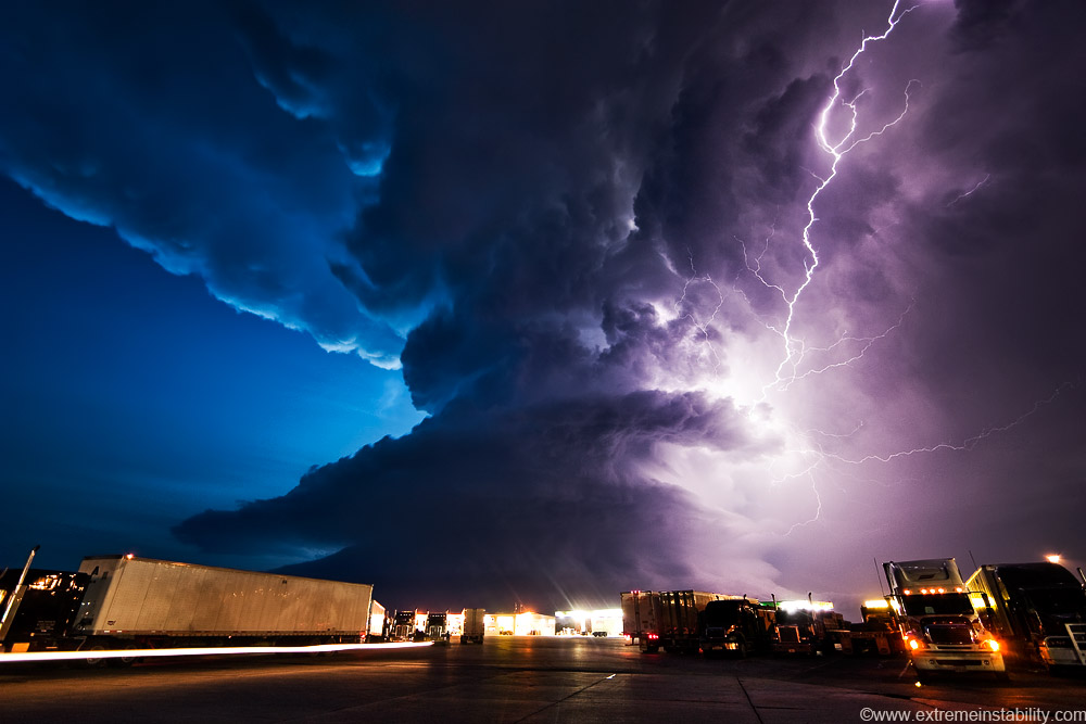
I wonder how many of these truckers are sleeping away in their cabs right now.

Like a dog begging for attention.
Pretty dang cool.
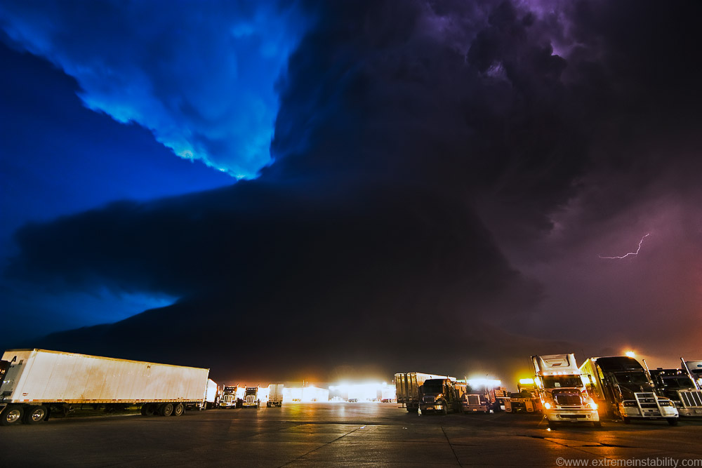
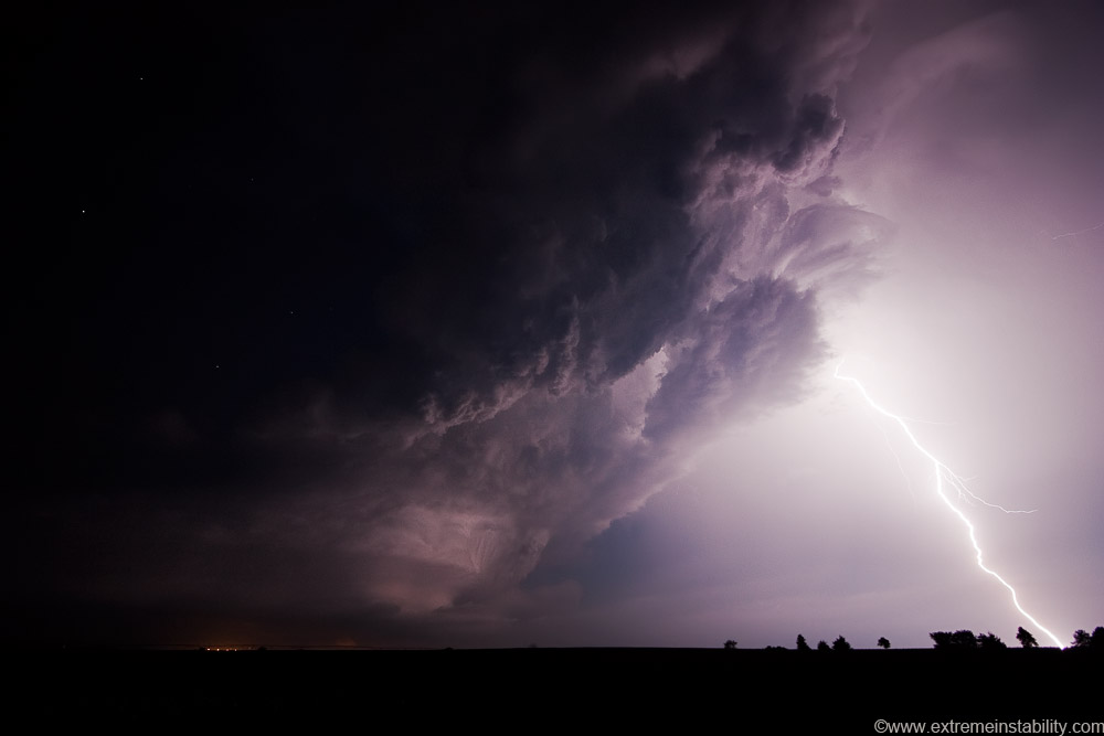
I think most of these were done at 200 ISO, F3.5, for as few seconds as possible mostly. It's usually good to shoot a storm near a city, if you can get some of the city lights to help in lighting it up.
Crazy crazy. Wake up truckers, you're missing the show! Spiraling base, lifting up into that big fat plume of convection, billowing towards the heavens. All spreading out into the twilight-lit anvil. This amazing entity about to pass over a bunch of sleeping truckers.
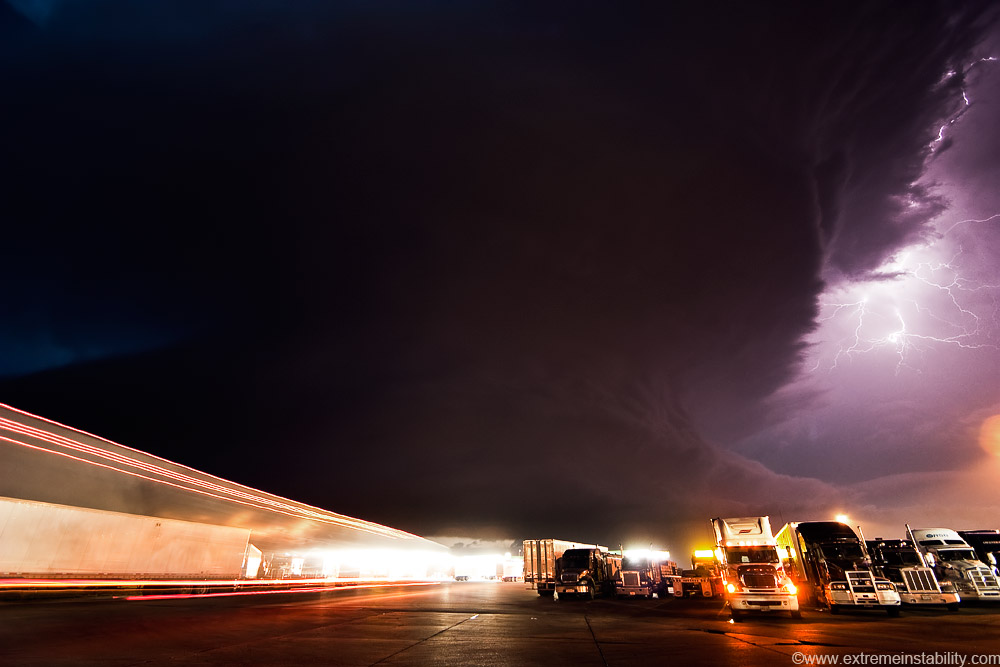
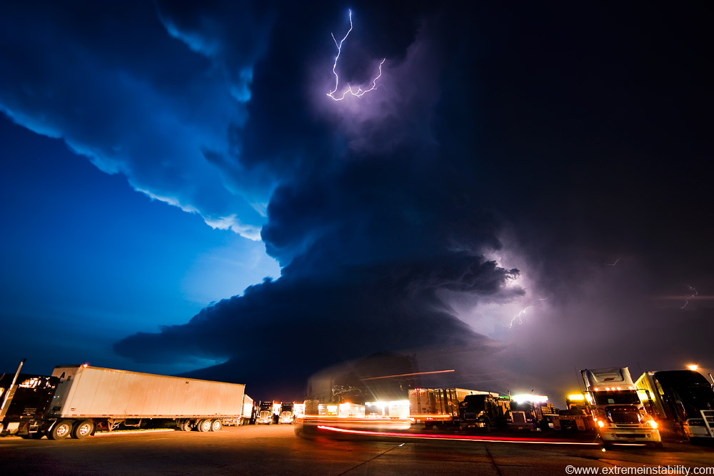
Leaving or entering hell? Must be entering as those look like tail lights.
One of the more odd things of all this. Look above those lights back there in the middle. Very late sunset features(clouds/sky) showing up on the exposure. Like light on the other side of the coming storm....though dwindlng(*enter spooky music* lol)
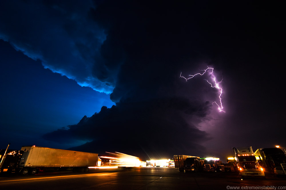
I eventually move east of York and pull over again. The skinny updraft wanted nothing to do with death. BAM these amazingly bright botls would smash down out of the updraft/anvil interface. A couple lit up/froze the storms features in the darkness.
A less bright one.
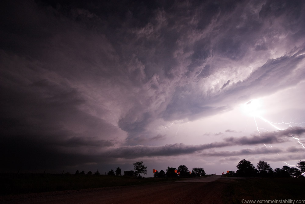
Storm near me again, bolt production slowing down finally. Quite the show this day!
Time-lapse of the stills...


