August 8, 2007, Tarkio, Missouri Torandic Supercell
I guess this is just another example of why I always end up chasing days I really don't care for. I don't need big tornadoes or supercells to begin with, so my standards are sort of low. What I do want are at least severe and nasty storms. Truly severe storms are fairly hard to come by. 60-70mph winds aren't that thrilling, neither is hail under 2 inches in diameter. You get much over either of those and things become more fun to me. It's just pretty rare to reach either level.
One gets sick of seeing setups with 500mb temps around -5c or warmer. You often see the same crap storms, mostly soft fuzzball updrafts. I knew the basics of this setup but hadn't intended to chase it till the MD(spc mesoscale discussion) came out for the area. The first thing I looked at where the current 500mb temps on the spc mesoanalysis page. -2c to -3c.....good grief. Winds weren't great either, and prog'd to lessen at that height(currently they were 30-35 knots). But, there was a ton of low level moisture and some backing low level winds along and south of an outflow boundary. It didn't look all that different from the chase 2 days ago. I did not want to leave the house. I honestly DID NOT want to go chasing, but, that's not all that uncommon for me on some of these setups. I go anyway. Being somewhat close will get me out the door on about anything, but even so, one gets sick of crapper setups even if they are semi-local.
Cells popped around Beatrice so I drove south to Nebraska City. Oh btw for any chasers interested, there's now Alltel data on I29 from Council Bluffs to Nebraska City. 3 seperate chases I tried to connect that whole route and could not. Whatever was the issue is fixed now. Hopefully other areas of IA that would give me that "password invalid on this server" error have that fixed as well.
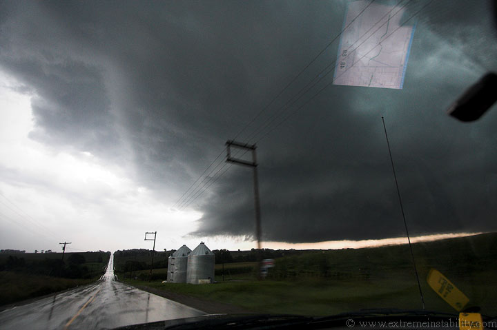
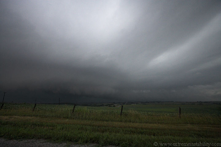
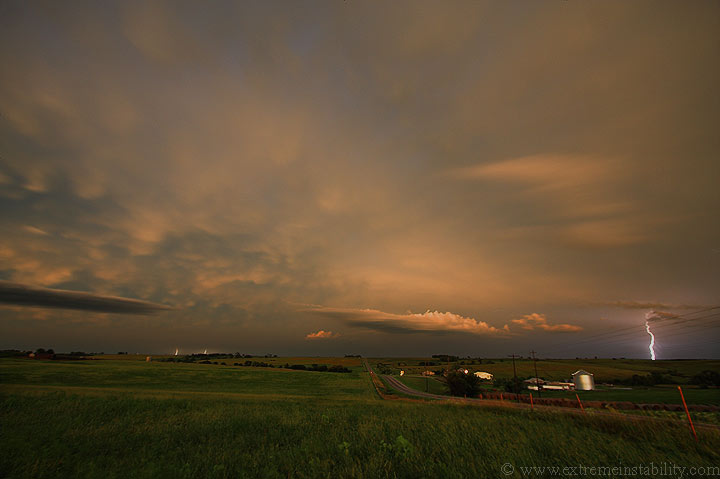
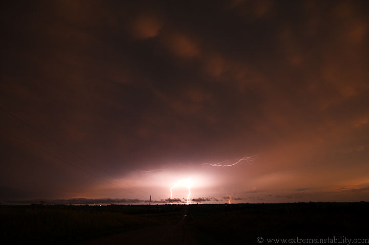
I get to Nebraska City and on radar there's just a big mess to the sw. I jump into town and go south on 75 to Auburn. This elevated storm(image above) rains on me as I get close to Auburn. I hoped things would look better/more clear south of this, and they did. I pop out of its core to a more surfaced based storm just west of town. It was one cell and was spitting out nasty cg's. Since it was so close I needed to get into town then east on 136.
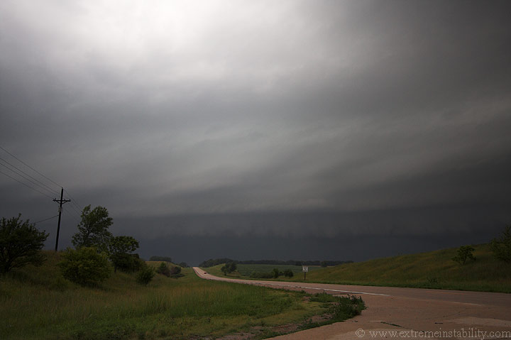
I drive east, in the extreme pea soup atmosphere, then pull off. A quick look back west reveals a rapid change to a big shelf cloud, one hauling butt to the east now. I talked to Steve Peterson around this time and he was currently in the core of this, trying to get east. I thought he had hope of making it before it lined out like this, and even some hope after that happened. But once I saw how fast it was moving, I knew he had his work cut out for him. Once it got going it had to have a forward speed of 50-60mph. This doesn't leave much time for any sort of slow ups(like any towns).
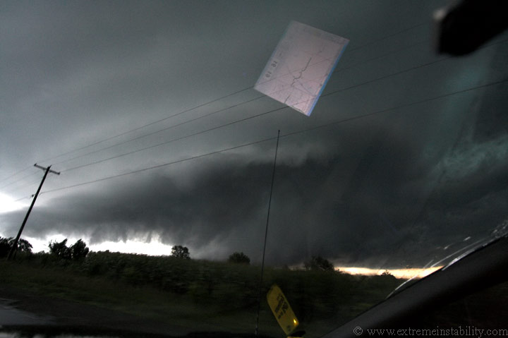
So I'm heading east to Brownsville NE, shelf growing in size and speed right behind me. I notice this beefy cell ahead of the storm. It quickly gained my interest as it was rapidly taking on supercell characteristics.
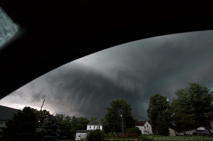
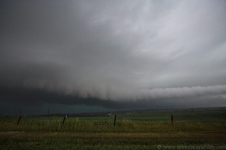
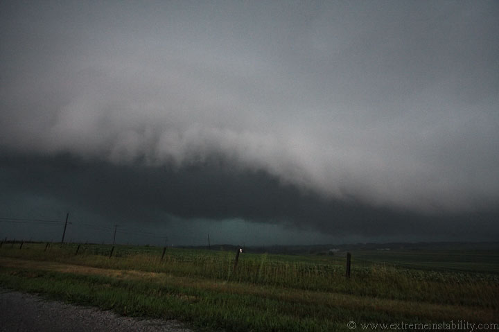
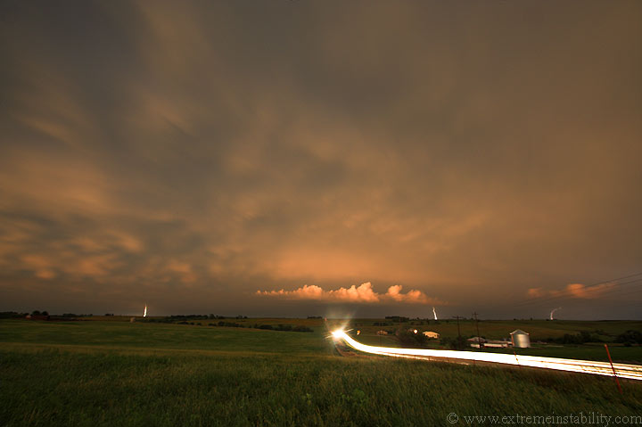
I'm now at the Rockport MO exit off I-29. The shelf was now growing some mean teeth, seemingly hungry for the near 80 degree dewpoints it had to eat in front of it. Rockport is just east of here. It was on my heels as I left town. Rockport would be black and full of downed trees, as I drove back through on my way home later in the night.
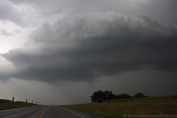
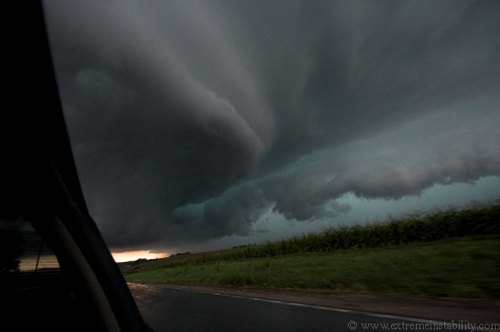
I'm now trying my butt off to get ahead of this increasingly amazing supercell ahead of the line. The shelf and teeth are still right behind me. This supercell was quickly getting a look like it was about ready to produce a tornado. It had a growing dark base wrapped well behind an increasingly large rfd cut. The north side of the updraft was like a big wall, with no visible precip.

Taking pictures in this part of nw MO isn't the easiest thing to do, even when one has time to stop, something I did not. I missed some of the best structure on this thing as I was gaining on it. It was quickly being affected by the shelf racing up behind it.
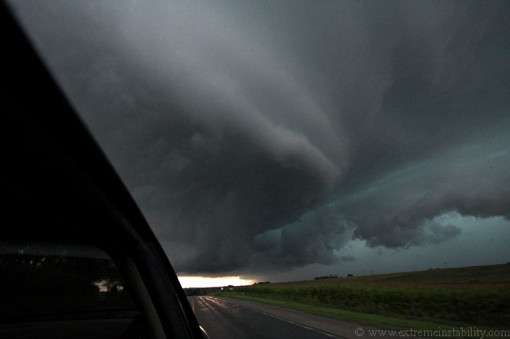
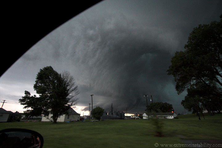
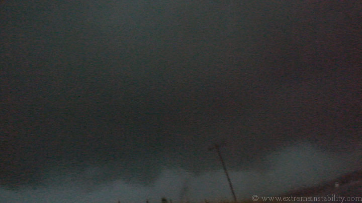
The shelf and the cooler air with it, are starting to hammer the lower levels of this storm. You could see them turning to the cool look rather quickly. But still, above there, this storm had amazing structure right now. You can tell how rounded and banded it was on the nw side of the updraft, in the above shot. That is my laptop screen reflecting from my seat onto the windshield. The image was taken at 11mm, so you can gauge that it's pretty much on me right now. I needed to get into Tarkio and east, dang it. I soooo wish I'd been ahead of this before now. It had to look sweet and I would have done a much better job with stills and the ISO speed needed to get them.
I believe I'm going north into Tarkio right now. The line has clearly hit the back of the storm now. Sucks it turned the base so cold so fast. Can still see the banding there was above though.
Actually I'm guessing the seeding aloft from the line did damage to this storm before the cold air from the shelf did.
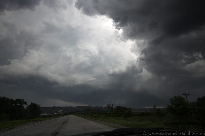
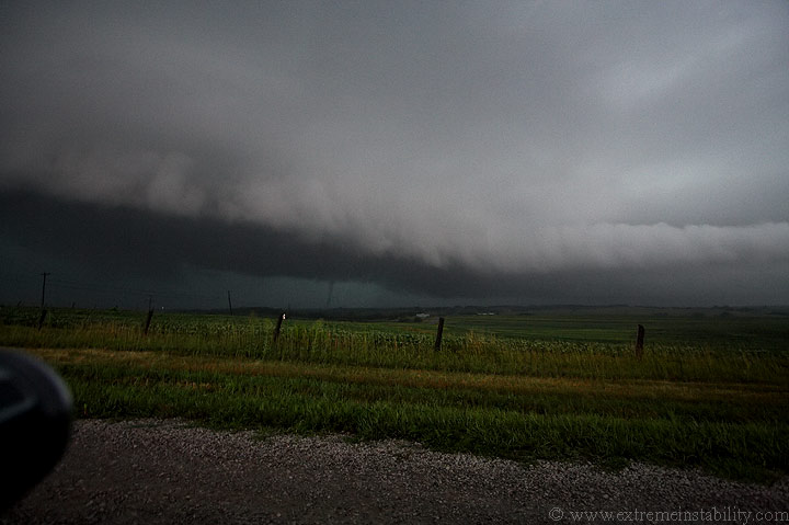
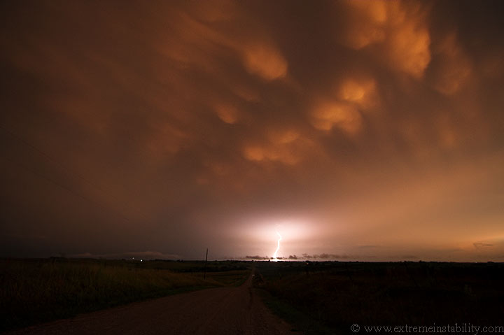
So you have this crazy, fast moving, line and shelf slamming into this crazy supercell. The low levels were extremely hot and humid ahead of them. I'm in Tarkio now, looking south. Right now the town is being peppered with CGs, one after another. Having no video mount for my car, I couldn't do both while driving. I really wish I was able, because one bolt hit less than a block from me. Several others were hitting a couple to a few blocks away. I thought for sure my biggest problem doing the move I was doing(passing the storm on the north side) was going to be large hail. Looking at the thing I was like, yeah I'm going to lose a windsheild doing this. I'm not sure I even remember rain through this part.
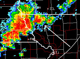
Here is a radar image of the supercell. If you look closely you can see the hook wrapping around that intersection of highways. That is Tarkio. There were several frames missing from the loop so this is all I could get. One can see just how close the line was to it then. I was between those two for a good while and am guessing I missed the rain in Tarkio by being between the tip of the hook and the rest of it to the north.

Somewhere in this move east throught own I come up behind a cop who decides to stop and talk to a truck heading west(ain't that illegal? lol). I squeeze by him on the right side and see another cop behind that truck coming west into town as well. They must have been tired(or scared) of spotting this thing. Sirens were not sounding in town at this time.
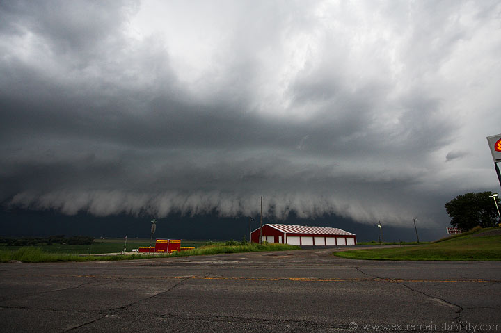
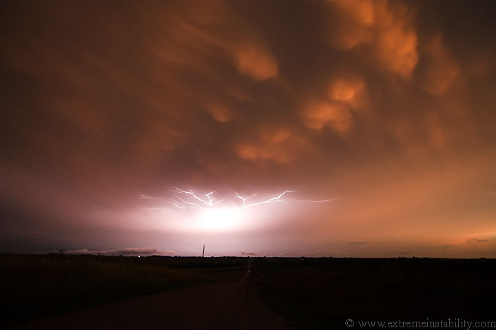
You can see the lowering that was in there, now shrinking up as the back of the storm gets smashed by the line. If you look passed it and south you can see the rest of the storm's base/rfd/gust front...now also merging into the massive line. That line saved someone some tornadic "fun"...I'm sure of it.
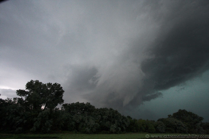
The rapid smash and undercutting continues. It sure doesn't take long with a line moving that fast. I'd assume that pointed thing was rotating.
I'm now about 5 miles east of Tarkio looking back to the southwest.
Well, guessing when a big rotating supercell gets swallowed, the momentum of its spin doesn't vanish in a few seconds. I was wondering at the time how this was going to work out, well here is how. The rest of the line can be see on the right side, far back in there. Ahead of that is an inflow cloud which was racing from the northeast to the southwest. The whole mess is now moving east extremely fast.
I notice an area spinning in there and comment about it on video. Not long after this, a tornado condenses and twists around under there. It's small, but it's just left of center. It was only visible like that for about 10 seconds, but the area kept spinning.
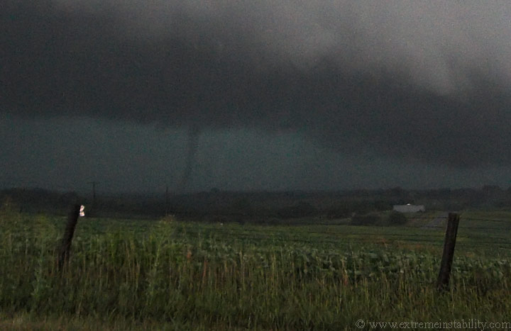
Here is a full sized crop from the still. I was shooting video at the same time and quickly took the still.
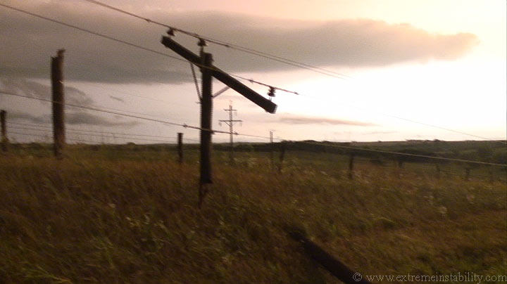
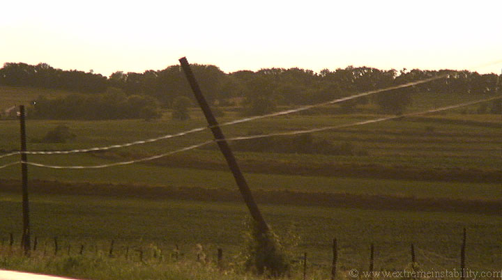
Ok now it gets a bit interesting. This still should show the area behind an obvious rfd cut, which had just produced the tornado. There is a brighter white object in this picture, a smidge left of center. The lowered, still rotating area, behind the cut, is above and left of that white thing(back of a sign). Now this highway has two sets of poles running along it, one on the north and the other on the south. This 10mm view can really mess with distances. First off, that area is a whole lot closer than it looks on the still. Second, it makes those poles look further from each other than they are. The larger looking pole to the far left doesn't have the top cross bars on it. The ones on the north side of the road were like that. The others on the south side are the ones with the cross bars. The second one on the north side of the road(4th pole over from the left) will soon be broke and leaning south. If you take the 4 poles on the left side and notice the two in the middle, those are south side of the road poles....those will both soon be snapped and thrown north. I never knew any of this happened till talking with Steve, then stopping to see them later.
So, the storm is flying at me and I've only had about a minute long stop here on this gravel road. I say on video, "I'm about to be in a tornado, I need to get out of here". Well evidently my short stop was a bit long. Those 10mm views above really screw up perspective sometimes. This image above is from video as I was getting out of there. I was simply filming the rotating area as I backed up to turn around and leave. As I turn the car east this vortice spins up just left of that pole in the capture. I never saw it at the time. Anyway, this pole would be on the ground soon, as would the one out of the picture to the right. They had to snap very shortly after I stepped on the gas to go east. Soon as I was moving east I was plastered by very high winds from the south. I kept the gas down as I knew what was likely passing right behind me. It's a fun, yet crappy feeling, sort of wondering just when your vehicle is going to be yanked off the road by the wind. It was a dumb move to wait those couple extra seconds to film the area coming, but I figured worst case scenerio another weak tube would form. I don't know what it looked like behind me. All I know is that vortex at the ground forms there the last second my camera is in that direction while I'm turning east. Whatever moved over the highway snapped those poles right then. Steve was gaining on me and saw them(now broke) as he came through.
We tried in vain to get ahead of the storm again(for me, poor Steve was in rain for an extremely long time after leaving home to chase). We finally met at some town east of Marysville MO. He was coming in taking the same small road east I was. I had just pulled over in town because I was just too unsure of that road. I finally had to give up being ahead of things again. Once I'd stopped and let it get near me after the tornado, I was never ahead of it again.
We decide to go look at the damage he said he saw. I knew it had to be near where I stopped. I keep looking for the hill I stopped on, as we neared Tarkio. Then I see it. The second I see the hill/gravel road, I see the poles on the ground. I never saw any other poles snapped, expect some well out in the field to the southwest, in a line from where that tornado and rotating area tracked through. The above pole is the same one as in that video capture above it. It's a little strange to me as it looks like a section of the pole broke out, so there are three pieces. I don't know, it seems like you'd just have two. Seems odd to have a portion out of the middle completely seperated like that.
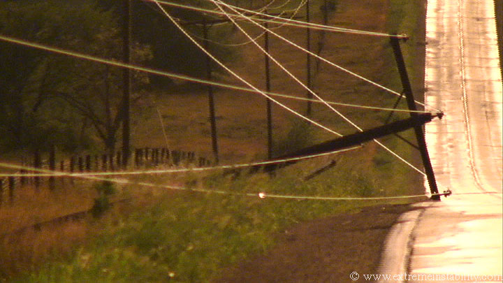
This was laying over just west of the broke one above it. I'm filming this and swear I see a flicker of light in the grass, along the line. I yell to Steve over by the cars, "I swear I saw a flash of light. These must be alive still." I think Steve yells back, "Go touch it." You should be able to see the spark in the above image, along the bottom wire. It was doing that over and over there. This was now quite a while after it happened. For some reason it is surprising to me they weren't shut off and no one was here by them yet(though they showed up moments after we did)...since it is 5 miles east of Tarkio, on a main highway, a good hour or more after it happened.
Here's the other pole on the north side of the highway, broke and leaning south.
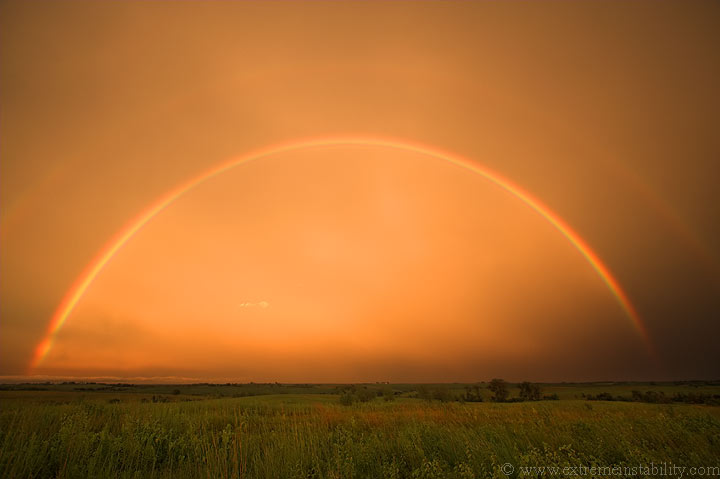
A sweet double rainbow which looks nowhere near as cool as it did in person. For some reason all my rainbow images suck. Maybe a polarizer would help?
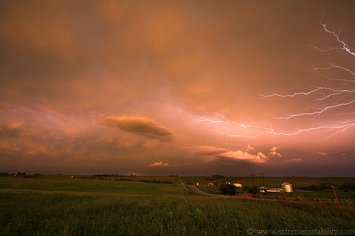
Several of the anvil crawlers were spectacular now. It's too bad many of my images are soft. Somehow I move the focus. I have an idea how! This 10-22 EF-S has the zoom ring and focus ring switched from that of my 17-40L. I'm constantly turning the wrong one.
Sweet scene likely ruined by softness(at least viewed full size). I never caught it was off till late in the night.
I may have fixed the focus by now, but I'm not too sure. No, I think this was another soft one. Hell that lens, I can have it set about anywhere remotely close to the infinity marker and be ok. When I saw it was soft and looked, I think it was near the 1 foot marker on the lens. Big fat DOH on that whole deal. I know I set it right when I started shooting because my first images are sharp.

I think this is when I finally had the focus set right again. The cool scene was pretty much toast a couple minutes later though, as low clouds blocked out the sky above.
This was one of the more enjoyable(though fast paced) chases I've had in a while. I still can't believe I saw a torando on this one. I wish I had done better on that shelf after the tornado though. It was getting some sick looks to it, but it was impossible to get ahead of if you had any turns or towns in the road. I was just about to do it again at that small town east of Marysville, but the road scared me. I surely didn't need to end the day with a tow from the mud or ditch, all for a shelf moving at light speed. Not just that, but it's often worth it to get behind the storms before sunset.
I will post a video of the tornado when I get a chance. It's not much, but I myself could look at my pics above and say, that could be photoshopped in. Video should lend enough proof for any who may jump to it being fake. The smallness of it, and the general look to the storm doesn't help. One doesn't see a tube under something that looks that cold that often.
Well I added the video like I said I would. I sort of figured encoding could be an issue with that tornado. It doesn't help the video is small, nor does it help that it was a dark scene which became fairly noisey on my video camera...and of course the tornado is small and short-lived. And, I also could not zoom in on it because at the time it formed, I had my still camera in my right hand, and my video camera in my left. But anyway, you can barely see it on the video. You can also see, I think 3, sparks on that downed line(have to watch close to see all 3). Also, on that last vortice seen before I turn the car eastward, you can see it form out of nowhere right when I turn, if you keep watching left of the pole right before it is seen. Right when I say "6:50..." if you look on the far left, you can see an area of rain. That was coming around this embedded area. If you watch to the right, you can see the right side of that bowl type thing. Part of me wishes I'd sat there and filmed what happened, since I'm sure I would have been fine. I never knew any new vortices had formed right then, as I never saw that with my eyes. I also didn't know those poles were snapped right there behind me until Steve told me, as he was coming east catching up. There weren't any other poles broke along this highway that we saw, minus some far to the southwest in the area the original tornado formed.


