March 28, 2007 Grant NE Large Tornadoes
My bad luck for about the last full year has finally come to an end. I just about added to it in a big way. My last tornado day was April 6, 2006 with about 40 chases between then and now. I don't just chase for tornadoes, so I chase a lot of days, but still that sucks. Had I done what I almost did this day, I'm not sure what I would have done. The bust that almost was, would have rivalled my August 24, 2006 bust. It's already been a dissapointing year too.
Saturday I drove to the Goodland area then back that night, or about 850 miles....for essentially nothing but junk. The next day where do I wind up? Rochester MN...then drove back home...after even worse junk storms. That was another 800 miles. I've had 3 other chases besides these that also weren't all that close and did not pay off. This chase wound up another 800 miles. Thing was, this day went NUTS! I just about blew it allllll again.
The first decision of the day was the McCook area, or Ogallala area. I wanted on the dryline where it would arc nw to maybe get stuff to blow more off it than along it. Trouble became would the real juice ever get that far back to the boundary up there. I chose Ogallala and spent all afternoon there looking at data, saying to myself over and over, you need to get into nw KS to that better juice, and soon to the early convection. Storm motions were supposed to be insane this day, like upwards of 60 mph or so. I figured, error to the north, use I-80 to go east or west to intercept things flying north. I also figured nothing was looking worth a darn yet and I had time to blow them off for a bit and check out some storms in ne CO moving towards Brule NE. As I do this, the stuff in nw KS starts to deepen and become more severe. Trouble was, it was pretty crowded with convection around there. I figured I'd at least have time to see something good first, then race south or east for the intercept. Well they soon started looking better and becoming tornado warned. New problem though, storm motions were not appearing insane at all, with all the storm interactions down there sort of slowing them up. Since they weren't rocketing north I knew I'd not get to them before dark now. I let the idea go and tried to do what I could with the convection coming out of ne CO....out there in the cruddy dewpoints. Deeper moisture was now racing nw, but southern convection was moving north and would soon be blocking off the good inflow to these western storms.
I noticed a decent storm on radar and moved to Grant NE. It was moving north along the CO/NE border heading just west of Ogallala. I sat on the nw side of town and watched. Tim Jones soon pulled up and chatted for a bit, sounding as frustrated as I was. I am fairly good at not seeing a whole lot of chasers. I guess because I'll pull off on gravel roads aways, instead of pulling off on shoulders on the highway. Well, I have a way of always seeing either Tim or Chris Lenz out on these roads. I wasn't all that surprised to see him pull up. Anyway, we watched it move north. It had decent structure and even an rfd cut and little lowering. Too bad the base was shriveling up. Most times a storm ain't coming back from that process. I let it go north. There was another cell sw of Imperial that looked ok and would move up here anyway. It was about to have issues though with a lot of garbage blowing north from nw KS. I gave this storm no chance in hell.
Tim soon leaves to go west to check out our little storm. I go sw and watch it go north. As it gets too far away, it suddenly has this beasty updarft with inflow bands going east of it, on the ne side. I was like, good grief it figures. Not much later and it was tornado warned. I believe this is the storm that goes on to produce a 30+ minute plus, large tornado nw of Aurthur NE. Screw up number one right there. Screw up 2, through whatever, was going on in nw KS at this point with tornadoes being reported. And where the hell was I? I was between the two areas waiting on a storm about to move into contaiminated air. This is where I'll start the photos section of this account.
Well my storm sw of Imperial was severe warned and heading more ne than n now, so I head east a bit to Madrid NE, just east of Grant. While doing so this base forms and some down right scary cg's start happening, out of the anvil, mostly from the storm I'm heading off(storm well southwest of this). I was actually laughing the cg's were giving me the creeps so bad(they were all so damn close).
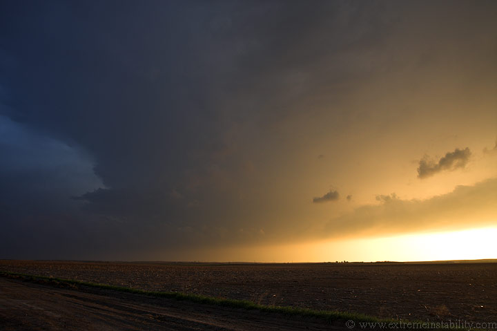
I guess that structure down there is my storm(looking sw). My base to the west lined out and actually moved west.
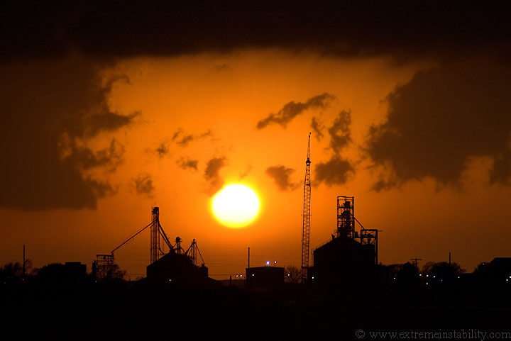
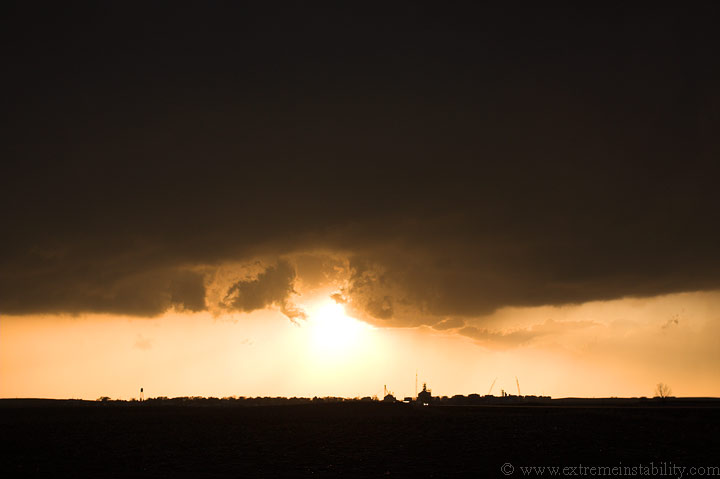
My storm(severe warned one to my sw) was not looking all that hot now and the convection to the south continued to stream north ahead of it. Reality was setting in quickly now. I was about to have yet another nasty bust, potentially really nasty by the looks of it. Up to this point a tornado outbreak was occuring to the south, all the way down to TX. My storm didn't seem to have any hope thanks to the crap coming north ahead of it. Not sure what else to do, I took out the telephoto lens and shot the sunset over Madrid NE.
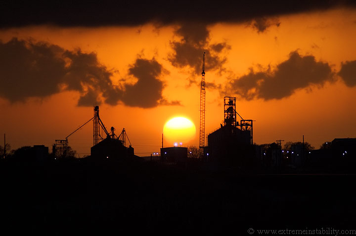
It was a nice sunset but really not something to save this day. I was a long ways from home, busting like no other. Also, my mom was to have neck surgery in the morning, so I knew I had to get back as I had to be up by 7:30. The sun was setting and I'm about 5 hours from home. If I left at 8/now I'd be back around 1:00 a.m. Even if there was a great storm within a couple hours reach, it would make for a horrible drive home and next day. I knew I needed to be heading back fairly soon. My only storm/chance had some serious issues ahead of it, and hell a couple tornadic storms south of it in nw KS, neither helping it with all their anvils/precip. I finally realized, hey, I'm used to this...I should at least get some lightning shots before I go. Knowing I probably just blew the day of the year, after doing it time and again last year as well, I became content with lightning...as I would have been had all those other things I was missing out on hadn't been going on. It was really weird at the time. I clearly remember thinking, what is wrong with me now, since I just didn't seem to care anymore...that I screwed up...again.
So, it's getting dark, and late. Lightning is looking pretty good. I grab my camera and cable release. Oh wait, I can't find the stupid cable release for nothing! I dug and dug in my car, getting laughably pissed now that I couldn't even do lightning. I was like, no, you aren't denying me lightning. I started to wonder if I even had it with me and if I'd left it at home. Then I find it!
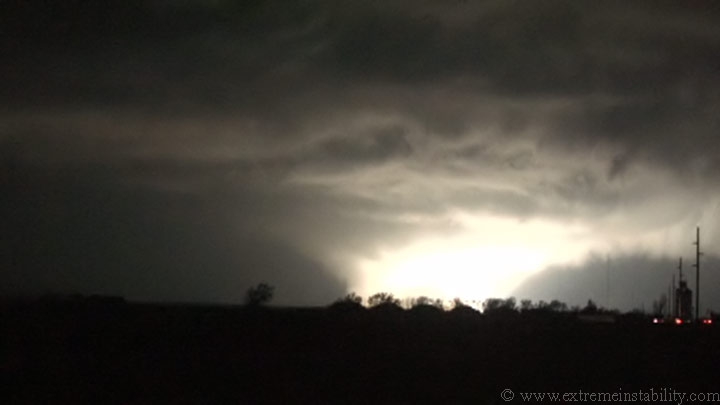
In this area I had some of the slower data speeds for internet. I was shocked I could even connect where I was. What I'd been doing is refreshing a nws radar loop in a window while I had another incase it froze/wouldn't load. It was pretty slow. So anyway, while getting the camera ready I went ahead and refreshed that radar in the one window, something I hadn't done for a bit. To my surprise(big time) my storm was now tornado warned! To be honest, I did not expect a thing, even though it was warned. It was now tracking due north. It looked to pass very near Grant, not far to my west. So I head on west. Two things to note. Had I not had data here I would have likely missed all that is to come either by shooting lightning from the east, or by heading home. The other thing is, had I not tracked down that cable release already, I would not have had it for what was to come. That alone would have SUCKED. I would have been furious not being able to find the cable release here in a bit. So...I go west.
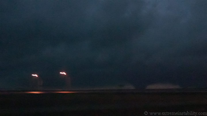
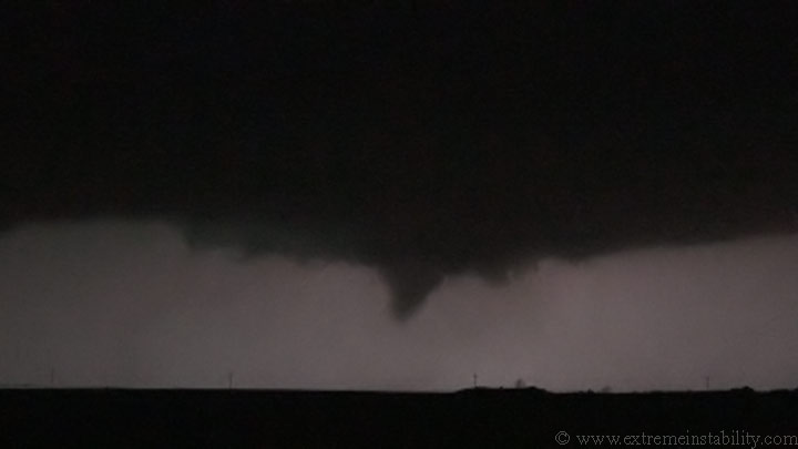
Where I was parked about to shoot the lightning, I was facing north with a small hill to my wsw. I'm pretty certain I'd have never known this was going on without that radar update, especially since I never run anything putting out nws warnings when I chase. Before I reach Grant I see a large tornado to the sw. I was shocked. I never even saw the structure of the storm first(lots of low clouds). I was like hello, big tornado there. I wasn't expecting much of anything. There's actually two tornadoes on this video capture, a big wedge with a smaller tornado to the right. I never saw the one on the right. It was now dark out, all I could see was during any flashes. I have my video camera's slow shutter on, hence the blur on those lights.
Matt Kassawara and Chris Rozoff have an excellent account of how this unfolded here.
It sounds like they are unsure if these merge or not. I'm not sure how they relate to what follows.
I do know that is a wedge and my first March and night tornado.
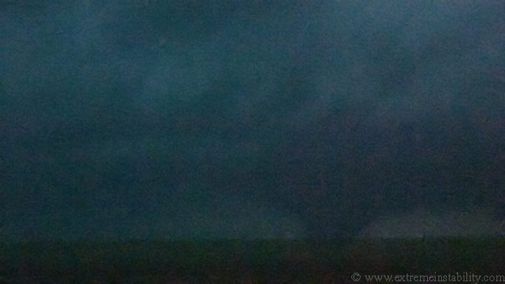
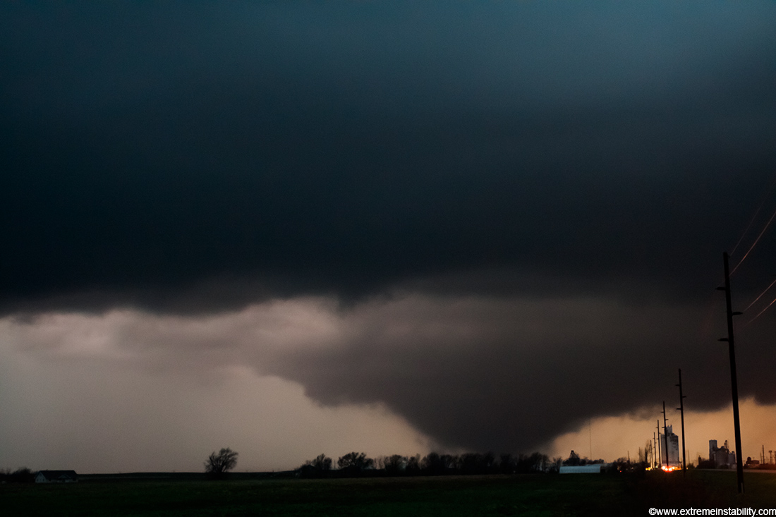
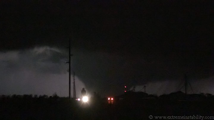
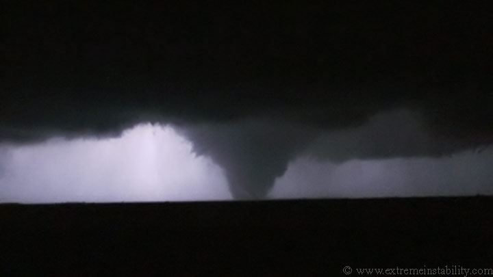
Ok now I have pulled over on the east side of Grant. Either those merged or the wedge died and the western tornado turned into this. I'm not sure what I did but I clearly remember some stout looking tornadoes under this thing around this time. A big cone would form and go to town for a bit. All I have here are some smaller multivortex structures. It was a bit of a challenge getting the video camera mounted and facing the right location, then doing the same with the still camera, since it was completely dark out now.
Egg beater tornado here. These are shot with my digital rebel with 1600 ISO at F4....varying shutter speeds. The winds were raging into this thing right now. You could hear it through the trees overhead as they bent over. I'd say 40 to 50 mph is a good bet. All these are shot from the same location on the east side of Grant.
This is a video capture now looking closer to due west. The bright powerflash makes the tornado look very large here, which I guess it was, but not so much as far as condensation. The left side had condensation on the ground, but the right/north side did not. The transformer is blowing on the far right side however, as the tornado approaches.
Here is another video grab a split second after the one above, showing
the flames off the transformer. Interestingly enough, the power in Grant
goes out just before this happens(never noticed till I watched the
video).

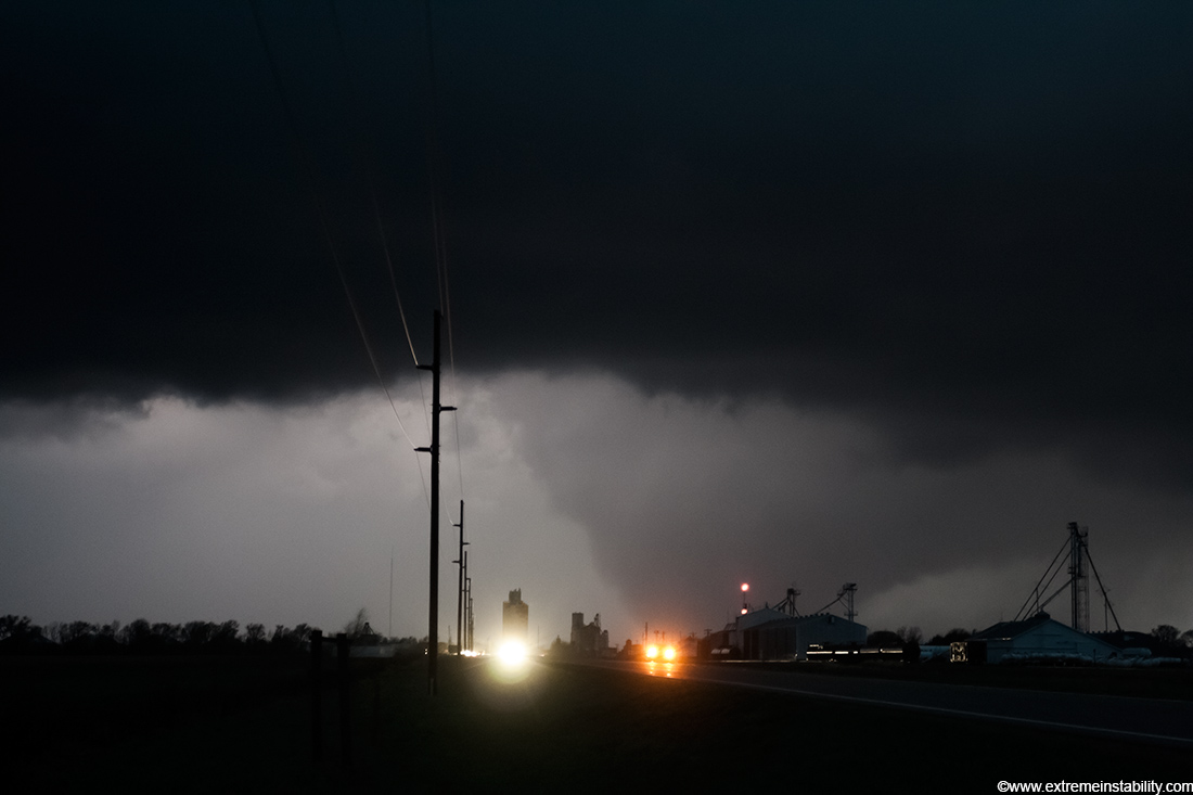
Same location, now with the still cam again.
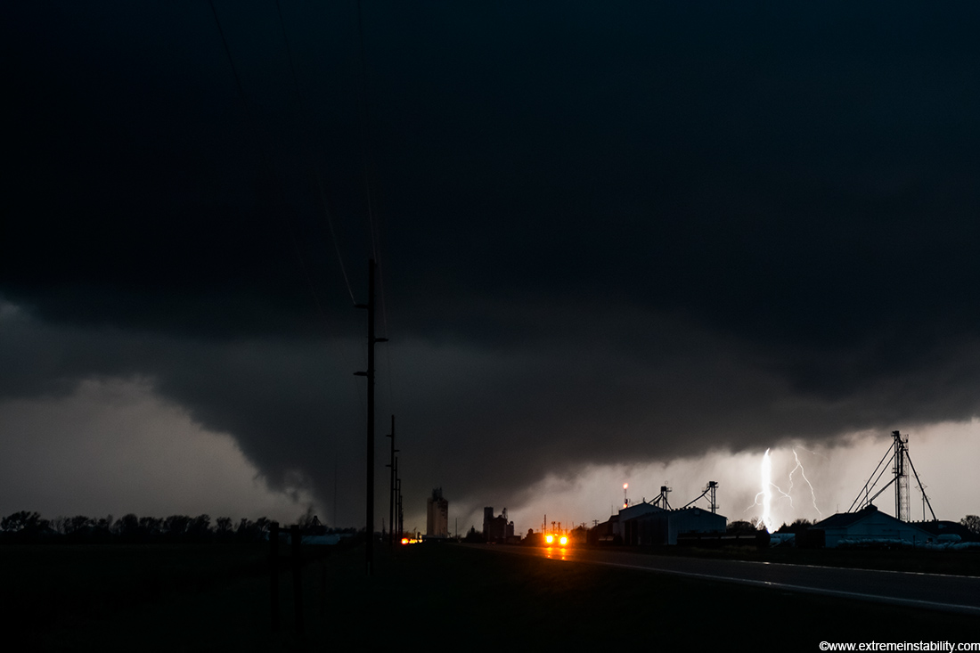
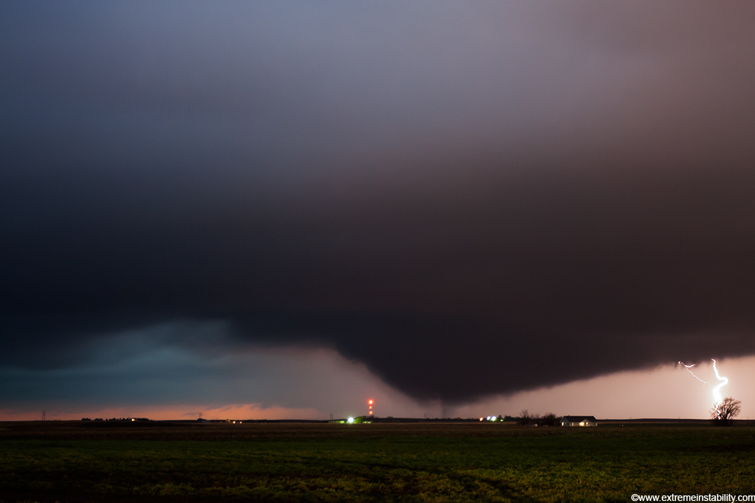
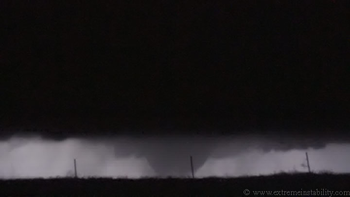
Tornado rapidly growing in size, just west of the powerless Grant NE. Lightning to the right is blowing out thanks to the 1600 ISO setting. There was no choice but to use 1600 ISO on this tornado. The hazard lights on that vehicle were quickly blowing out too.
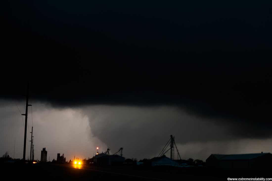
That is what I mean by rapidly growing in size. This is a video grab. Just as it was crossing this highway it decided to morph into this beast.
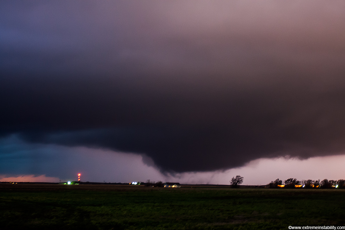
More stills. I'm surprised there were a few cars still coming east during all this! I bet they had quite the experience, likely waiting for it to cross or just missing the thing. After reviewing video I'm thinking most of the traffic coming east had just come south through town and turned east.
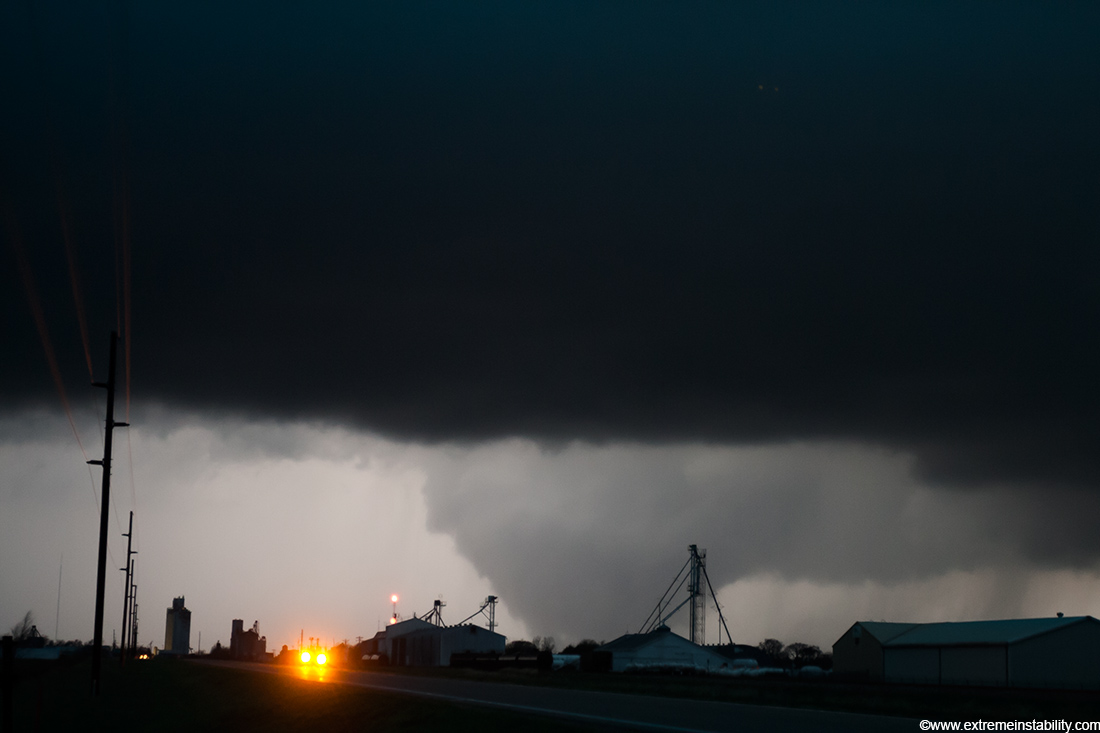
The town of Grant is obviously very lucky.
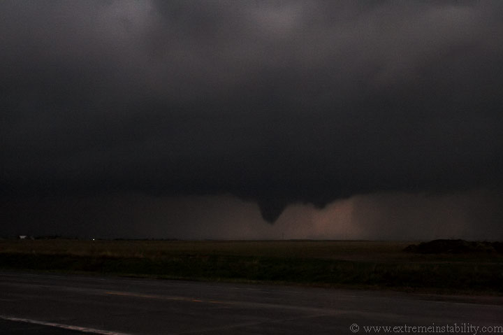
I drove into Grant and then north towards Ogallala. The tornado now took on a shape a bit similar to the Brady NE tornado. Like Brady it was moving to the northwest. I can only image what this would have looked like during daylight.
It soon wanted to wedge again. The coolest thing about this drive north were the lightspeed tumbleweed chasers, flying west towards the tornado. There was a constant stream of them, whipping from right to left in my headlights. The inflow winds were very intense.
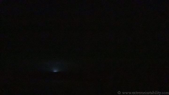
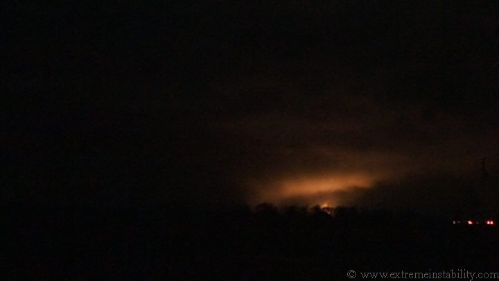
I soon could no longer see the big tornado. Partly because I was driving and partly because I was getting too far north and it was in the rain. I don't think it was completely gone yet. I could see a new area already spinning up on the se flank. In no time it was producing a tornado, which I never got any good images of when it was first there and completely on the ground. This powerflash appeared to be associated with the rfd as the tornado is clearly right of it on the video.
Here is the cone as it lifts nne. For a while I couldn't tell if it was moving left or right. Something very strange was going on at this point. There were loud geese! It's something I'm not sure I've ever heard on any tornado video. Usually they are north by tornado season lol. I guess it shows how untypical it is to have tornadoes in these parts this early. They sounded highly "troubled" as they honked and honked overhead, on and on.
I'm getting near Ogallala now. I start to ignore it, even though it was still there. I lose sight of it as I enter the town. Since it was to my west I figured it was safe to stop and quickly grab a pop before blasting east on I-80. As I go to pay for it the cashier's machine acts up and then the power starts to flicker. He said he couldn't ring me up and I said, "Here's 2 bucks, will that work?" He says, "It's only a dollar thirty nine." I say, "I don't care I want out of here!" I had already mentioned to him there was indeed a big torando with this storm just minutes ago. So, I give him the $2 and run out the door. The tornado was hitting the southwest part of the city at this time.
All hell breaks loose the second I hit the onramp to go east on I-80. I imagine they were the highest winds I've been in. They were moving my car all over the place. Somewhere near the lake recorded a wind gust over 90mph. It was now pretty insane looking at the radar all down the high plains. Tornado warnings all over the place. Any storm that was out ahead at all, wanted to rotate the second it formed. As I go east I noticed a new cell ahead a bit heading towards Paxton. Great!(that is sarcasm, I was in the worst location for this to be happening at this time). It even had a little hook on it and was just severe warned. I was entering the storm at this time on the interstate, praying to god it wasn't in the process of going nuts like the others had been doing. I beat it and don't have much of a problem, outside the one semi I passed, losing all visibility thanks to the high winds from the south and heavy rain. I never tried that again till clearing the precip.
What a day. It's crazy to think there were two tornado producing supercells immediately south of this storm around the same time. At least the one had a long lived, large wedge tornado. In all there were 67 tornado reports at last check, with many of them being large, significant tornadoes.
Here is a link to the storm reports for this day.

