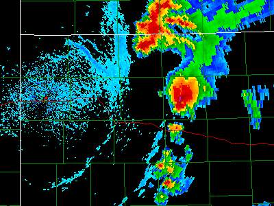
June 9, 2005 Hill City to Stockton Kansas Tornadic Supercell
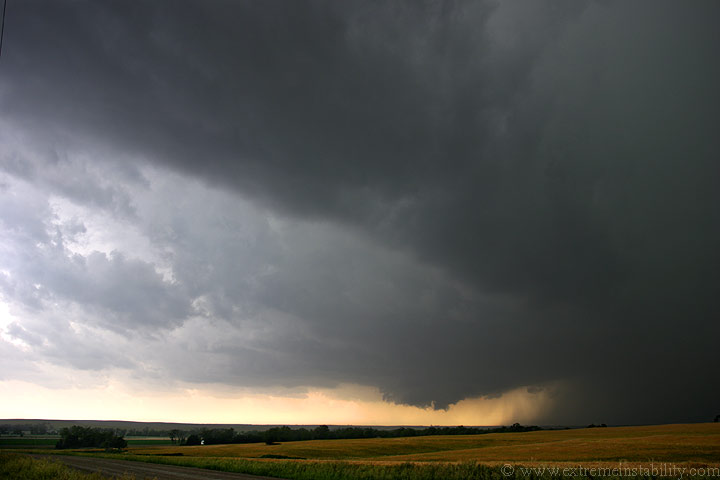
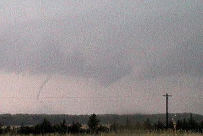
Southwest of Hill City Kansas at 3:03. The storm was tornado warned at this point. I sat here and watched it get organized for about 30 minutes.
I'm now getting large hail and move east to Hill City. Notice the almost mouth appearance to the right side of the wall cloud. It does this again later and looks like a big alligator head. Time is 4:10.
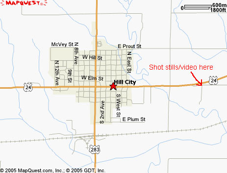
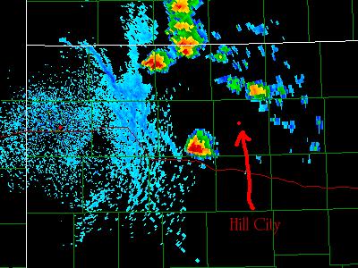
I stop a mile east of Hill City, just off highway 24, and shoot all of the tornado event from there.
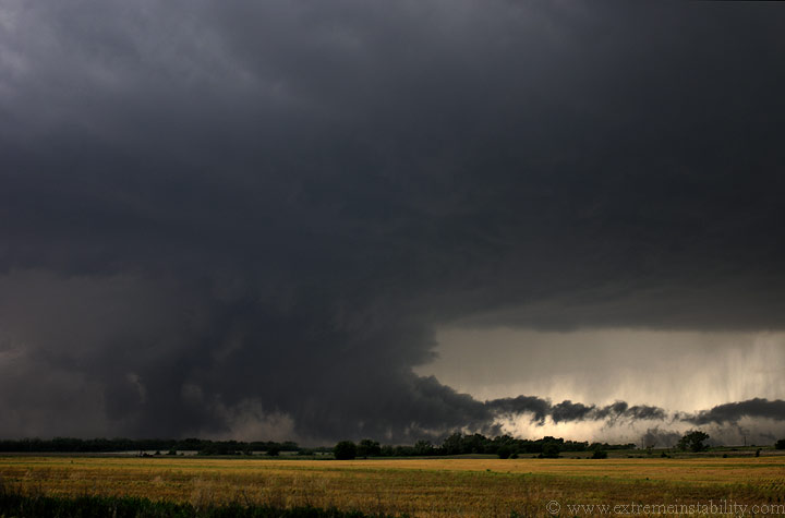
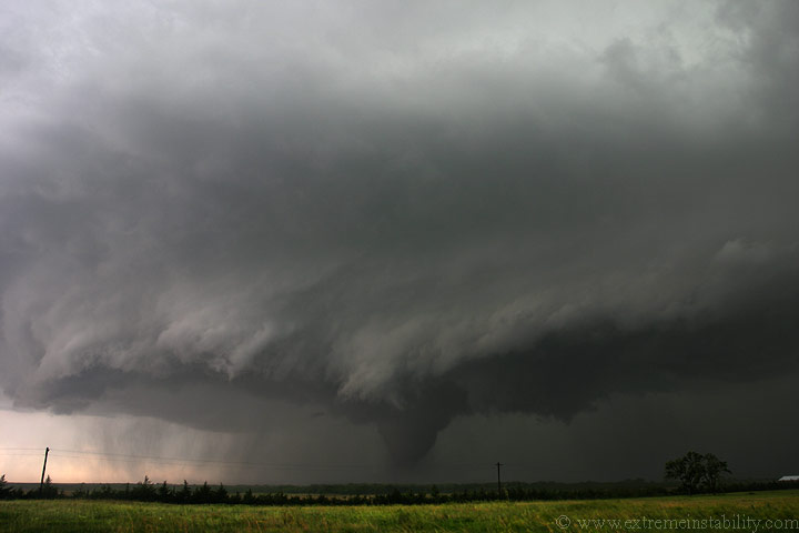
The tornado quickly develops as soon as I get pulled over. Time 4:24.
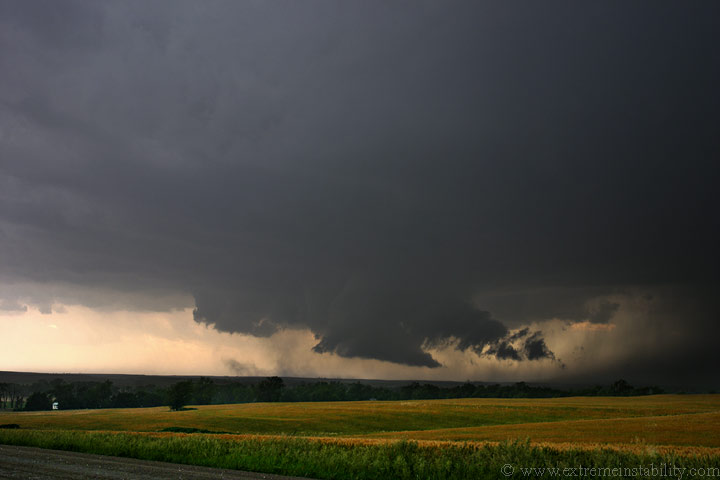
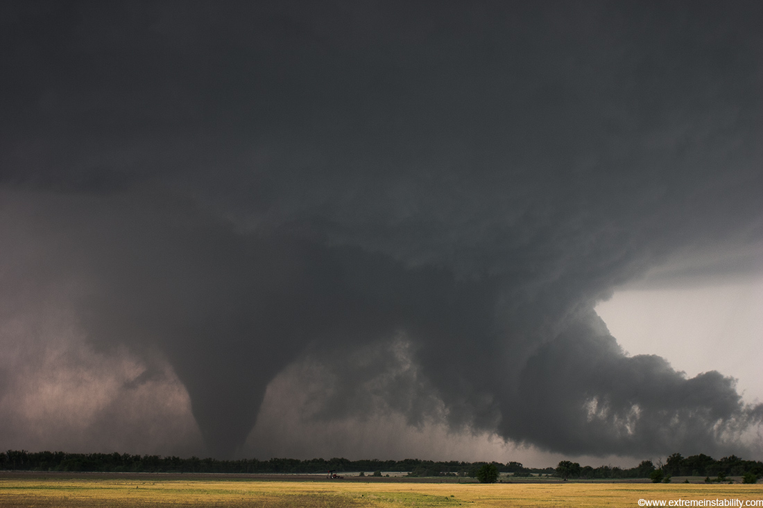
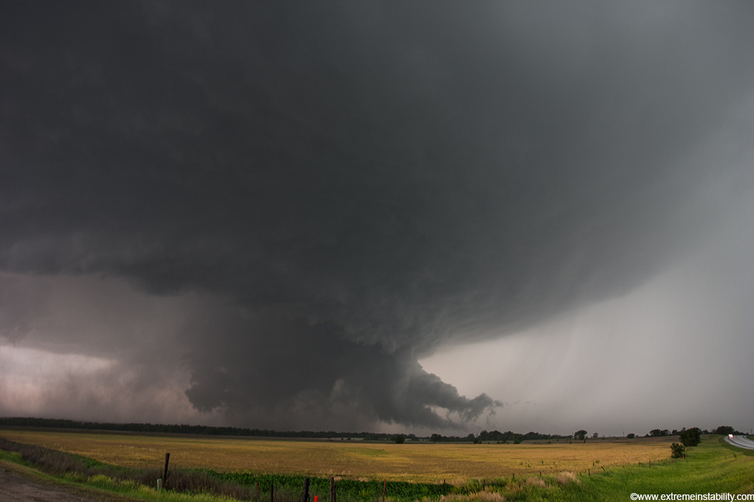
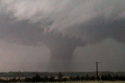
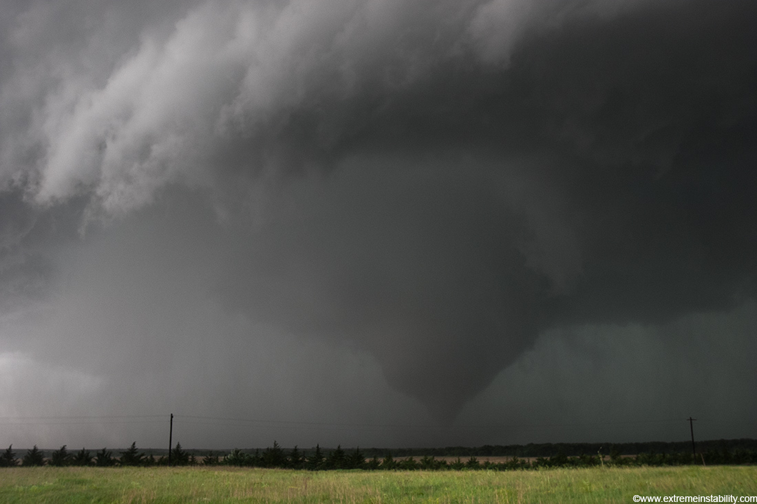
Very strong, large tornado moving east, about ready to get pulled back north. The motion in this tornado was pretty amazing at times. Time 4:26.
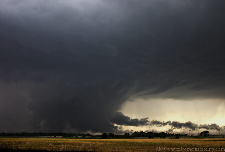
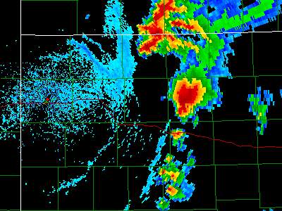
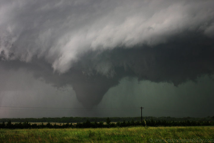
Storm getting extremely wound up now. The tornado gets lost in the mess below for a short bit. Time 4:32.
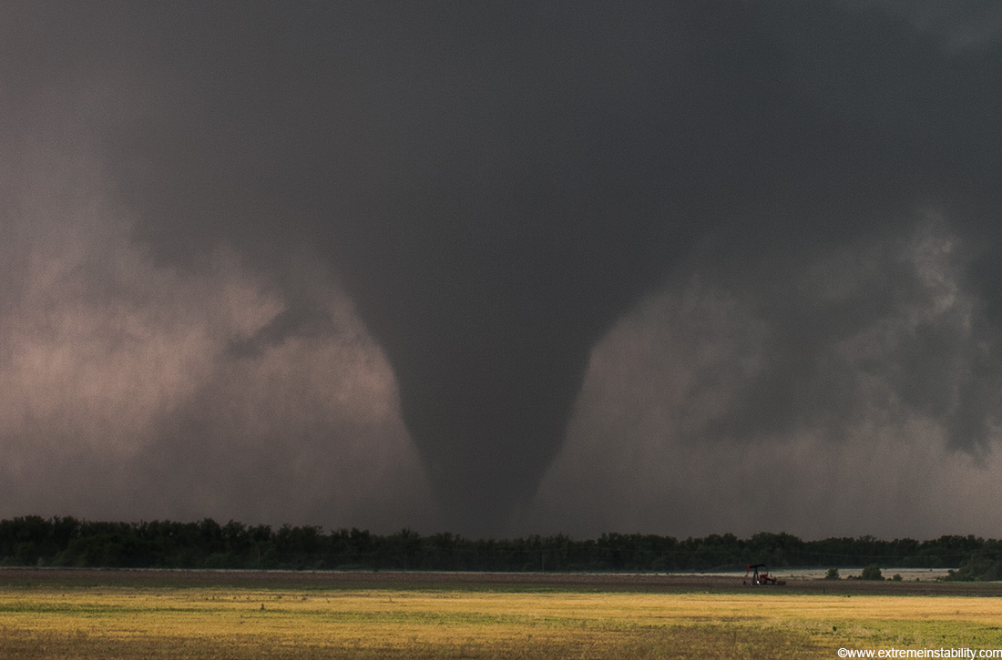
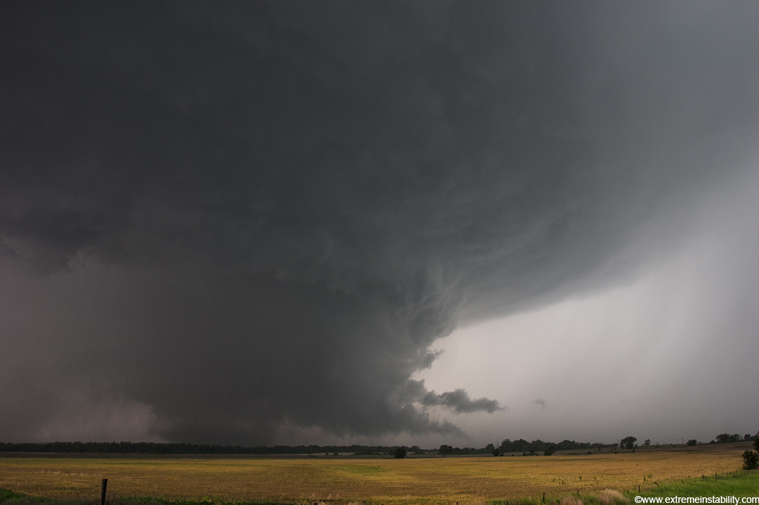
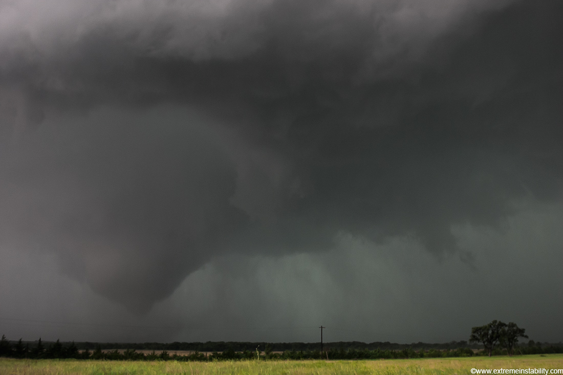
It then reforms and is arcing out the side, pushed south. Time 4:33.

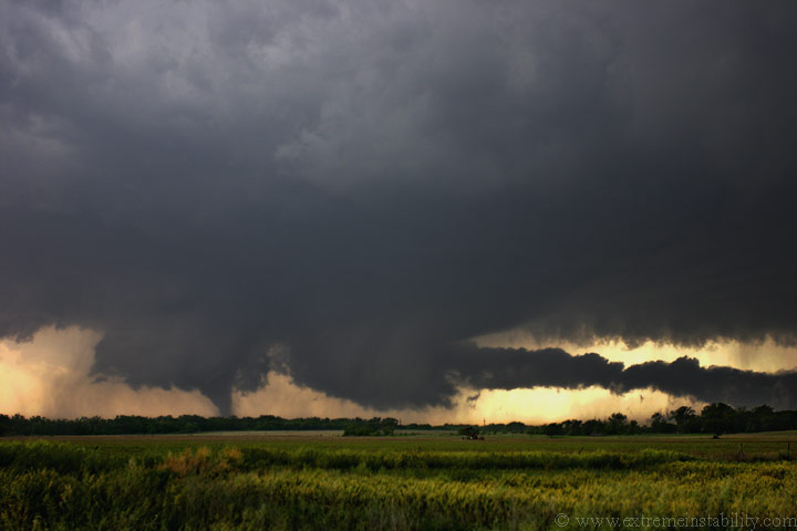
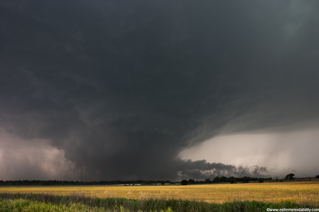
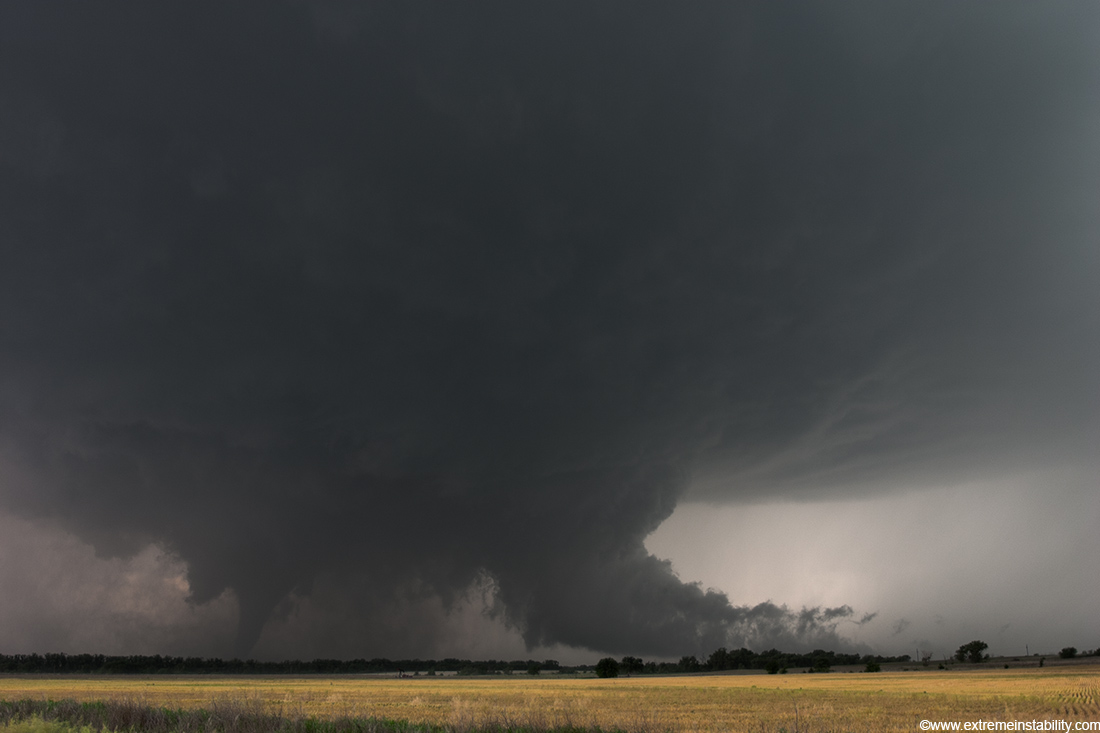
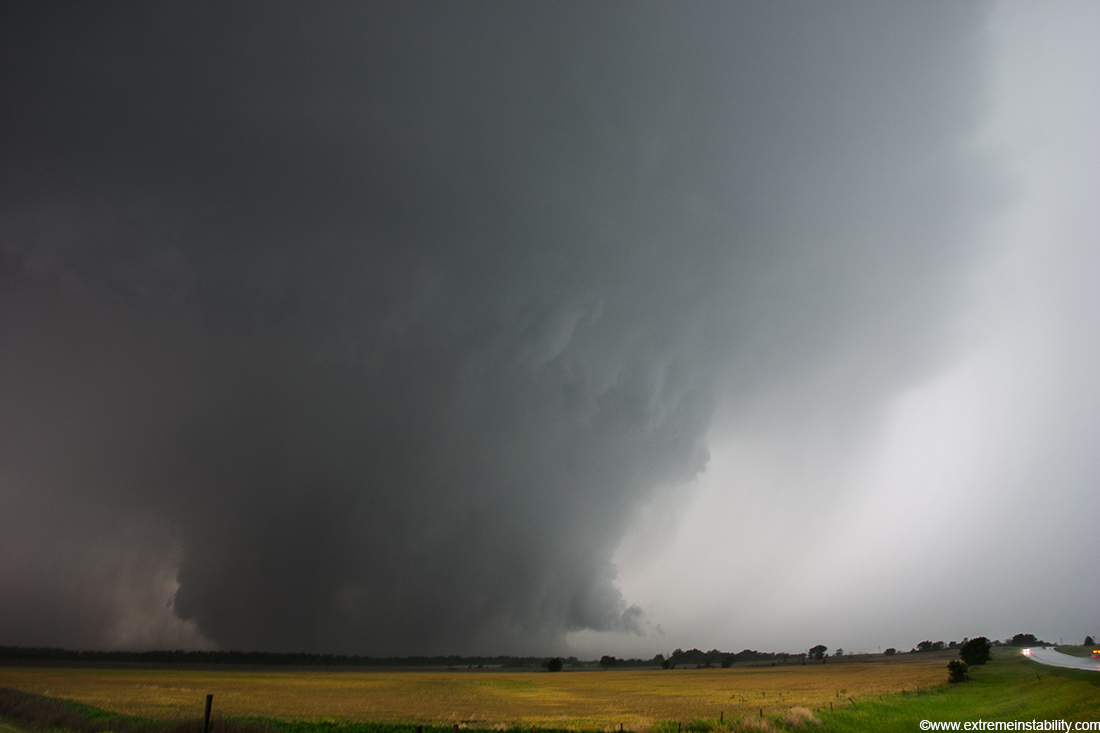
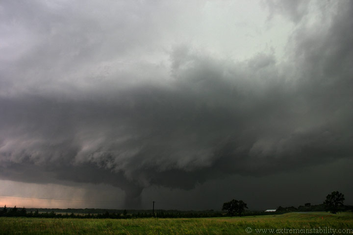
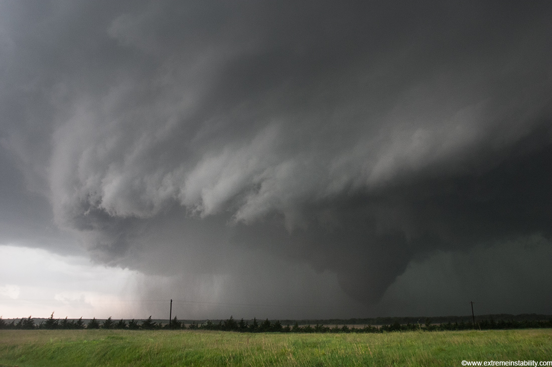
Stout tornado now under this very impressive supercell. It is hard to beat that structure and tornado combo. I wish I had a better video camera at the time and also left it at a wider perspective longer(as far as video). This segment is so cool to me on video, but I quickly zoom in on the growing tornado. These still images are at 17mm, so they are very much wide angle shots. If you follow the storm base around from the right side of the image to the left you can see it goes off the left side. If you continue(where you can't see it) it comes back into the shot way back there to the left of the tornado. This is more clear a few more shots down.
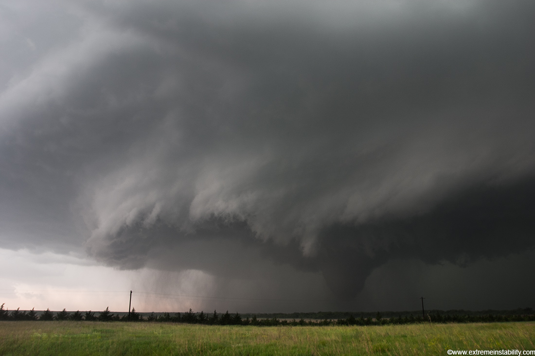
The very bottom of the tornado did not always match up with the sides going up as seen here. You could see some multivortex action down there, which most every tornado will have.
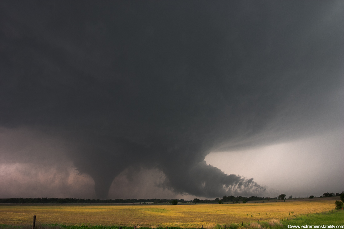
The Alligator Head! My dad actually pointed that out to me. The head is trying to eat the town of Hill City now as the tornado is passing JUST south of town.
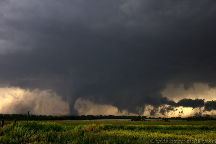
Tighter crop of the image above. Time 4:35.
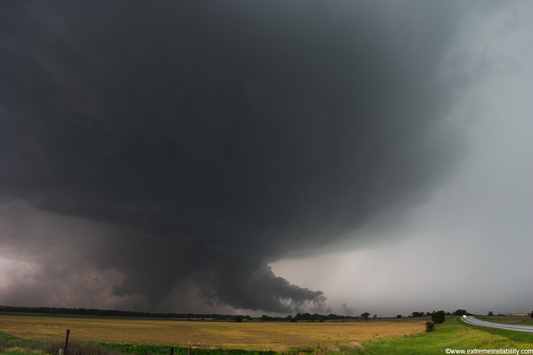
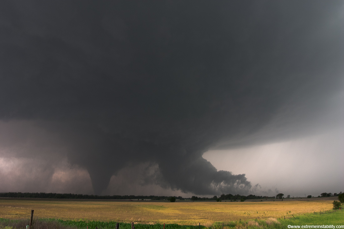
Flat out amazing structure. This is half of the storm. I'm not sure why I never got any stills of the southern half. I guess the vault region and crazy inflow tail offered so much over here. You can see the southern structure of the storm towards the back of the left side. If you start at the tornado and draw a line to the right and curl back left with the base of the storm and keep looping it would go of the left side and come back on towards the back. The structure is basically like a big coil coming around and to the tornado.
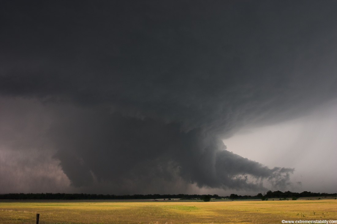
Condensation once again losing its balance. Time 4:36.
Right after this still it again gets a condensation tube to the ground.
Not alot more to say about the thing. What a treat this was and lucky it passes south of Hill City and not right through town. It was close. I'm looking sw at it and it moves directly at me. Time 4:38.
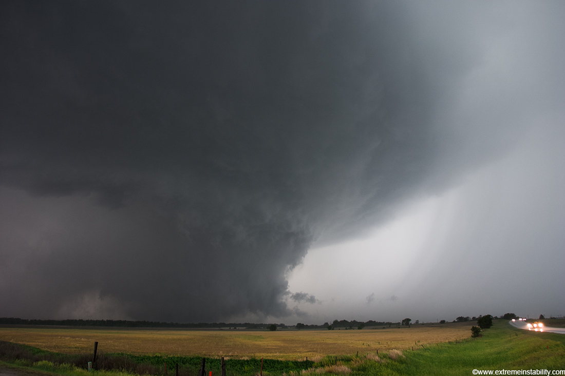
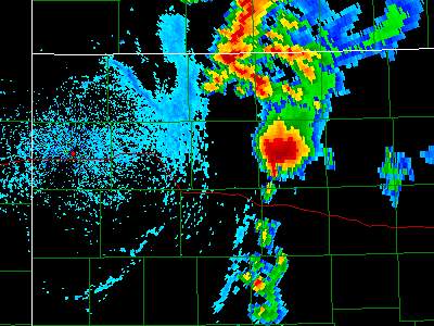
Once again hail becomes an issue/concern so I leave shortly. It is probably 2 miles away(it has to be based on other accounts/images of it).
I'm not sure I ever saw it as a wedge unless you count the north side of the meso scraping the ground. Time is now 4:40 or 17 minutes after it first formed.
I leave here thinking I left myself time/room to escape and what do I encounter right off the bat? ONE LANE ROAD CONSTRUCTION! I was soo pissed. This was still pushing ene at those of us stopped there, with a new meso and huge wall cloud just ssw of us. Their lack of awareness could have killed people very easily. Hell they should have been able to see the thing from there! No reason they couldn't have. That was one of the worst feelings I've had in chasing.
5 minutes before that road construction stop my video camera quits recording stuff, though it said it was. The zoom function was all messed up so I had to dig out the back up vid cam. So I missed some of the end of that Hill City tornado. I'm very lucky I got what I got with it as it tried to short out once at 10 minutes into the tornado and then another 5 minutes in, before it quit right before I left after 20 minutes of video. Evidently it got too wet and was shorting out somewhere. I'm glad the zoom was having a mind of its own or I would have never figured out that it wasn't working or recording anything.
So now I'm just sw of Stockton with my back up vid cam and my still
cam. I didn't shoot any stills of the elephant trunk part as it was so
rainy anyway. Here is the elephant trunk to the right of the developing
tornado.
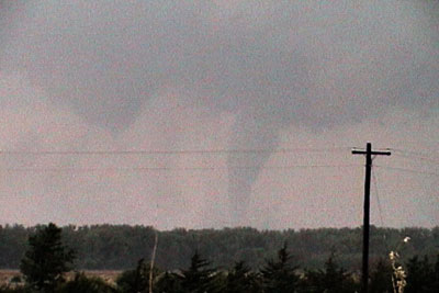
Here is the same elephant trunk to the left of the developing tornado. It was moving around behind the developing tornado.
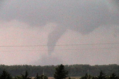
The rope out was pretty dang cool. You can still see the cone forming
in the center, to the right of the roping tornado. Boy does this old
digital 8 video camera have noise issues now. My mini-dv wasn't great or
anything but it was much better than this.
Now the middle tornado is well developed to my sw, heading directly at
me once again. It never moves left or right.
Most all my stills on here are 17mm wide angle shots, so things look much further away than they are.
Very cool structure yet again, with rapid motions.
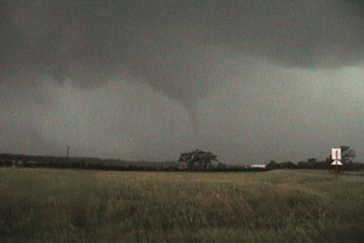
Getting fairly close now, still just outside Stockton on highway 24. Time of this image, 5:48.
A third tornado comes down north of the other tornado. This storm
seemed to be really pushing east fast now, so I left right here. It was
on my heels as I got into Stockton. Evidently there was some damage in
town to a theatre. I wonder if it was tornadic. I'm sort of doubting it
as it seemed to really bow out the second I left.
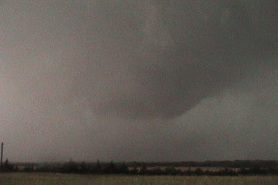
The tapered cone tornado is now losing its dust bowl and lower condensation, likely due to strong undercutting now. I'm sure it was still a tad windy under that.
After I beat it through Stockton I realize I'm pretty stressed now. It is odd when tornadoes are moving toward you for the last couple hours you start to build up some stress. At this point I was starting to simply want a motel for the night. I go well east of Stockton before finding a highway south. I drove south at a slow pace, just taking a bit of a break. I then head west towards the new tornado warnings and see those storms now suck. I end the day at the Super 8 in Hays KS.


