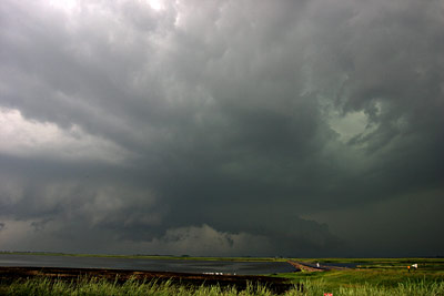
June 26, Aberdeen SD Supercell

Convective initiation in ne SD sw of Ipswitch. I got north of the boundary and then moved west to this area and kept driving south till I got into the se winds.
It would be nice if xm radar would show outflow boundaries as this one was quite obvious on ABR radar(later when I saw the archive of the day) yet invisible on xm.
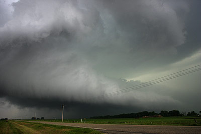
A new base forms south of the previous one as it goes north across the boundary. This first storm's precip/downdraft sends out more cool air and helps to re-enforce this boundary for the south updraft base.
This was scud pushing south but now attatching itself to the base of the southern updraft. This happens often, but is cool enough to note I guess.
The storm is not doing very well near Ipswitch now. I tried to go north on gravel but my option east was one lane crap. No way was I going to try taking that road. I then started getting rained on as I moved back south to the highway. Rain scares me on those 'gravel' roads as many turn to slime, which my mustang quickly rejects. So I rapidly got my butt back to highway 12 west of Aberdeen.

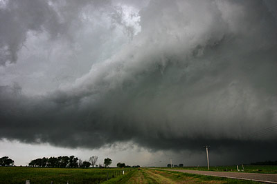
I wasn't thrilled with the storm and what it had shown so far but it was my only option so I blast east and go back north on the same highway I used just an hour or so ago. I think it was highway 45 to Leola. Halfway up it the storm goes bonkers.
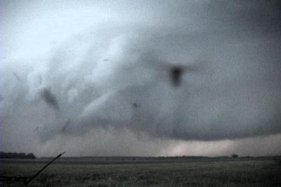
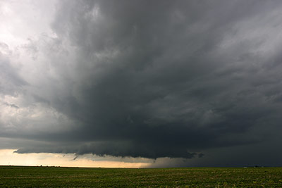
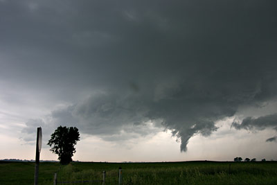
It was approaching from the west while I go north. I had everal miles to go before the east highway. This fat tail cloud was really cool as it got all twisted up into itself.
I think I stop right about now, halfway to my east option. I was stopped at a paved option east, but since it wasn't on my street atlas when viewed wide I wasn't sure that it'd stay paved. I ignore it and continue north here in a second.
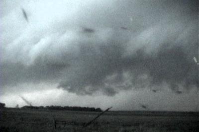
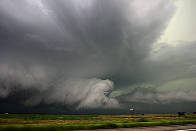
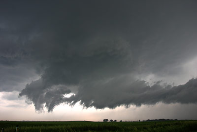
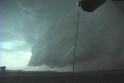
Here is a rapidly moving rfd plume, looking south.
It was too bad my only real option was to get my butt north, right into the core of the thing. I was quick enough in doing so that I avoided large hail that was certainly in this core. As soon as I get out of the precip, while moving east on highway 10 out of Leola, I could see a line of convective towers directly east of this storm. At first I thought it was some other boundary(as this boundary went more ne I believe). Well, what I'm pretty sure happened was this intense rfd surge was enough to fire those up a bit. It would be odd they'd happen in sync like that and not be related to this strong push.
Whatever the case, those convective towers really hosed that storm as it was complete junk as it came out of the rain towards me. I noted that the sfc flow ahead of this was still primed and that any convective towers were now gone. It also still had its boundary, obviously. So, I stayed with it. That is one thing I really do not like to do, leave a storm.
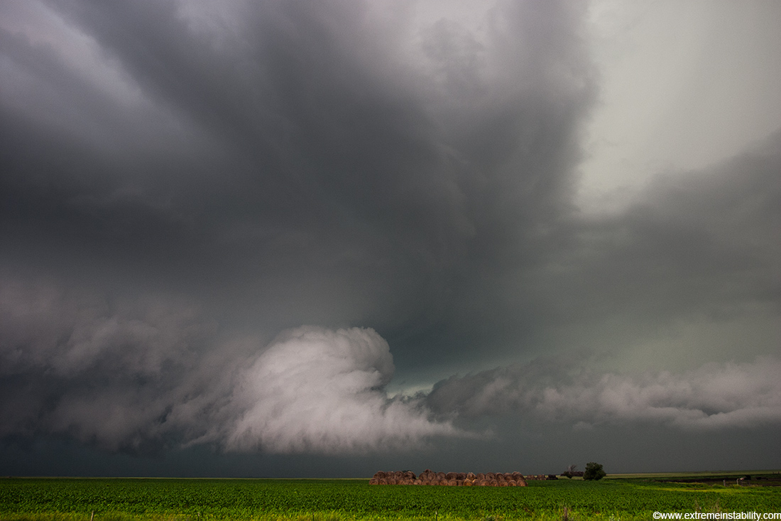
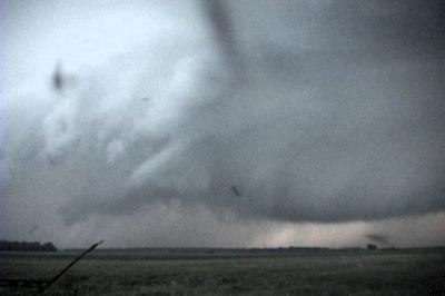
Somewhere in here I meet up with Kurt Hulst and chase it with him. Right before this I said to him, "Man this thing looks like complete crap again". He said, "Maybe it is just cycling". I said, "Maybe". Boy was it cycling! The thing went half nuts just minutes later. This was a weakly rotating funnel trying to get down. It had slow moving, slow spinning vorticies in it, which were seemingly bent around each other.
During this there were some nasty cgs. When they hit you could feel the shockwave through your chest.
I think I'm now near Helca SD. Yeah, it is pretty sweet now.
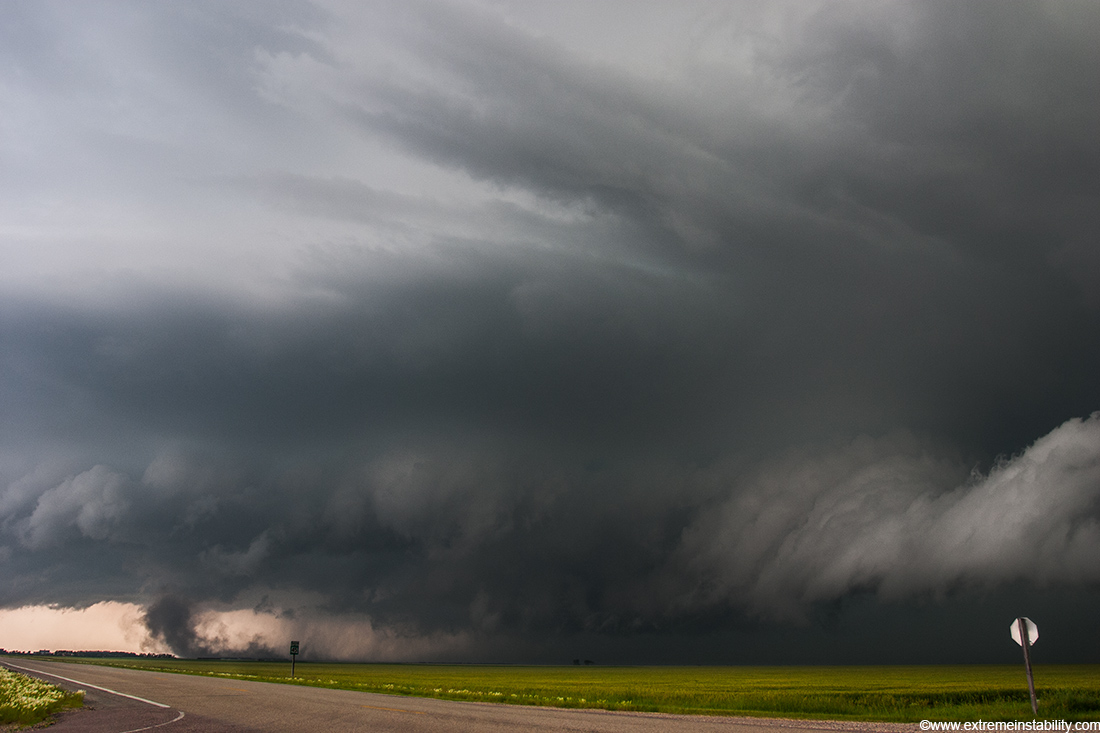
Doh! I thought for sure this was going to tornado, and quite close.
This is about the same time as the above image, but back in the rfd. This would be the fastest moving clouds I've ever seen. Just their motion towards me made me ready to leave. They weren't really able to organize into good rotation but man they were flying east. I left as it is almost on me. I hate that feeling where you think something is about to happen and you do not want to stop recording for nothing, while at the same time it is becoming too close, forcing you to move east.
Now in ND. OH! I haven't mentioned the mosquitoes yet. They were unreal. I'm not sure I ever imagined it was possible to be that bad. Literally the second you pull over on a gravel road and put the window down several come flying in. At times I bet there were 30 or more trying to come in at once. This would happen the second I stopped and put the window down. It was hard to record through the glass as they were ruining the video. I'm certain I cussed more times on this chase than any single year of chasing. Anyway, that was an all night deal, and not after dark either, but during the evening light. It was also at every single stop. I can't see any place on Earth being any worse. That area has lots of wetlands and lakes. It was also amazingly humid. But, anyway.
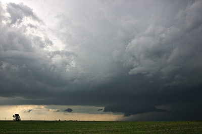
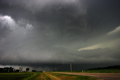
I was sitting on a gravel road, windows up, facing north, not even caring much about the storm at this point. Then they say on the radio it is tornado warned again so I look back south and was like, crap. This was shortly after that as I get going east again. It had some rather sweet structure right now.
Here is an example of one stop and what it was like to have the windows down. These are all mosquitoes trying to come in the window. I should at least be able to make a funny video with some of this. There was blood all over the inside of my car from killing so many of them. On the mirror, the dash, the windsheild.....etc. On the drive to Sisseton SD my windshield became so full of dead bugs it was getting hard to see through. The next morning I got just enough of a shower/sprinkle while driving south that I could wiper some of it away. It was really sick, this red/orange goo going off the sides of the glass.