May 24, 2004 Chester NE to KS Tornadoes
I slept in way too late this day. I knew I had slept in when the first thing I see on the computer is a PDS box already out until 10pm. I woke up at 11:30 and made a mad scamble to get sw.
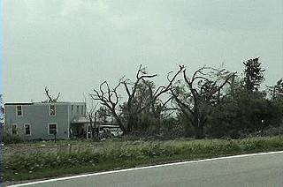
Heading west here south of Lincoln and I see tornado damage from 2 days earlier(Hallam Nebraska May 22, 2004). Driving through two day old tornado damage in a PDS tornado box, it must be 2004 in Nebraska. I flew west to the triple point. Two tiny blips were showing on it already with a tornado warned storm to my east.
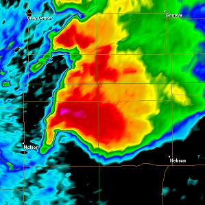
Time: 3:26
I think I was northwest of Hebron at this time trying to figure out the movement of this storm.
A huge thanks to Steve Peterson for letting me know the storm was not moving ne but more se than anything. The radio was reporting it moving northeast. I would really never trust storm motions on tornado warnings. They are very often way off. I race south and learn I missed at least 2 tornadoes already. I don't think I missed more than the 2 Steve and his chase parter got because they were there quite early. So this one here is my first tornado.

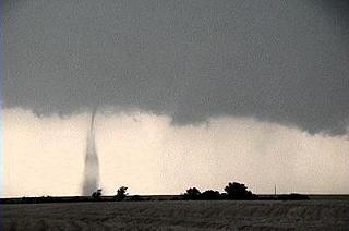
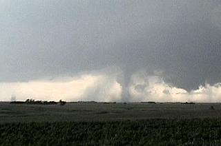
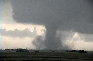
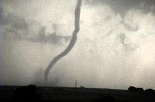
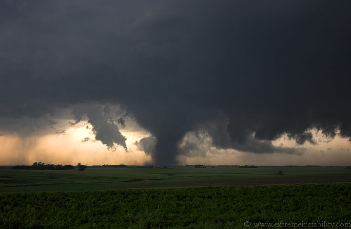
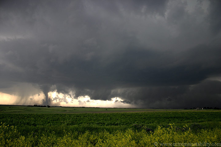
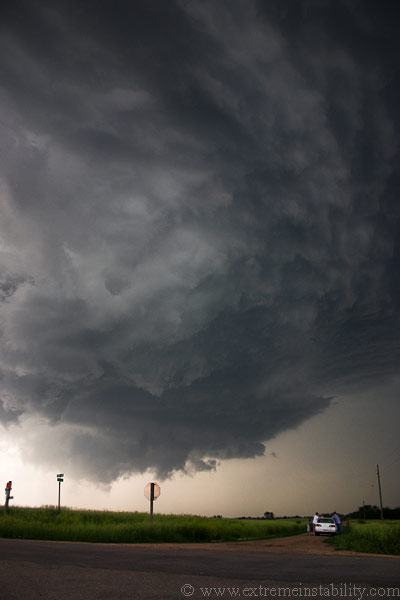
I'm looking sw at the first tornado getting larger. Note the new lowering to the right of this tornado. It is about to produce another tornado under that lowering.
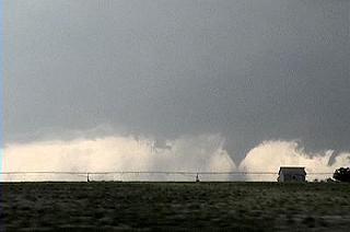
These are shot near Chester NE on the KS border looking nw now. The first tornado is now gone and the second is well underway.
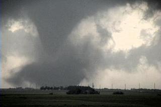
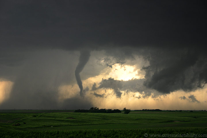
The second one can be seen in the middle here with a third forming to the right of the image, north of it. Also in this image is a fourth to the very far left. It is just a tiny dust whirl on the ground but you could see a small needle funnel above it. That is 3 on the ground at the same time.
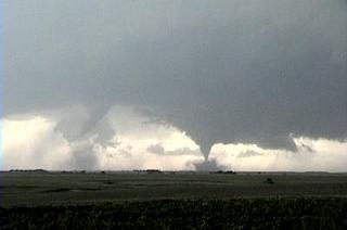
The second tornado is weakening as the third gets larger to the right.
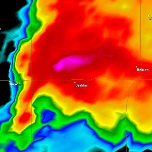
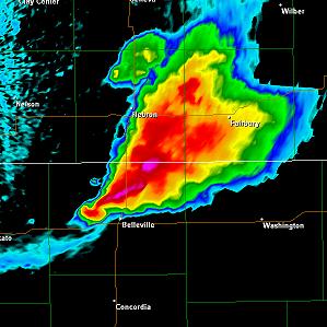
Time: 4:10

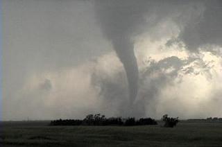
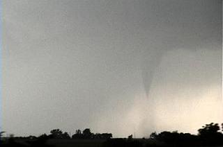
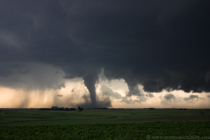
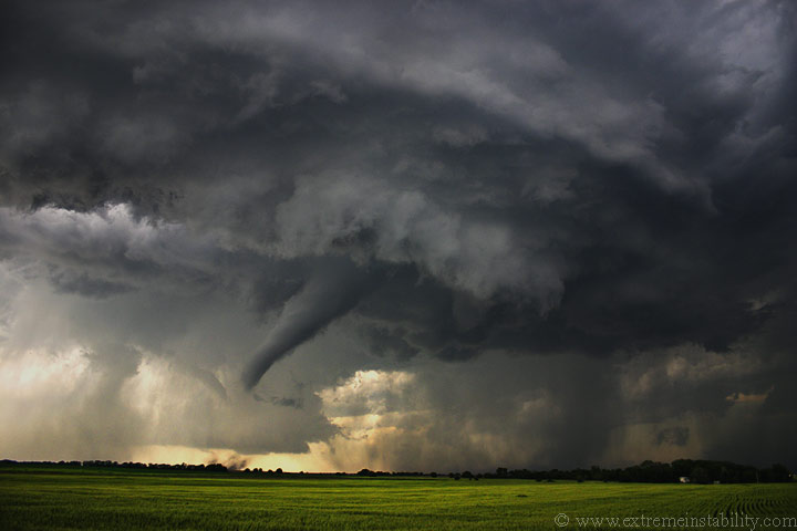
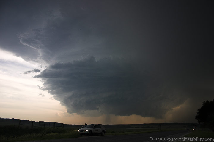
Same time as the radar grab to the left and I believe the same as the main tornado of the day pictured below.
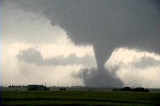
This one was the tornado of the day, with this storm anyway.

This is doing damage at this time.

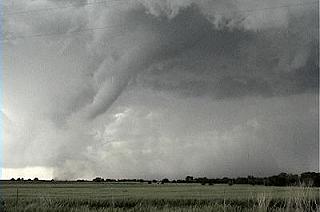
Several minutes after it formed it is now starting to thin up some. It is really cool how all that dust falls to the ground and it has this magical motion in it.
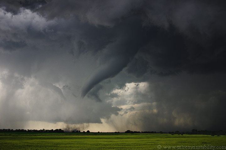
It was on the ground at least ten minutes.
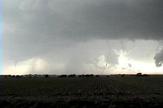
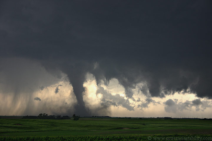
Now I think this is the same tornado roping out on the right here, with a new tornado to the far left. That far left one would be my 5th one I guess. It was hard to keep track of what was doing what.
That long-lived one had a rather wild rope out, with some high speed kinks rolling down the tornado.
Number 5 somewhere in northern KS as I drive south.
Here is number 6 a few miles into KS on 81. It was a very weak tornado and not terribly far away.
Time 4:55.
The storm is elongating as it starts to get really undercut by cooler air.
Nebraska chasers are so competitive. This is how we wave at each other.
Digital Stills From the Chase
The rest are a few digital stills starting with the main tornado of the day.
I only got stills of the main tornado and then the ending weaker one in Kansas. The rest of these are from that weaker one along 81 in KS.

It had a pretty cool ropeout right on the highway. I don't think the traffic even noticed it was there above them.

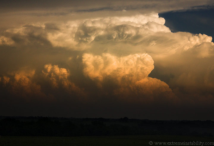
I let the flanking-line/gust front move overhead. This scene was simply amazing. I probably enjoyed this scene more than all the tornadoes combined. The sun started shining under this flanking-line and made for quite the scene. Tim Jones can be seen walking back to the van. There were frequent cg's coming down now. I really don't care to be out in the open around lightning so I hopped back in the car.

Chris Lenz next to his van.
I scooted east more and watched this storm continue to have nice structure but struggle at the surface.
Looking se into eastern KS at nuclear bombs. Several supercells went up near Topeka and were quickly tornado warned. I struggled with the decision of trying to catch them or to be happy with the day. I enjoyed their view on my drive home after deciding not to tear after them.
Big thanks to Amos, Randy and Steve for passing along info from time to time during the chase.


