May 22, 2004 Columbus to Blair Nebraska Supercell
This was a beast of a supercell(s)...yikes. I left Blair and get data at the Crete library. South of Geneva looked good. I go there and get more data and see the early convection out in sw NE. A line of cu showed up on Satellite from Omaha to Grand Island. Hmmm what to do, west or north. I go north in hopes this area along the warm front would organize. It did. I interecepted the first supercell se of Columbus. It had a huge rfd already. I jump east, south of Columbus and then head north to Schuyler.
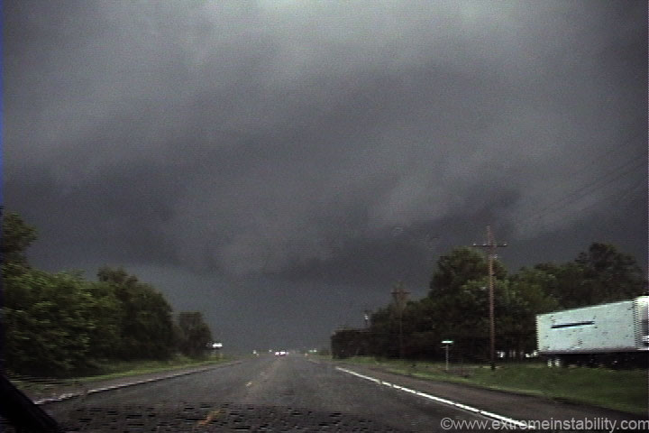
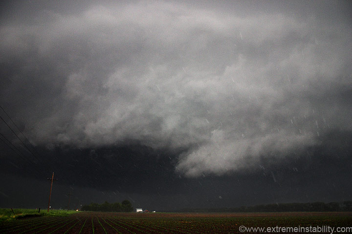
I'm somewhere east of Columbus on highway 30 here. I didn't get a whole lot of digital stills of this thing. It was just a massively impressive sight.
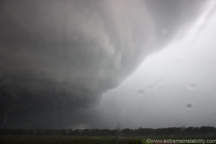
This was simply amazing...beautiful...and had insane rotation. I've ever seen anything like this.
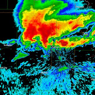
The radar is at the same time as the image above. Notice the precip from some new convection right in front of the hook of this storm. That is a very tight reflectivity band for the hook. You can see how it is right on highway 30. Time: 6:37
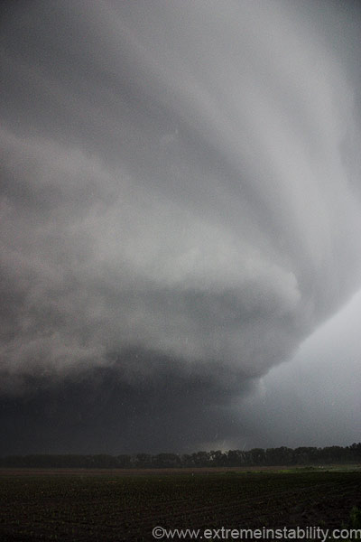
No doubt this would have put down a nice tornado had it not had to eat a storm infront of it. The wall cloud was spinning nicely right now.The whole thing started to look like Columbus 98 from the west. Of course all those white streaks are hail stones falling in the hook area.
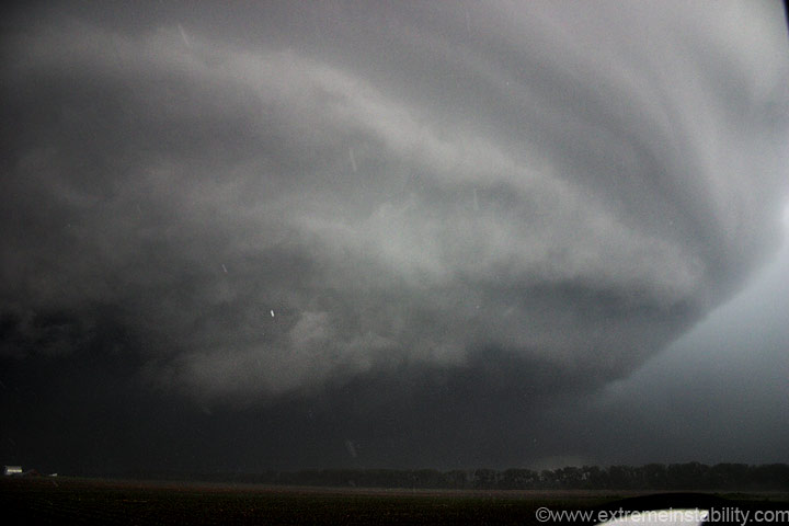
What a meso! Look at that big chunk of hail falling out there.
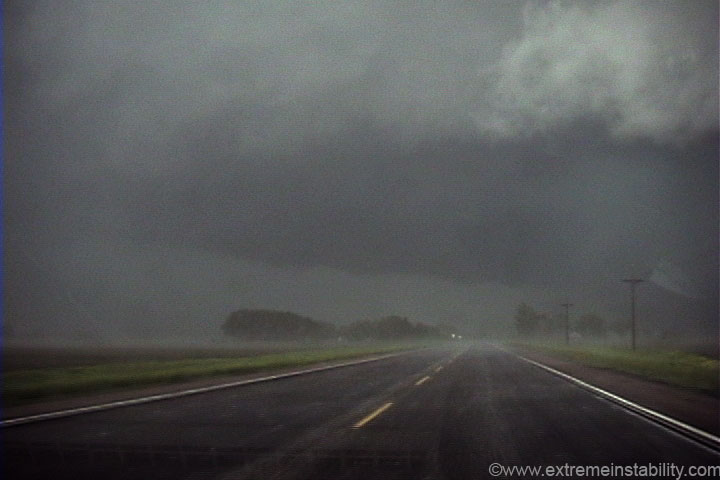
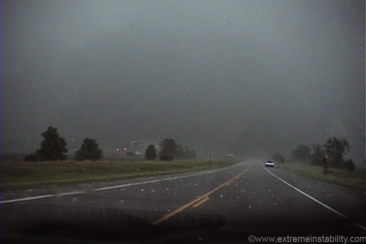
I had to get much closer to the base this time before I could get out of the wrapping precip. All the towns along this highway are really lucky that convection popped up right ahead of it when it did. There is really little doubt what it would have done had that not happened.

Looking north out my driver's side window and up at the high speed motion.
Peaking out the south window.
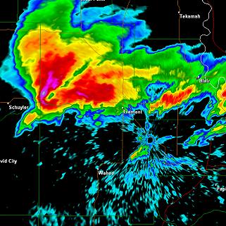
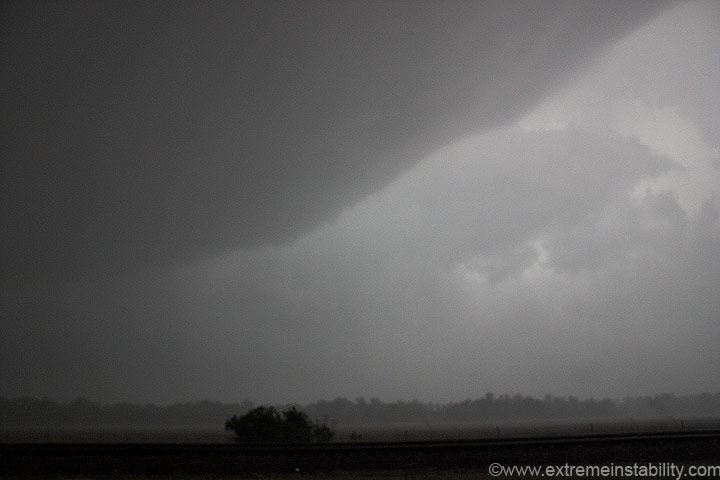
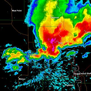
The lead convection kills my storm as it wraps very hard in rain and hail. You can see here the new storm is already forming a hook. It's a bit hard chasing this from the west with no information. I was completely unaware of that new storm ahead of this. On the northeast side of Fremont, an air-conditioning unit on top of the Walmart there, was blown off the roof and onto an suv, apparently from some brief touch down. That location is right at the tip of the hook in the above radar image.
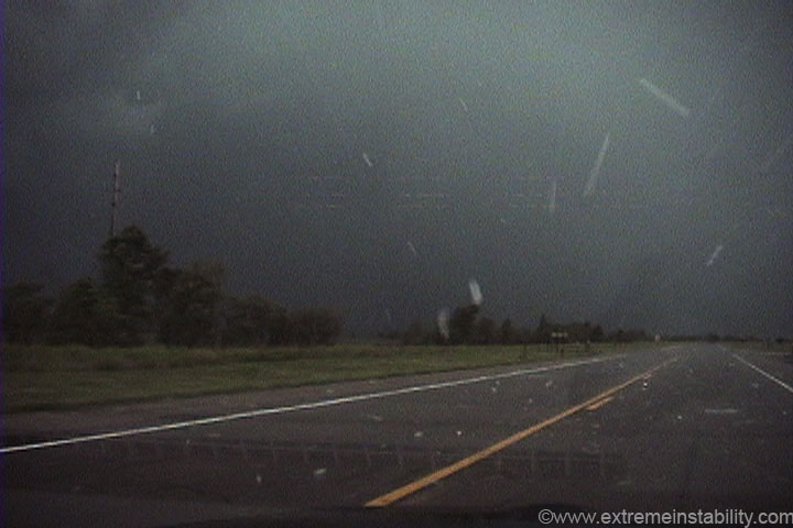
As I lost visual on the structure, I had no choice but to try and punch east, as cautiously as I could. There were stones up to the size of baseballs laying on the shoulder, as well as some smacking the ground still, bouncing several feet back into the air. How none of the big ones took out my windshield is beyond me. Must not have been all that many that large.
The new storm, which was going over 70dbz on radar right now, is producing this large hail. I kept talking to my parents, telling them to get under ground(since this had been heading right down highway 30 for Blair). My dad describes how the entire sky is being sucked west into this supercell(I really wanted to be east of it after hearing the descriptions).

I'm right behind the new area of rotation seen here, just outside of Fremont. The Walmart I mentioned is pretty much right under that velocity couplet.
I'm still behind it as it forms yet another hook just south of Blair. I had enough of trying to get ahead of this mess and let it slide away to my east. It was not only pointless with no info, but just a tad dangerous. I pushed my luck enough and decided to call it a day. The baseball size hail continuted into Blair, trashing a massive car dealership on the southwest side of town. Lots of windows had holes in them. My parent's house had their siding trashed on the north side.
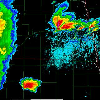
Backing out a bit to show the supercell near Schuyler at the same time as the supercell nearing Hebron. Time: 6:37
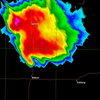
Hebron Supercell. Time: 6:59

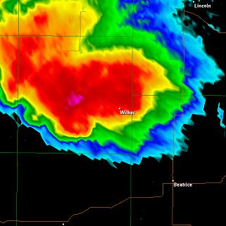
Now the same storms at Blair and Wilber now. Time: 7:38
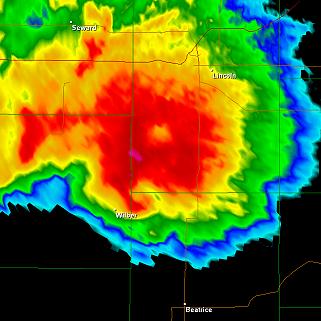
Enclosed hook sw of Wilber. Time 7:55
Storm just outside Hallam at 8:24. The largest tornado in history is about to destroy the town of Hallam.
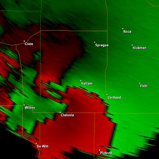
Velocity at the same time as the previous image at 8:24


