May 16, 2004 Holt County Nebraska Tornado
This turned out to be a bit of a needle in the haystack day. I lucked into the best storm of the day. I had no data after Neligh Nebraska, which I thought would suck. I talked back and forth with Steve Peterson who was near North Platte. I decided to stay north, closer to the warm front. I head west right into a digital void(no data). I heard the severe warning down in Loup county and started to see convection to my nw and w as well. Hmmmm, what to do. I gave up the convection west and north and dropped back se, then south on highway 11. I intercepted the Loup County storm west of Chambers. For about 40 minutes all I could see was continous lightning and an apparent hail core to my wsw. Not knowing if it was wise to try and drop sw I just sat and waited. This evolved...
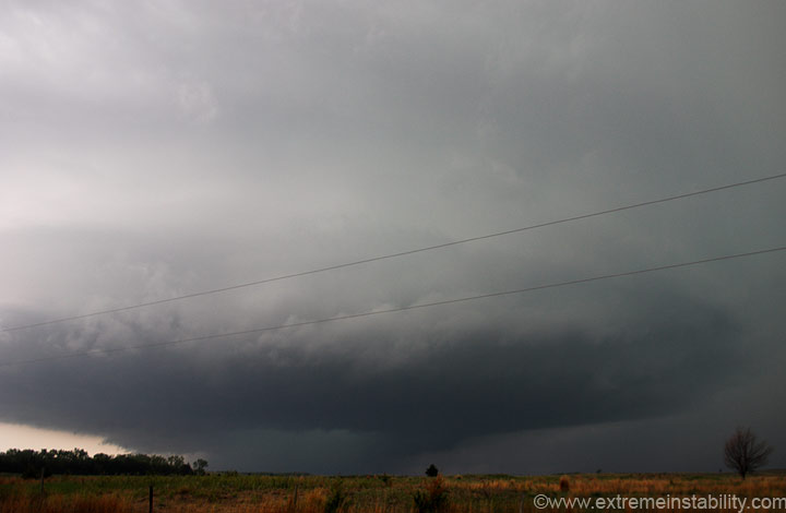
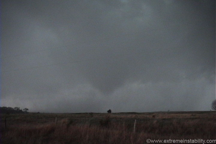
I was slightly shocked to see this structure emerge out of the rain. To bad about the darn powerlines. I do not like to be out of the car in lightning, and the lightning frequency was intense right now.
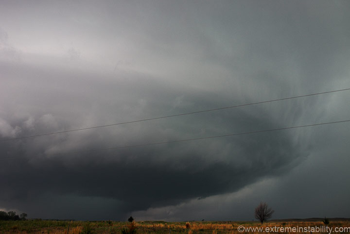
As the storm moved towards me, the rain let up a bit, revealing a nice rfd notch and developing tornado. It seemed like the second this contacts the ground, a flip was switched on the lightning activity. Lightning went from simply crazy to nearly nothing, in what seemed like less than one minute.
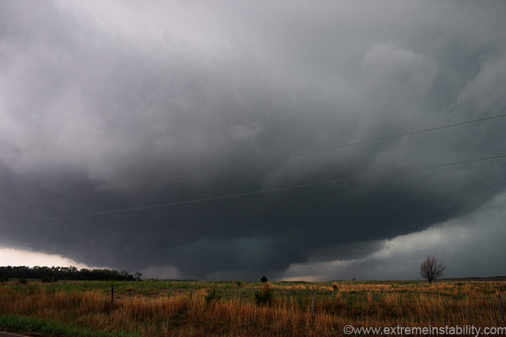
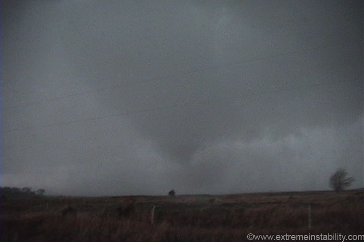
This tornado quickly forms, then lifts, but the rapid rotation continued. Notice the rfd cutting north. That is a pretty impressive rfd cut. The storm was taking on a donut hole appearance in there.
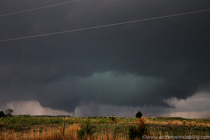
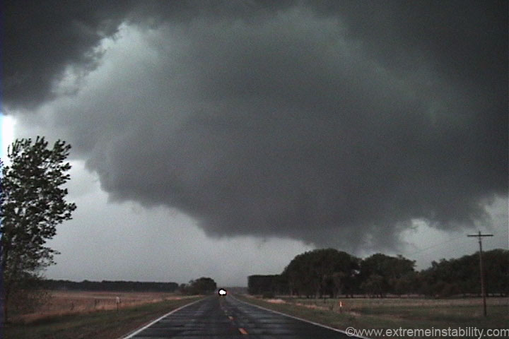
It was right about here the rfd hit me from the south, as it raced north. I don't recall ever being in strong southerly winds in an rfd before. If you find yourself there, it's likely you are in the path of a developing tornado...which probably ain't that far away. I had lost the area of rotation to my southwest as it filled with rain. I'd been watching a new lowered area to the north of it, to my west-northwest. Then all the sudden I notice what is going on, a tornado is approaching not far to my southwest.
Maybe it is hard to see here, but it's in the middle of the image. It's not far away at all. I was now spinning my video camera around, removing it from the window mount, and putting the car in drive. I was parked on a north-south road with no options near me. I needed to drive north about a mile and race back to the east, before this reached the same locations. I wish I would have just had a little more patience and taped things from right here. I just had no lead time, to see what it was going to do.
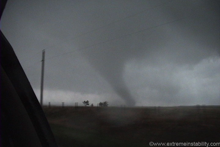
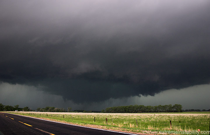
The previous image very quickly turned into this one, above. I'm wide open with the vid cam, which gives this a view that looks further away than it actually is. That is around a half a mile away or so and moving northeast rather quickly. I'm driving north to my east option.
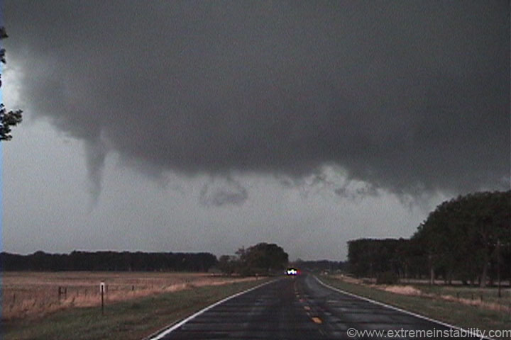
It weakend then came back, then weakened again by the time I got ahead of it here. I'm looking west as it crosses the road. Note the new funnel rotating rapidly around this wall cloud. If this was to put down a tube here, it was going to just appear...BAM. The whole wall cloud had very strong rotation over this highway. When that is present it seems when a tornado forms it does it in a big hurry.
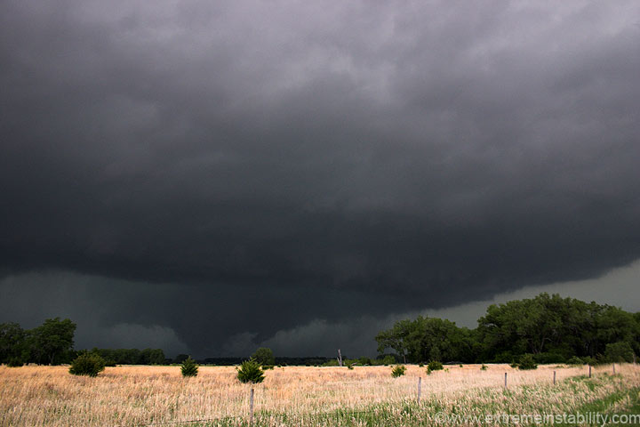
Strong rfd cut and rotation continues as it lifts rapidly to the north.
Back to some digital still images.
I tried to beat it up to O'Neill, but it didn't really happen. It had lifted sw of O'Neill, but looked to do it again real soon. One would have had to go up into O'Neill then back down to the se, punching right infront of it. It was just west of the highway and I knew I wouldn't make it up into O'Neill and back out and southeast quick enough, so I dropped back south and ended the day.


