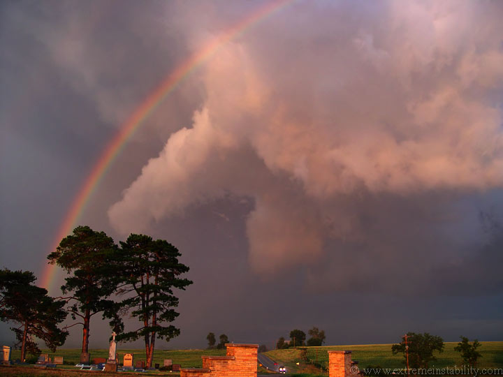
July 26, 2002 Falls City Nebraska Supercell
First chase with a still camera.
I left Blair at 4:00 pm for a Falls City target. I wanted to drop straight south to start things off right along the boundary and then perhaps drift west if need be. I sat near Table Rock Nebraska for about an hour, from 6-7, watching extremely elevated garbage. Temp/TD's sw of here in say the Concordia area were 100/50 while east of there in St. Joe they were 99/70+. I was in saturated mid-upper 70 degree air just north of the boundary. I noticed this persistant block of scud to my sw and figured that was marking the boundary pretty well.
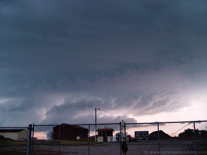
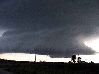
I decide I may as well drop south to see if this does anything, since it was evidently right on the front. Well as I get into Falls City it was obvious a pretty nice show was about to happen with this storm. The pic with the fence is just east of Falls City. I move about a 1/4 mile further east and then just sit back and watch what followed. Some of these are digi cam pics...others are vid caps. The supercell moves from the wsw, pretty much due east, almost over head. I was just north of the meso, basically under it when it passes.
Video grab.
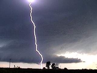
Same cg as above. I've never been so close to so many cgs before. I was going back and forth between stills and video through alot of this. I did manage to get a very long sequence with the vid cam mounted on the window. It had very nice rotation, you don't even need to speed it up.
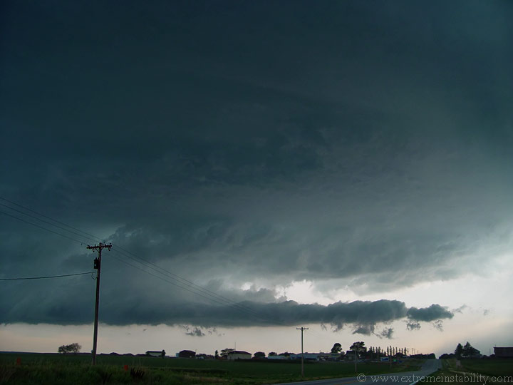
What a sculpted lowering.
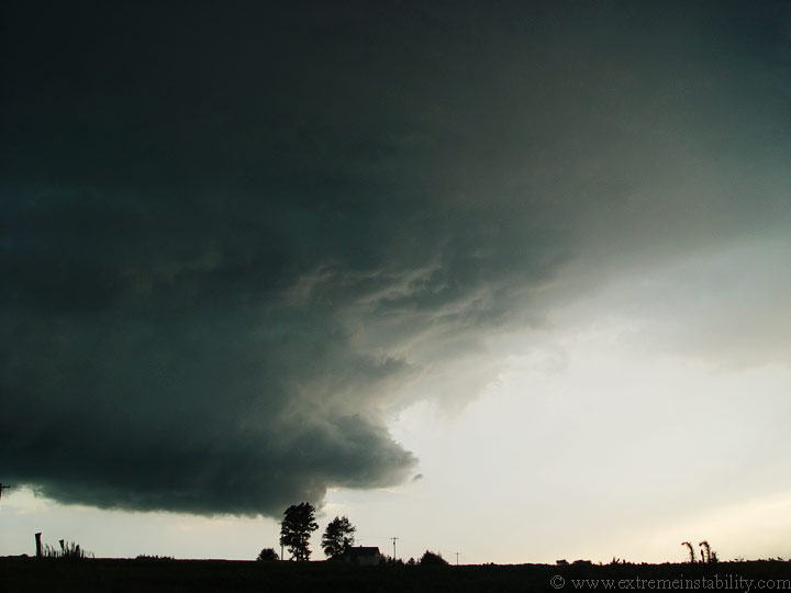
Can you say vault? View is still looking due west, soon to be mixed with either west or south as the meso passes over.
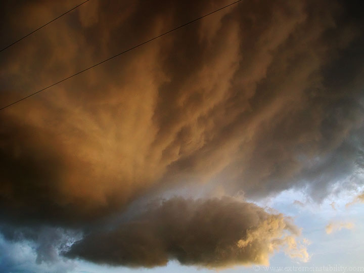
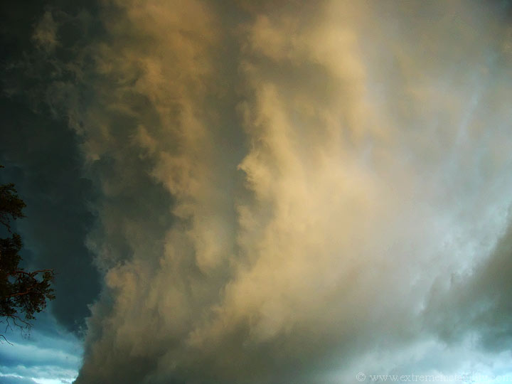
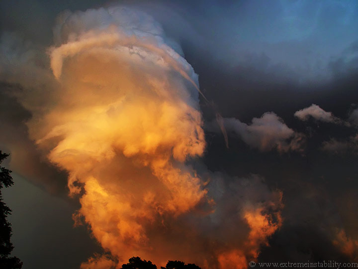
The setting sun really gave it some awesome coloring as it moved overhead.
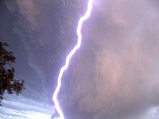
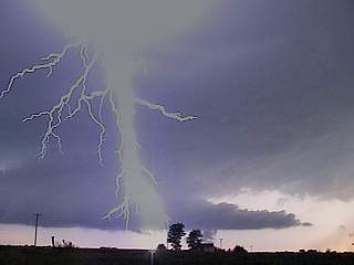
I'm looking due south here. That bolt is about a block or so away, if that. This was flat out awesome, watching the clouds race right at me around the meso and the numerous cg's.


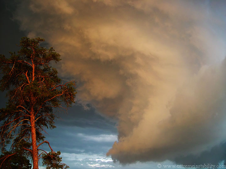
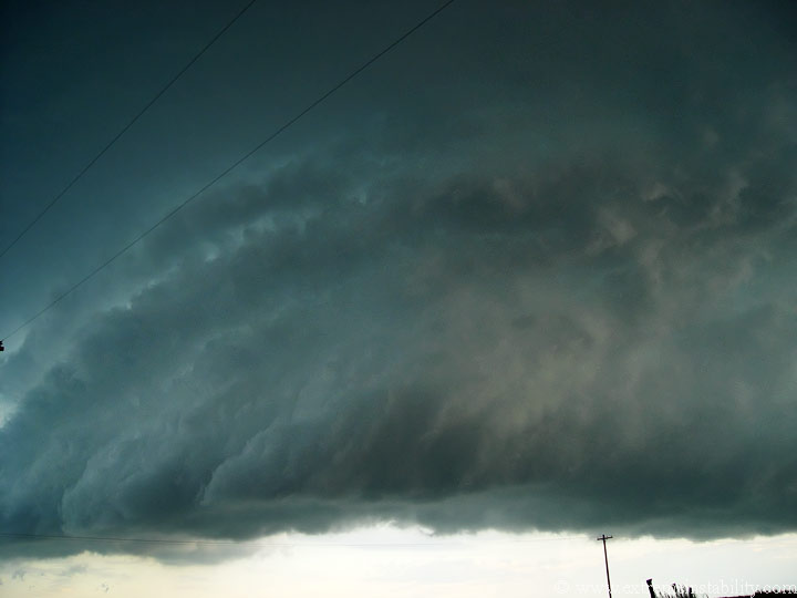
Notice the funnel wrapping around the updarft. It was tough to video tape it and take pictures at the same time.
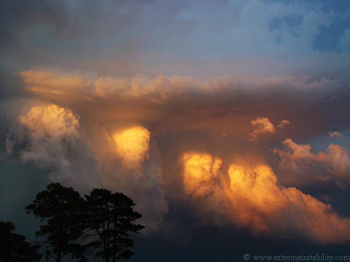
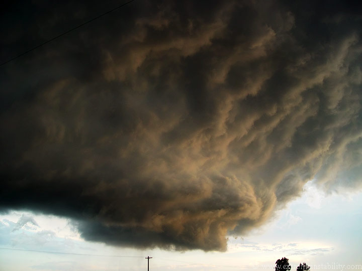
Just look how ragged the bottoms are to these individual updrafts feeding up into the storm. The convection with them was quite intense though. As it moves east from here it gets more and more elevated and dies.


