October 4, 2013 Sloan Iowa Tornado
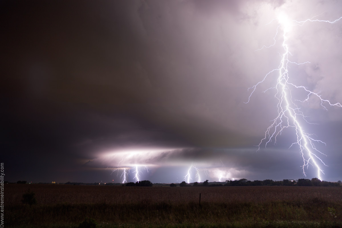
Well first off this image is from the night before, down in southeast Nebraska. Sat near Hebron all afternoon and evening. Storms fired at sunset. I head east to intercept the supercell southwest of Lincoln. I get ahead of it and at first it looked really good. Then eh, ok. The problem was the lightning actually really sucked. Never back-lighting things worth a damn. Just this one decent spurt of some.
Other storms were firing and it was soon to be a mess. I elected to punch north behind this one and head for home. 15 minutes after doing so it is producing a tornado to my east. Sigh. I was actually in the back side of the hook on 77 getting hammered. Water splashing off front fender it was so deep. Anyway onto the next day, the 4th.
After seeing all I missed on this one, I'm super unmotivated to do this account. I've had the worst luck the last 2 years chasing. It'd have been alright if the one day it turns around at all, if it could have been for the better views and tornadoes. Instead, it's as if it suckered me most of the day into missing as much as possible. But hey, I sort of fought back and got something lol.
I drifted north on 275 to West Point after sitting at Nickerson forever. Stuff had fired, sort of, near Columbus. I was keeping that in play and any further development down the outflow boundary to the southeast. I knew the stuff to my west at Columbus would need to turn northeast to be any good anyway. And the other aspect of this day was the river concern.
Stuff had been trying to my southwest as I drove to West Point but it was taking longer than the Columbus storm was. By the time I get to West Point the Columbus storm had started to do better and would soon turn northeast and produce the Wayne NE wedge. My stuff was trying more though. I opted to head to Tekamah, as there were also signs of stuff firing northeast of Lincoln too. Wanted to keep that option open too and well I'd need to drive back to Blair to cross the river in that instance. Instead once I reached Tekemah I drove north, outpacing the struggling stuff to my southwest. At Decatur I stop for a bit. My stuff was still lifting due north quickly and still struggling to root and be worth anything. Wayne storm seemed to b-line for Sioux City now. Knew I could beat it on I29 and still keep mine in play so I crossed the river and did that.
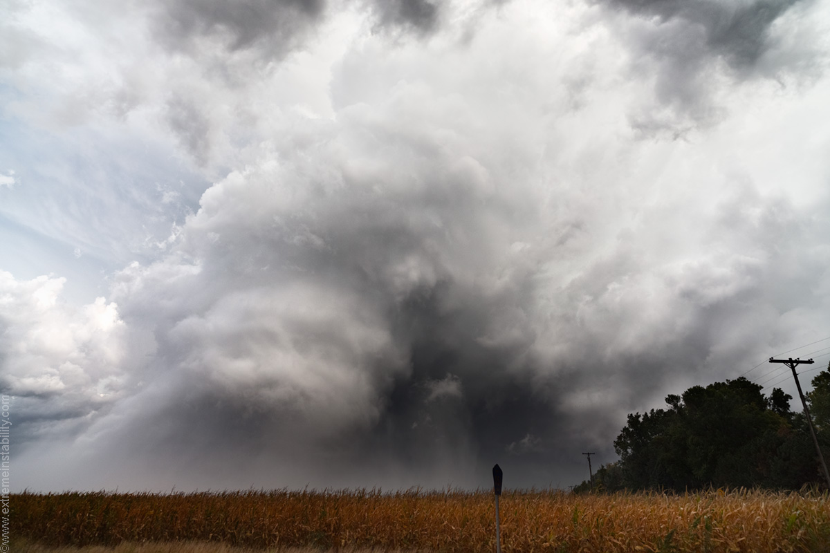
My stuff continued to struggle, so I said screw it and passed its path and got north of it at Sioux City. The second I get up there my crap roots and instantly goes tornadic. $%@$%@$%^ I punch southeast into and ahead of it from Seargent Bluff. I was quite happy I could do so not in the bluffs yet but on the west side of them.
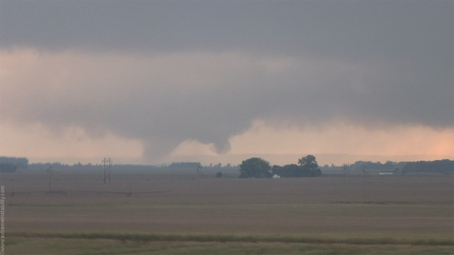
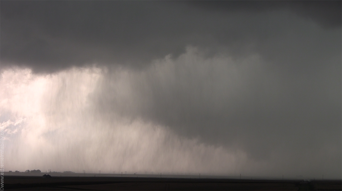
Not long after getting a view of the base it produced the above tornado.
I'm northeast of Sloan now, a sunlit vortex rotating around the back of a growing large bowl. I thought, I'm so set. High contrast, wild motion with multiple touch downs. My thought was, well it won't be that much longer till dark, I better at least concentrate on this current intercept from one place and not try to stay ahead yet. It's like it strings me along just so I miss the insanity it does past me.
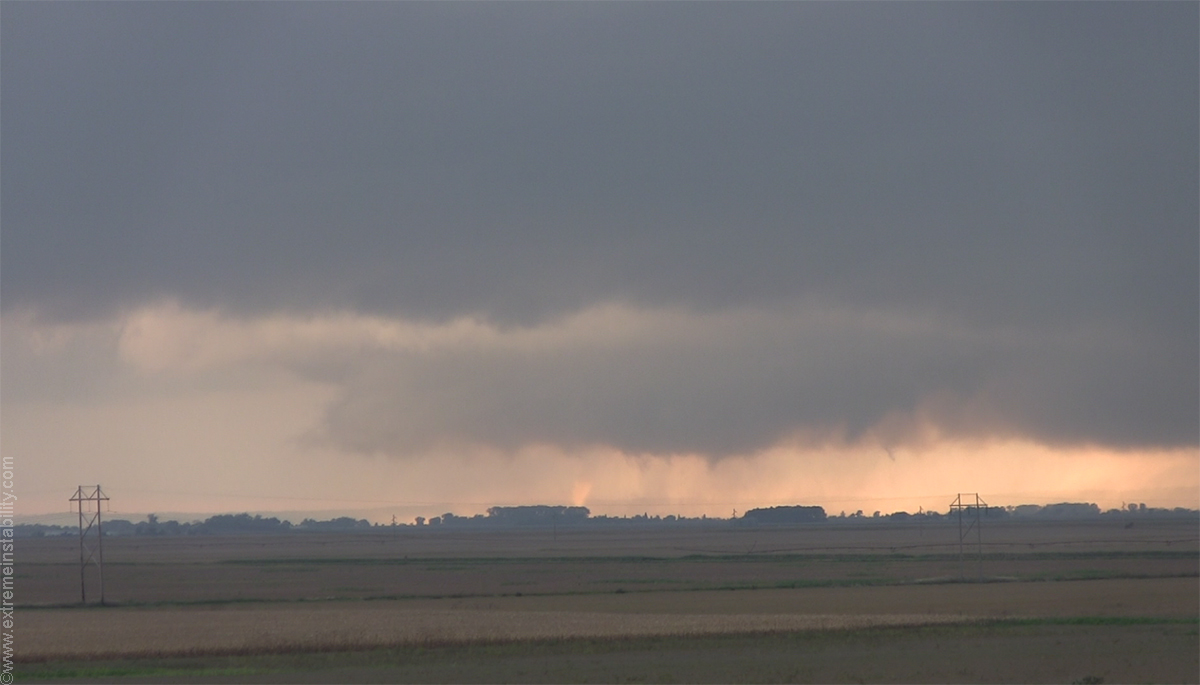
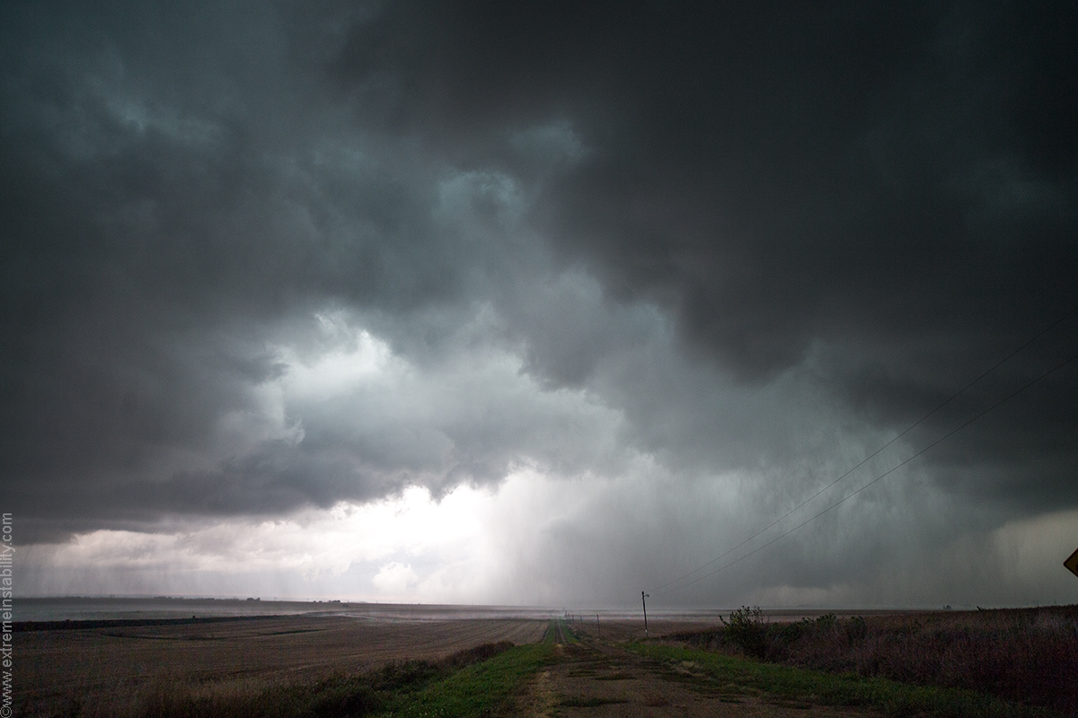
Anyway, there were intermitent rain-wrapped cones in this. Starting to get structure now. I thought, eventually this will let up and something will show itself. That has burned me in the past where I didn't figure it would and leaped ahead. Gah.
Instead just views of rain band choas around a common center that wasn't always down.
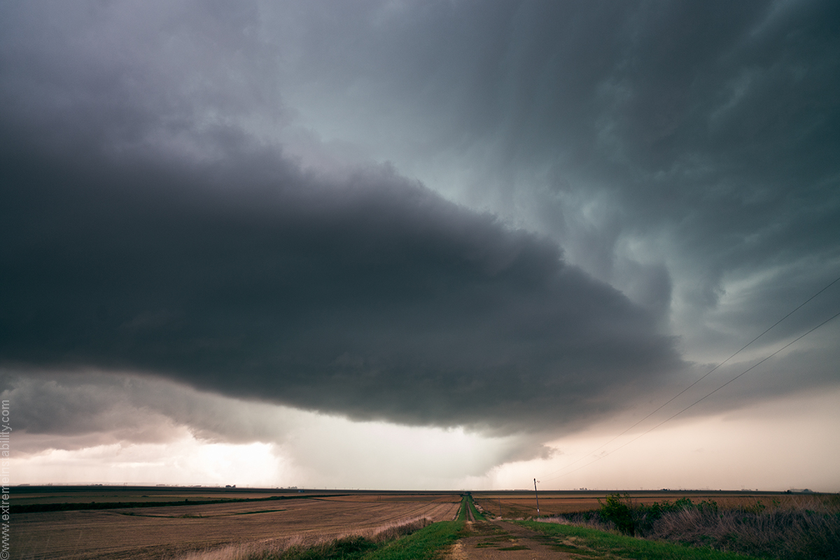
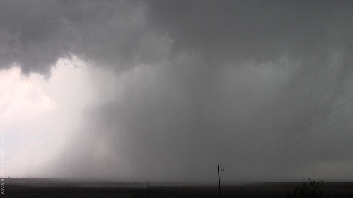
Wide angle view as it is due west lifting northeast. Got real windy.
The one bad thing in this area are all the northwest to southeast road options. I was on one and would have to drive back northwest to ever go east again.
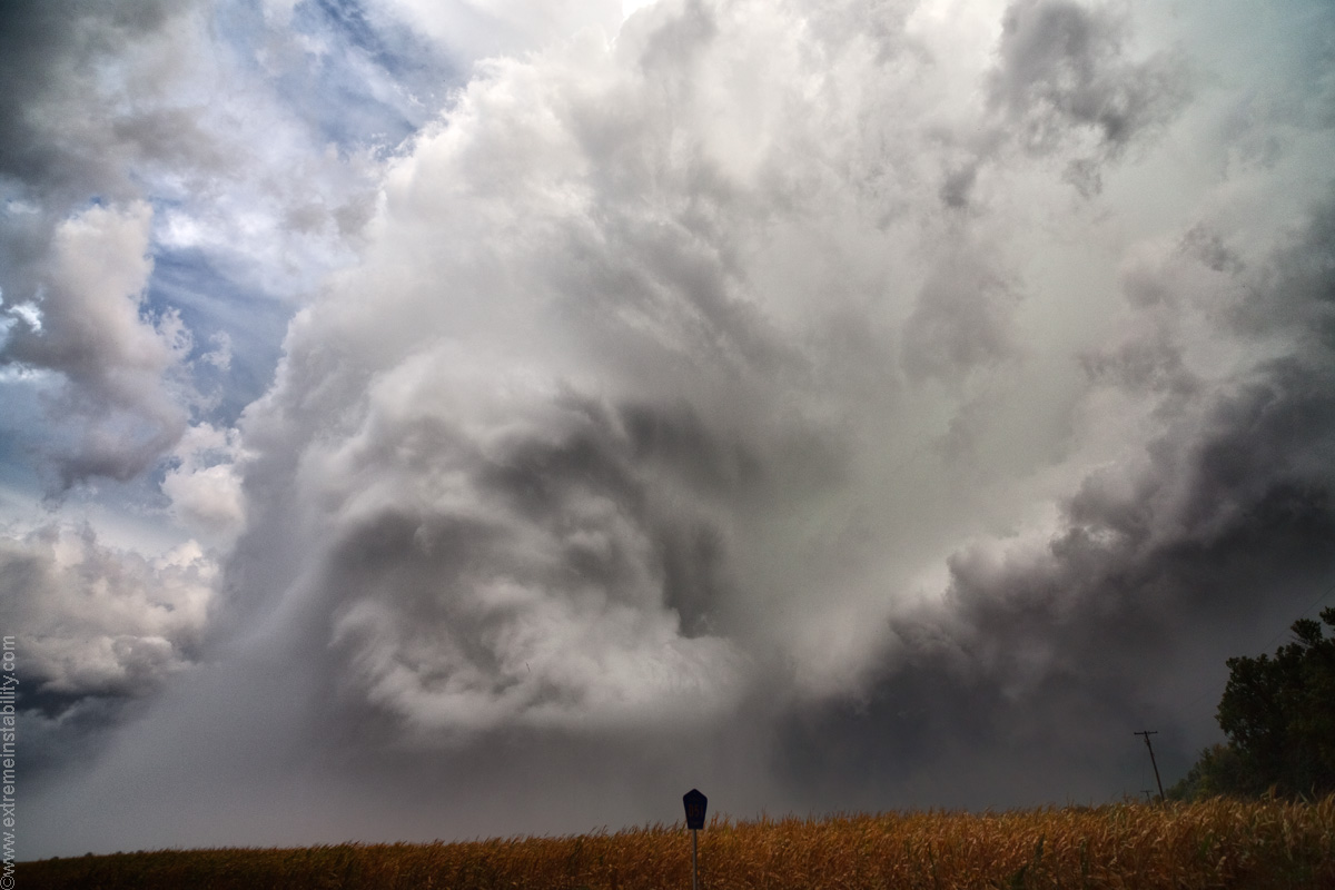
I drove northwest to get closer to whatever was happening in this deal. It was cool looking as the updraft plume seemed to extend almost down to the ground. This was quite occluded and left behind, but eh pretty hard to just ignore and go east to stay with the rest of the storm. Did that June 15, 2009 and the occluded thing went crazy as I was then too far east. I can't win. I'd also have to drive northwest into it to get to my east option. Yeah right.
I'm 90% certain the storm is starting to produce the next tornado by now, over the hills to my east a bit. The damage issues I soon come across suggest this.
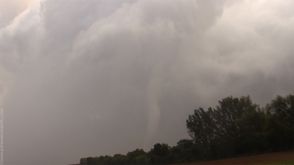
I start my jog to the northwest and sure the tornado finally reveals itself out of that mess now, with no views and 1 minute before it is gone.
I reach my east option after driving northwest and take it. Wasn't that far behind things. Far enough though. I get to a north-south option and elect to drop 1 mile south and continue east instead of going north to Moville. Right away I find a big hot tub laying on the highway. This wasn't in the damage track but about a mile and half northwest of the new tornado damage track. How far northeast of where I was before is this? Like 4.5 miles. So the new tornado had formed less than that distance from where I was on this highway on west side of the bluffs. Had to start while I was messing with the occluded tornado cyclone. NWS damage survey says it was a bout a mile is all east of where I had been on the highway west of the bluffs!
Anyway I go around that and take that jog east. Right away I find trees and a house across the highway. I back track and try the north to Moville route but that was now blocked due to that hot tub.
That next tornado was amazing from video I've seen. So was the structure by then. Just into the hills from where I was dicking with the occluded tornado cyclone. Just so annoying to know I was right there, impossible to know it at the time and if I did, I was dead middle of the northwest-southeast road anyway. And right the hell up against the hills, so zero view east to maybe see the heads up. All I knew was the big occluded tornado cyclone was still churning away near me.
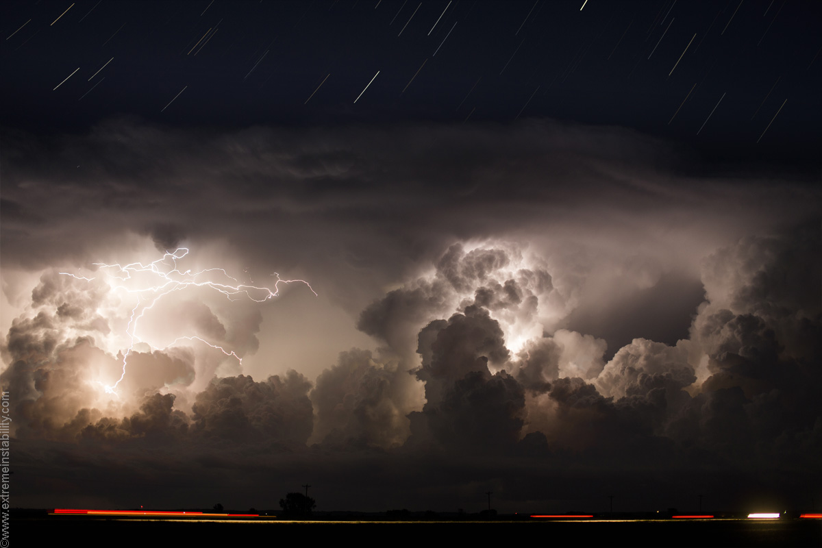
After a few damage issues I gave up and turned for home. Everyone was ok at the stuff I came across. I wind up shooting a time lapse, which is pretty cool. 1200 1 second shutters with the 6D and Sigma 50mm at F2, 200 ISO.
October 4, 2013 from Extreme Instability on Vimeo.
The HD version is better and apparently one has to watch it at Vimeo to see it in HD


