Sand Left Behind After The 2011 Historic Missouri River Flooding
Brief history on the flood itself. The easiest way to sum up the flood of 2011 is this way. The Missouri River dams were built in the 50s. The record release rate out of Gavin's Point dam, the last in the chain, before 2011 was 70,000 cubic feet per second. Thanks to historic snow packs in the Rockies, followed by historic rains in May over a 2 week period, big time releases happened. Gavin's Point DOUBLED its RECORD release rate to 160,000 cfs. It was 140,000 cfs for months. You know it's crazy when 60 year records are doubled for months. An enormous amount of water came down the pike and spread out from the river banks. It then flowed and stayed in those areas for an extended period of time.
I have no desire to figure out the exact causes and things to blame. Try these out if that's of interest. Combine record snow packs in the Rockies and historic rains, running 600% of average in May ontop of that snow and you have a problem.
http://www.nwd.usace.army.mil/docs/MRIndependentReviewPanel.pdf
This was taken in January 2012 at Desoto Bend NWR. The other gravel road in there was still under water, so the water was still high on the lake, but look where it was during the months of flooding in 2011.
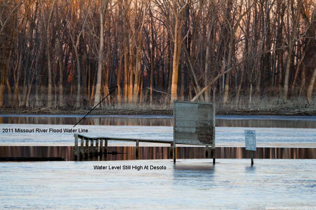
Another shot taken at Desoto Bend on the lake. The river runs right by here. Clearly the water on the lake is still way high, engulfing signs and the docks. But look at the flood water lines in the background.
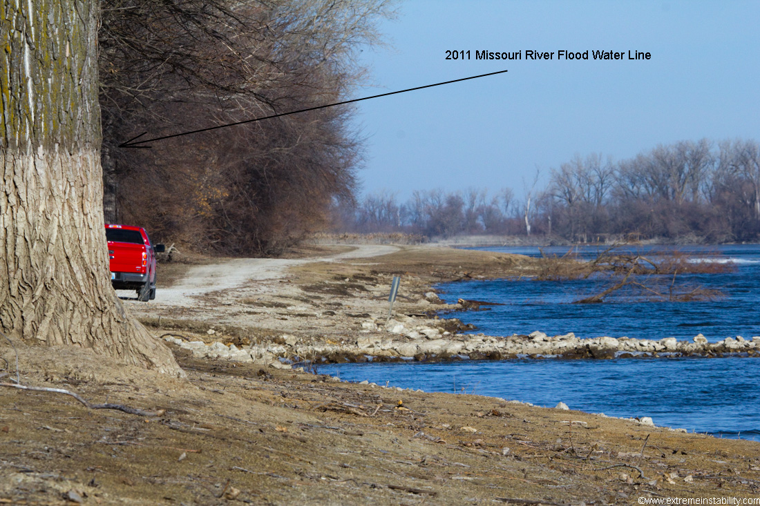
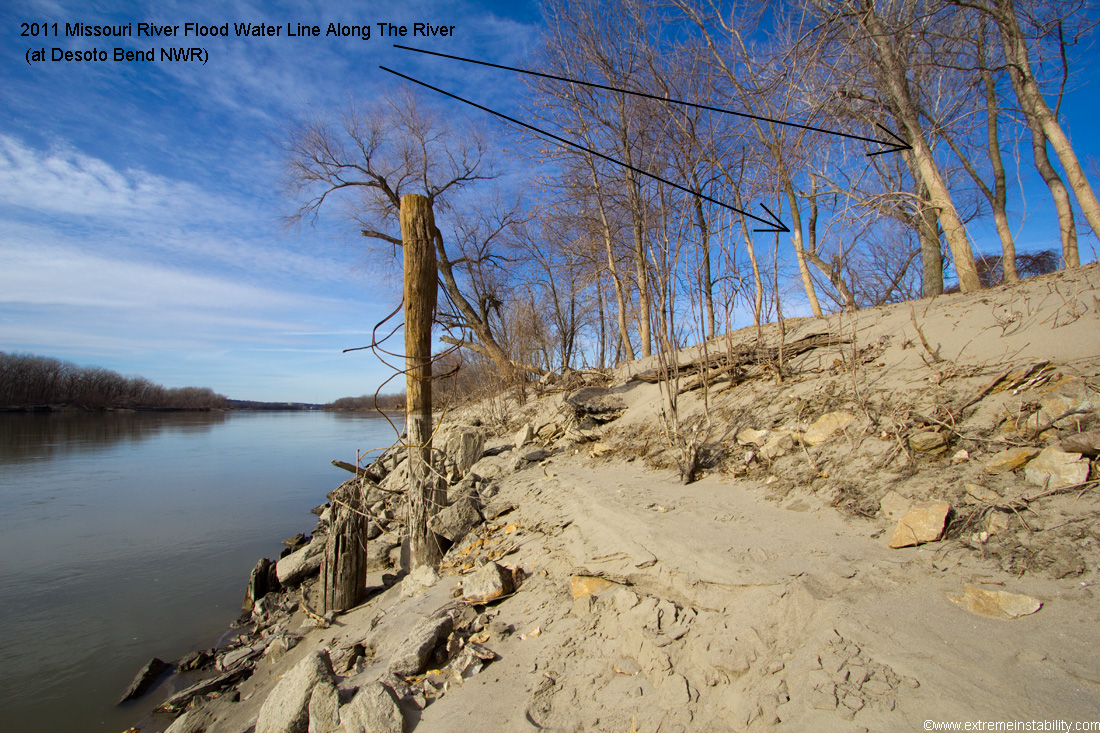
Still on the lake in the above. The river is right there by the tree line on the far left. Again, there is a gravel road for the lake right by me here that goes under water during this shot. Yet look where the freaking water level was during the flood. Water sat that high for months. Given it is a river that is flooding, a lot of the areas the water was also flowing, digging up sand and depositing in a whole lot of places, as you'll see.
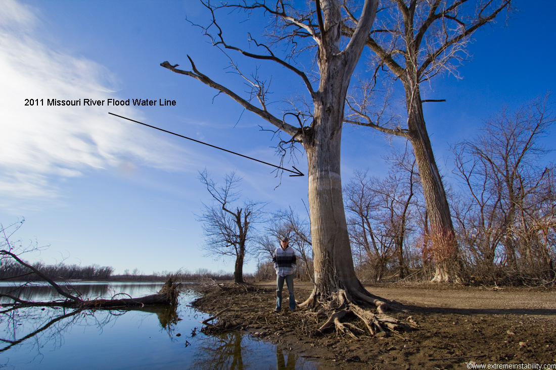
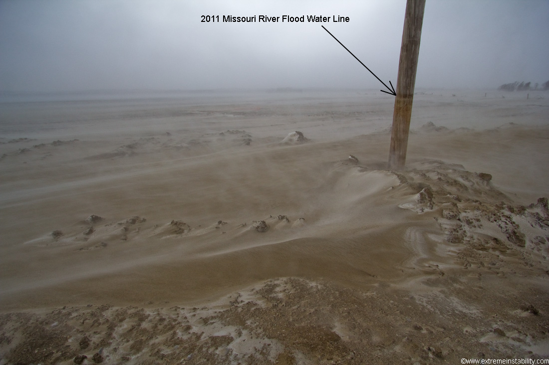
I'm now on the bank of the river there at Desoto. You can see where the water line was during the flood. Crazy.
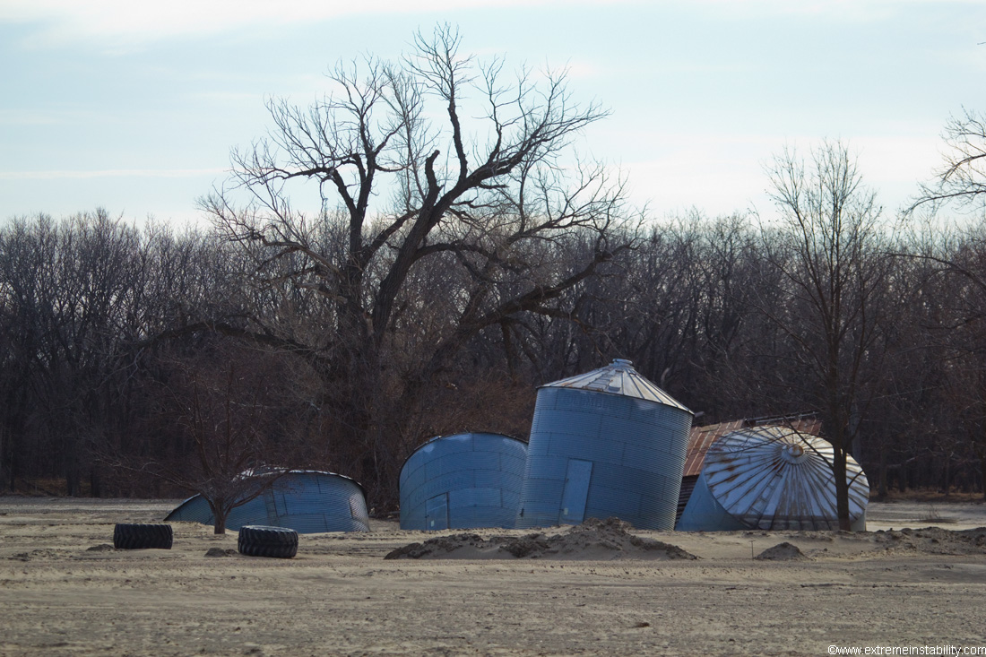
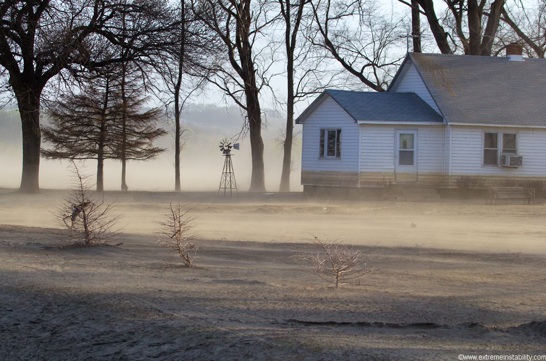
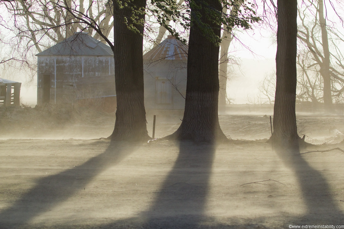
Grain bins in western Iowa sinking in the ground after the flood. A lot of sand left behind here too.
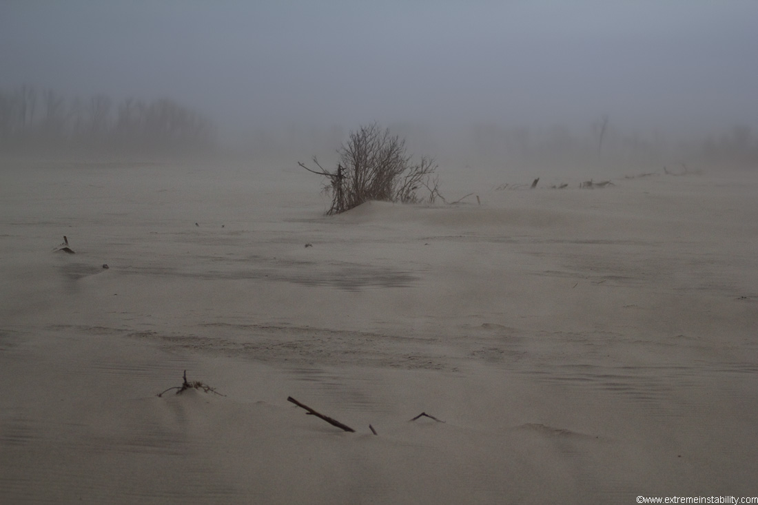
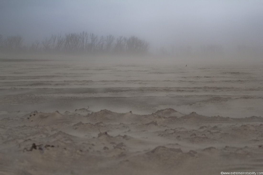
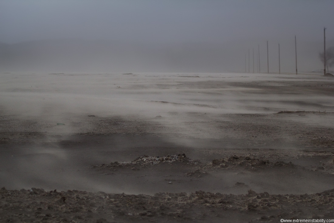
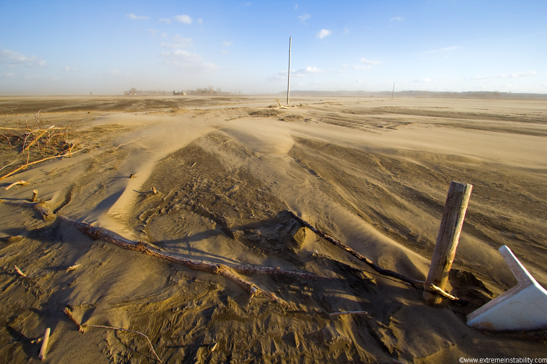
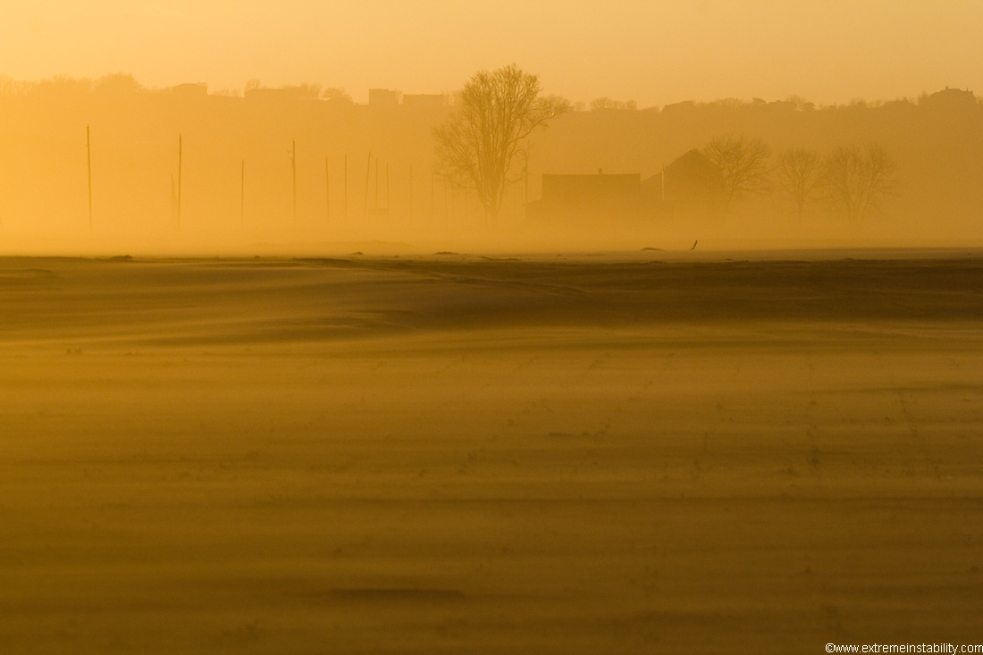
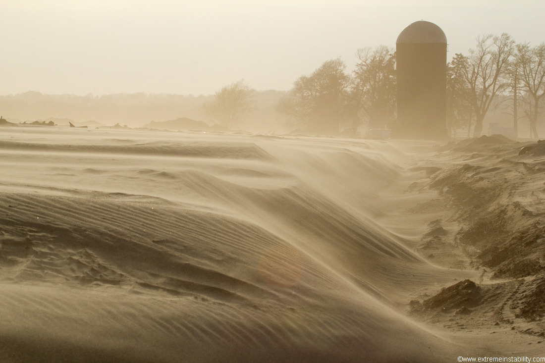
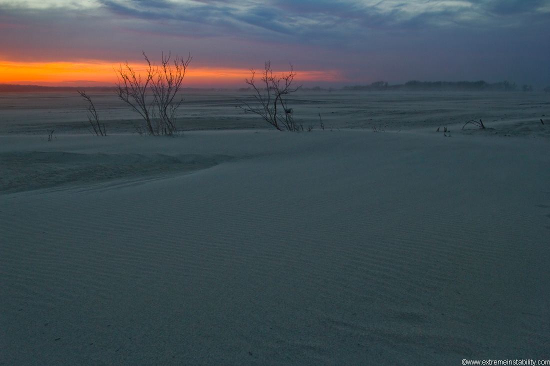
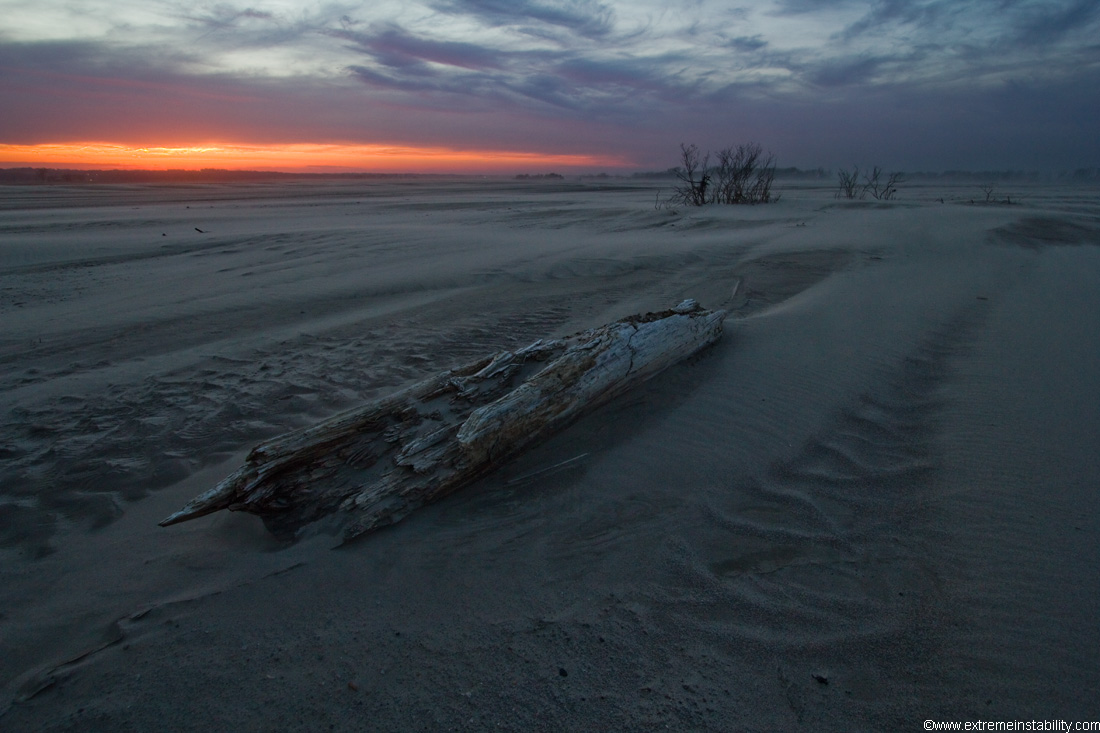
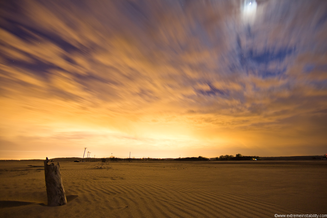
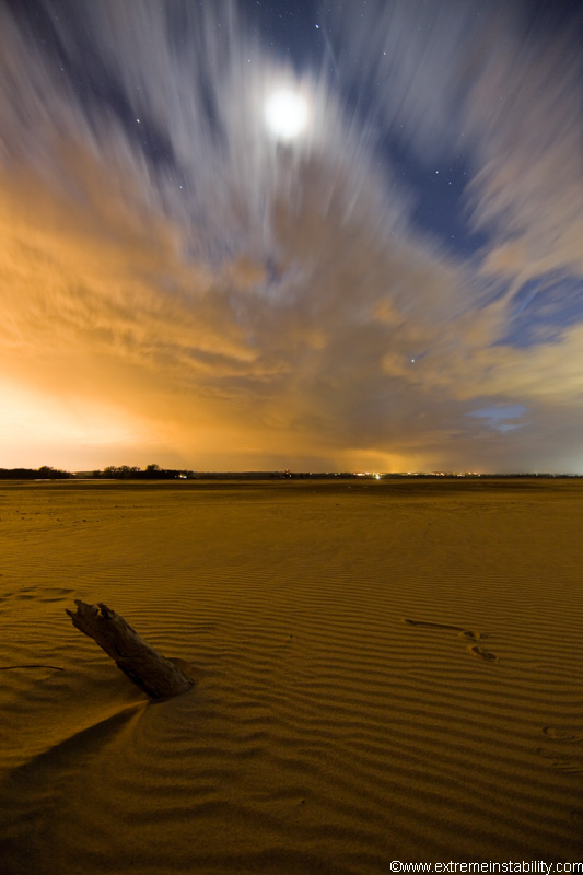
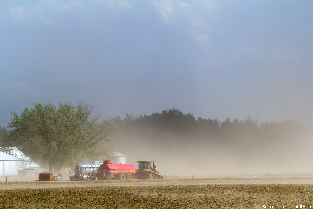
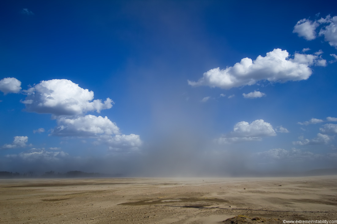
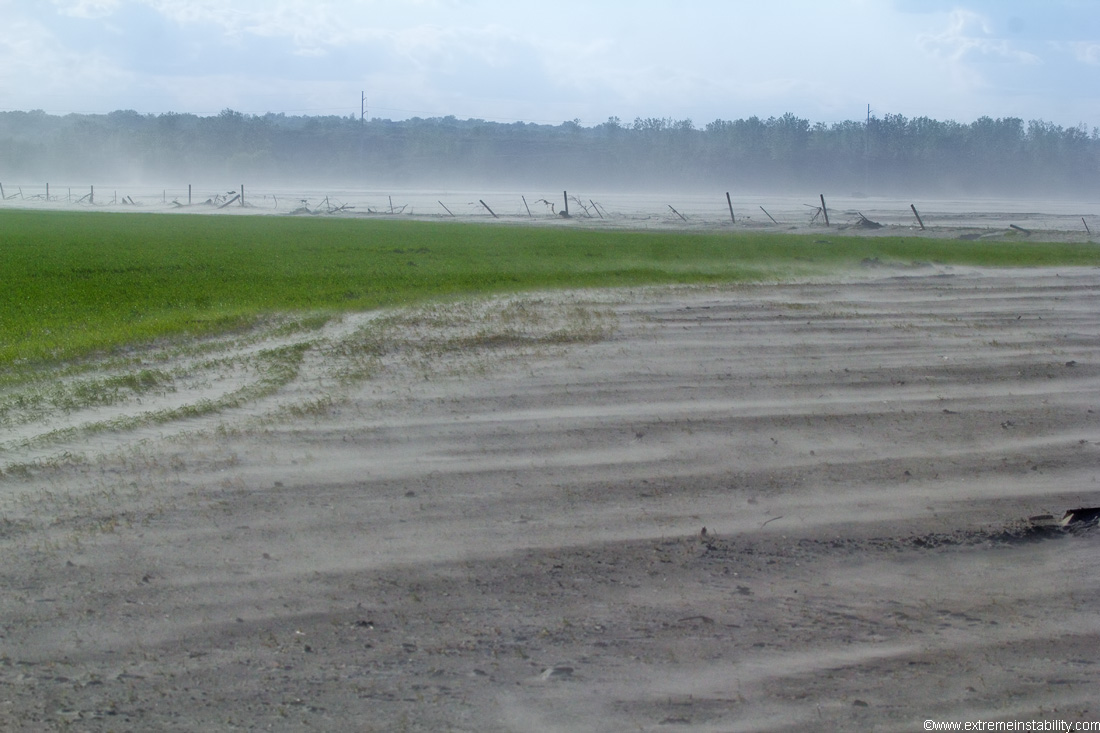
Now that the flood is over, a massive desert is left behind for many. It's hard to comprehend the amount of sand left on fields now. Feet of the stuff. When the wind blows, it blows.
These are now east of Ft. Calhoun Nebraska.
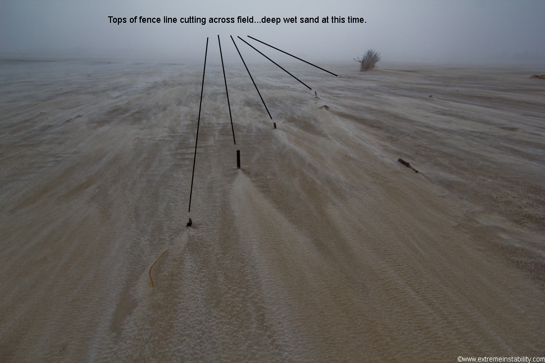
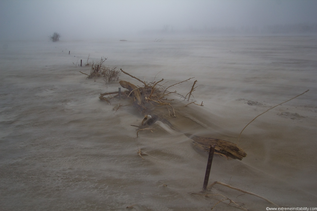
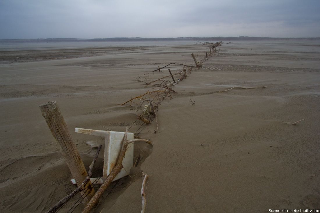
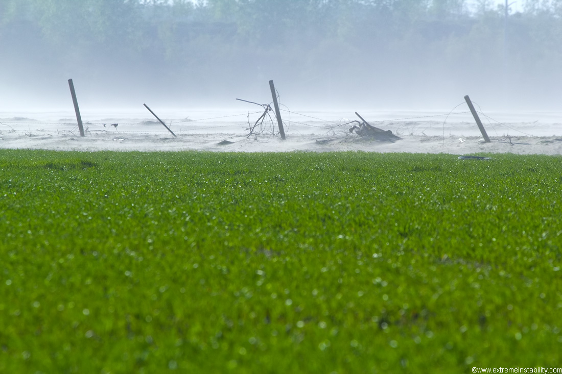
This should help convey the mess some. Only the tops of a fence line are showing. That's really not mud either. It's wet sand. You could dig down in this and get nothing but sand.
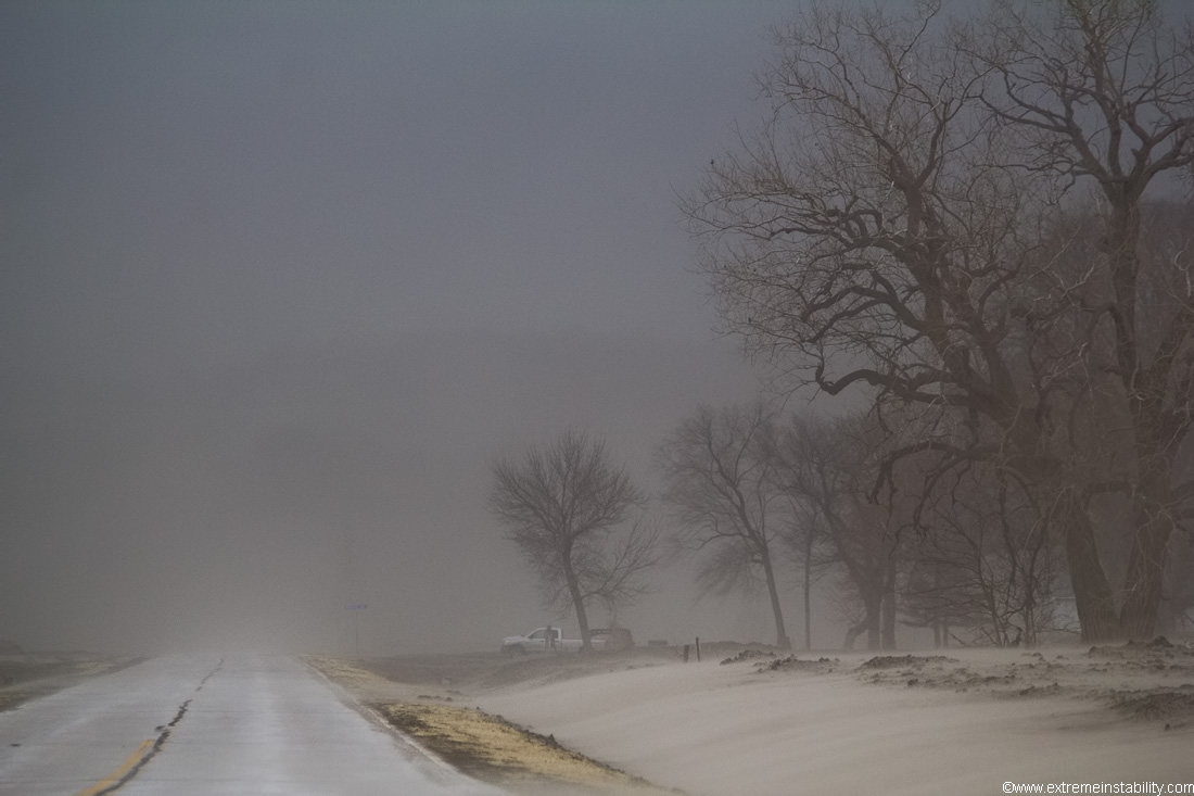
Some snow showers were mixing in on this day.
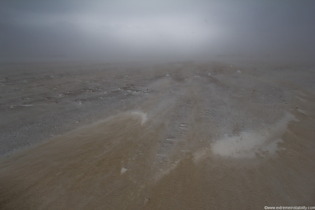
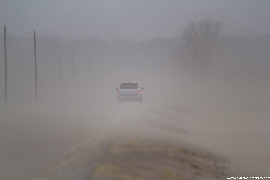
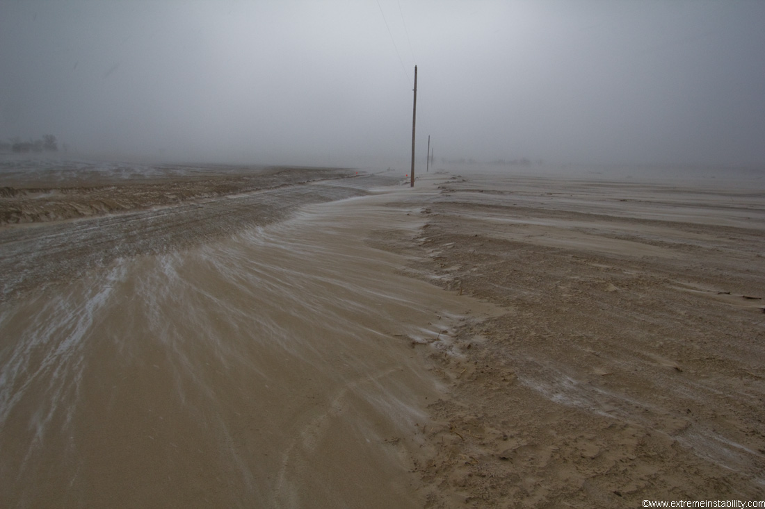
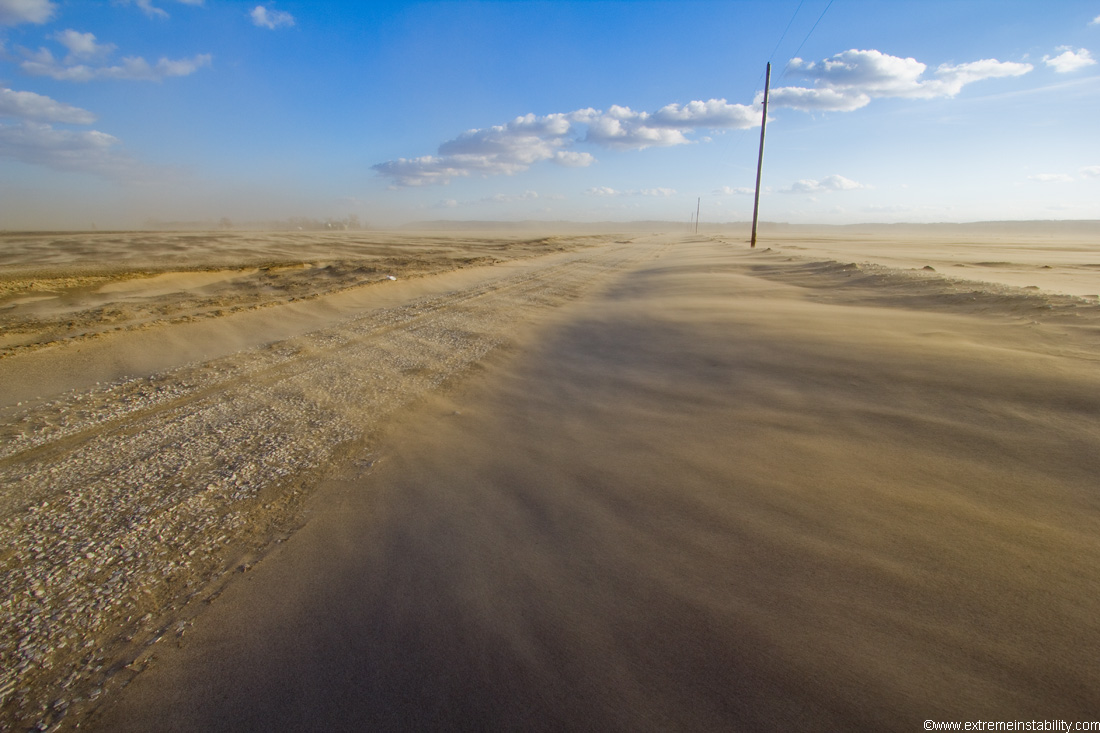
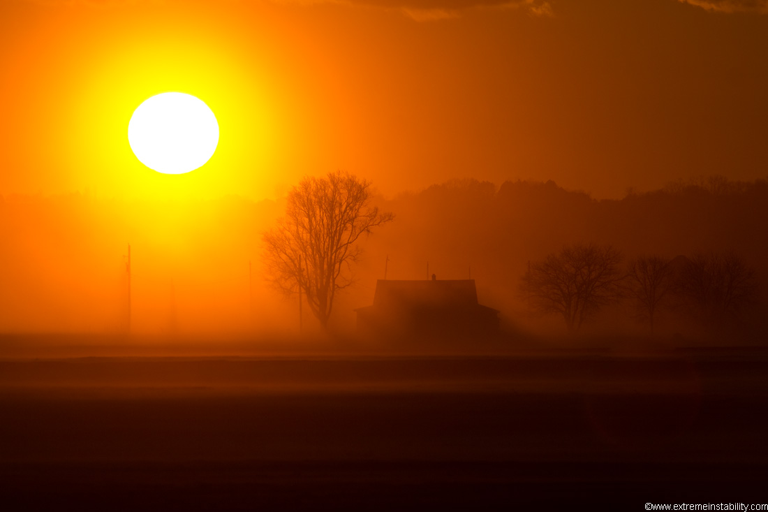
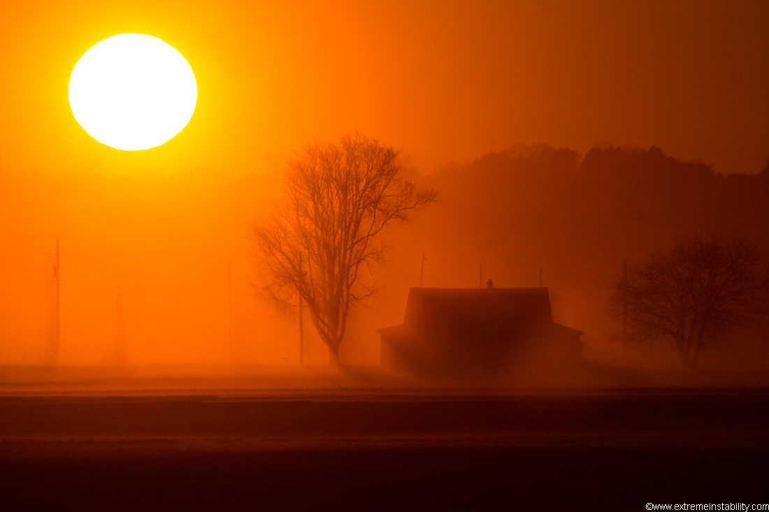
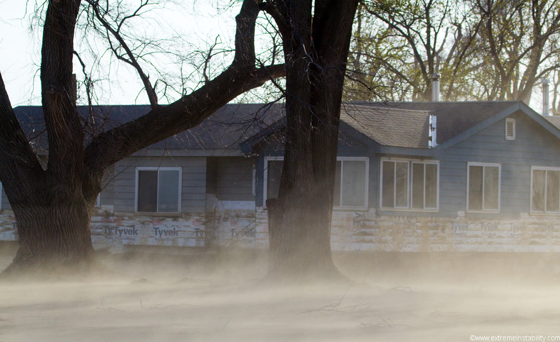
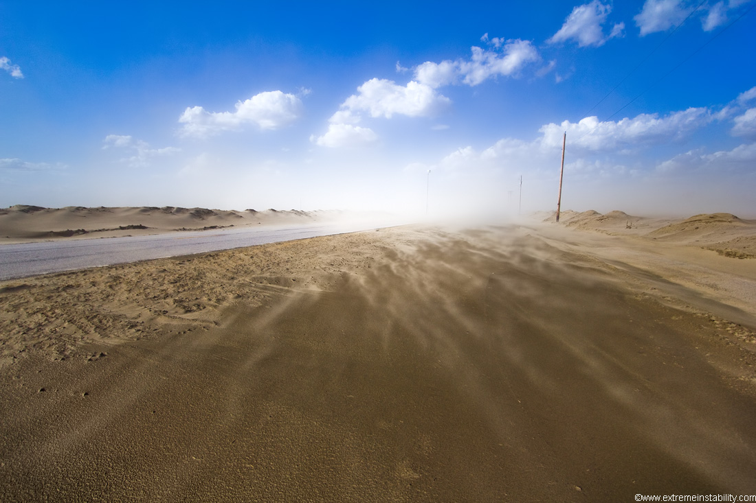
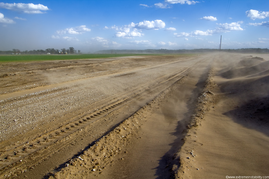
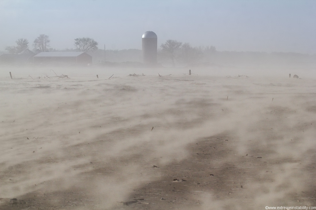
Raging winds blowing what sand that wasn't wet.
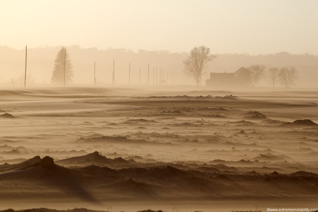
Area was drying out some on this day. When this stuff finally gets dry, it's a massive mess in the wind. You look down on the river from any hills and all you see are walls of sand blowing up and down the river. One day north winds blow a bunch south, next south winds blow a bunch back north.
Even right after rain or snowmelt, top stuff would dry enough to blow around, while the rest sorta gets stuck there for a while. It dries out pretty darn fast.
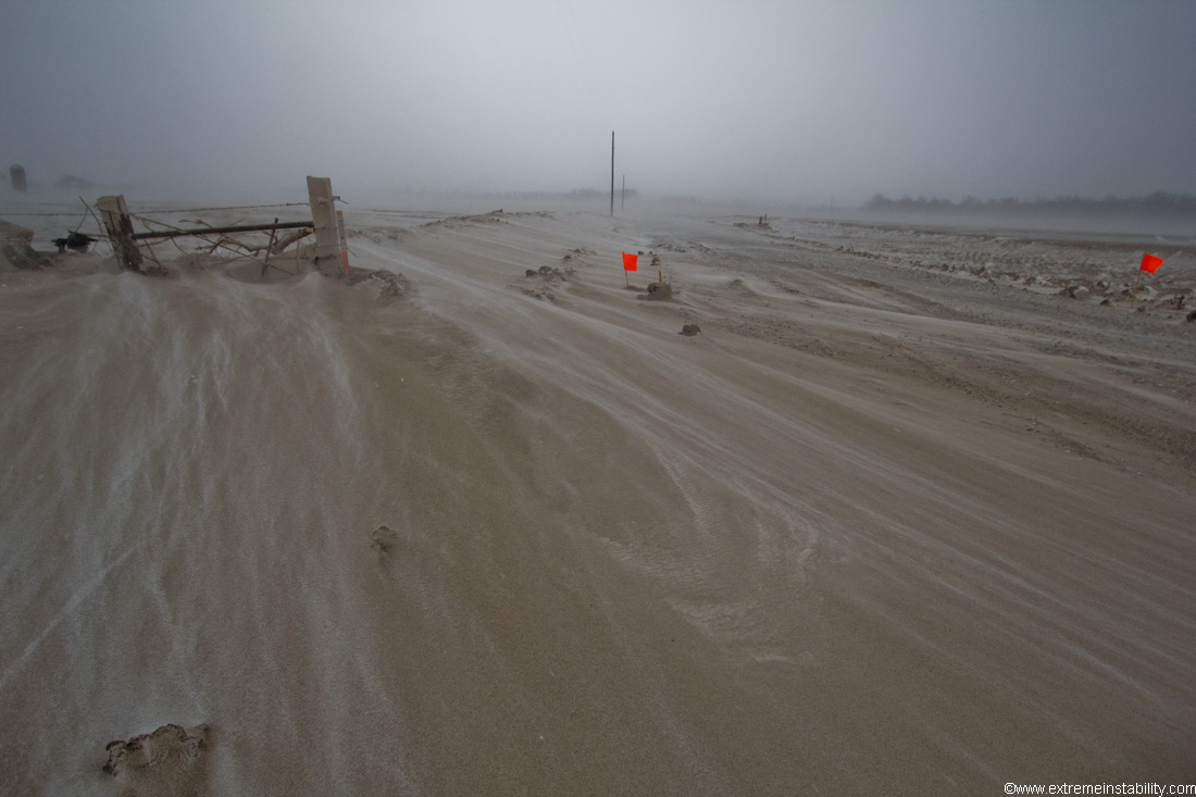
Flags marking the gravel road so it can be cleaned off again after it drifts over.
The fields should be even or below the roads obviously, not feet above them.
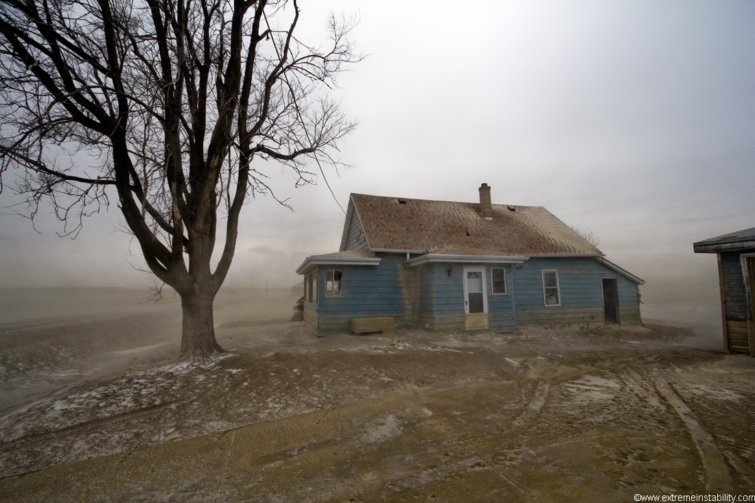
Too many abandoned houses in these areas snow.
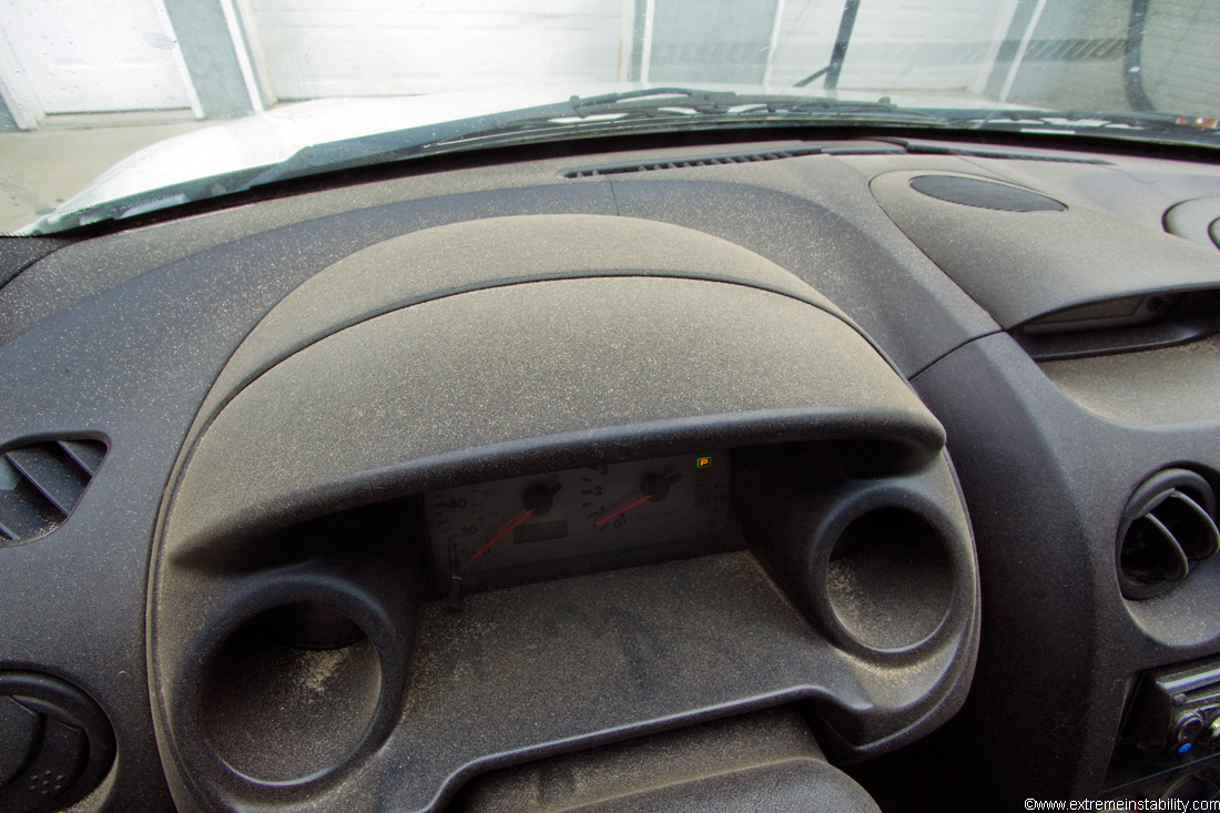
Each time I go "chase" the sand storms on windy days, this eventually happens. It's a real pain to deal with and clean. Your eyes take a nasty beating. I never remember to buy some goggles. Your nose ends up globs of brown goo. Deposits of sand in the ears that come out after about 10 showers. And amazingly annoying for camera gear.
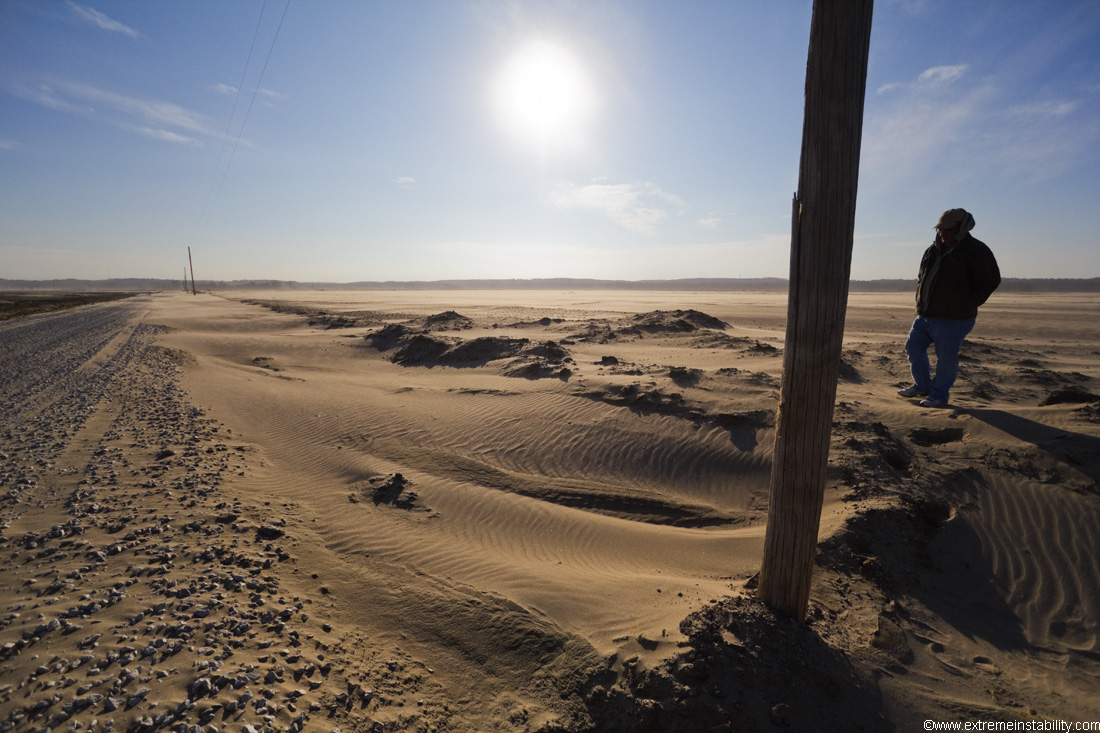
Randy came up from Omaha on this day. Gives a bit of scale standing on the "field".
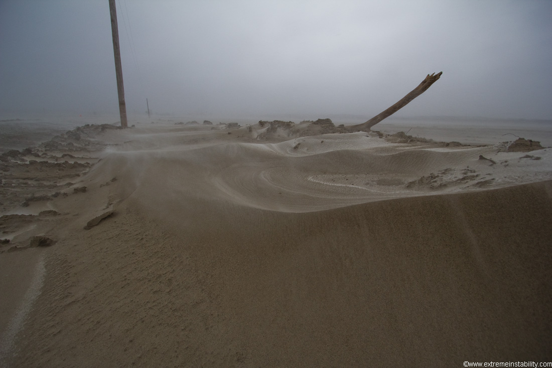
Once it gets some time to dry, it's straight up a desert of dunes.
Hard to tell but that is blowing sand with field rows showing under in this spot of a field.
That'd be the same abandoned house as before on here.
Last time I saw this ditch it looked full of sand. This is looking west, so drifted on strong south winds.
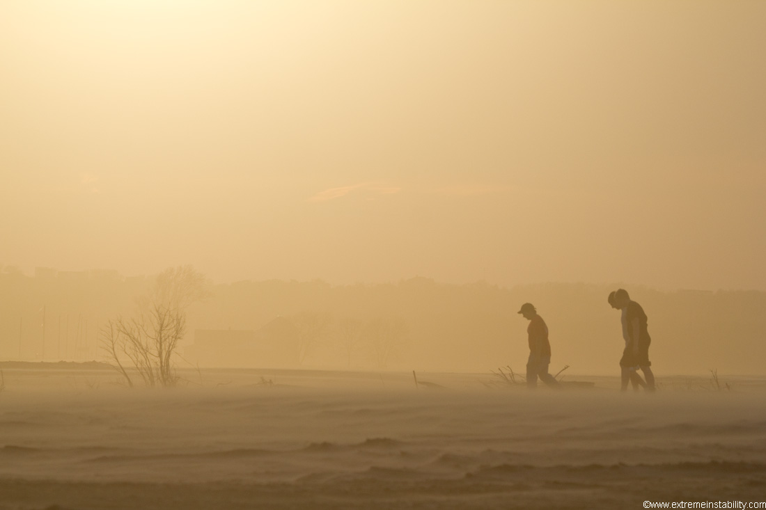
Kids out looking at the desert during some wind.
Looking south towards Omaha. Had the 5D III I rented out there for this. Glad it wasn't windy in this case.
The most recent images at the time of making this account(April 23). It's kinda strange in areas there now, with things turning green and growing around all the sand.
I always end up going there when it is windy. Evidently I love cleaning out my car.
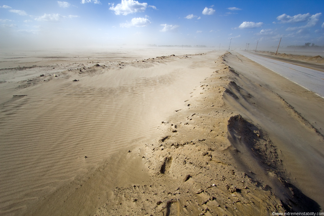
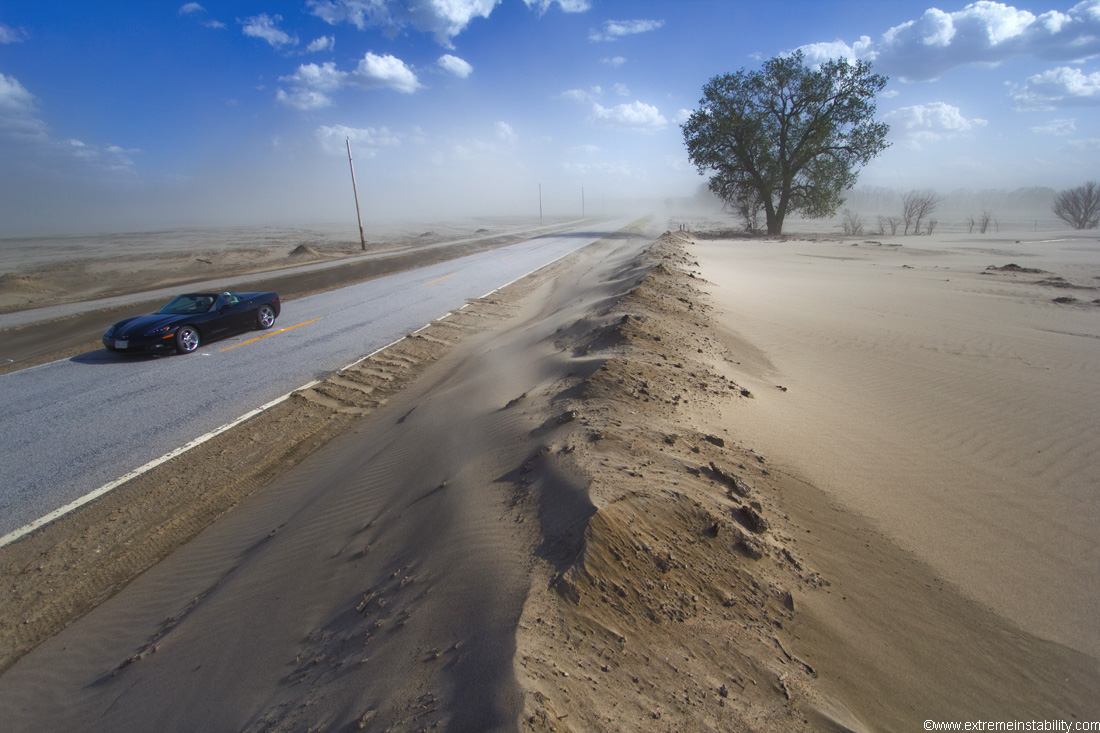
This at one point was drifting over the west lanes of this highway. They at some point pushed it all back and higher. I for damn sure would not be driving a convertible vet through here on this windy day.

Kinda weird.
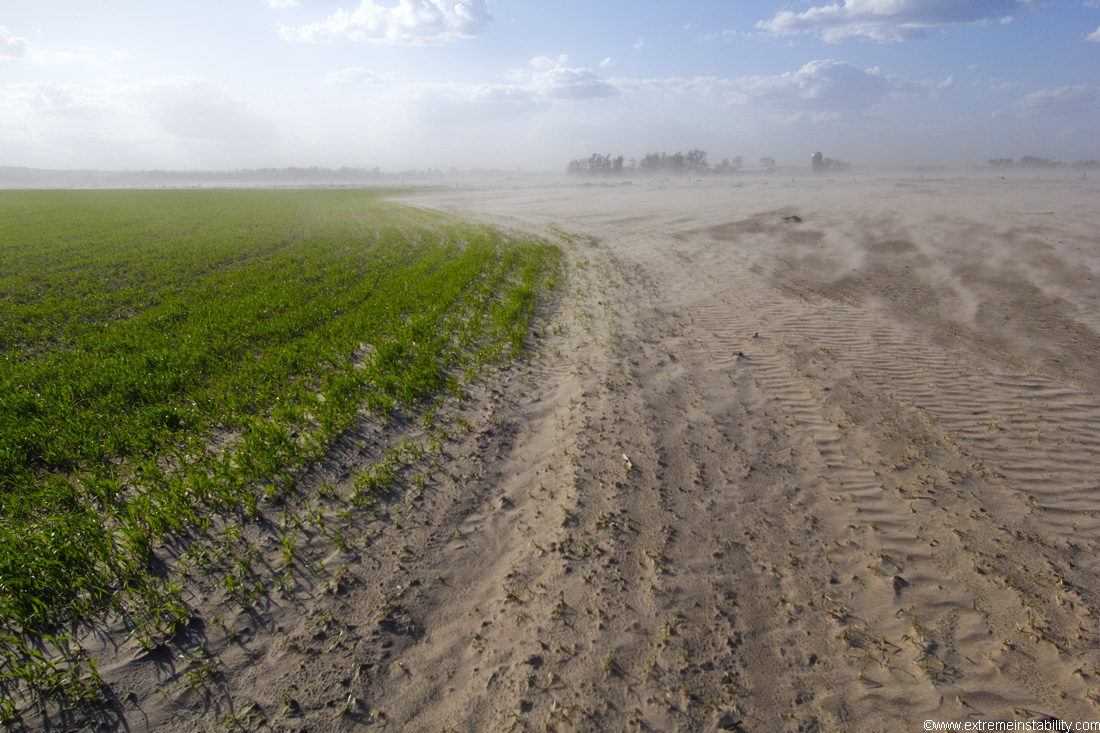
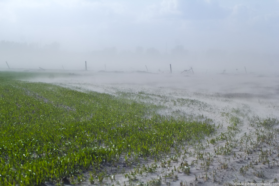
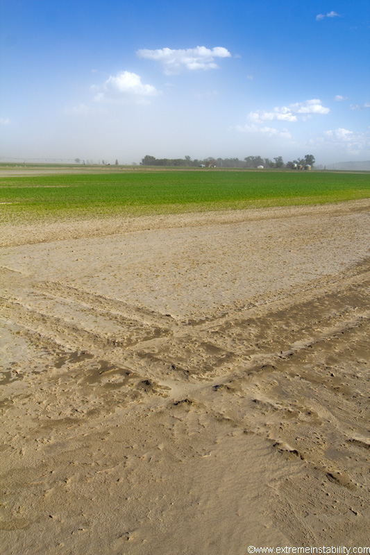
Desert ain't stopping these crops.
Video of some of this with wind, up to 720p on youtube.
I have a page with a few photos during the flood here:
http://stormandsky.com/2011flood.html


