July 23, 2010 Vivian South Dakota Record Setting Supercell
Boy am I not overly in the mood to type this out. DVD work, plus a slew of frequent outings(I'm quite behind) just seems this is all I do! But here we go.
It was a no brainer chase day. 50+ knot wsw mid-level jet, topped by about 100 knots up stairs out of the sw, sfc low in sw SD with a warm front going ese along I90 with backed low level flow, big cape and mid-July. You have the warm front to help turn anything that forms to the right, but don't really even need that with the flow aloft. So you get a storm to turn right/ese and it's vented very strongly aloft out of the sw. Mid-level flow was unseasonably quick, which lead to the storm moving fast around 40 mph. This moving into backed low level flow, leading to strong storm relative inflow, all the while having excellent venting aloft. I noted lower 70 dew points clear out to Philip on my way north. It's not every day you get 70s way way west. It was just obvious the day would have a beast in some form or another at the triple point out there. Not that I expected it to be a supercell that would break the world record hail size and I'd actually be watching it at the time. Thing ends up dropping 8 INCH DIAMETER hail on Vivian. Find yourself a ruler and see what that consists of. Aberdeen NWS said initial findings suggest the storm had updraft speeds in the 160-180 mph range.
Around noon or so I end up meeting up with Evan Ludes and Chris Allington at Chamberlain. The HRRR model insisted supercells would fire at Pierre and move se forever. RUC thought more sw. HRRR was overly insistent on this whole deal. Actual surface trends said the HRRR was smoking crack. We drift west to.....Vivian. Actually the exit to Pierre is where we stopped just past the Vivian exit. We had towers to our north....oh no the HRRR was going to be right? We had stuff trying to go to the nw straight west of Pierre. But.....just south of that one storm out there, was a tower and repeated returns forming in the same spot. See that.....go to it....or at least don't screw your options ignoring it. The atmosphere is showing you there's focus there when it repeatedly is "firing" in one location. The dryline arc was quite obvious on satellite and I worried it was too big of an arc. But either way, it and sfc put a big fat x on where that very weak return kept trying to go. I kept figuring.....that's the storm of the day.....but it wasn't so simple. There was a cold front slamming se which didn't appear it would take too long to catch either of those storms(one actual storm and the weak repeated returns). The other issue here was VERY hot and dry air south of that dryline arc which was curling to an almost e-w orientation back there. I was like, that fires there it's going to moves too much into that bad air, which was very apparent looking at the cu around down there. One had to worry about the towers further east on the warm front or even something more se out on that dryline arc. We held for a bit there keeping options open while watching the top go up and anvil to our west on what would be the storm of the day. Finally we bit on it and flew west.
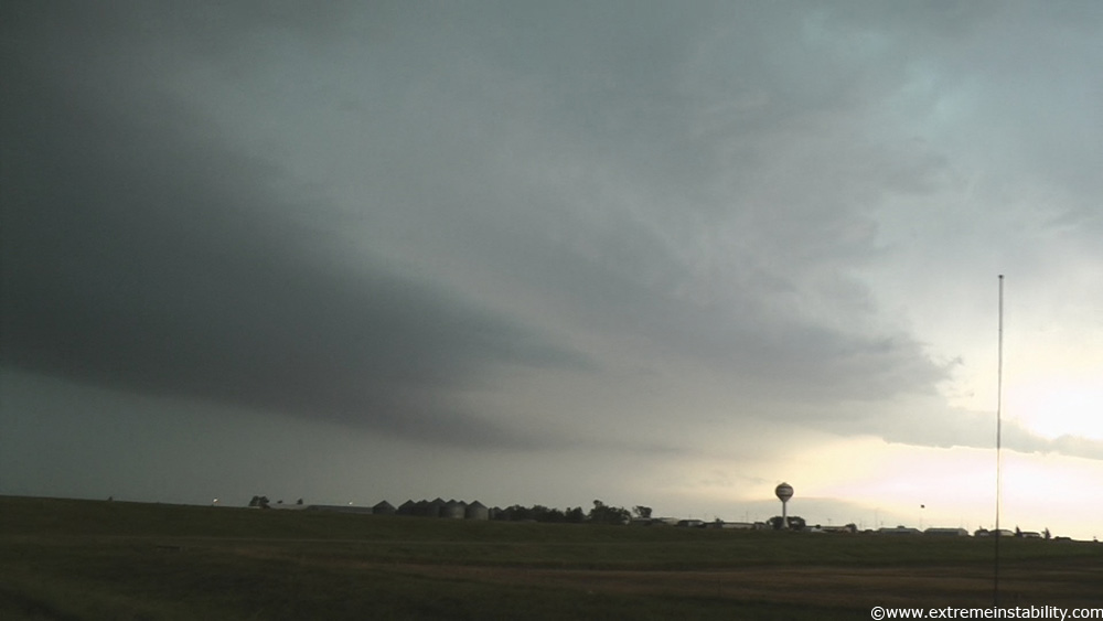
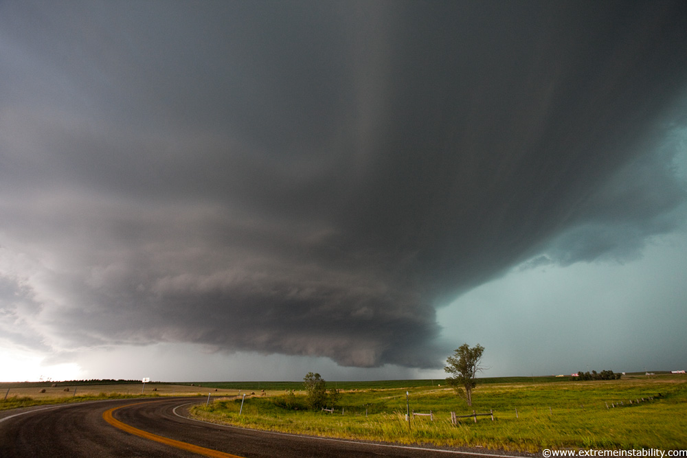
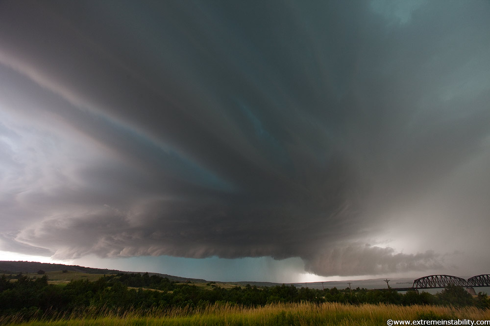
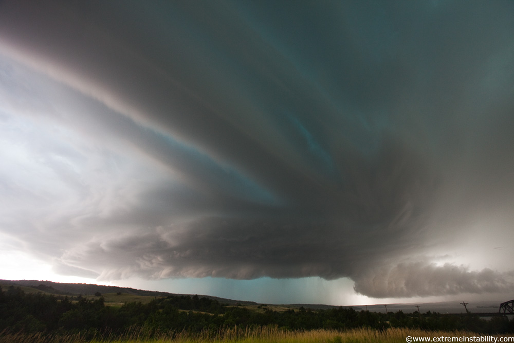
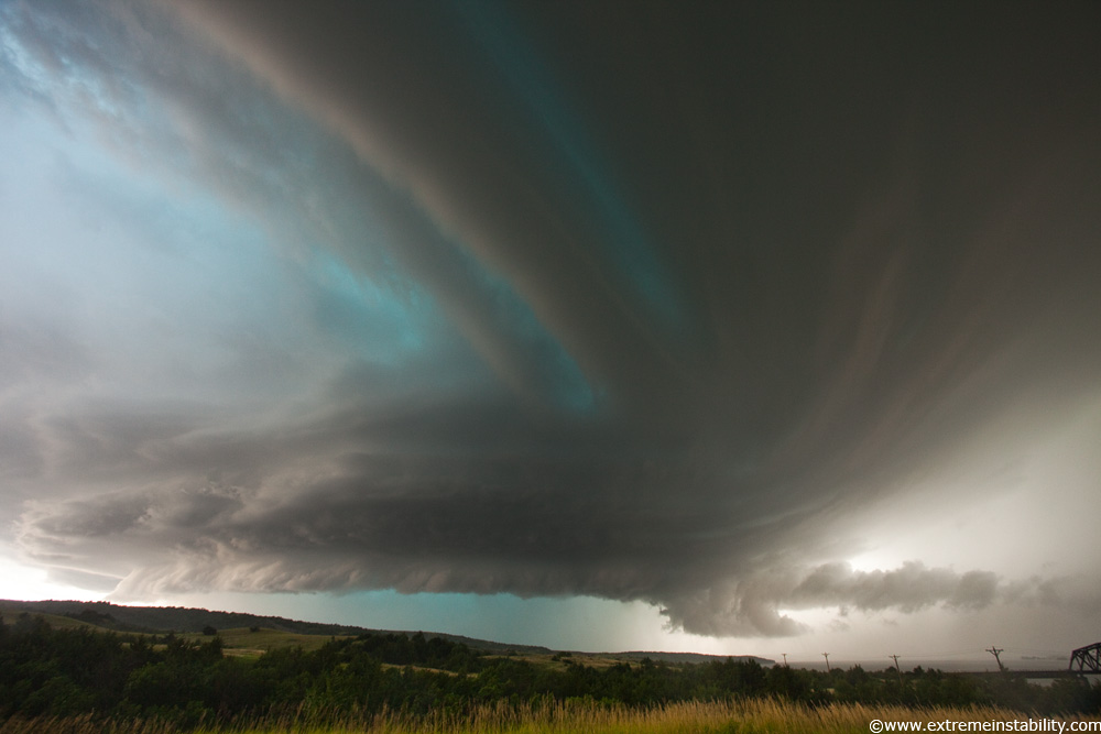
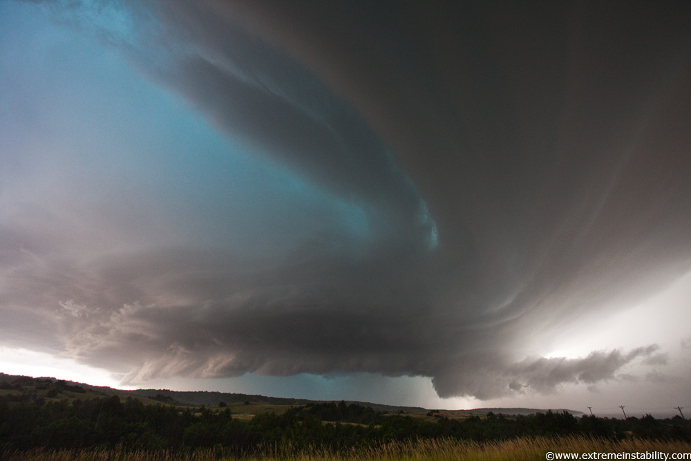
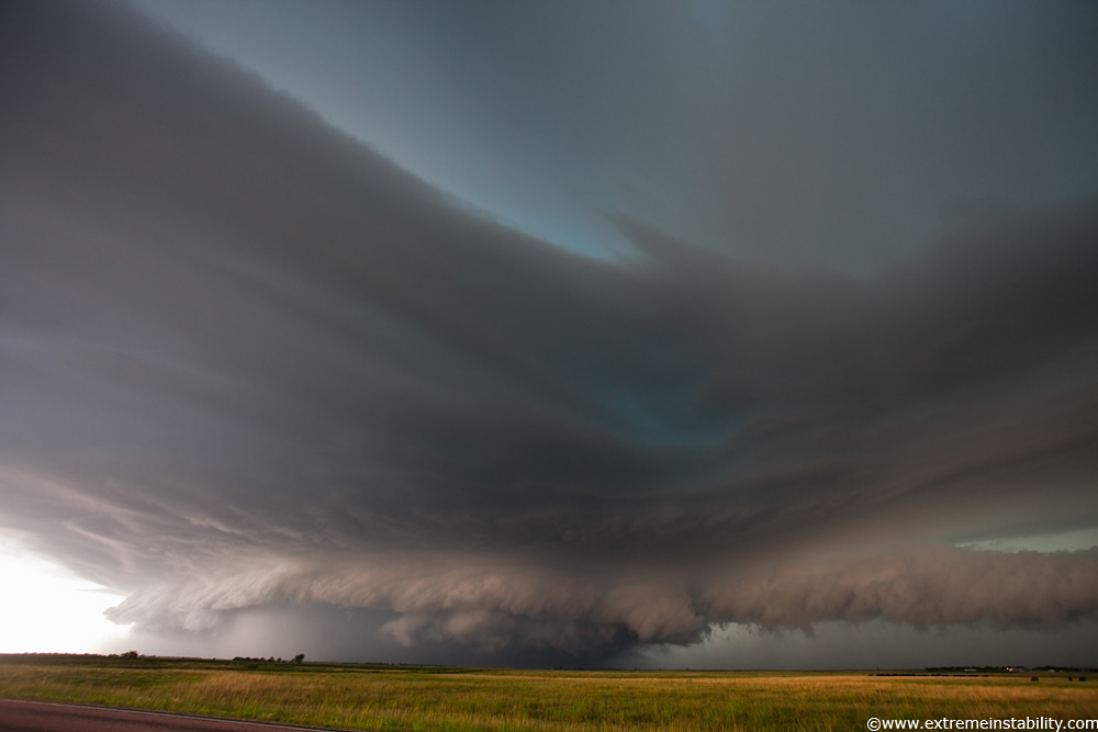
From west of Murdo we couldn't see much of it other than one brief early view of a big wall cloud. Road options rather bleak to get any closer so we waited there. We soon went back east to Murdo. But what to do there. South now or go east and maybe get cored on I90. Went east and the above came into view. Beast beast beast. The VIL on radar was maxing out. The thing is you see that further east and half the time you can't even find hail in it. High plains though and hail production is a lot more likely. I was like, better go east now unless you want to lose your windshields. This is prime territory for big hail, west but yet still east lol. Just the sweet spot getting more towards the higher terrain, while having big time juice out there. All the juice was pooling in this pinch point region of the dryline arc and warm front. At the same time, surely back as far as it was on that dryline arc, it was getting the blast furnace hot air from the sw mixing in down low'ish. Shear and that sort of instability in place, it's not a shock it produced monster hail.....but yeah world record size is of course a shock!
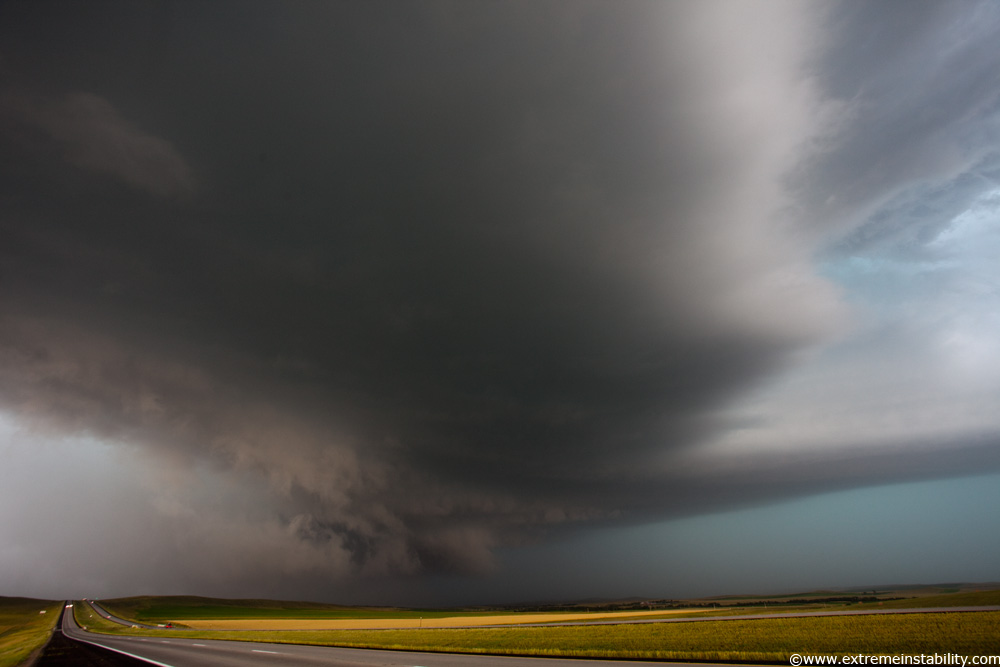
It's dropping those 8 inch stones on Vivian right now in the above. The curling rfd and gust front are going clear left of frame obviously. Beavertail up there on the right, along the warm front....its forward flank down draft/precip core. I have video right before this while driving. It had a big turning mass blasting up dirt. It looked like that was about to turn into a significant tornado. Instead it gets undercut by cold air as seen above.
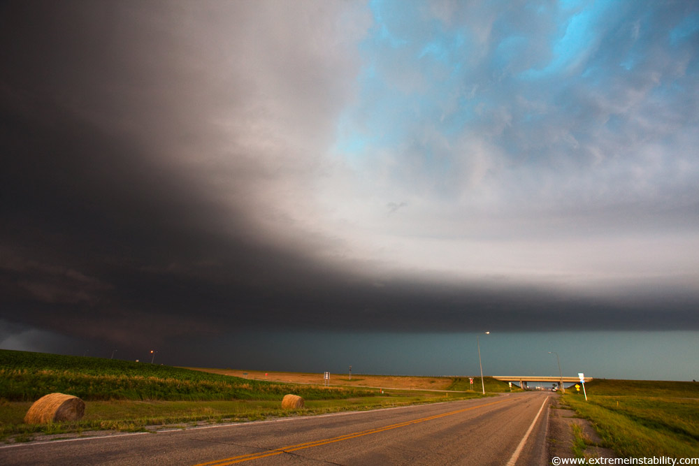
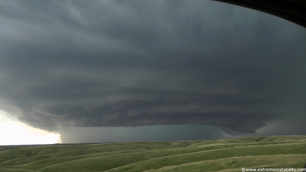
The next exit east of Vivian. The trick became just when to bail south. Problem was every south option to do so, would screw you on the storm. Just too far to be able go to east again. The longer you stay on I90, the more certain you are to end up in that green core, as the storm moves ese. For sure the structure would be best up there, so I was game. Heck if I could do it over and know it was dropping 8 inch hail, I'd have driven into it then. Or at least a gas station canopy. Like where we'd sat for quite a while earlier would have worked. I imagine there was quite the battle for spots under there! I look for big hail repeatedly and more often than not I'm a core killer. I'll see a VIL max and big indicators, drive for the center of the thing and bam the long lived VIL max vanishes. Or there are times like this one. You go and do that and you just won't see what the storm does after that. Good luck racing back out of baseballs(forget it on 6-8 inch stuff lol) on a storm moving 40mph. It would have been worth it to see those stones but that is the deal, you have no idea that is the kinda stuff falling in there. 8 inch hail makes baseballs seem pretty boring. Oh well, least I saw the storm. Next to no chasers were on it then, which is always nice. Summer remains fairly safe for avoiding big chaser numbers, at least once you get west of the population centers just far enough. Like the July 13 chase near Fargo was a completely different story.
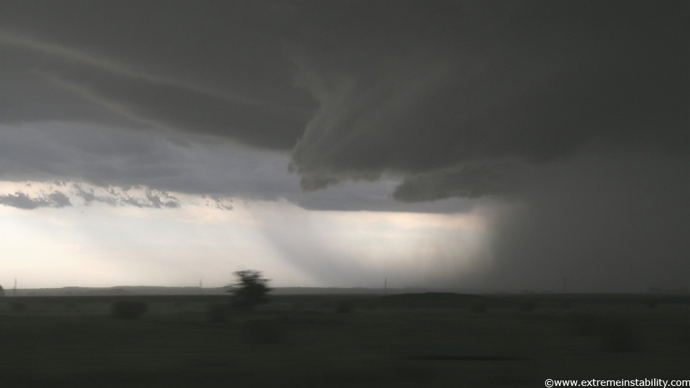
Panning the video camera east at the same location, a scary sight. That's essentially a convective long beavertail attached to the storm. Just imagine a circulation rolling down the warm front and that's its warm front. A little black hole was eating bits of SD as it drove down I90.
I'm going east now, just left that other spot. Still on I90, that is what that beavertail looks like now. The poor travellers that didn't think better of just driving into that structure. It was simply amazing after this, the number of vehicles at exits parking under the overpasses.....waaay ahead of precip. Must have been some station broadcasting, "hail to the size of bowling balls can be expected between mile marker x and mile marker x." Travellers were obviously getting some heavy worded warning from somewhere.
A new base popped up right in front of the storm. It quickly got its own curling inflow band. It would rapidly merge into the black hole behind me.
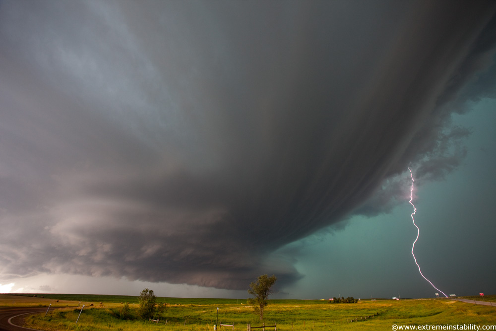
Still right off I90 looking west. That's a fair indication on how frequent the lightning was. Got that taking a still.
Each of these stops sucked. Bail south now or go east again on I90. Like it was a hard decision and the storm was trucking east, yet it was a simple decision....IF you weren't afraid of a core. Dropping south for certain would give me a view for maybe 5 more minutes. Then bye bye or view from the sw of the thing. Go east on I90 and you get the structure and probably the hail too. I was getting more and more amazed at how much better staying on I90 was working out. Then at Chamberlain backed the GPS out and saw the se jog I90 takes there for a bit...thanks! The more of these very brief stops I got the more I wanted to skip an exit or two and get further east so I could stop longer. It was hard getting any stills.
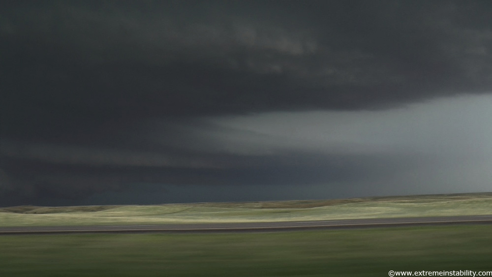
Video capture driving east on I90, lovely terrain/landscape and an HP supercell.
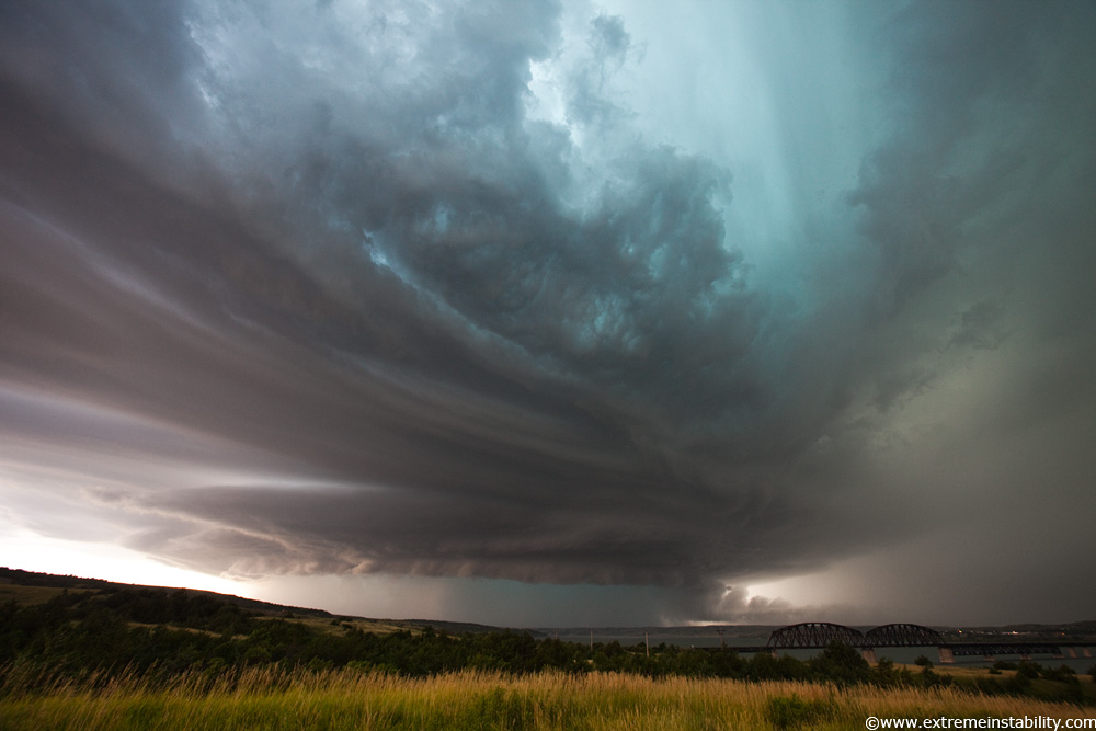
HP beast and it's over the lake/river at Chamberlain! I took this crappy gravel road down to the water from here but it was scary and no view anyway. Thing was full of big big ruts and steep as hell. I was like, get off this before it gets wet.
Just before this Chris says they have softballs bouncing over their car, as they took some gravel road and were trying to get back to I90. Small hail was landing here at this time too. Slightly blue-green up there.
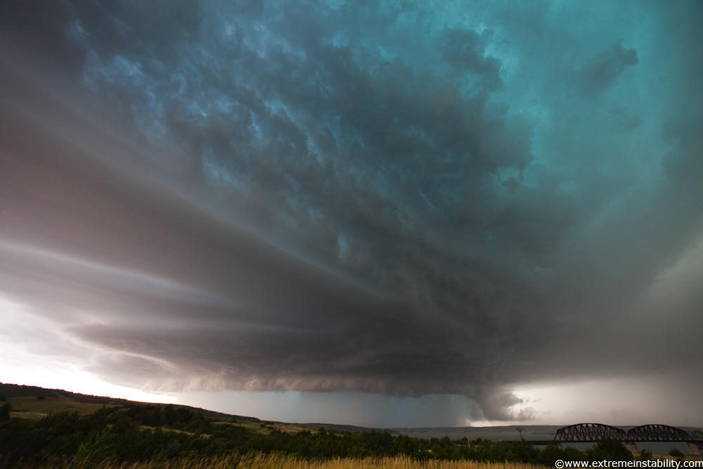
On the right the thing got an "alligator head inflow cloud". Saw that on Hill City 2005 and now this one. Looked more like it before this still.
The banding was the best part, just kept changing how those were up there.
It was highly electrified here. I pan up for the bands and this bolt comes down almost right for me, then slants over and hits something nearby.
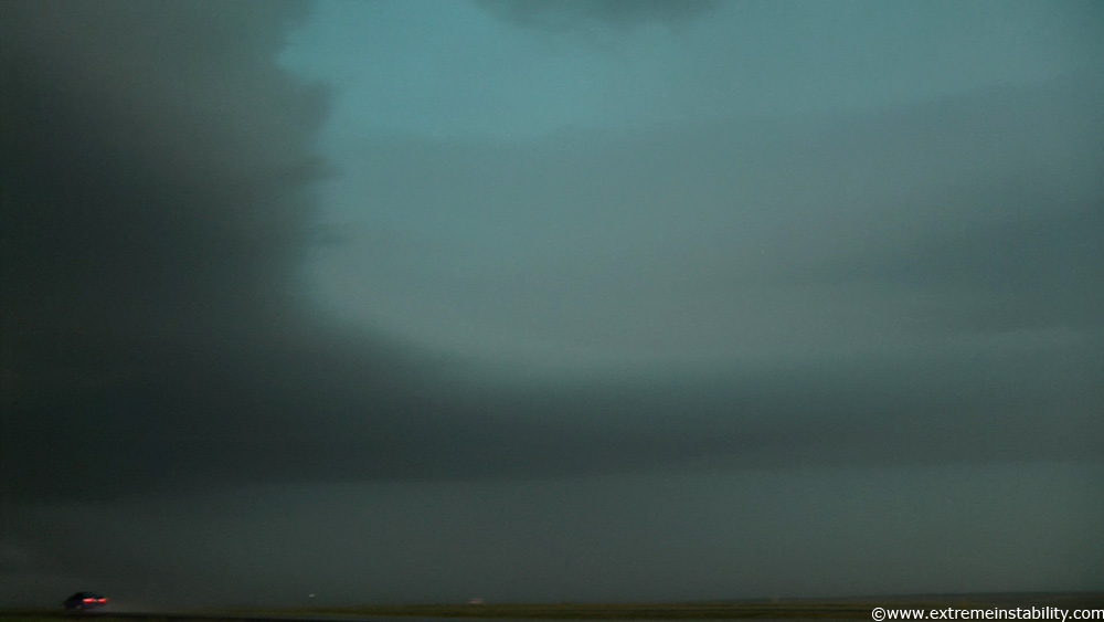
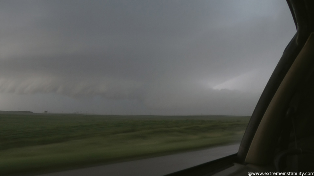
I waited here for big hail but I wasn't getting it. I go to leave and can't find the entrance onto I90! I thought it would be on the right as I went back north that very short distance. Nope. I get north of the interstate and flip back around, just in time for the core to slam me with high winds. I was like, crap where is the eastbound entrance! Found it, it was a looping one that was paired up with the deal I'd gotten off from. I thought I was screwed for sure, as 60mph winds or so, blasted through as I made the turn. I get going east and it's excessively saturating rain rates. That "atomized" type stuff. I'm going 60 mph east on I90 and can't see jack, but it was like it wasn't raining. It was all blowing with me the same exact speed. The video is odd as it doesn't even sound like its raining and the wipers aren't sloshing all that much off, but heck if you could see a thing in the stuff. I knew I was just barely in it and if I kept at it I'd clear it soon enough.
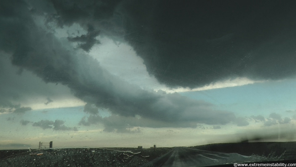
Clearing it and looking south. Shelfy structure and a tube of what actually seemed more like rain than dirt, going forward and then upward ahead of the structure...thanks to the strong winds.
Panning back mostly west at the beast still chugging along.
Running low on gas and it looking to finally line out now, I let it overtake me southeast of Kimball SD. Thing had been a supercell for around 100 miles. Oh yeah when I got back ahead on I90, eastbound I90 was 100% void of other cars. It was so surreal for so long. I was like, this thing has totally shut things down behind me. No one clearing it. I was hauling east at a good clip and not even catching up on anyone. Just me on I90! It was just very much twilight zone'ish.
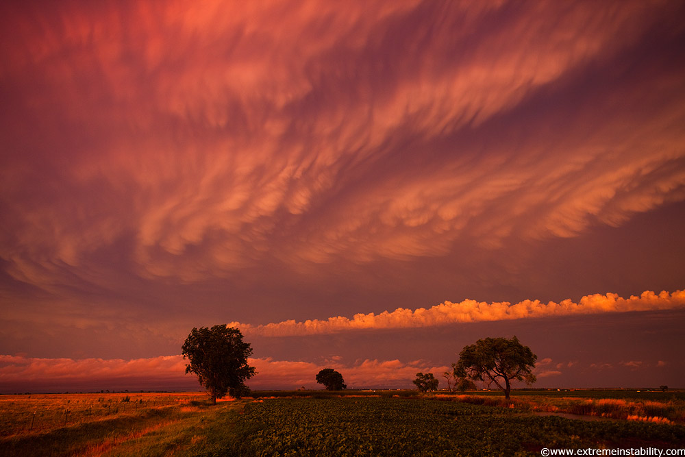
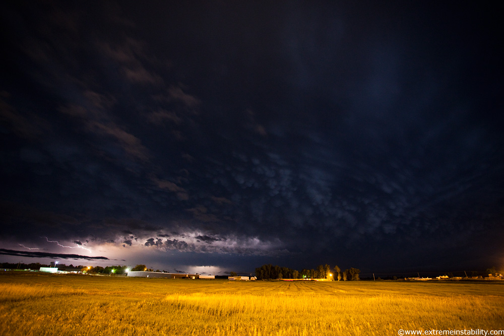
I went back to Kimball and got gas with mammatus hopes. Low clouds screwed my church idea there, so wound up going east and just getting field with mammatus stuff.
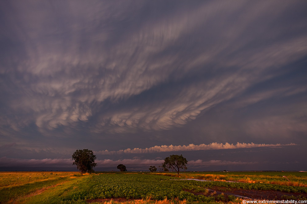
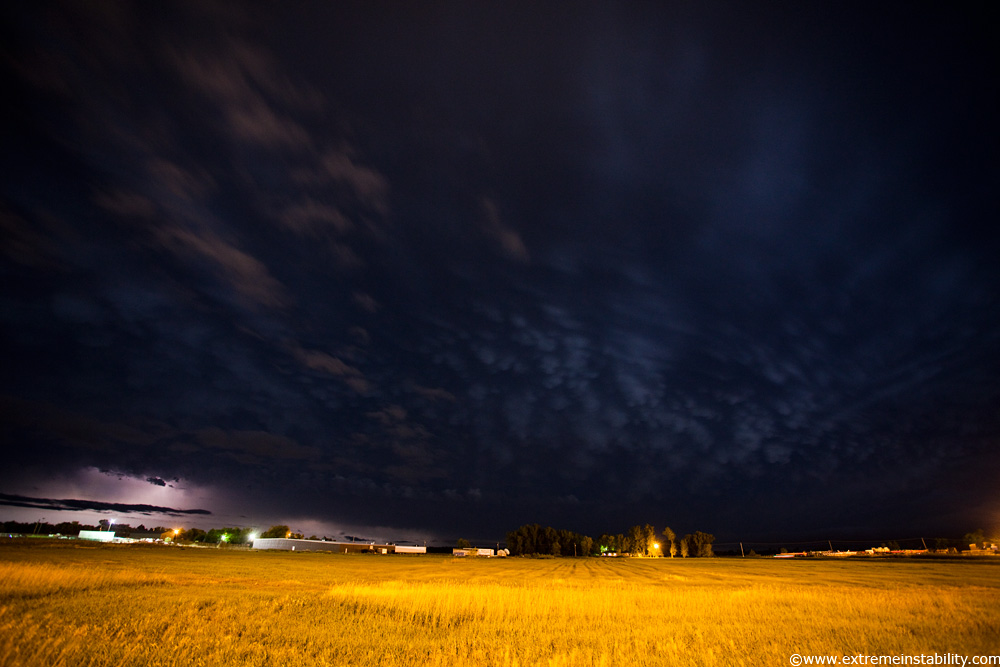
During the extremely late twilight I was seeing just how crazy they were, as I drove back home down I90. Each freaking exit I'd think to stop at, low clouds would be there again. I finally do stop at Mitchell and get these. High iso, dimly lit fields and very late twilight or just lightning and a storm, can be amazing subjects.