June 20(I think), 1996 Blair Nebraska
This account is before I had my first actual chase. It is one of many storms I recorded from town from 91-99(yet the only worthwhile one, lol).
The first supercell went about 5 miles or so to the north. The second, very angry looking one, went directly overhead. The third went about 5 miles south. I only snapped one picture of the first weaker looking supercell to nnw. As I pulled up to my friend's house(at the begining of all this) the sirens were sounding. There were no storms in sight at this time. Soon after the first one appeared to the northwest of town, moving basically east.
This storm looks pretty good to me now, but at the time I didn't know any better. I'm writting this in the spring of 2000. I'm glad I didn't follow it, because I would have missed what was lined up right behind it.
Supercell #1 nnw of town
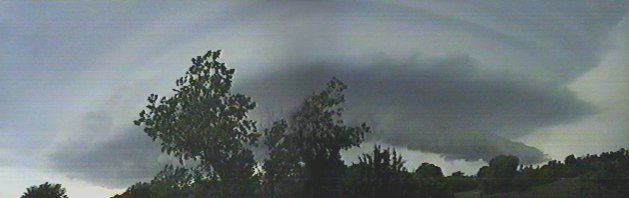
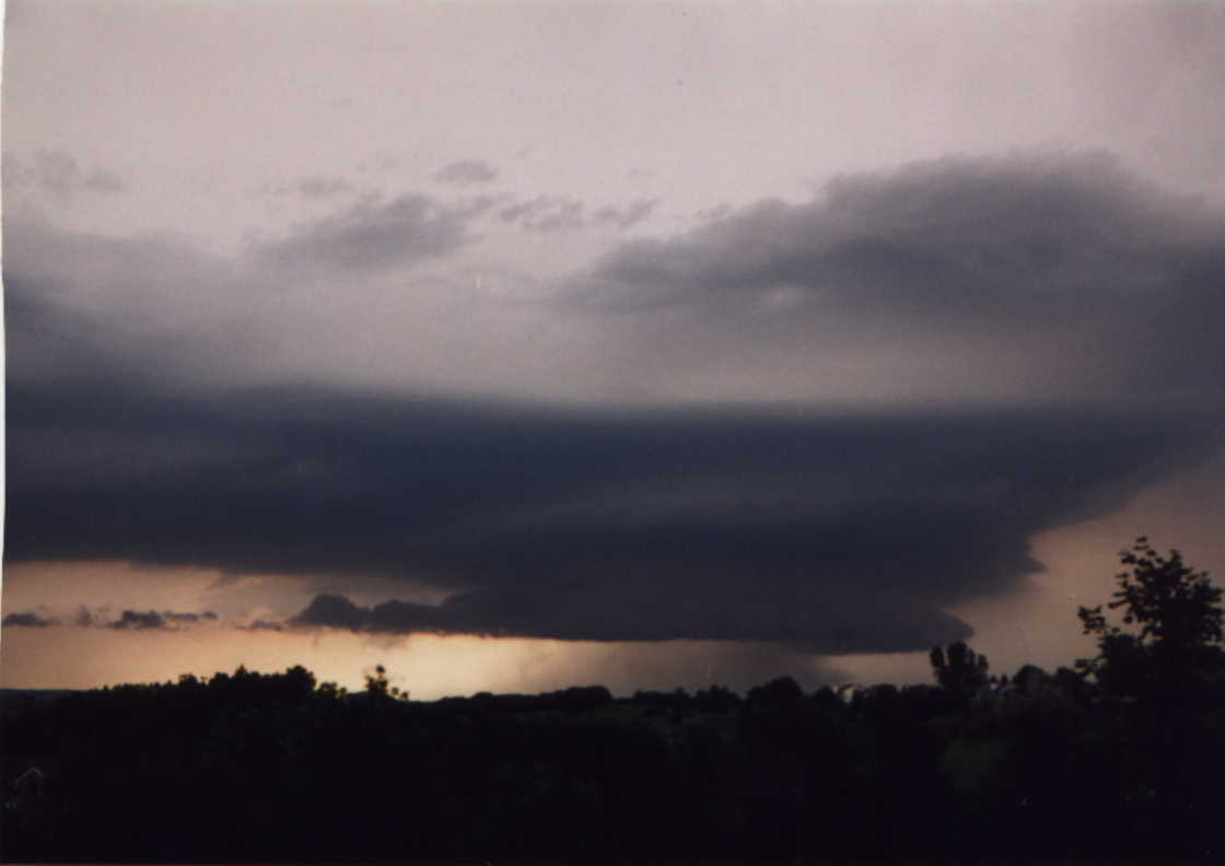
The second supercell was one impressive storm. This was all shot from a friend's back yard. None of us could believe what we were seeing and had no idea what it was going to do. What we did know was that it was going to go straight over us.
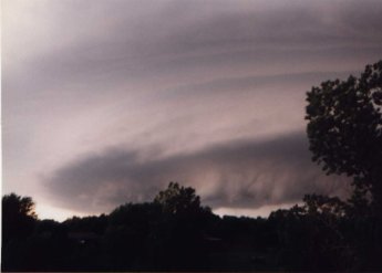
I knew enough at the time that it was a supercell and figured it was rotating pretty good based on the striations(this was a big time flying saucer). All of us thought we were going to be in for some major trouble/fun when this moved overhead. We were sure we would be in for some hail and high winds and maybe even a tornado. The tornado thing bothered me, because their basement is only half underground(the west side walks outside to the pool). As it passed overhead the most we got were some sprinkles and an awesome view of the belly of a mountain sized(much larger actually) spinning updraft.
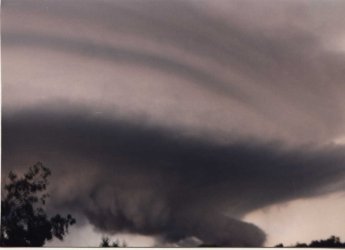
The thing I noticed the most as it passed overhead was how much the bottom of it wanted to push down. The cloud motions weren't rotating all that much underneath, but you could see areas pushing down from time to time.
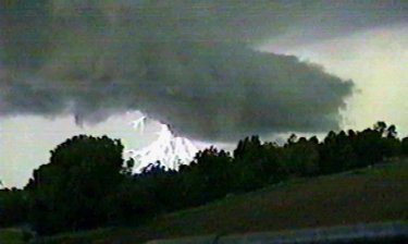
It put out this nasty CG with very thick branches. Other than the lightning and nasty look we did not see much from this storm as it moved over us. I imagine it was dropping some decent hail to the north a bit.
Supercell #3
The third supercell came just after dark. I never got any pictures of it, but did get into some good sized hail. A friend and I took a drive to see what we could see. Since the storms were progressivly coming in further and further to the south we should have driven south. What we did instead was drive west a little and end up under the hail shaft of the it. As soon as the hail started hitting the truck we flew east in a big hurry. The third tornado warning for Washington county was being issued at this very moment. The sirens sounded in Blair three times this night.
My friend dropped me off at the house I was at and then he headed home. Within about a minute or two of this, the hail had made it into our area once again. The hail was just under baseball size. We stood at the slidding door and watched as the hail pound the pool. Hail ripping into water like it was was pretty cool to see.
This storm produced a tornado about 10 miles southwest of town. The tornado damaged a church(with people in it) and some farm houses. I'm not sure what it was ranked, but I would guess most likely an F1 or F2.


