November 12, 2005 Woodward IA Tornado
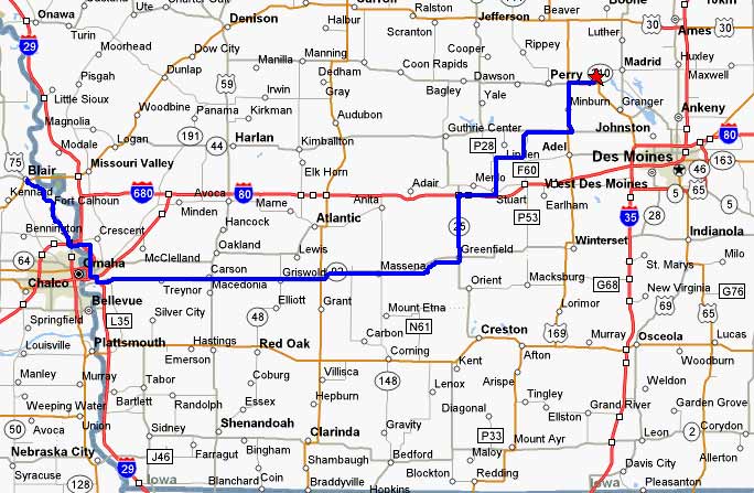

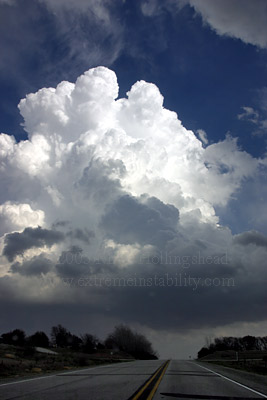
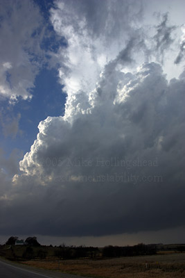
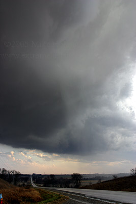
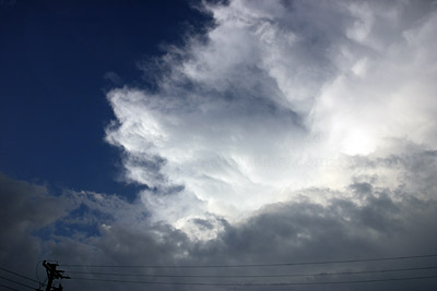
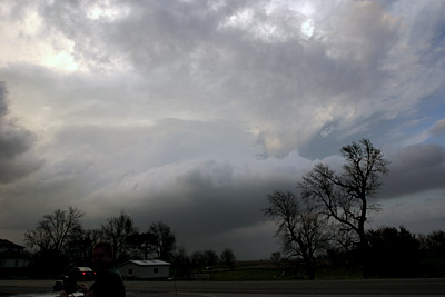
What a day this turned out to be. The GFS nailed this system several runs out while the ETA struggled and only caught on the night before. I knew I'd be chasing close to home and was surprised how hard it is to sit home and not jump to any other location. I am one who does not like to sit at home and wait for things too long. By around noon or 1pm there was a nice n-s line of cu from se SD to se NE and another area in ne KS. The cu near and just west of Nebraska City had my attention but I wondered about the rest of the line. The line was close enough to me that I needed to move on east or some direction soon or I'd be behind the game. One more satellite image and I was off. The area near Nebraska City got just a tad more agitated so I flew se, fearing what would now happen north along this boundary. By Council Bluffs a couple returns showed up near Nebraska City. I quickly blasted east on 92 out of Council Bluffs to stay ahead of things as they lifted rapidly ne. This is a storm north of me which actually went up near me as I went around Council Bluffs. It was no concern now as I'd never catch it if I wanted to.
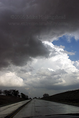
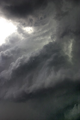
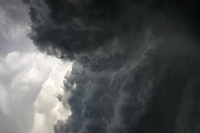
Still scooting east as this arcing line of small cells lifted rapidly ne. I'm under the base of one and can see the next one to the east moving north. This was now the game plan, just drive east and whatever happens happens. The ragged base of this storm was actually corkscrewing pretty hard. They were all really weak yet and rather low-topped.
Looking north at the storm I was just under. Zoooom! I only stop once this whole chase so all these stills are taken while driving. I just made sure to pay attention to how much bright white cloud was in the shot, if any, and where my metering point was, and adjusted the offset accordingly. I left the lens wide open at 17mm and focus on manul, to infinity.
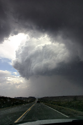
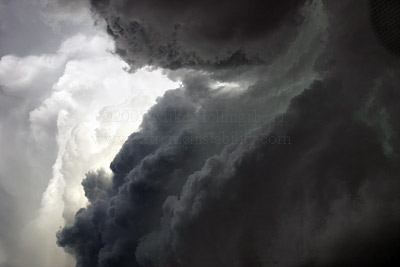
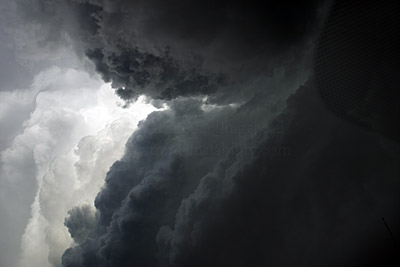
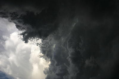
Looking east at the next cell. I thought my day might be over already right here as the line must have been arcing more ese than I thought and my game plan was starting to lose on me. It crossed the e-w highway before I could even get to it. Notice the anvil on both of these.
Wait up!
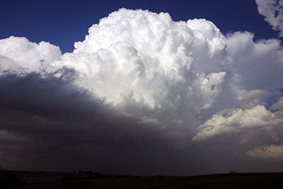
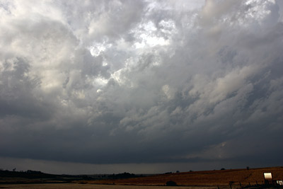
This was the last one that was still on radar. Oh and I did not have xm today on this one. I thought I'd miss it but really didn't. I could visually see another tower to the south that was not on the last radar image I grabbed when I had a good digital tower. It looked as healthy as any of them had and even looked to maybe be backshearing some. The next time I grabbed a radar(think I got 3 all day) I could see it and where it was. I then lose site of it in low level crap and keep on going east knowing it was surely on its way. Just looking at the core show up to my south I knew it was the healthiest thing I'd seen.
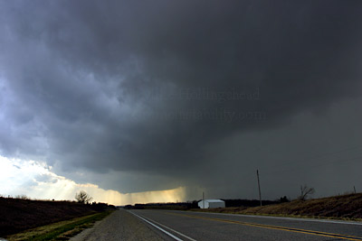
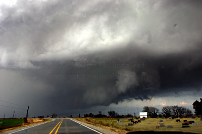
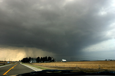
I don't get into much of the core as I go east and it goes north behind me. Thunder was pretty constant as it did so. I'm looking sw at this storm between Massena and Greenfield where they highway is pointed sw-ne for a bit. I used it to see if it was moving more right and it was a smidge(seemed to be going largely ne while everything so far seemed nne). The storm seemed to split. This core goes ne and weakens while that updraft base way down there right over the road clears out from this precip. Then it seemed to get a bit of undercutting from this core's outflow. Seems like when this happens like it did a storm roots better and turns and it certainly got better.
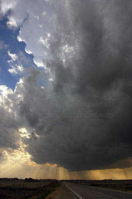
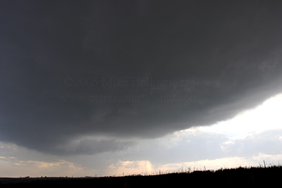
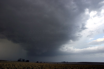
Nice vertical updraft above this base. Note the clearness on the far right side. It was very precip free now north of this base.
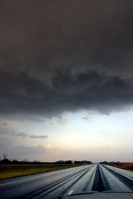
This was the only time on this chase I pulled over and was able to get stills that way. Thinking through the rest of this chase day I really wish I had not stopped. Well wait, I get a couple more quick stills here in a bit by the interstate and was stopped....briefly.
Time to go as it is not tracking ne along that highway but lifting more nne....oops. I lost ground again there.
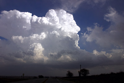
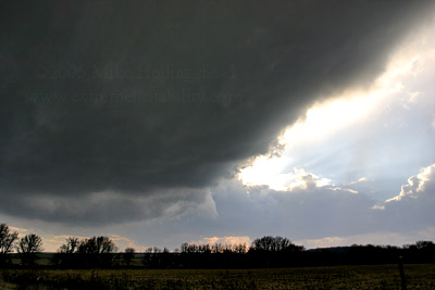
Going north out of Greenfield towards I-80 on highway 25. Note the beaver tail to the nne of the updraft base.

I was now excited for the first time all day. I thought for sure it was about to produce here. See those little lowering thingies in the middle of the base? Those were pinwheeling around each other for a while. That would have been a cool looking storm and tornado with that structure like that.
Now I'm at I-80 on 25 looking just sw of me. Steve Peterson pulls up here. It had quickly gotten a bit linear then just as fast it got another rfd cut in it and a bowl appearance to the base.
Time to go again. There are no more stops at all till the end of the chase and so far the two stops I had probably equaled 4 minutes.
The same moment I say to Steve, "look at that precip falling" small hail hits us. You can see it falling here on the right half.
Going east on I-80 now. It was cool to see the white stones falling back from this as we moved east. The storm has a small hook on radar at this time. As we get east of the updraft again we are hit by pretty intense southerly winds. I was very hesitant to pass this one semi as it was moving him all over the place.
Looking north at the updraft being ripped ne and forming an interesting avnil. Storm is just left of picture.
Updraft getting organized/rounded.
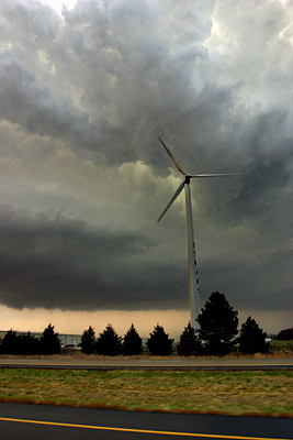
Couldn't just drive by the windmill and not take its picture.
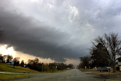
We get off at the Stuart exit and go north. Storm getting a linear lowering.
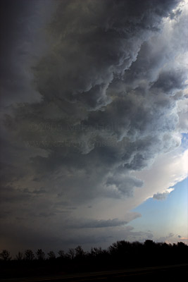
We kept zig zagging trying very hard to stay somewhat with it. This was absolutely amazing what happens here.
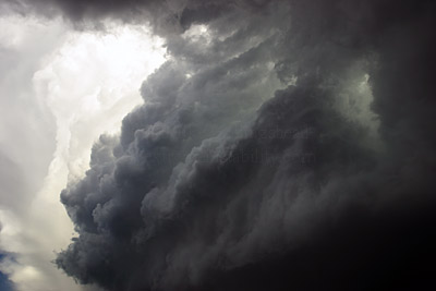
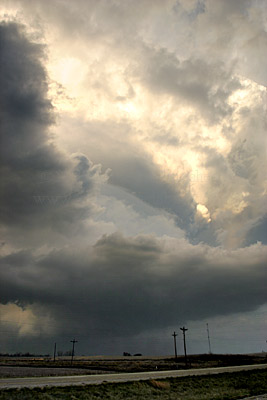
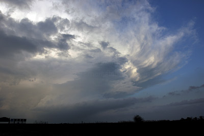
This updraft now meant business and we were RIGHT behind it now. This is looking up through my front windshield as we drove. It was hard keeping this exposure within the dynamic range of the camera. This part of the updraft was curling cyclonically east and forming a tight notch into another plume. The updraft billowed straight up and was making for a bit of mammatus in the backsheared anvil.
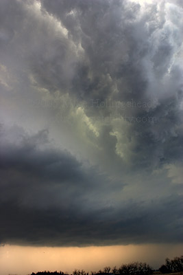
These are all shot where we turned east to go towards Linden. Just an amazing site. I soooooooooo wanted to pull over here and take some stills but knew I couldn't. Look below this and you can see something wrapped and low back in there. This was not long before we see the big tornado. I'm wondering what exactly that is as I missed it with my eyes(they were fixated on this amazing updraft display above). Quarter sized hail was on the road in this location.
Just amazing.
What power. I chase for that right there. Note the sun block thing where the mirror attaches in the upper right. This is looking straight up. I had the ev set for like -1.3 stops hoping my metering point was on the dark cloud(which is actually middle of the exposure here) and not the bright cloud. Without it on -1.3 or so it would have blown out. If the dot was on the brighter cloud most of the shot would have been black. Not an exposure friendly lighting situation.
Going east towards Linden. Something might have been wrapped up back in there left of this picture or in the one up a bit. That was happening and this new lowering was forming south of it.
Getting east back under it. I was in heaven looking up at this.
Just one more.
Somewhere sw of Minburn yet. Note the beavertail on the right side of the picture. I wished the thing would have slowed down!
Catching up again with a better view of the inflow tail pointing straight se.
With those winds aloft it was having a hard time producing any sort of backshear.
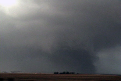
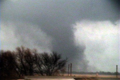
We got slowed up in Minburn by slow drivers and this slowness continued north aways out of town. While being slowed up we spot this guy to our east! At first I was like, what the hell is that. I was thinking at first it was just rfd kicking up dirt. I could then see near violent motions around it.
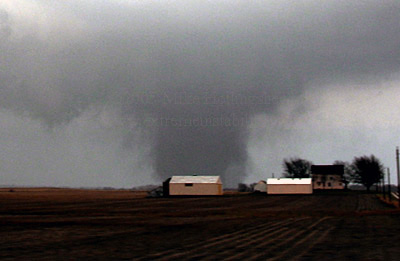
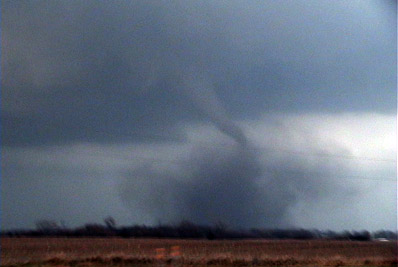
Full condenstation tube in there kicking up a lot of dirt.

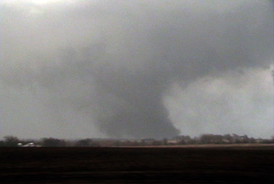
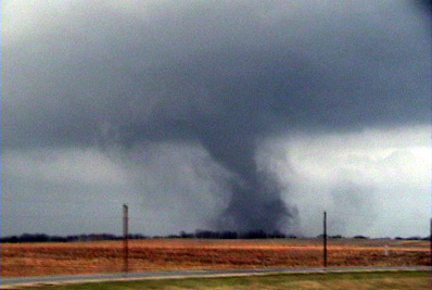
Tube getting a bit fatter and standing more upright.
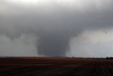
Stronger yet. These are all looking due east on our n-s highway.
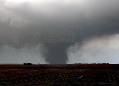
Bigger.
Big.
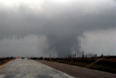
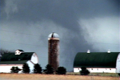
Very strong looking tornado as we get off 169 and head east towards Woodward. Almost looks like it has a helical vortex spinning off of it.
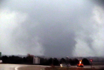
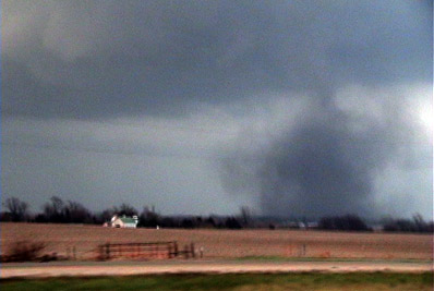
I'm still on that same on ramp. Cars are stopped on the e-w highway left of this picture. I thought we were done right here but nothing was stopping traffic.

Moving east trying to get closer. Steve is now infront of me and a cop is blowing our doors off.
Not only could I not take stills and video, so only got video, but getting steady video on this highway and zoomed in was impossible. A couple segments of the video are ok, but dang do I now wish I had stopped in the open and got some quick still video of this wild tornado. The motions were still pretty incredible.
I think the motion was so incredible due in part to the tornado's forward speed.
I'm guessing right now is when the guy in Woodward is shooting that crazy video as it is in his backyard.
The tornado is now trying to rope out and starts to hang back a bit(not much).
Just about done. Thankfully it doesn't seem like it entered that town when it was its worst. Maybe it did, I'm not sure, but I'm guessing it didn't.
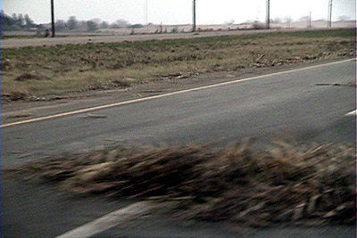
As we go to where it crossed it was dotted with piles of wet cornhusks.
Tornado gone, nice structure continues.

For some reason it impresses me it had this big fat inflow tail pointed se as it moved ne so fast.
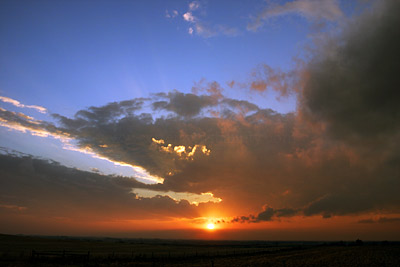
One quick shot of the sunset as we continued north into what was left of Woodward IA.
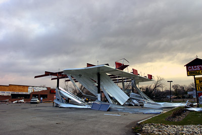
This only happened a couple minutes ago. Emergency people were already turning traffic around here. We really couldn't see much of any severe damage from here. I thought just the last part of the rope out got this gas station and the roof on one house. Evidently that was not the case. Note the brick wall being broken on that casey's store. Behind that tin near the north side of the Casey's was an overturned car. We saw it on the news and whatnot but completely missed it as it was behind the debris from our vantage point.
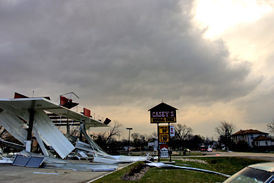
Hard to see here but this tornado must not have agreed with the recent high gas prices. It removed the 1 from the $1.94 leaving .94.
The storm seen from the gas station. Our chase was now over. It goes on to produce at least one more tornado near Ames IA. Glad it missed the football game!
Zooom!


