June 28, 2017 Shenandoah Iowa Tornadoes
I did not think I was going to chase this day the days before it. The models showed mostly southwest surface winds along a cold front sagging into IA. Veering to westerly aloft but still not that much turning, thanks to being so southwest at the surface.
There were some hints out in the warm sector there would be more southerly surface winds, or at least like south southwest. This with a fairly strong low level jet. Especially by the morning of, when the HRRR model was in range. The hodographs looked quite favorable, given storms out there off the cold front. And the HRRR was being insistent on firing warm sector storms in an east northeast line across IA. It became a no brainer, go keep it honest. Biggest concern was just ending up with too many storms.
I drove east down I80 in western IA thinking just get ahead a ways, then drop south some to where the HRRR was insisting on storms forming pretty early. Problem was for me it is hard to target where there's no real surface boundary. Kept thinking, just where am I targeting here exactly. But all morning long I could see a bit of a dry line pushing east across se NE with due west winds around Lincoln. Meanwhile a more gradual shift was taking place along the rest of the cold front further north and then east in IA. Beyond that, looking across IA I was at a loss to find some surface convergence. I quickly said to heck with this drive east idea and dropped south for that boundary.
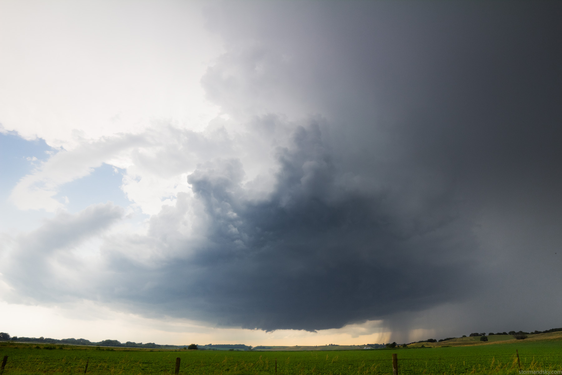
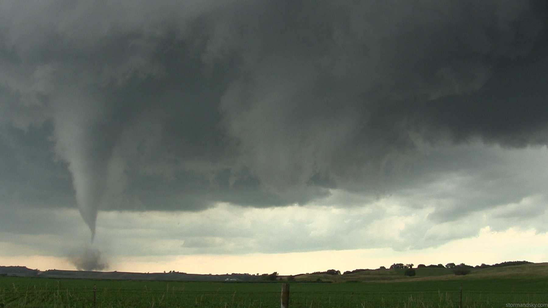
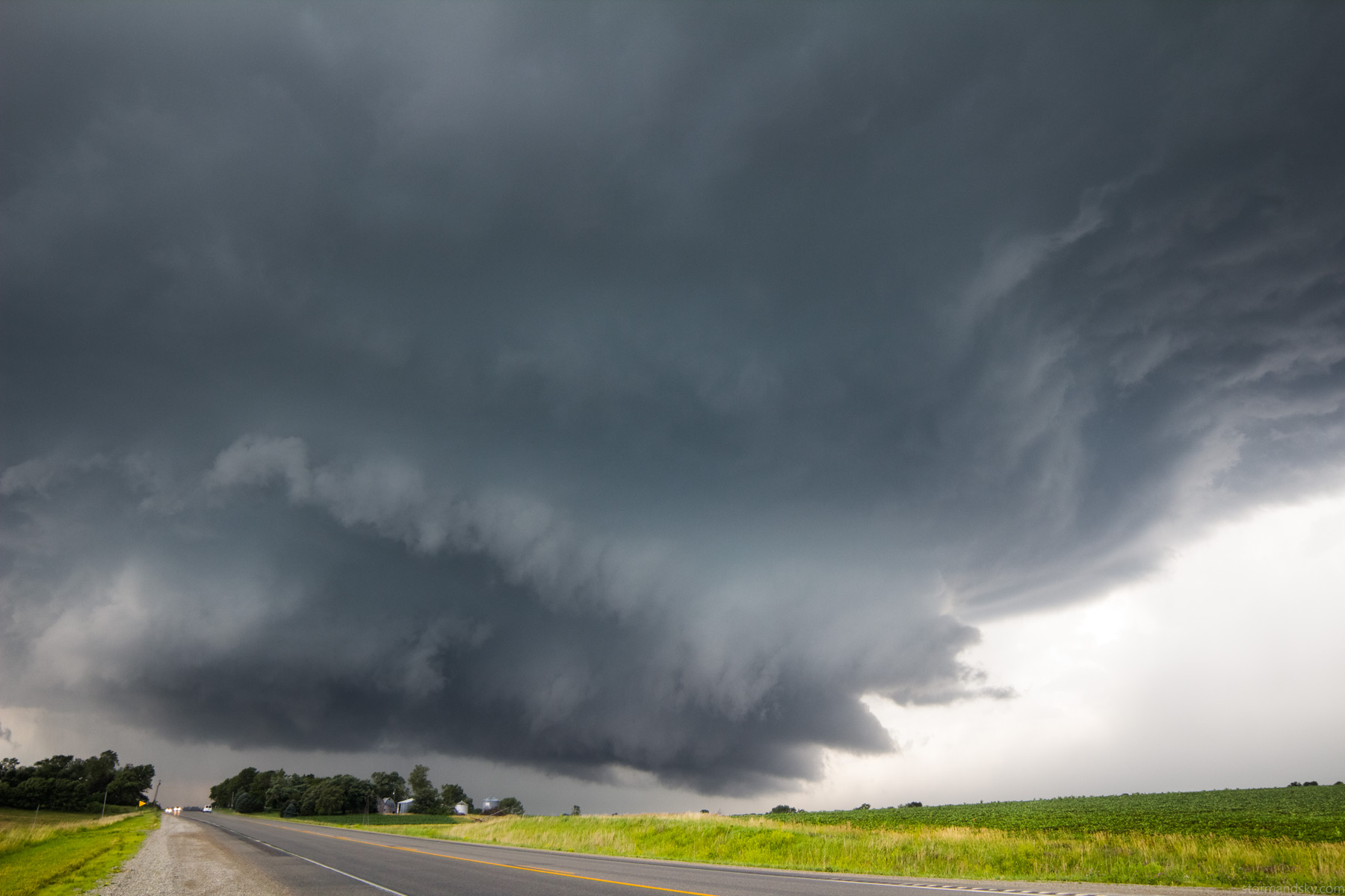
They started to develop in NE around 2 or so I guess. I stopped near Shenandoah then went west to look. On radar then there were several smaller cores and it felt like it was going to go messy with just a swath of warm sector storms everywhere. I was down in a bit of a valley just watching radar. Soon as I drove back out and west the short bit to look, I was like, heck this is going to be a nice supercell. Then in very short order I was convinced it was also going to produce a tornado, which it fairly shortly did.
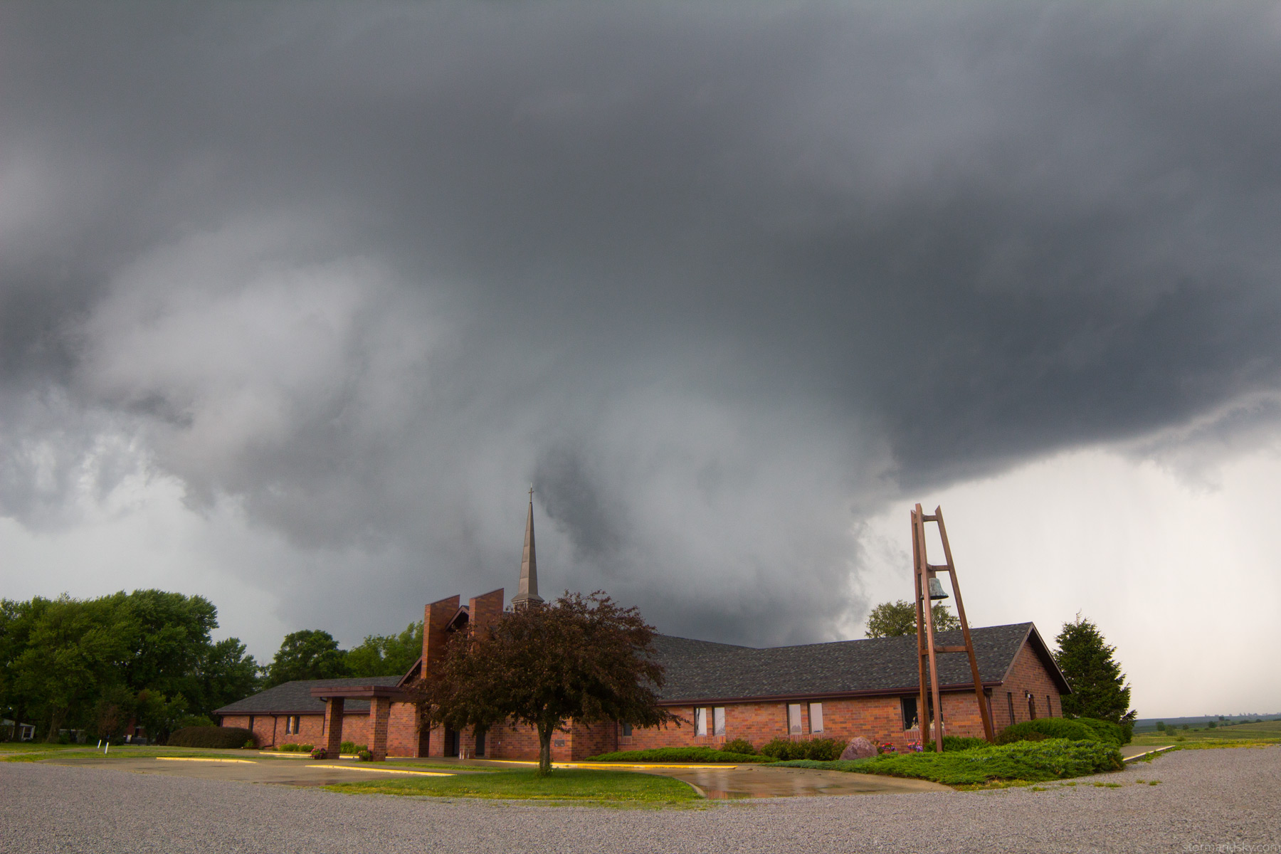
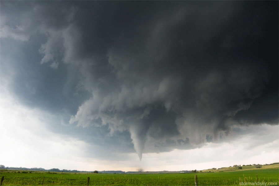
Here's a radar frame from west of Shenandoah. It seems maybe it produced before the tornado warning. I know watching it at the time I was thinking, I can't believe this ain't tornado warned yet.
On the drive south I had this fly that would not leave my legs and feet alone. So much so my brain jokingly thought of ways to install a bug zapper on my floorboard. It became less of a joke as I shot a time lapse of this now...using my window clamp for a mount, due to my broken/shortened tripod as well as lightning. I needed to keep the car still, but no, biting fly. Much movement and the time lapse would wobble. I doubt I'll do this again because it's also annoying to listen to on the video. Clunk clunk clunk every 2 seconds for the shutter.
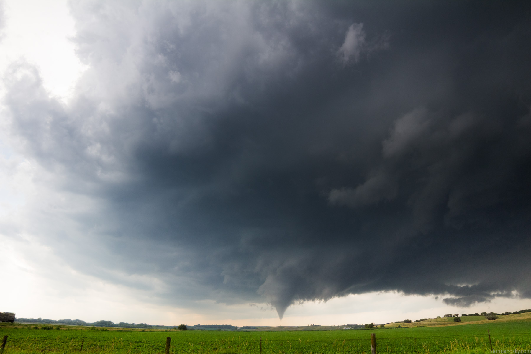
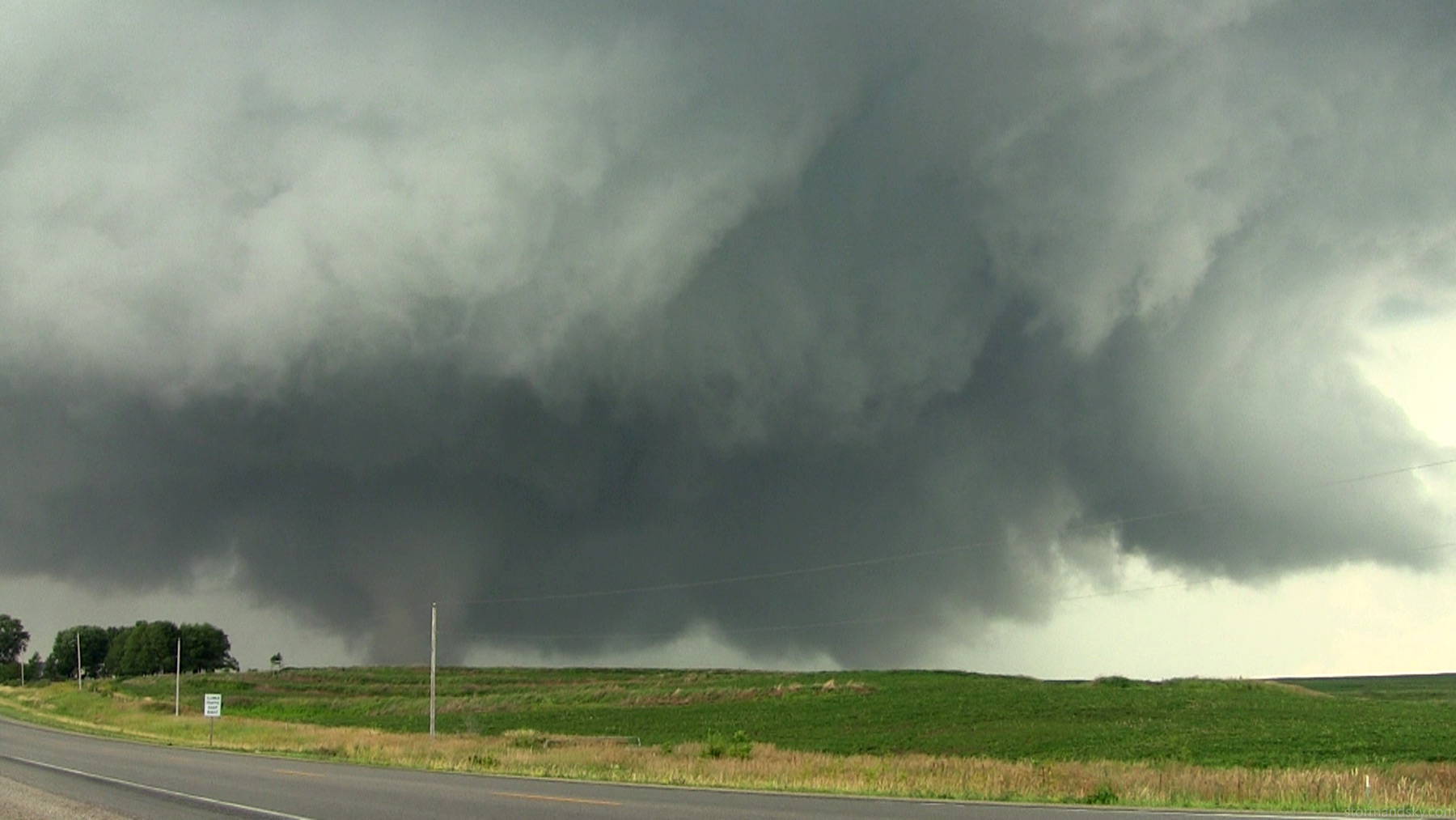
Anyway, I had this time lapse going for a while now before the tornado formed. I was like, I can't believe I got a time lapse of pre-tornado through formation of one that is coming right at me still. I only really started to shoot time lapse this year, and well this is the first chase with a tornado this year.
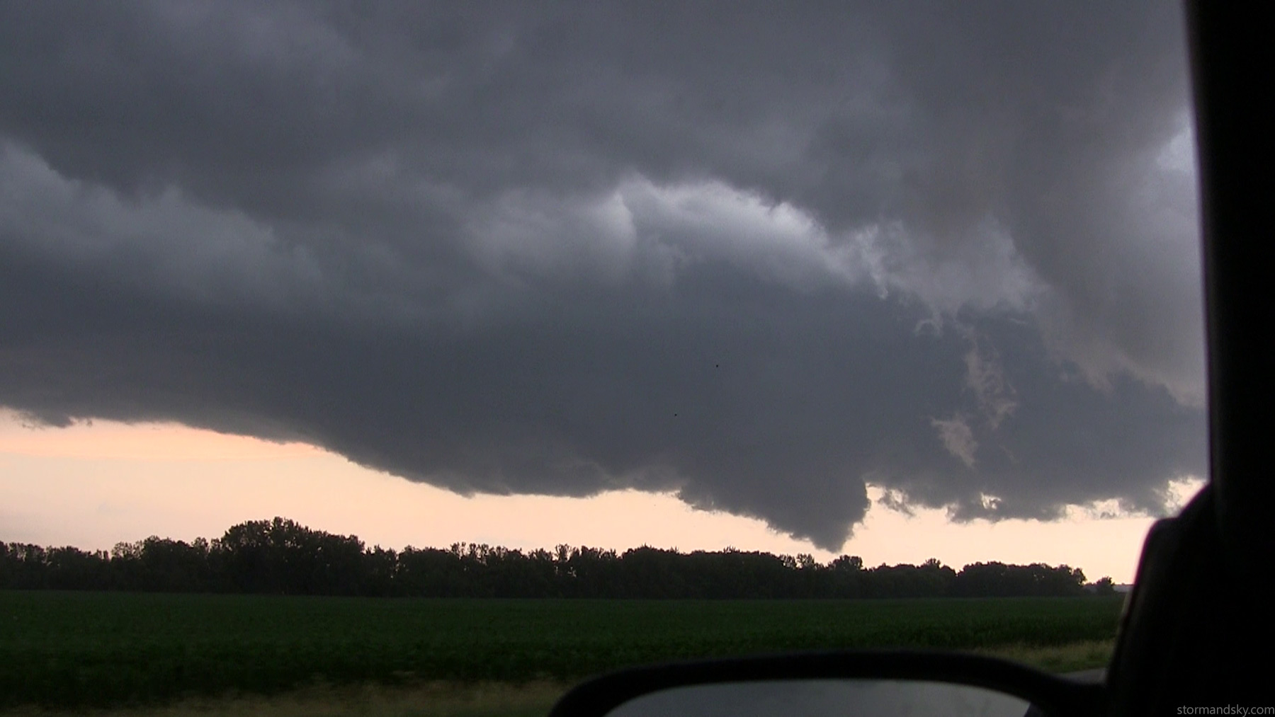
The photos are 14mm on a crop sensor. Here's a video frame. Soon as the tornado formed I thought, hmmmm, I really want to go drive close to this. It looks to be damn close to the highway no less. But I had the time lapse going already. Thought I really need to keep this time lapse going, as who knows what it will do yet and cutting it off now feels wrong. But I really wanted to leave for video. It's only 1-2 miles west. I've pondered this scenario already, at least when it's out on a tripod and not using my car window. Thought seriously about just leaving a camera going on a tripod, driving closer for video and coming back to pick it up. I 100% would have if it was on a tripod right now, remotely obscured from view, like out in some grass, low down and a bit down a gravel road.
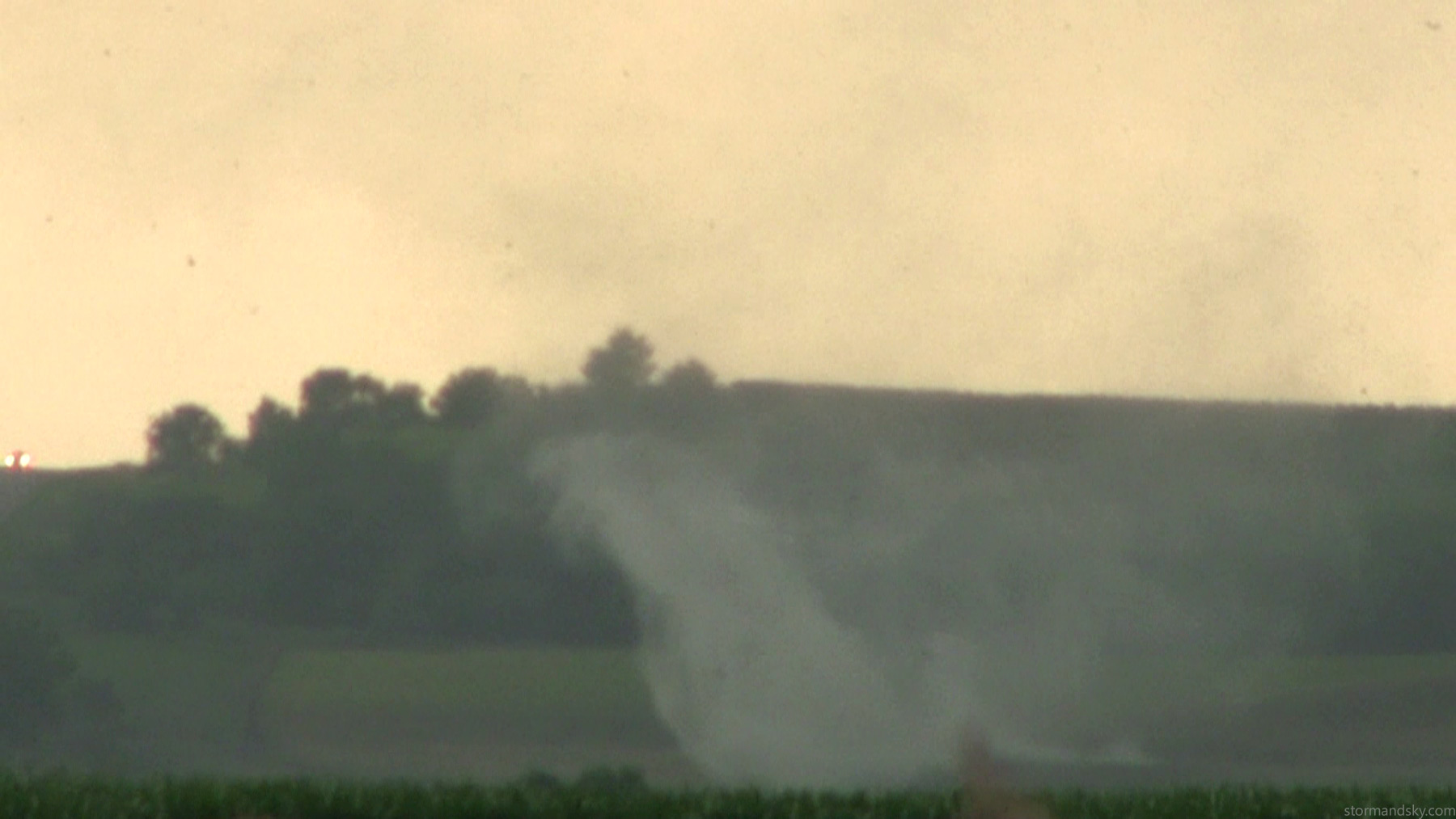
But I chose to keep the time lapse going and just stay there. The problem I encountered was this area up and to the right in the frame. It was quite clear it was ready to become the next tornado any time now. And it was increasingly right on top of me. Kept watching it and thinking, that thing any second now is coming down.
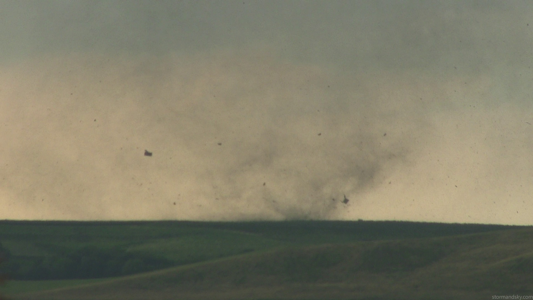
I thought these were tree parts at the time but hours later I saw that a house near there did get hit. It didn't appear it did much though thankfully.
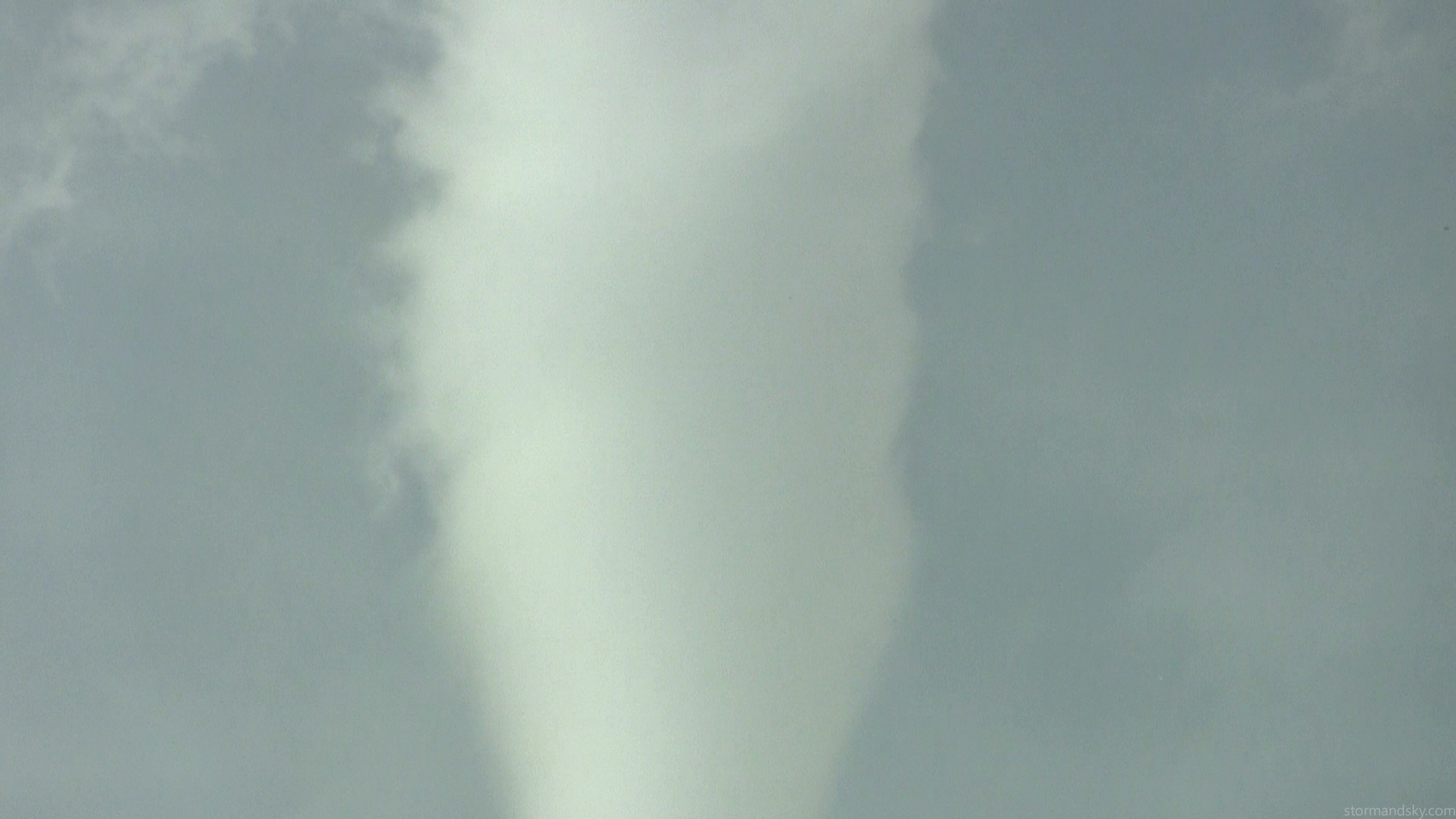
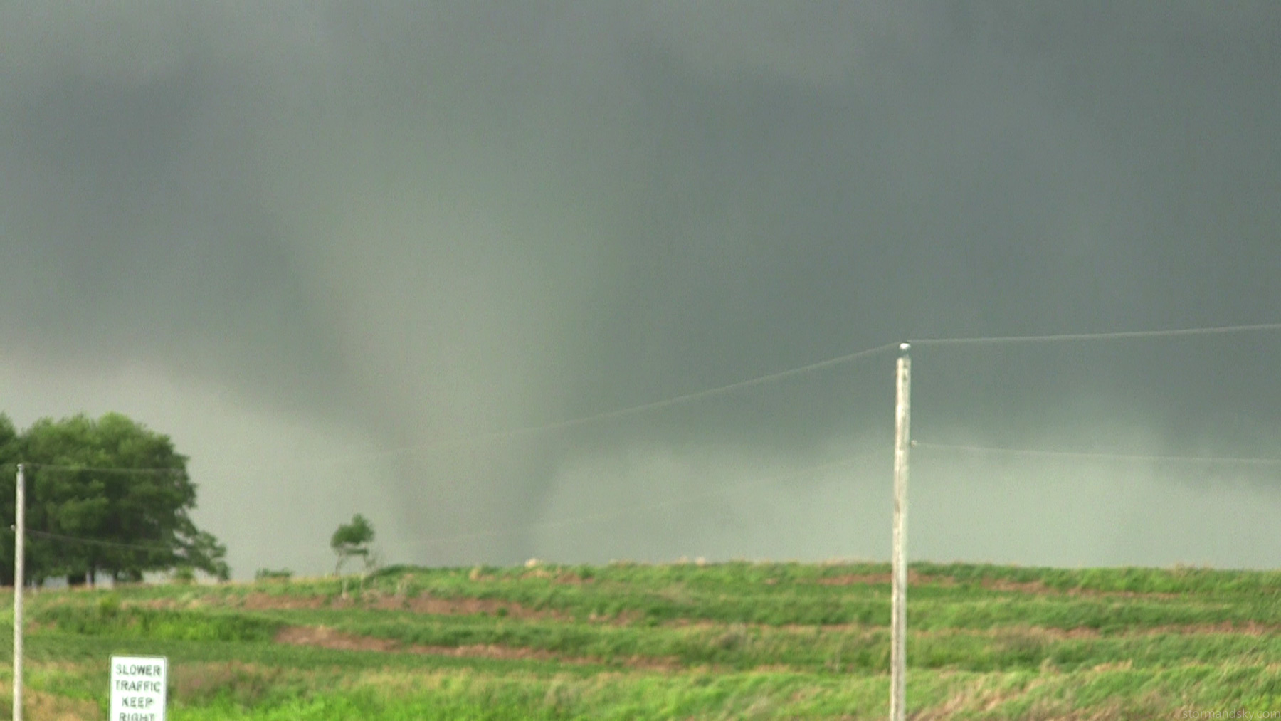
Little bit of a zoom on it with the video.
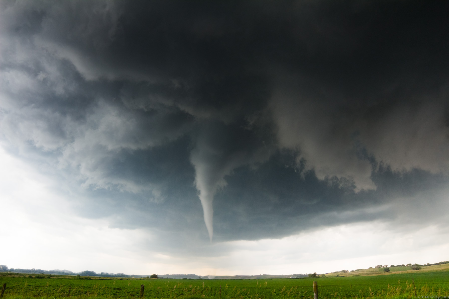
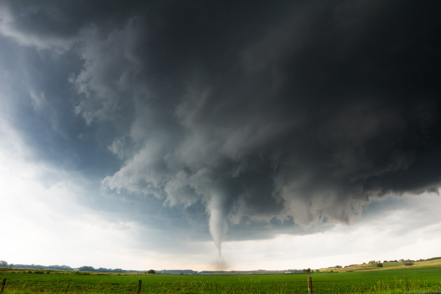
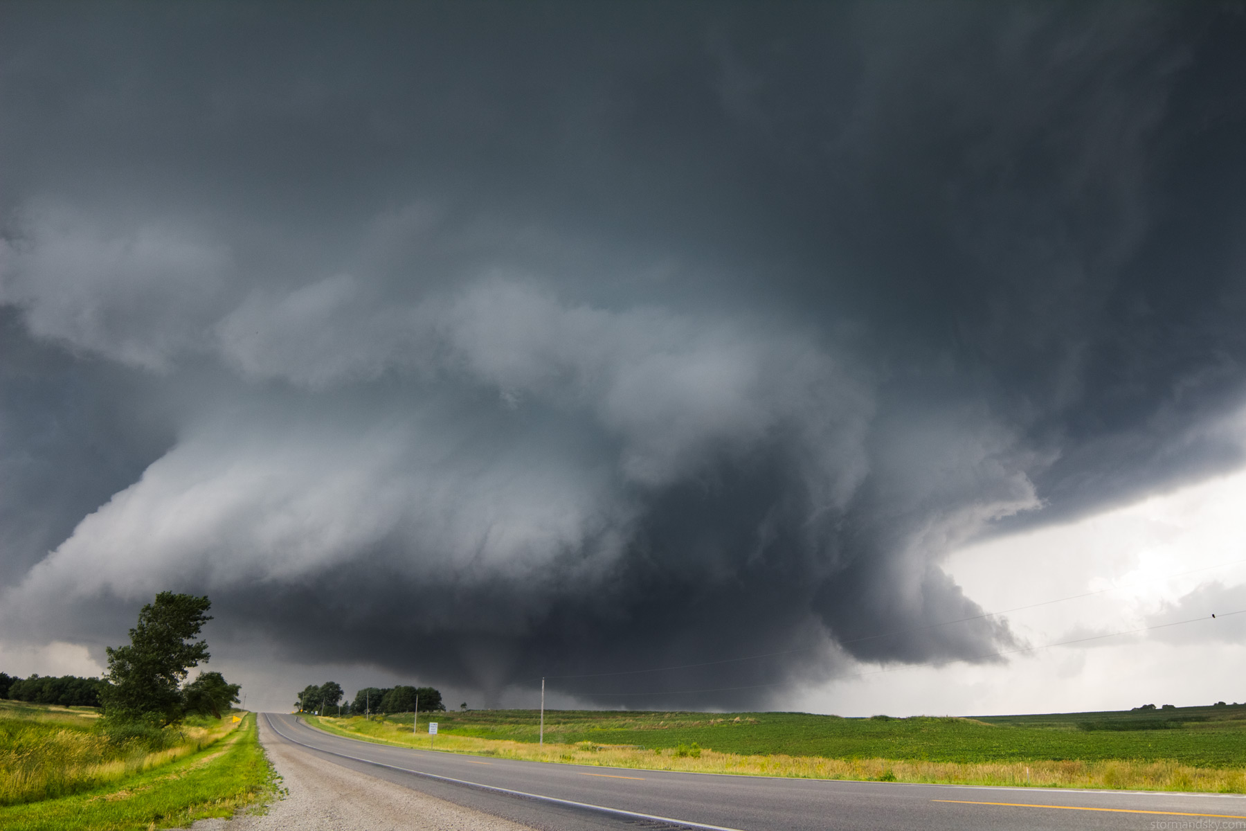
Time lapse still going. You can see how wide this is and how far that looks, but compare to some video about the same time below.
Now coming across the field. This tornado was anything but frightening. It was just the new area ready to go that was getting very much on me. Thought that finally comes down, I ain't going to have any time to judge it. It's going to happen on me. Finally yanked the camera in and left. Sucks too as I could have time lapsed the tornado rope out for like another 10 minutes from right there. You'll see it still there in more shots.
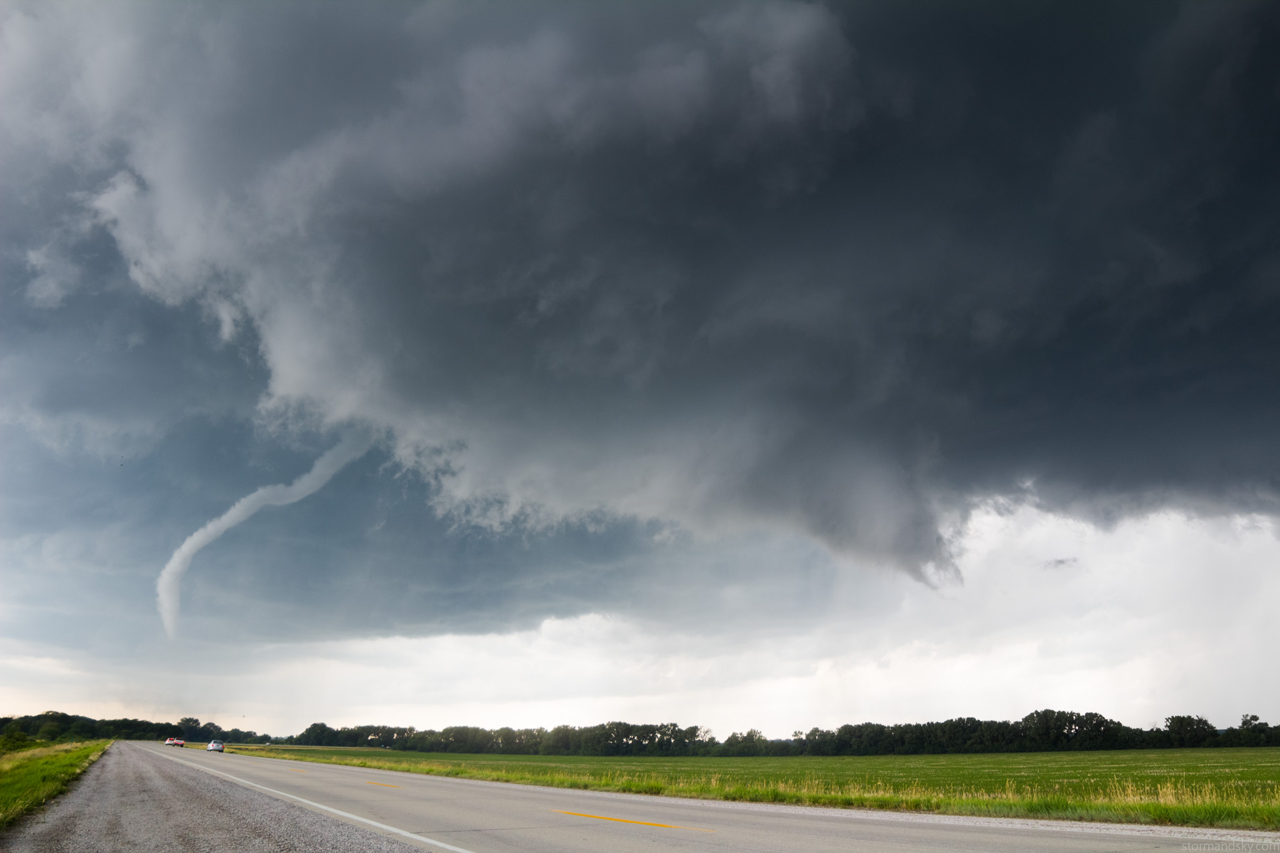
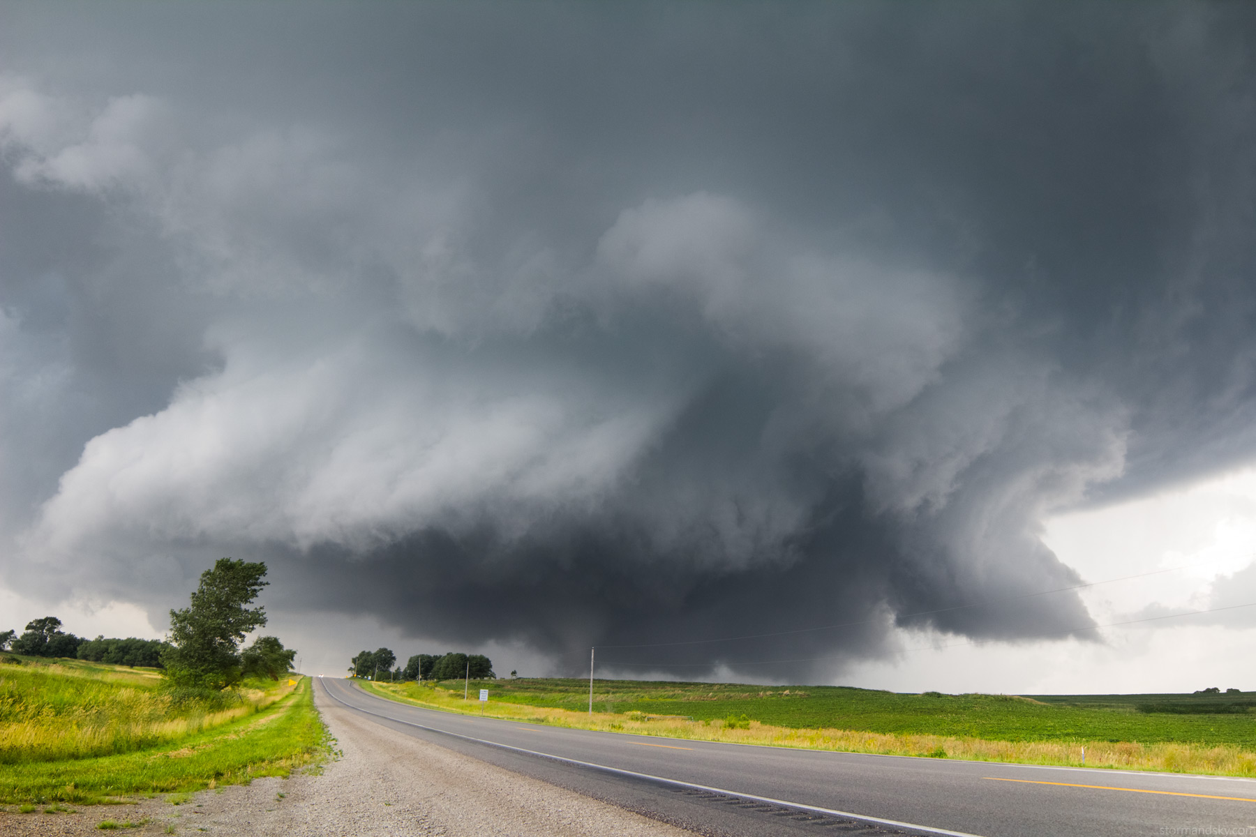
Moved just a bit east and stopped for a second again. The highway here is a fairly busy one this time of day into the evening. It was getting a lot busier with people out looking, as this was now about to enter Shenandoah. The area that was carving out and trying to spin up on me was losing some of its punch for a bit.
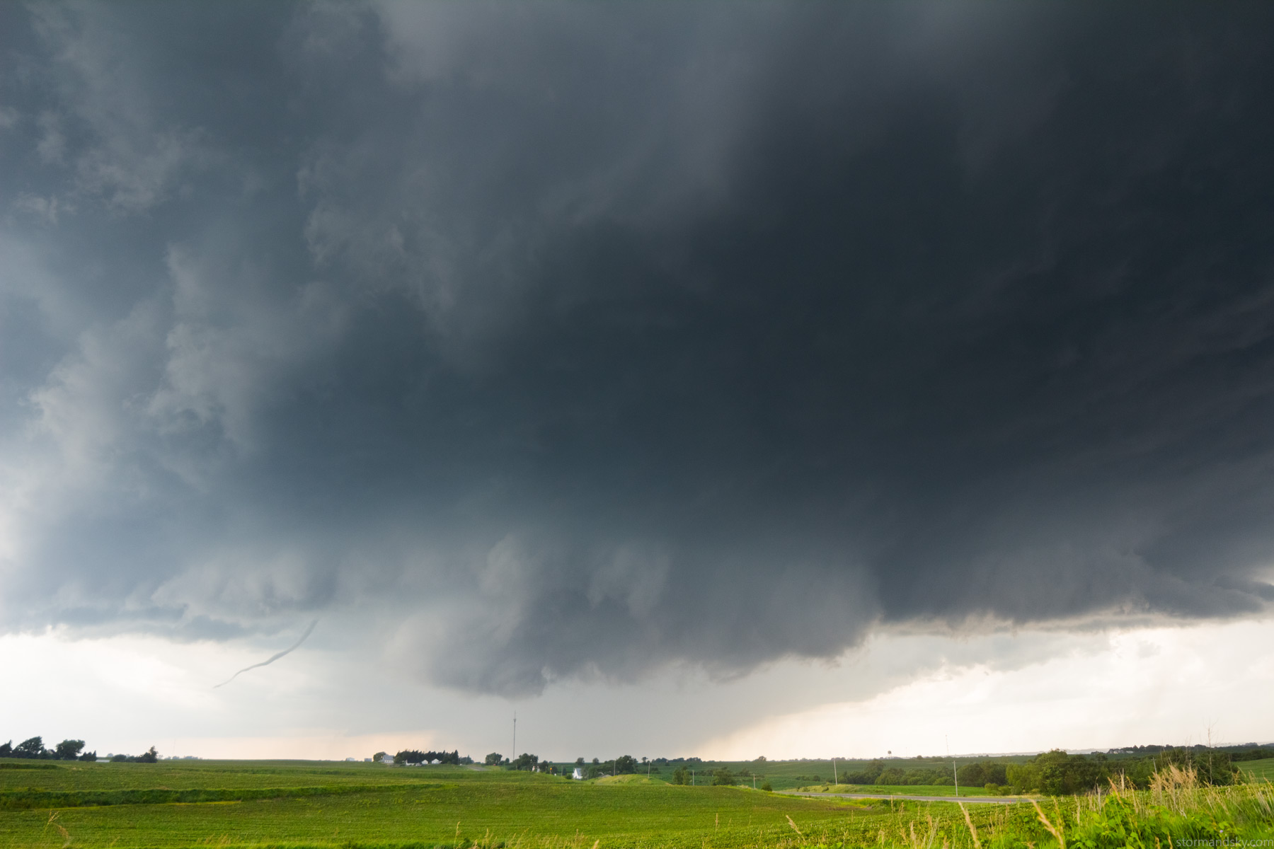
Now on the east side of Shenandoah as it moves over town. You can see that rope is still going on in there. The structure looked like it had some tornado potential with that cut but really not the greatest.
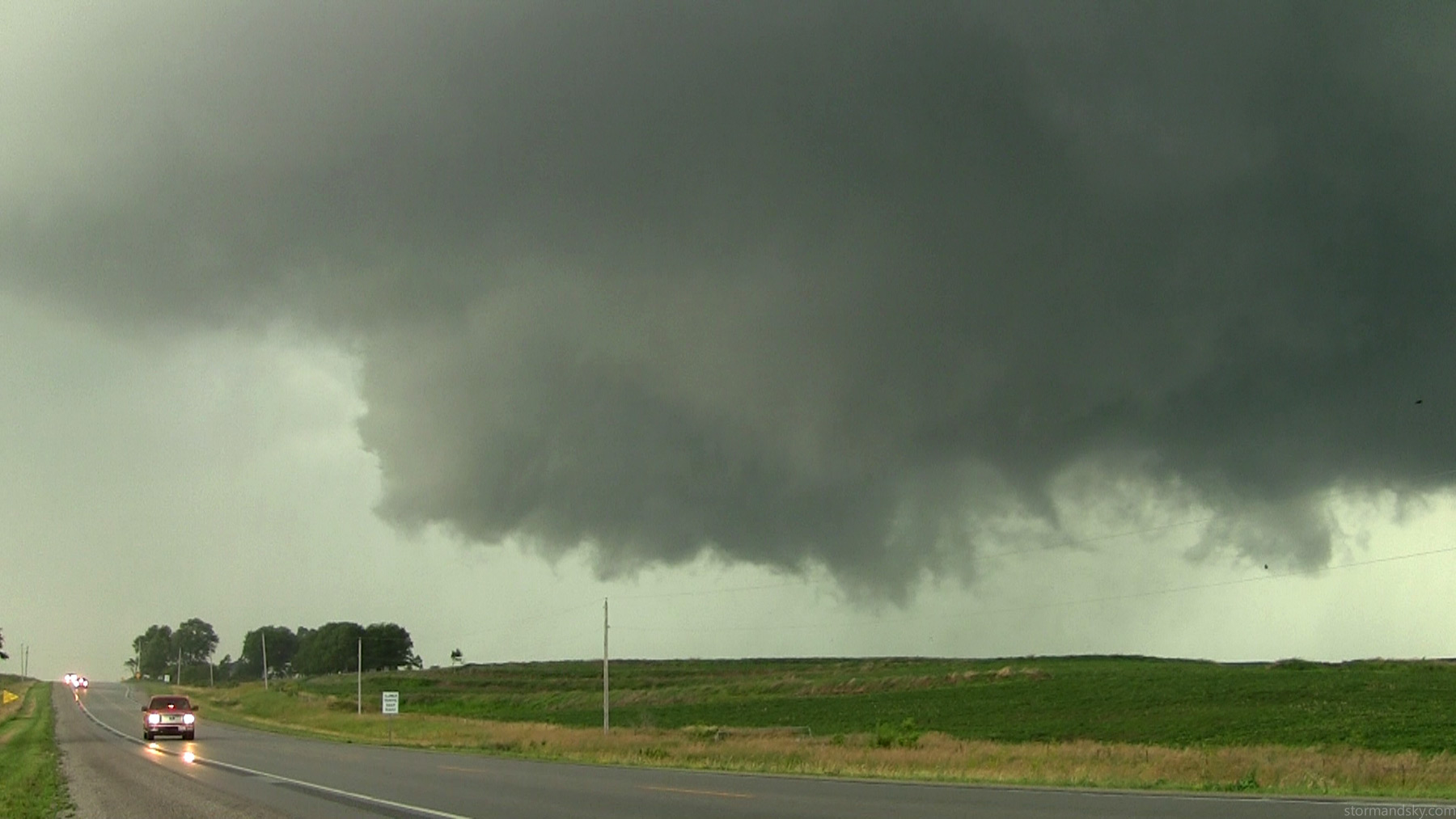
Felt relieved it was not cycling a new one again yet and seemed maybe it would not. Because if it was right now, I'm pretty certain it would have been squarely on town. It was really blowing out and seemed it would just go outflow mess. Plus more storms were popping up all over.
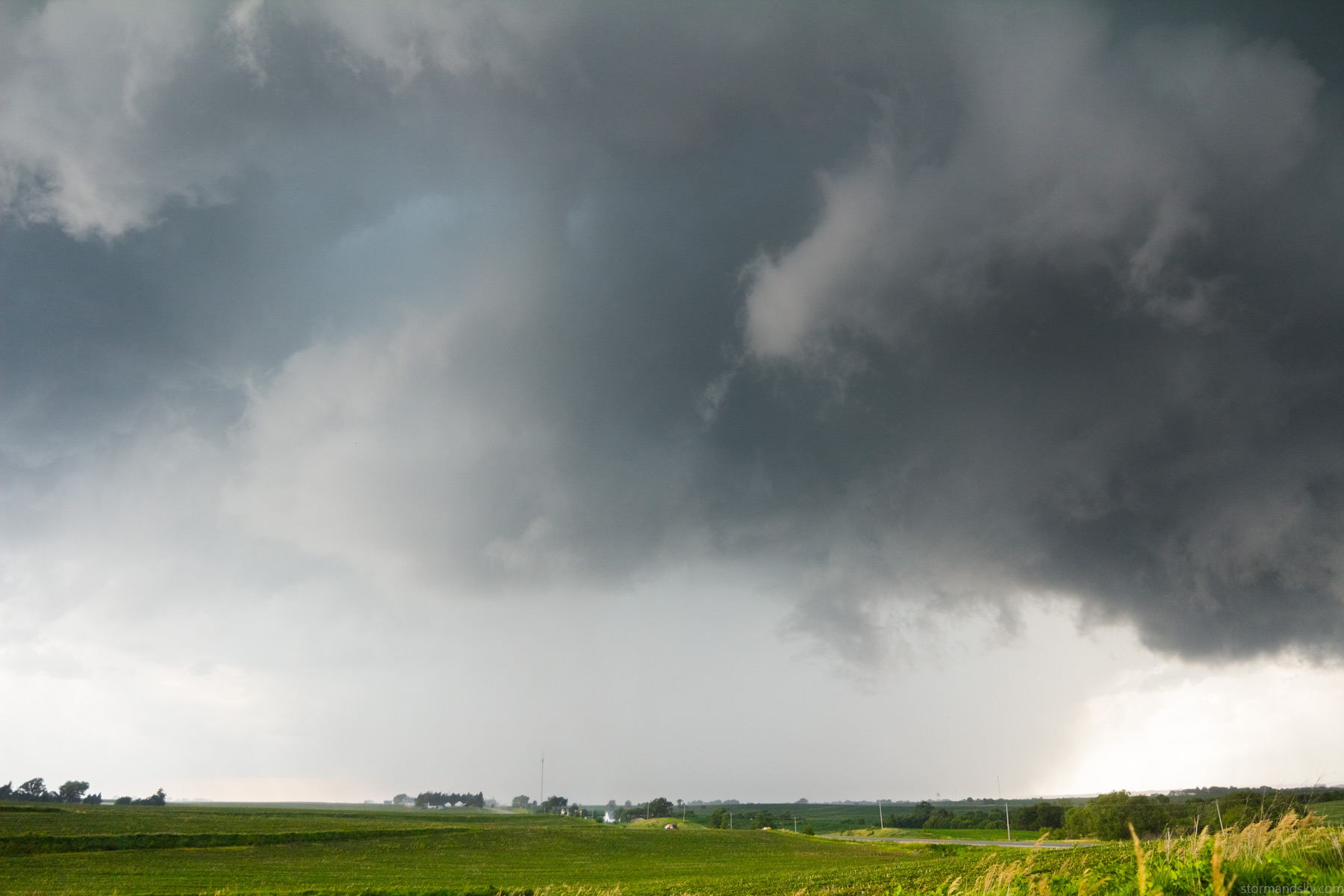
Moved east some more after shooting a few more time lapse shots from that previous location. It started to get a bit of a mean look now. The atmosphere was quite primed right now. Low base juicy and low level shear getting on the high side.
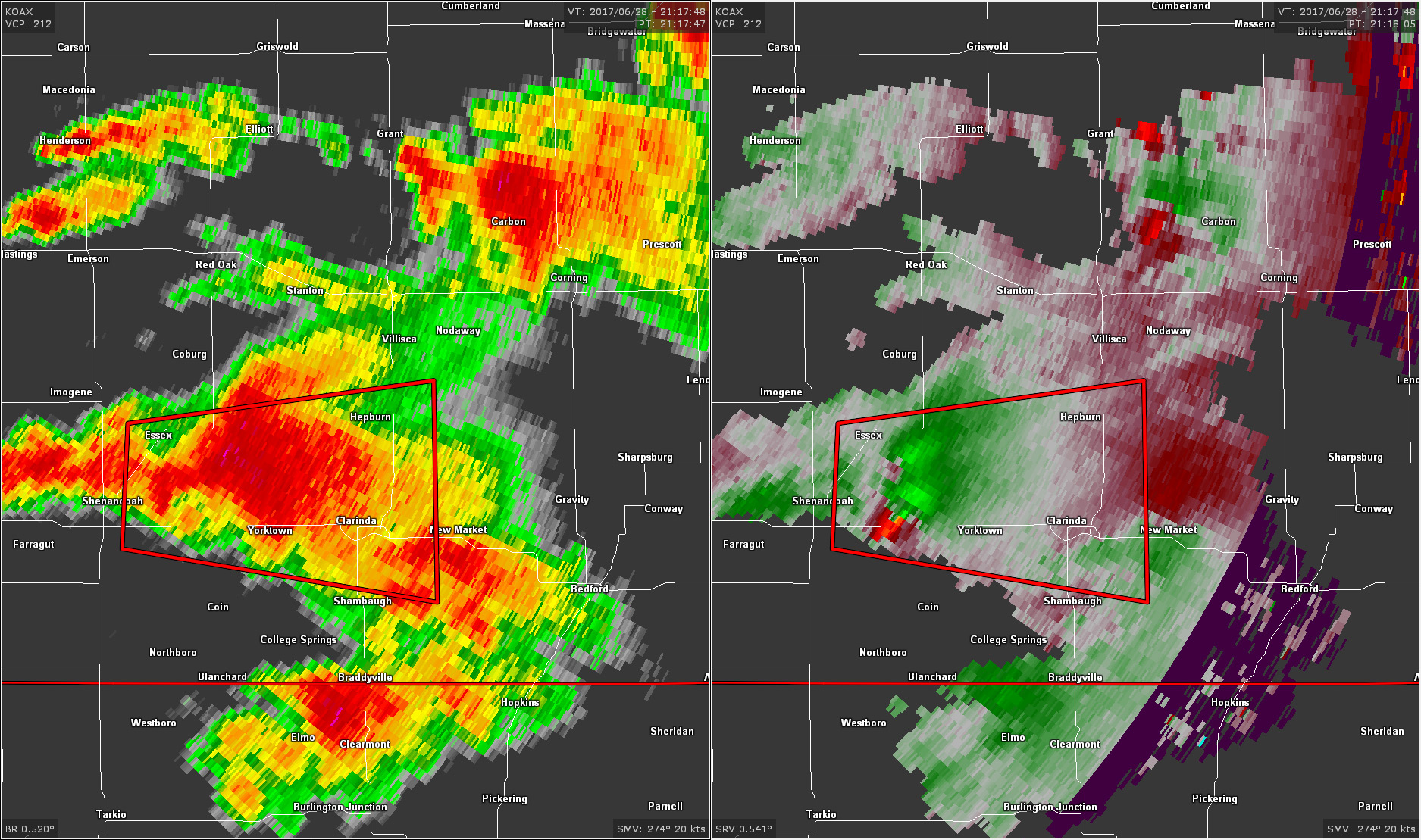
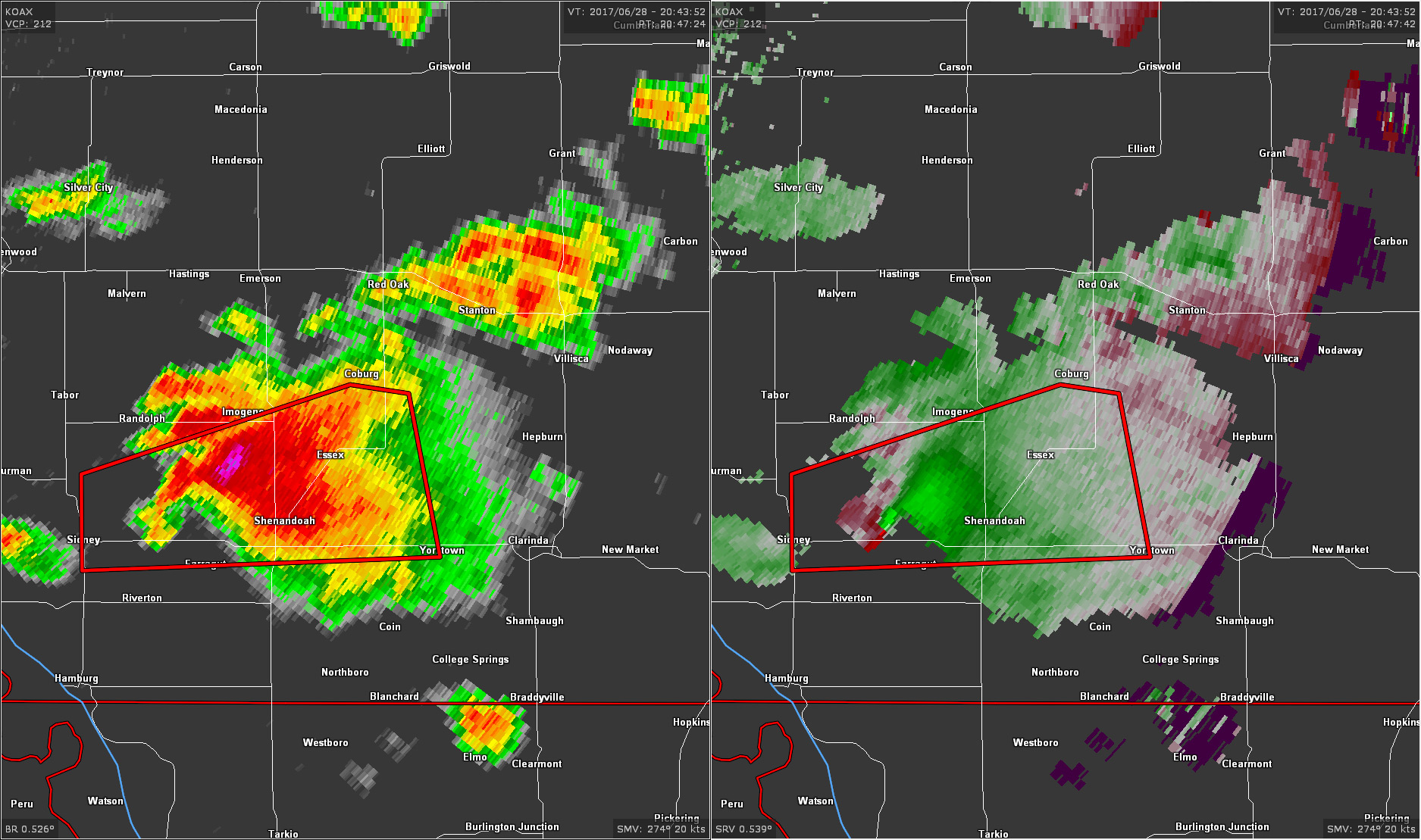
Here's another radar grab for now. Strong couplet showing up right on the highway. Notice all the other storms. I really don't care for that in volatile setups. Dealing with one storm you are watching is kind of simple, given no traffic problems or road problems of course. More on this new storms everywhere stuff in a bit.
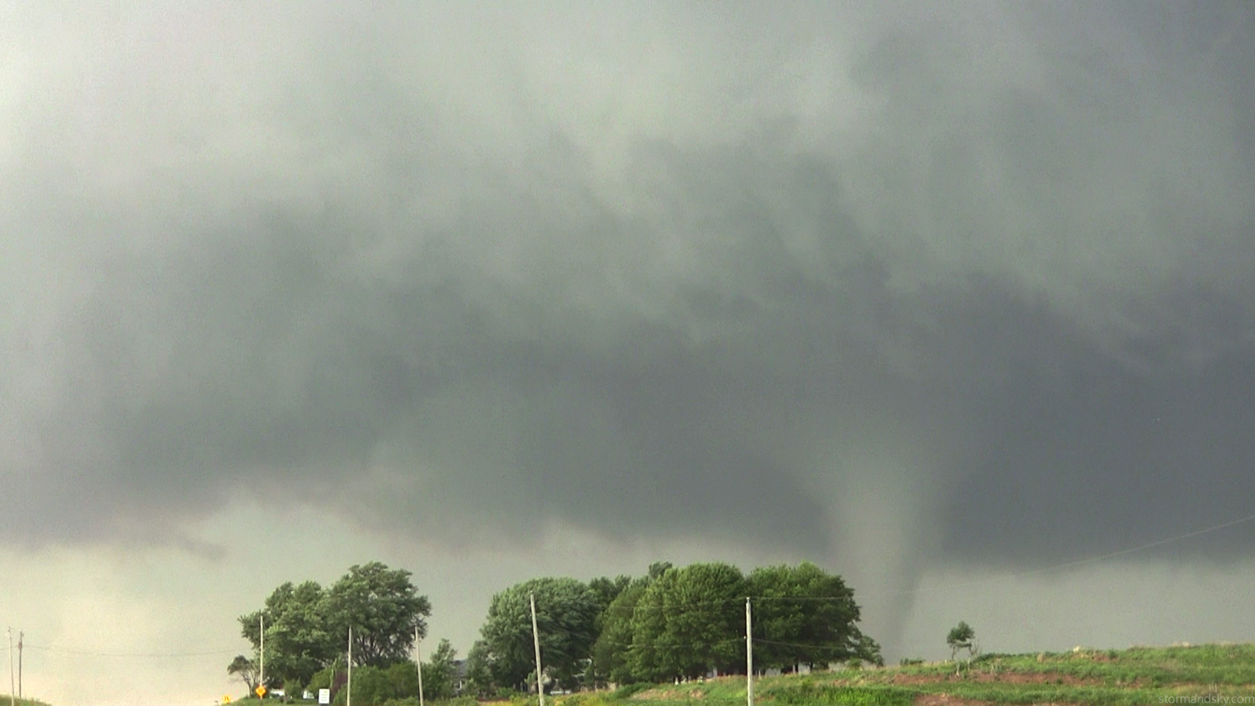
Boom tornado again, stout looking one.
Oh how I hate my video camera. Focus controlled by lcd screen sucks. It sucks even more when it has a mind of its own in manual once you zoom. I'm constantly redoing it to infinity to make sure. Sometimes it stays there even if you zoom, other times it's suddenly at 2 meters out. The one time I did not check it, as I was also taking stills and whatnot. Glad I at least backed it back out for a bit and it was then back in focus.
This storm looked nuts right now. It looked violent but later while watching the video I could see the tornado really didn't. The front of the storm sure gave the impression though.
Here's a wide angle still showing more of the structure. That stuff is intimidating when you are always in its path. If I'm in a situation I'm actually fearful, I leave it. This is like something else. I'm not fearful really I don't think, it's more just stress you can't control. And it stems 95% from the unknowns of the traffic. There are periods when the highway is open, then all the sudden a line of cars to the point you can't get back on the road. Happens all the time in chasing. You eventually can but for a little bit it doesn't feel you will. That's what I don't like. Whenever it's even mildly crowded I really don't like it.
So you are there watching this right now. Nasty storm with a tornado under it. It's quite likely to want to turn a slight bit more right yet than it's been going. So it's very conceivable something even bigger grows under there and is coming across and down the highway soon. Put me there solo with it and I'm half as stressed. Just that unknown with numbers that gets so hard to manage.
It pretty quickly lost its balance. Was still going around under there and moving down the highway fairly quickly now. I could hear this noise that sounded like bad tires on a highway for a while now. Wobbling high pitched noise. I couldn't figure out why it wasn't here by now though. Several cars started to come over the hill about the time I wanted to leave. Suddenly I was in that situation with a bunch of cars and needing to get on the road now but couldn't. Then at the end of them comes this fire dept. off duty vehicle with lights going, and what appeared to be two cops behind him with sirens. They weren't going very fast though. I waited instead of cutting them off but could see his hand waving go ahead. I jump out and only later thought, I wonder if they were making people go.
At Clarinda now and you could see what all the surrounding convection was doing to it now. Very much getting that shrinking cold look now.
At Clarinda I was done with this storm. I could either go east or south. I'm really not a fan of numerous storms erupting close together in a volatile environment, which this very much was. With data sure it's easy enough to manage. But it's totally possible to lose it at the wrong time and wrong place. Get in a core from one thing while something violent is moving up. Say like the Joplin evolution. I thought, I'll drop south and at least get south of everything.
On the way south I could see a new more legit storm crossing the highway and sliding east of it. It was quite apparent it would probably want to do something. At the time I even thought, this is June 17, 2010 s MN right here. Before it was really even going. The one road east had some turns and wasn't a major highway. I thought does that thing even stay paved. I then got to it and saw what looked like 1 lane construction stuff. Was like, screw that. Of course this goes on to produce an insane wedge as it crosses into Iowa. Would have been so easy to just go east at Clarinda before and dropped south somewhere and saw the back of it for a bit. Heck shooting east would have gotten into clear air as easy as south did at the time anyway. Never did see any shots from the east of that storm/tornado there either. I can sort of imagine what it looked like given what mine just did before and mine being the lesser of the things. Quite lucky that thing did not hit any town too. Anyway the above image is from before I reached the east highway just into MO there.
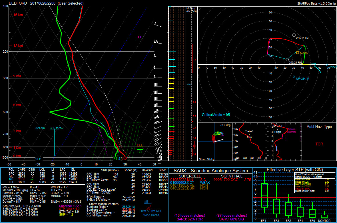
Dug up a sounding from the HRRR model for that area at 5pm. They actually held south surface winds in this corridor. A few were even slightly east of that. Pretty potent. Not surprised there were 30 tornado reports from this outbreak.
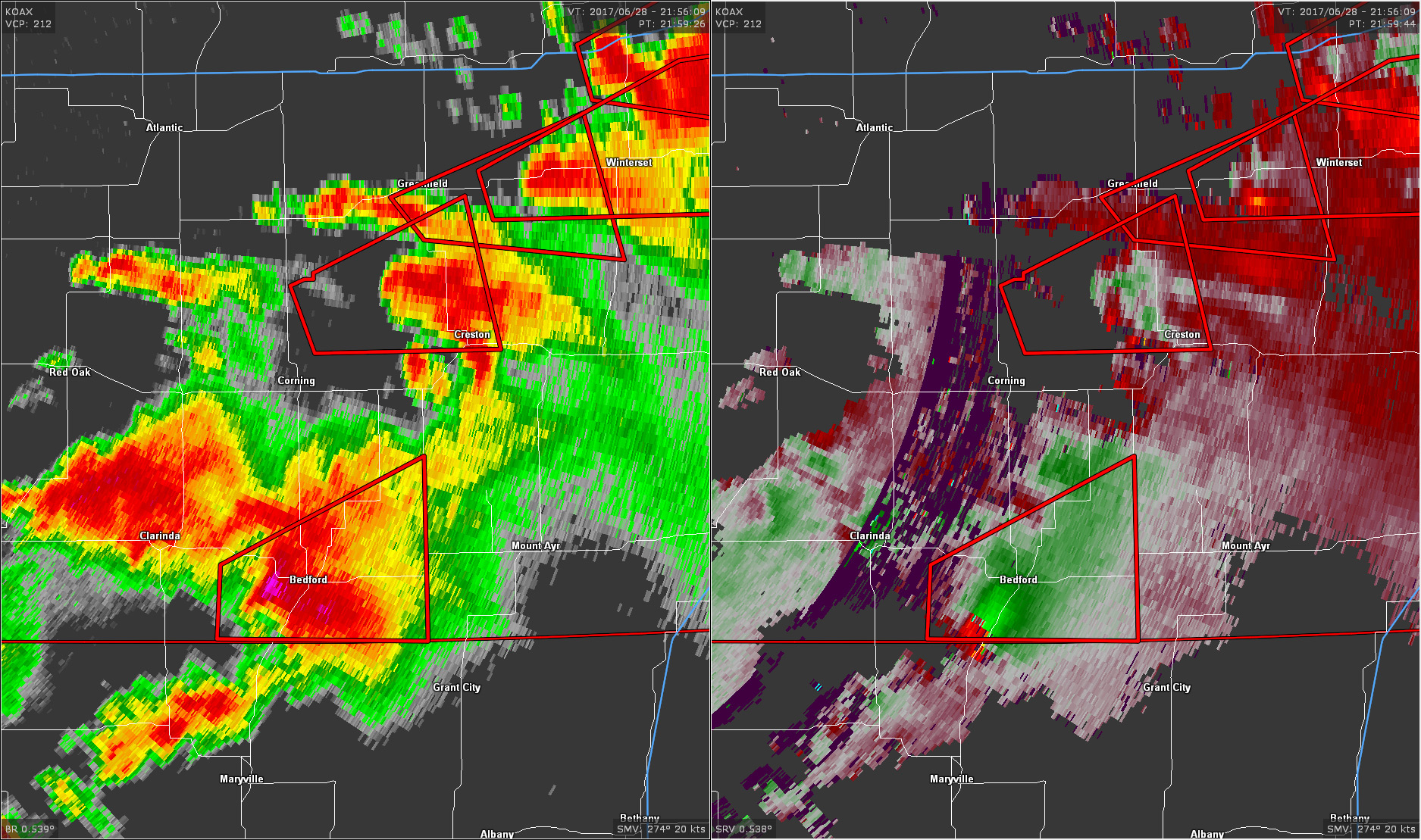
Radar during that Bedford wedge. The base scan from Omaha at that distance is about 8500 feet though.
I'll eventually do something with the time lapse and video. At this point I'm kind of trying to make a short time lapse film from the year. Kind of a bad first year to try such a thing. Need quite a bit more material to even be close but there's time left.
Here's a short looping gif from part of the time lapse.


