June 14, 2013 West Point Nebraska Supercell
Mid June and I just now have a storm worth posting an account of. Wow. Unlike 2012 I can't blame it on the year. Oh well. It's a start but I have a lot of catching up to do.
I drove to Albion around 1pm. Sat there for a while then Steve showed up. A while later Tyler showed up as well. The boundary had slid east of us but wasn't moving very fast or doing anything, so we sat there for a while. Plus there was a chance something could fire to the northwest. While sitting there I discover the insides of my back tires are toast. Should have had an alignment done after we changed the rear shocks ourselves...evidently. Drives straight but eh something is really wrong. Tread on outside still fine. Tread on inside you can't even find the tread bars. Too far gone to even rotate them now. Probably got half the tire life out of those and will now still have to do the alignment thing anyway. Didn't save any money skipping that.
Cumulus field to our east gets a bit more agitated, to the north east of the hot high based storms that had formed southwest of Columbus. We move rapidly north and then east on highway 32. Well we moved north to 32 then saw the agitation getting going so flew east. We reach highway 81 at Madison and begin to think the cu field up there might remain capped. Thought was to then get to storms moving into Columbus and hope they do better entering the better air. I'm heading southeast towards Columbus and see a close tower just northeast of town and the back of something else further up there. Soon one blip was on radar but seemed it had to be past the first tower I could see. This blip was right on the nw-se warm front boundary that was clearly showing up on radar. It was a super easy decision to me then to get to that storm. Crappy part was this was happening as I was entering Columbus, sigh. I had planned to drop south of town for the other storms but now wished I was back up on highway 91! So I drive through town and get east to Schuyler, then race north from there to highway 91 then east.
There were two returns, one better one to the northeast of the other but both at that boundary. Figured something nice would form on the boundary and turn right. I thought maybe even turn southeast on it. Anyway the storm was still pretty lame as I was getting closer to it and just south of it. As I drove east and got southeast of it, it looked mildly better. I turned north on some gravel road north of 91.
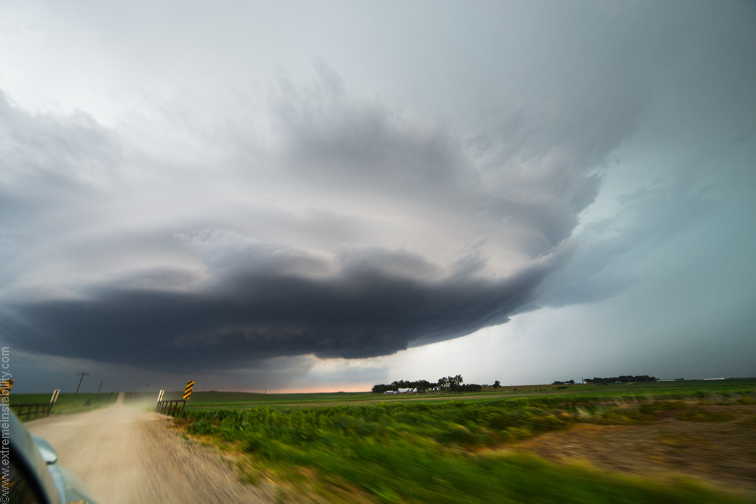
Jumping east on a gravel road north of 91 southwest of West Point. About now I thought, hey this is a start. I figured really this was all the better it would get. Really not good enough. It was pretty humorous about now realizing I've driven 240 miles to get 45 miles from home lol.
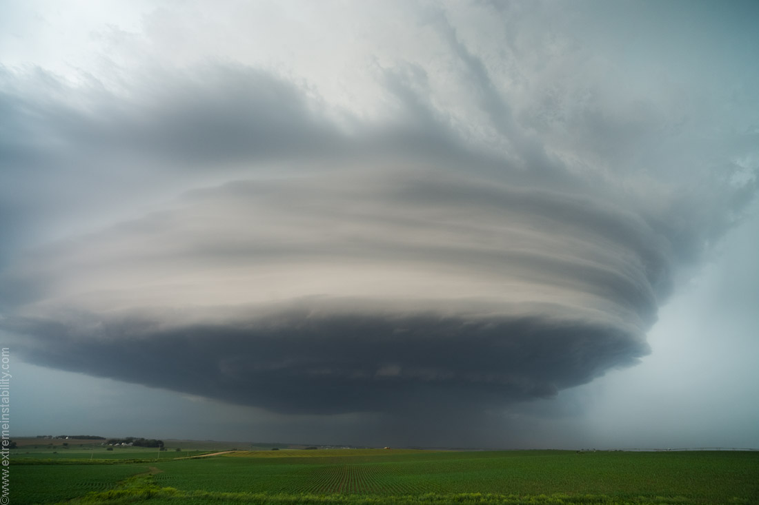
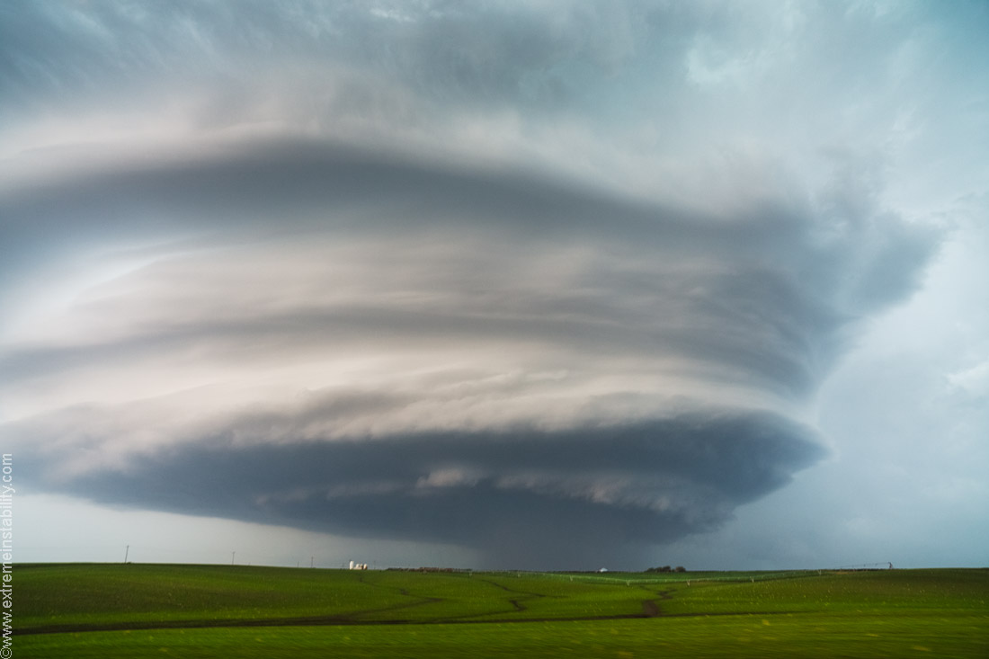
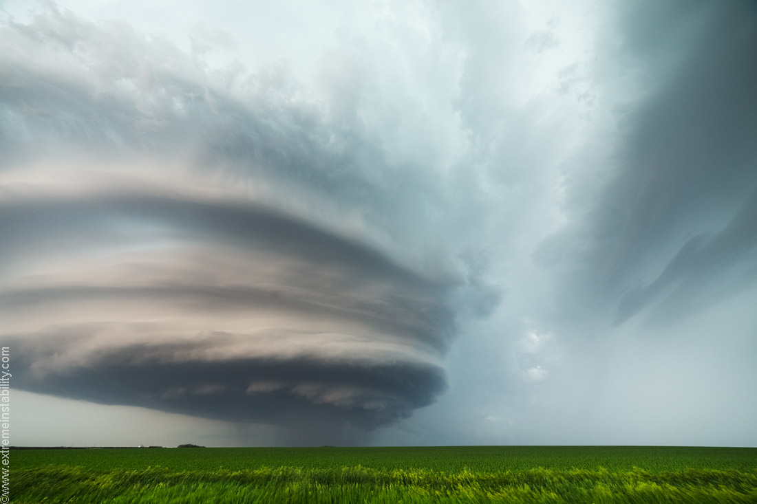
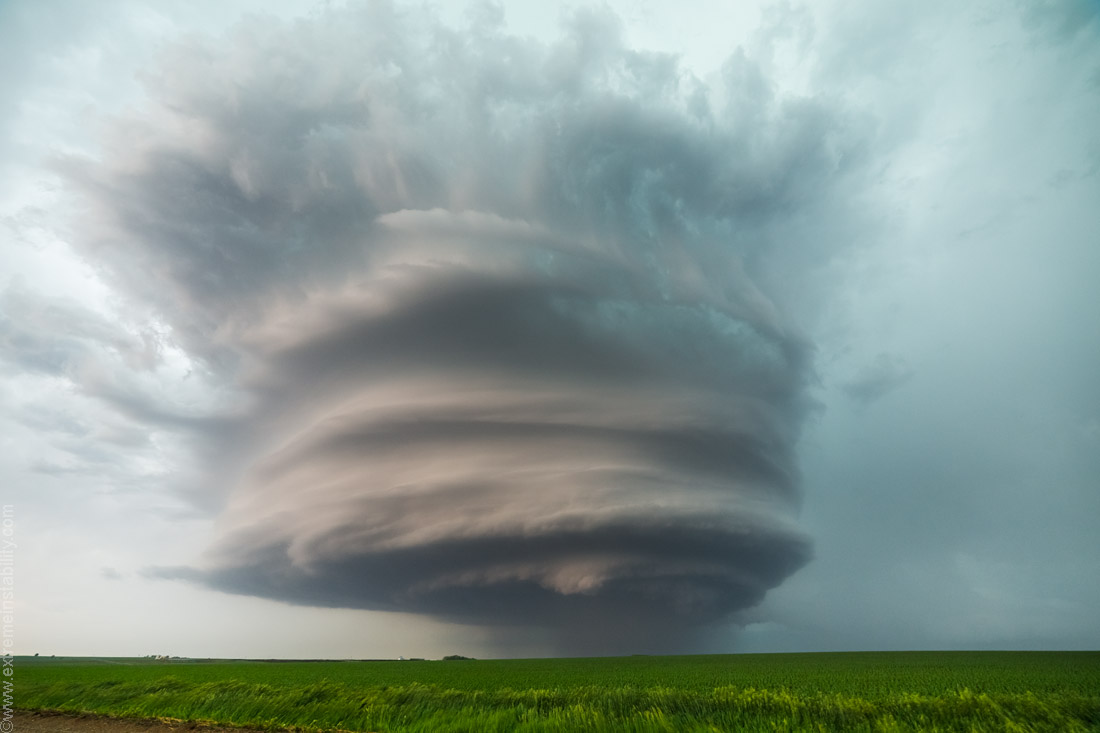
As I drove north in front of it, it got a bit better. Now I thought, hey now we are talking. Somewhere in here I see Brett and talk to him for about 10 seconds. Just north of him was a big ol church. Had to shoot it. Wish I had just stayed there and shot it with the storm more.
I drive north some more. The radar deal showed a whole lot of chasers in the area now. I saw very few and I knew most of the ones I saw. So glad most muck up the highways and loiter there...cept when I'm using them of course.
Wrapped up.
All these were shot with either the Samyang 14 or Zeiss 21 on a 6D. The wider ones like this obviously the 14.

The best looking storm I know of from that area of NE in a long long long time. I live close to here and I have nothing from northeast NE east of Ewing and south of where the highway 12 storm was shot("Katrina") west of Sioux City in 2004. I consider the area a blackhole and always hope to be chasing west of there, closer to O'Neill, as just that change in distance is the polar opposite for me and what I've caught. I've caught the most worthy stuff from Valentine to Ewing area. While biggest void even closer to home between Blair and Ewing.
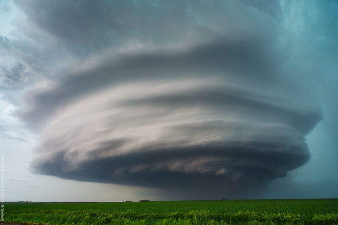
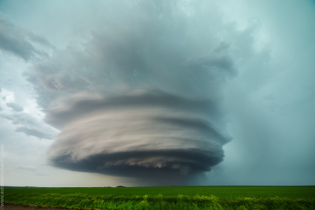
It's just too bad it was going to get overtaken from the stuff to the southwest so soon. Might have had close to 1 hour of being cool though. Took forever to get a tornado warning out of it, which seemed surprising watching it at the time. And once there was a tornado warning the storm wasn't even worth the digital space on the card. I was right there in the area on highway 32 then and it was just a blob. It had a ton of rain in front of it then too, right up to it. I actually drove up into the core to sample the hail but it was lame. It always is when I willing decide to sacrifice all the glass in the car.
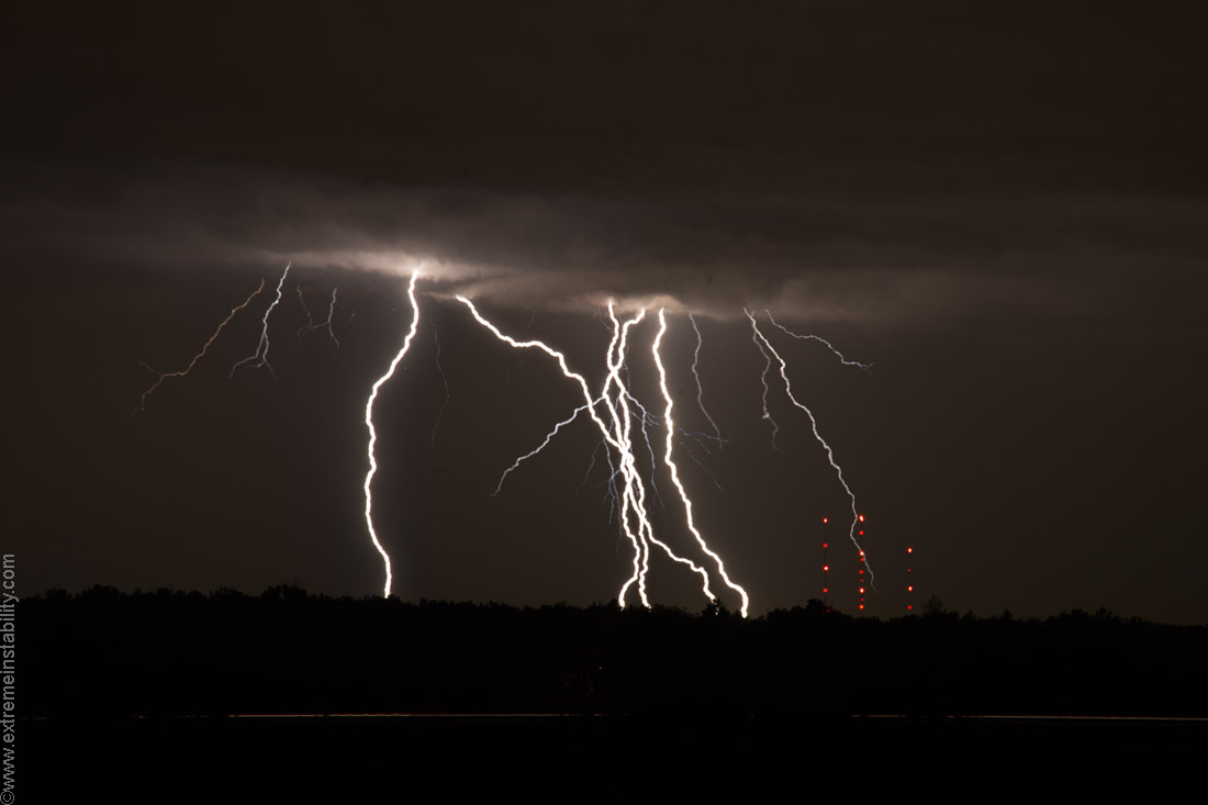
Raced a line home. It looked mean on radar and I just barely beat it to town. Actually tied it. It was amazingly weak though. Then met Randy and Bob to shoot some lightning from the barn. There were some pretty good crawlers. I wanted tv tower bolts so I shot those over and over. Nothing ever hit the towers, let alone rose up off the towers. That amazed me as much anvil activity as there was above them. I wish I had switched to telephoto sooner. I could have plastered this frame with bolts from stacking. This is 400mm. I was at 50mm hoping for crazy upward bolts. Finally after about 50 CGs down there I put the telephoto on, only to kill them about 5 CGs later.


