May 21, 2011 West Point Nebraska Hail and Supercell and Other
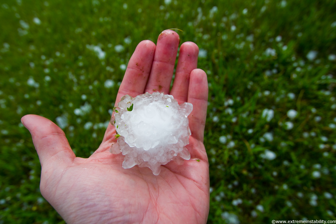
Not a ton to say on this one. It was another cold core setup over eastern NE and found larger hail again. Found these just east of West Point. My search was limited due to lightning from some convection south of the northward moving supercell I was chasing.
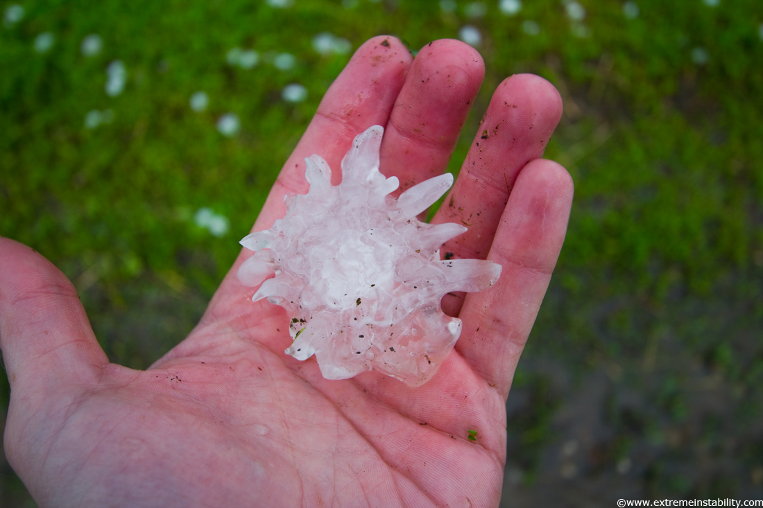
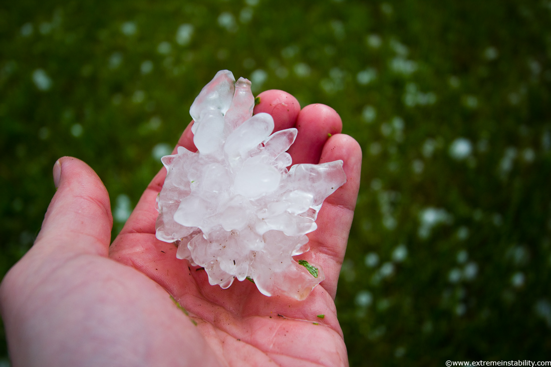
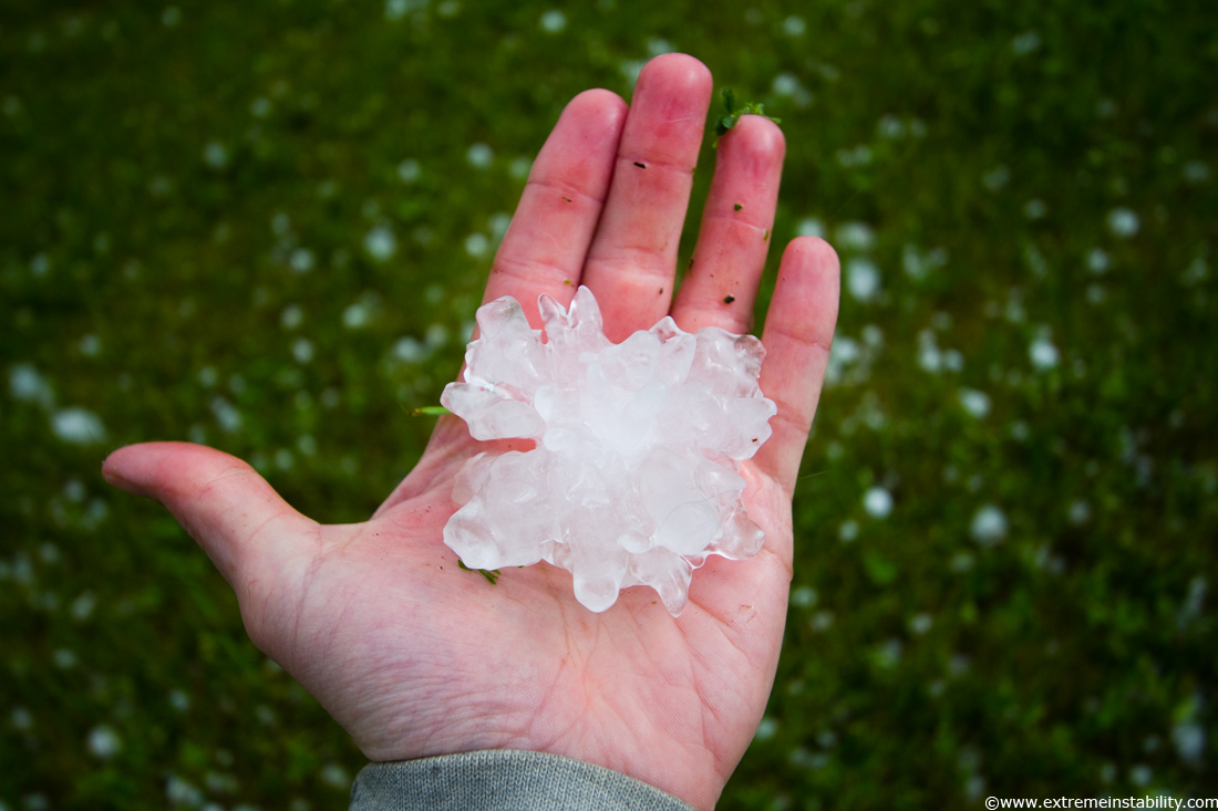
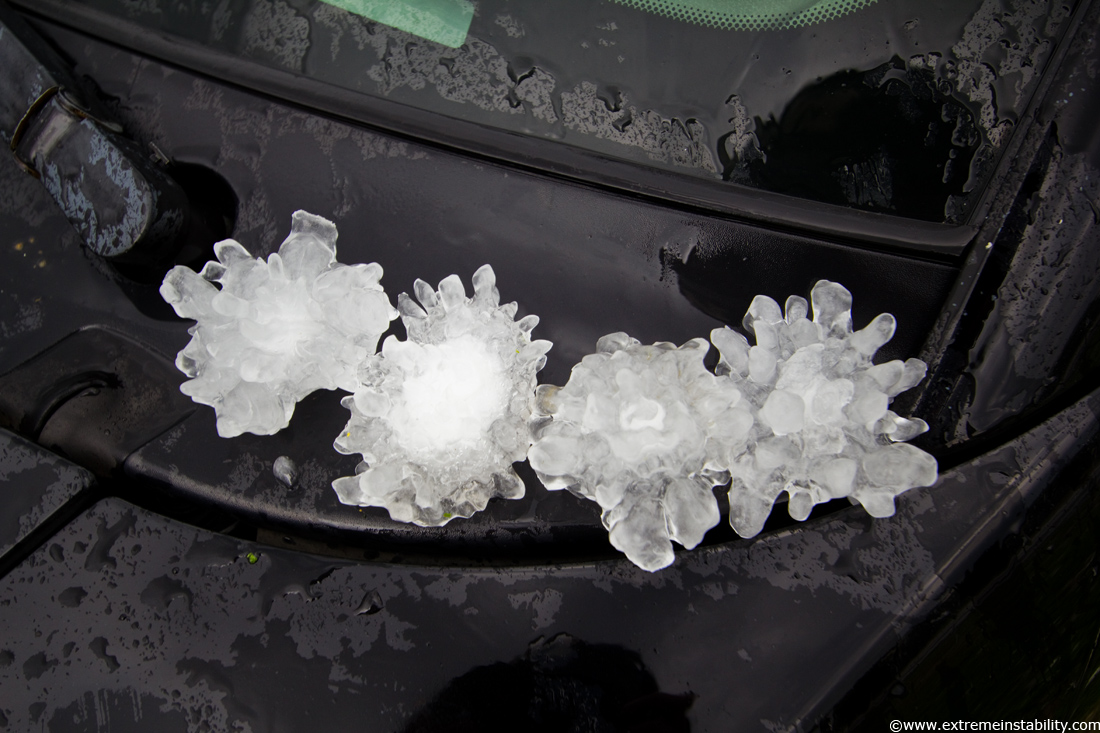
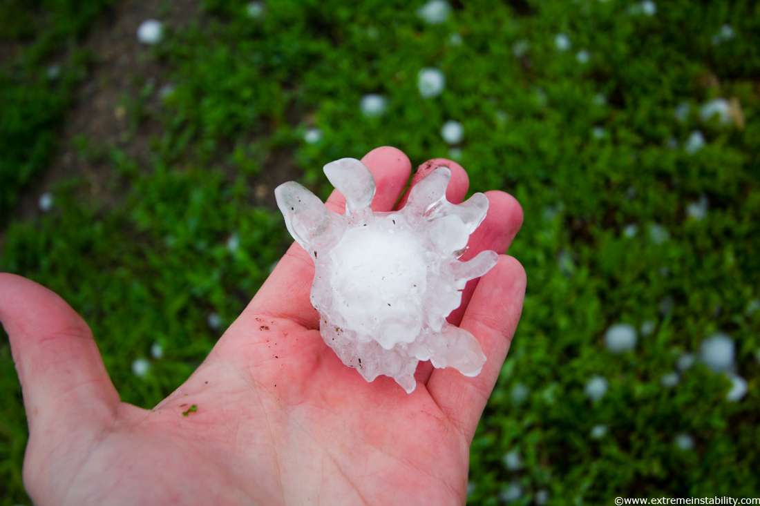
Unlike the last cold core supercell, this one was producing very odd spikey hail.
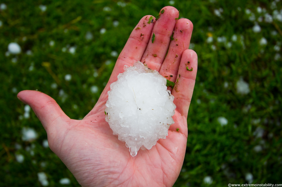
The biggest one I found in my limited search there. Probably like last time and around 3 inches the longest way. I have a cooler with pop and ice on most chases. These two both I didn't even plan to chase, so never had the cooler. Figures find the cool hail both times and would have liked to have had the cooler.
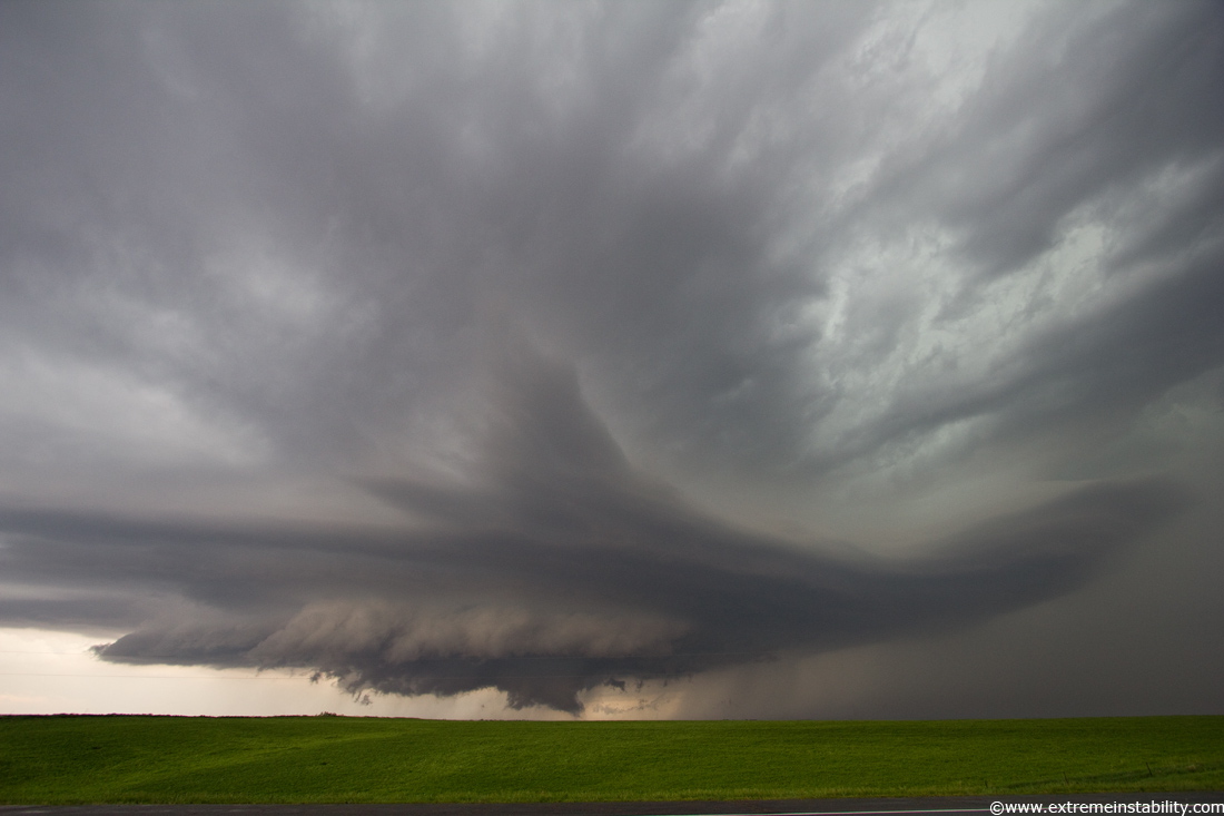
The supercell finally matured nicely and turned right and just about produced a tornado. Here I thought, wow I actually got some decent structure on a day I hadn't planned to chase. Then I see images from Kansas and Oklahoma of amazing supercells. Wasn't exactly a day screaming amazing storms would happen.
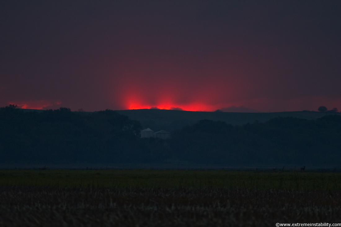
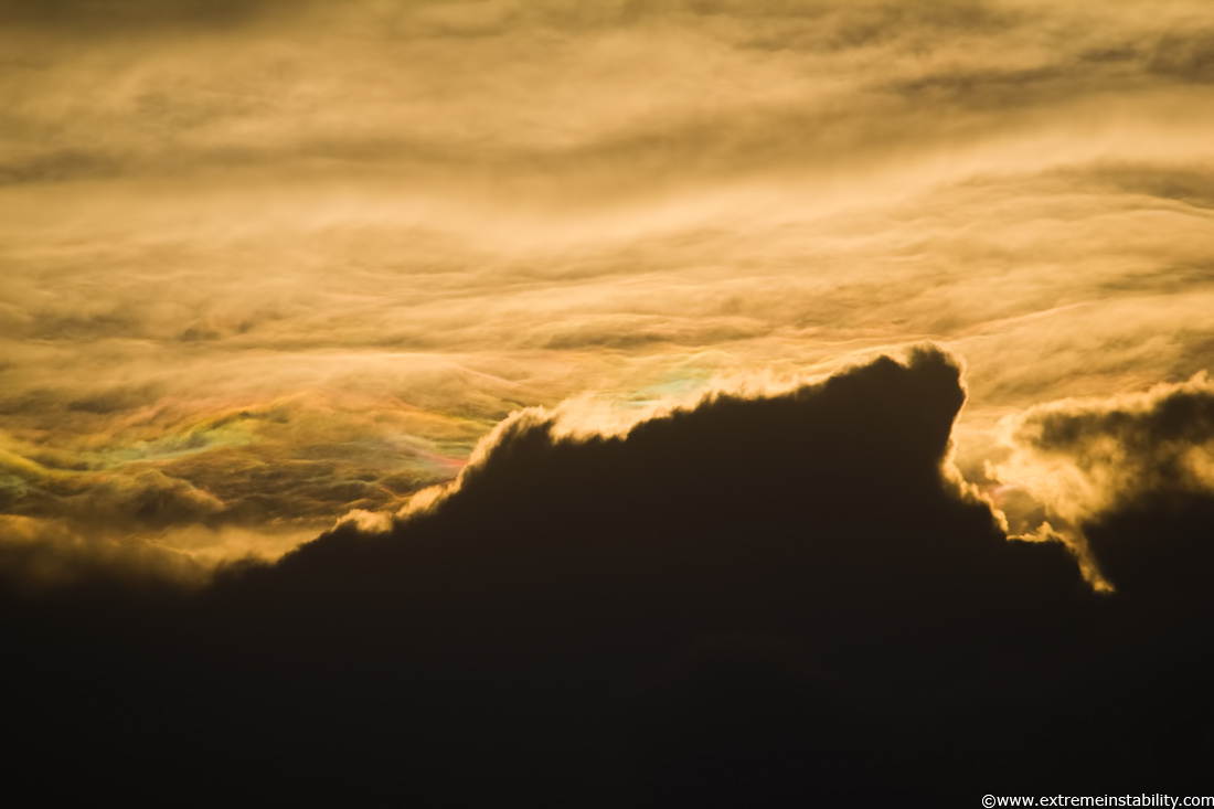
Sunset from back near town. Some crazy mammatus formed over Omaha around now and would have been an amazing twilight subject had I been there. Instead I chase the next three days in Oklahoma and se KS basically coming away from those days with just a nice mammatus display. It's sorta annoying to realize I spent about $400 for those days to come back with mammatus not quite as nice as what happens in Omaha the night before I left. Just a little. Not to mention the other screw ups like missing big time tornadoes. Weeeeeeeeeee.
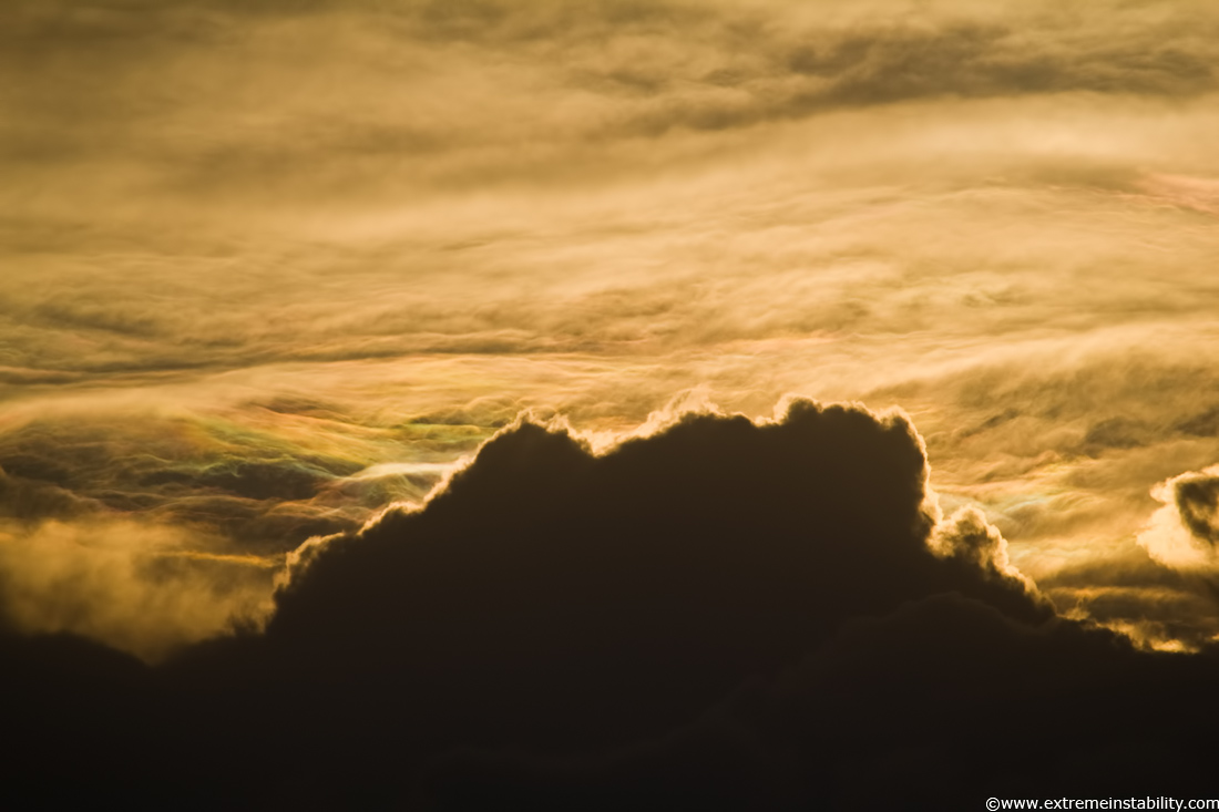
This was on the 24th coming back home, from Newton KS. Iridescence behind an updraft.