June 11, 2008 Missouri Valley Iowa Close Funnel
Well, this was one of those strange chases where I wind up driving 350 miles to see the best thing about 10 miles east of home. I first went south, since I thought I needed to be in se NE somewhere. Plattsmouth's bridge being closed ended that idea. Sat there for a while watching things. Then flew north all the way to Onawa Iowa and watched that storm. It was never impressive. I worried about the southern one that would head ne towards Blair(home). So back south I went. So that is south, then north, then back south....already in the chase. There were lots of radar returns along this cold front now. It was a little tough picking the bigger supercells out just on radar. There were three in the area I could see, the Onawa thing, the southern one near Wahoo, and another heading ne towards Little Sioux in between those. That middle one looked pretty interesting as I dropped back south, enough so that I stopped on I29 and taped it from just north of Little Sioux. This would be the storm that would hit the Boyscout camp.
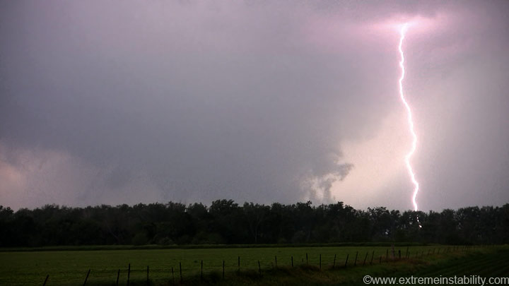
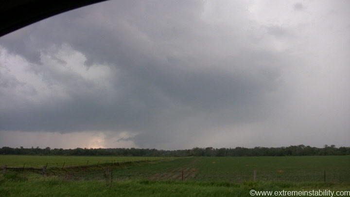
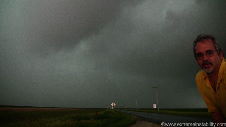
Looking west from I29 near the Little Sioux exit. Oh yeah, most of these are crappy video grabs.
That is not a tornado. I'd be surprised if it was anyway. I couldn't see any rotation and the structure didn't look "tornadic" yet.
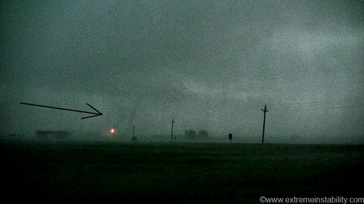
It's a really good look-a-like tornado though.
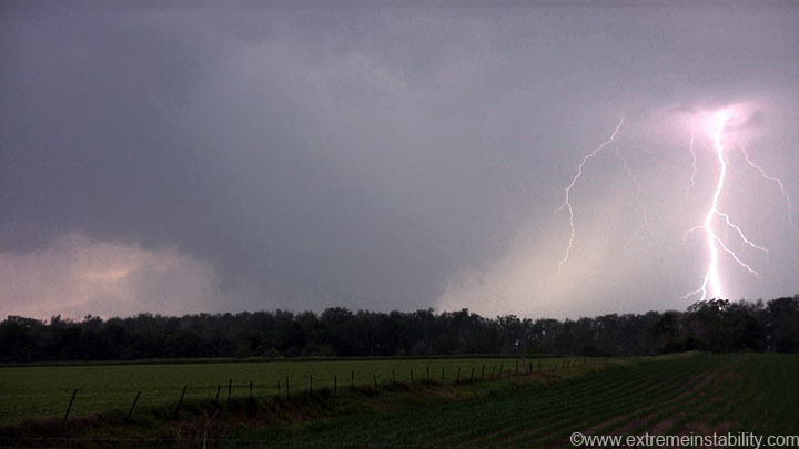
That lowering quickly got cold and undercut looking. I went south and got off at Little Sioux to try and find a place to watch, but there were no easy close spots where one could see anything. All I could see was the linear nature to the bases well sw of this storm. Still worried that southern one was the best I got back on I29 and continued south. I'm sort of glad I didn't see the Boyscout camp tornado. What a sad deal. I was there just last year while trying to find those lakes I could see on my GPS. It amazes me something that appeared this linear and junky could quickly change and produce a tornado of that strength. The couplet was quite strong on the last radar image Omaha got before they got hit by lightning and went down.
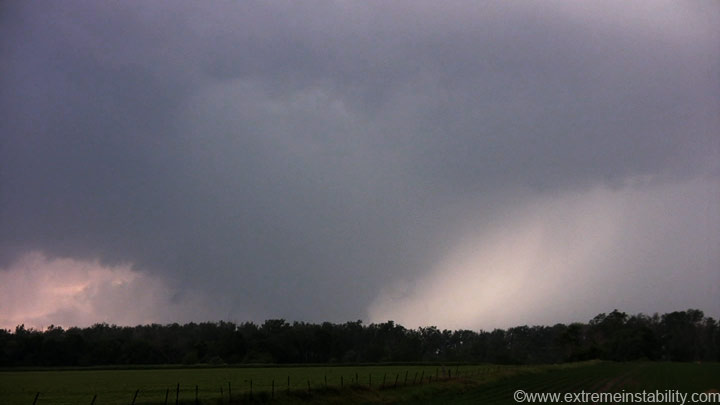
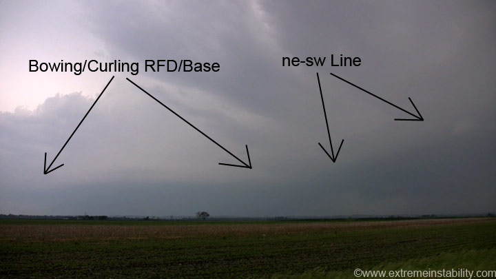
Something that I should have noted more than how long and linear it was south of this, was the fact there was no linear bases north of this "action" area. The main updraft was still up there trying to say, hey, look at me, don't forget me. Sure the lower features can really tell you a lot, but so can that big updraft and the lack of updrafts just north of it.
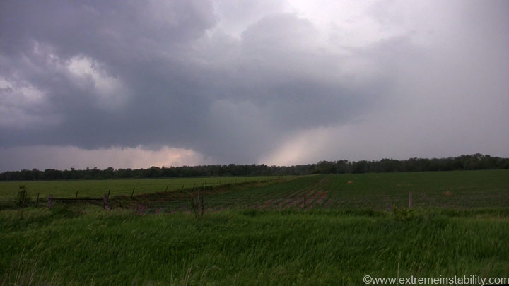
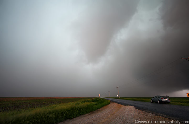
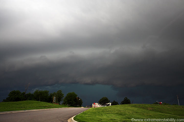
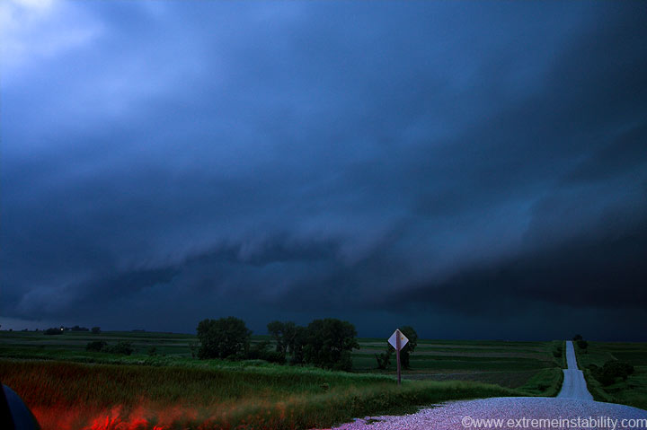
Anyway, I'm now between Missouri Valley and Wilson Island, watching that southern storm approach, finally. I really could have watched the Little Sioux storm for many many more minutes and still been here in time for this, as I waited here for several minutes. I didn't want to rush into NE and try and catch it on highway 75 in the hills.
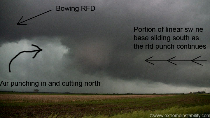
To the northeast of this storm it was as clustered and linear as it gets. Thing was the main storm coming ene had a very strongly arced rfd/gust front. It was really bowing east in the center. This is really common. It just has a hard time producing any tornadoes since that sw-ne line doesn't let the north side of the curl pull back around west and wrap up anything. On occasion though it can get it done, just doesn't happen too often with a big line ne of things. The contrast was "wonderful" as you can see.
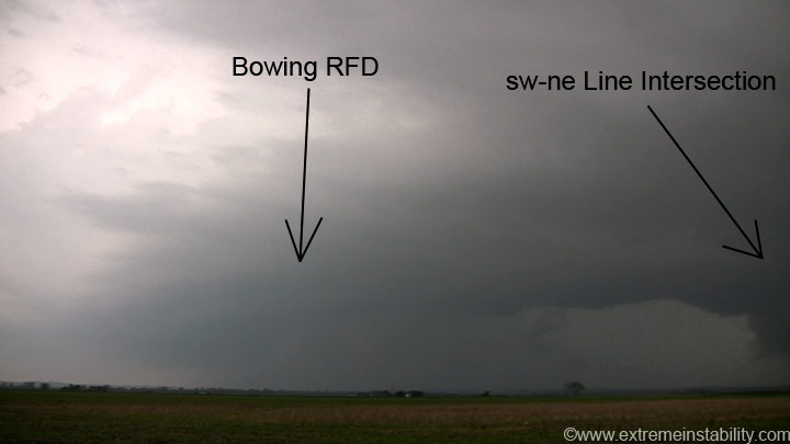
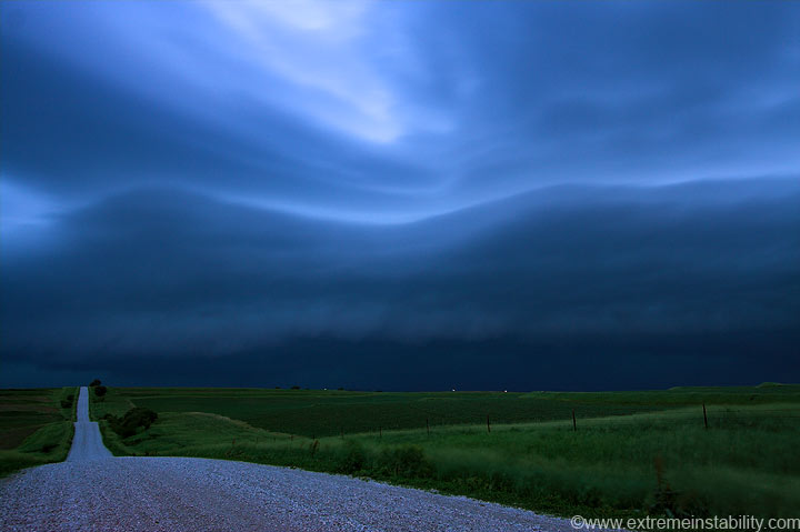
As it got closer it started to get that look. The look like that curling rfd was strong enough to get some separation north of it and control things more than the cold undercutting linear nature to the ne.
Right about now I figured it was indeed going to produce a tornado.

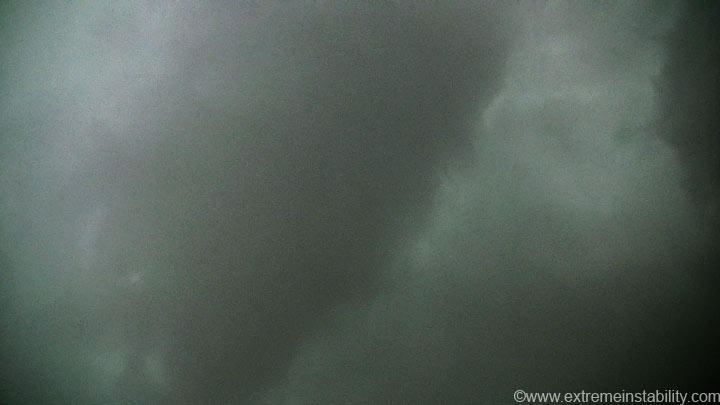
It was pretty easy to see this process unfolding. It's like that rfd cuts in hard enough it starts grabbing part of the lower base/updraft and chopping some out. It cuts more and more, making it bigger and bigger and more and more wrapped up.
More and more cutting as some of that air slides down the ne side of the developing funnel, increasing the rotation and smoothing out the appearance.
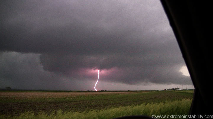
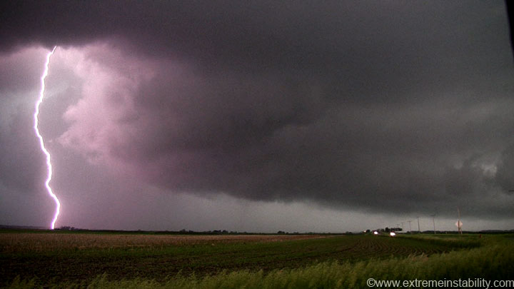
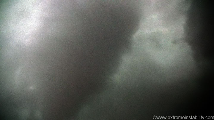
Sprinkles let up just enough I could mount the camera and get a couple still images. This car pulls up, and someone gets out. I didn't know who it was and figured it was some local. I say to myself, you idiot, what are you doing(mostly because I thought it was just a local that would come chat with me at not the greatest time!).
Turned out it was Damon Scott Hynes, a chaser from NE. I was like, dude, you're going to get hit by lightning, since there were already some really close bolts. That or this big fat funnel is going to get us both! The video camera is zoomed all the way out. It wasn't that far away now, but still looked weak.
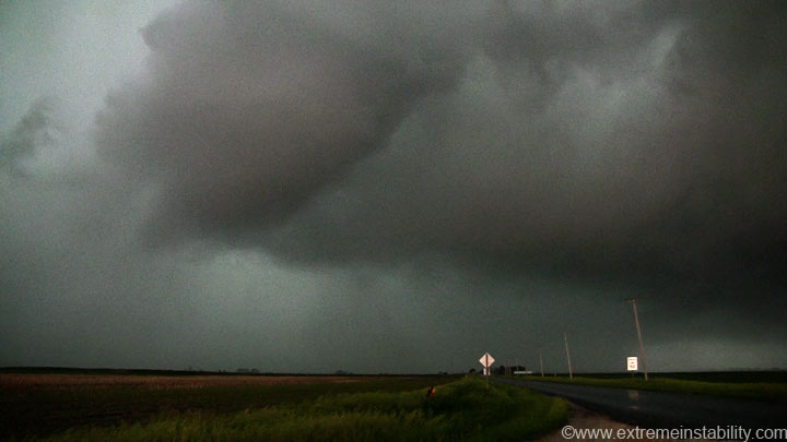
Another ultra wide angle still. Damon now back in his car. Nice seeing you Damon! Sorry I wasn't very chatty.
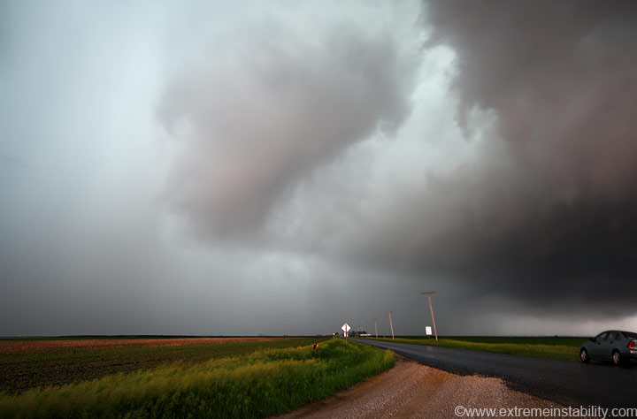
I took the camera down from the window as wrap around rain started to hit. This was looking more upward.
Contrast enhanced.
Now looking up out the windshield. You could still see the tip in the rain, and it still looked weak.
Those two thingies would be directly below whatever was left of that funnel. I don't know what those are exactly. When you get heavy wind blow rain, you can see some odd behavior in the bands. Those sort of stayed in that one area a bit long though.
That punch and rfd cutting would continue and intensify. It was so hard to get back out of that wind and rain. I hopped on I80, which was right by there and went east...once I spotted the ramp to do so(it was horribly hard to find in the rain). As I was doing that a bolt of lightning hit a light pole just in front of me. Wish I was recording on that one!
As I go east, the thing is turning into a landcane above me, as the gust front base ahead of the rfd SCREAMS northward. Southerly winds below and behind it had to be 70 mph. Each hill top spooked me as I tried to get back ahead of it. You could tell something bad was going on just north of I80, since the motion in the rain was so intense from the due south, not west. This would get 3 tornado reports as it heads ne towards Carrol. I could never get back north far enough to look back sw down the notch.
Dark now, and somewhere nw of Red Oak.
This was the storm that had an intense hook as it passed over Offutt. It was a messy line now. I end up in Red Oak where I top off and head back home. I learned it's not wise to talk on the cell phone when getting gas. I took the credit card out, thought I hit credit or pay outside and put it in. It then said pump. After it was done it said something about see cashier, as I waited for it to print my receipt. I just thought it was out of paper. Had I not wanted a pop I would have left. That would have been bad. I ask her if it took my card, just to make sure since I was in there anyway, and she said no, you hit pay inside....and she authorized it. Ooops! I wonder how hard it would have been to prove I thought I hit pay outside and that it took my card. Had I not been talking on the cell phone I would have noticed more of the screw up I think. Thank god I needed a pop and wasn't in a big hurry to chase anything.


