May 22, nw KS Tornadic Supercell
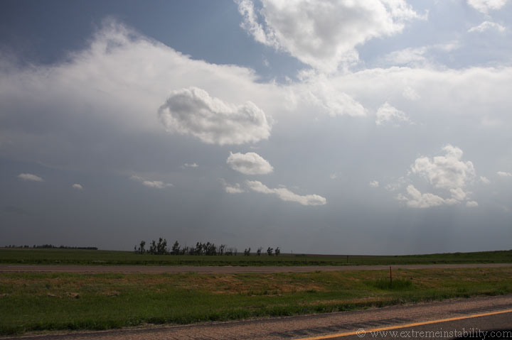
Above is a fresh anvil streaming east off the first real tower of the day(in KS). I'm west of Wakeeney somewhere, not far west. It's nice when the target actually works out and something doesn't pull you away from it early. The target was pretty darn obvious today. Every chaser and their mother would soon be all over this action.
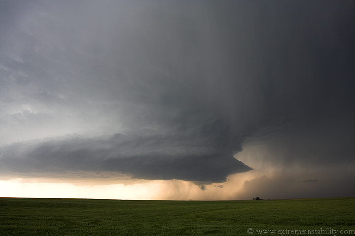
Fast-fowarding a good bit here. I'm pretty much in the exact spot as I was when I took the first picture on this page. There were several smal bases, but two soon dominated. I don't think I'd call the one on the right here the left split, as I'm not sure it was really a split. I think it was just another entity. Which would dominate was the question. The souther base struggled for a good while. The northern one looked good, got a nice lowering/wall cloud/pseudo funnel......but I wasn't feeling it. It looked too small and coolish.
There were very few chasers around when I first arrived south of I70 on some gravel road. I sat there watching this happen for about 30 minutes or more, before moving north of I70 to this spot. I sat here for probably another 30 minutes. While here a bazillion chasers drove by heading north on this gravel road. In my car I wanted nothing to do with precip on anything but pavement. So, I prayed for the southern storm. It worked.

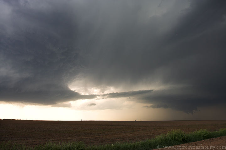
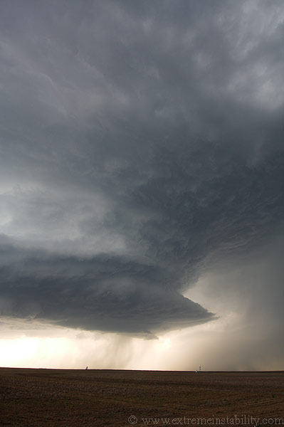
This is the southern storm turning into a beast.
The problem was it didn't turn right enough for me to use pavement. So, I opted to go east first then zig zag to at least stay away from the precip. I was all by myself taking the gravel roads I did(worse roads than the n-s one I was on, but they'd all at least stay dry). I didn't see any chasers again until I got to the highway south of Hill City, where I saw lots o chasers. I noted no real problems with how they were driving, etc, but apparently it got worse after I passed through. My thought was drive north into Hill City then east, to get out aways to get a better shot of the structure as well as get a bit away from everyone.
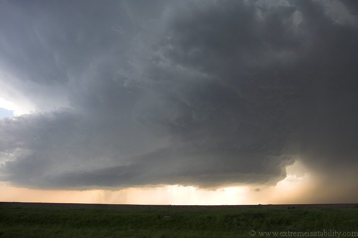
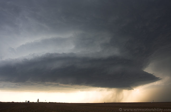
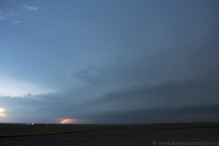
This is the storm as I drove north. It did not look like it was going to tornado anytime soon, so I figured I was doing the best thing I couuld at that time(drive into the rain going north, then back out of it going east). Well I get east of Hill City and I was not getting the view of the storm and structure that I had hoped for. I could actually barely see the storm. All I could really see was rain. The storm wabbled more right on radar as I made this move, which didn't help my cause. I could barely make out the tornado it produces. I'll maybe post some vid caps just to show I saw it, but I'm not even sure that will work lol. It was as bad of contrast as you get. I know it was it though as the report time lined up with this....and I thought I was seeing the tornado before I'd heard any reports.
After it produced its tornado it lost a good deal of its punch and structure. It was also now being rained on by new storms sw of it. So, it was time to find a room and get back out to shoot some lightning. Well I stop in Plainville KS and look up the super 8 number in Hays, to the south. I call the 1-800-800-8000 number and get it, but no one answers. So I get online and book the room that way. I think I'll do this much more often now. I then drop south and shoot some lightning on the new storms to the west.
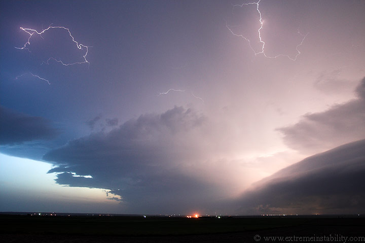
The lightning frequency became incredible. There were a good 4-5 flashes each second, mostly small anvil crawlers.
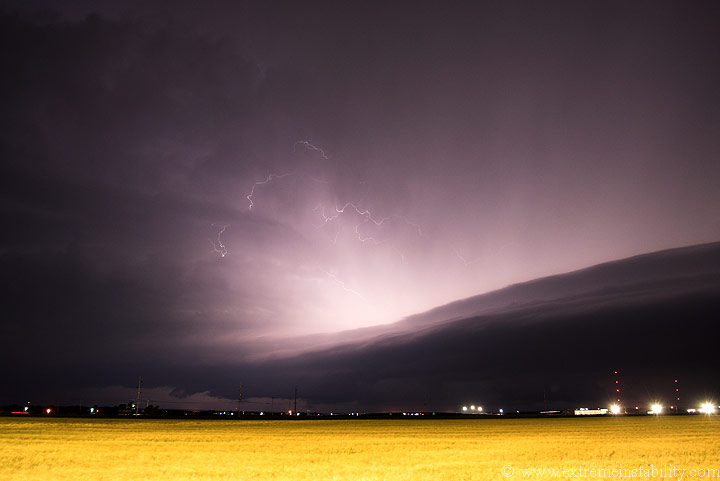
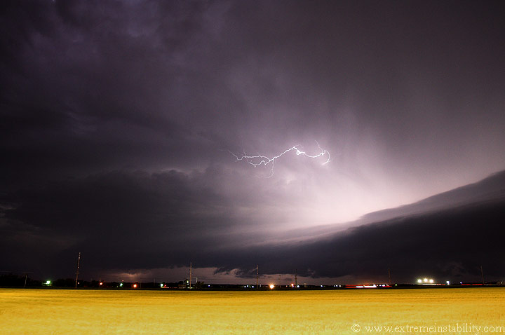
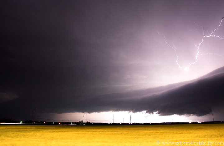
As some rain hits me to the north, I move south to Hays, but stop at the Walmart on the nw side of town, just north of I-70. The scene was pretty cool for photography, with the lights illuminating the field some. I had to drive up behind the store a ways to find a dimmer section of the field. Even here it was quickly wanting to blow out. With the fast flashing anvil crawlers one needs a faster ISO speed to get them to show up well. This just makes the lit up field want to blow out quicker, shortening your shutter speed(which you need some length to get the bolts). To the north side of this, it is your basic shelf cloud. On the south side you have a more sfc based rotating updraft base(or at least a curled one). You can see where the shelf intersects this in the center of the image. At times there were some decent lowerings in there, but they were mostly of the cold outflowy variety.
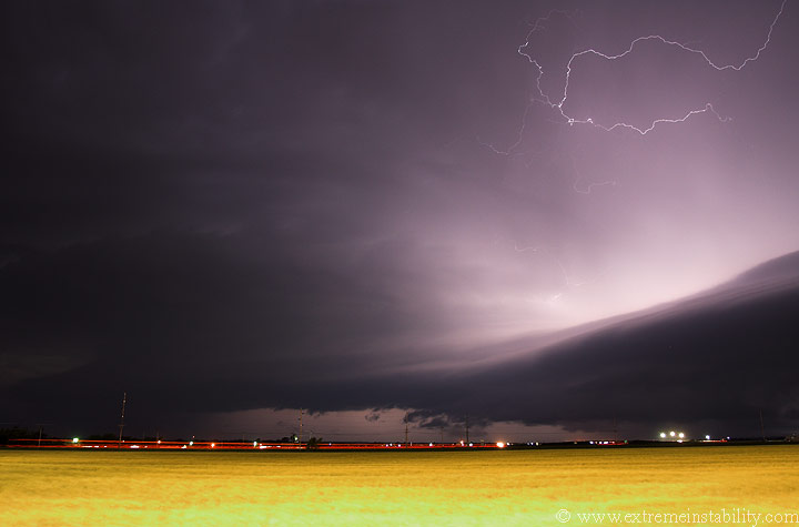
If you have traffic/headlights going by, it's often best to have them trail the entire image, as it just looks better than them going a short distance and stopping. Well I tried, but the shutter length needed to do so was just too much for the foreground. This was as close as I got. You can see I missed the start of them by a hair(far left) as I watched for the truck to enter the shot so I didn't start too early(using up more time than I needed).
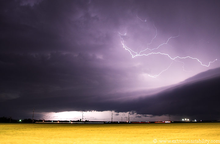
The inflow winds were cranking still. I'm behind the building and still the ese winds were moving my car around. The camera is mounted to my window. Look at the left side of those headlights. See the squiggly movement? My car was rocking at that point, obviously. The further right portion doesn't do that, so you can see right where it began rocking.
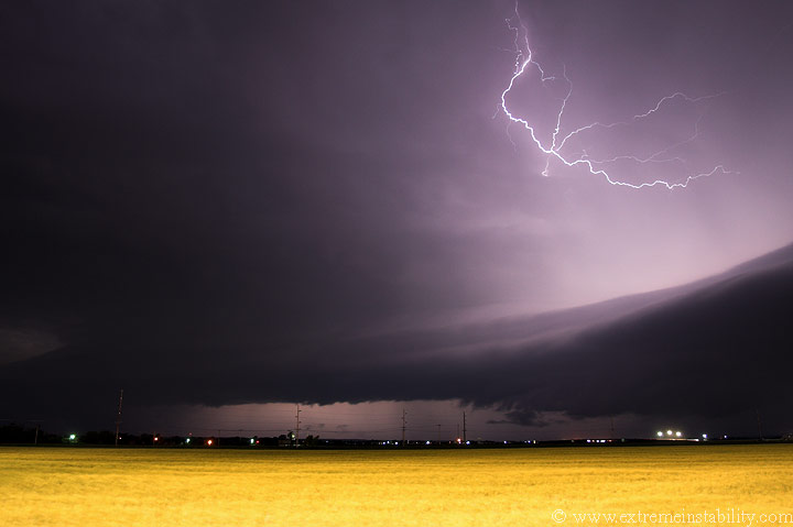
You can see the lowering at the intersection with that shelf. This will kind of work its way sw down the storm. Next the area a bit left of that will become shelfy too, while a new portion to the sw of that will curl east. There wasn't a lot of hooking going on on the radar right now, but shorly after this the tip of a quick hook goes right over this location, tearing up part of the roof of the Comfort Inn and doing other damage nearby.
So, it starts to rain again, ending my photography hopes. I drive the
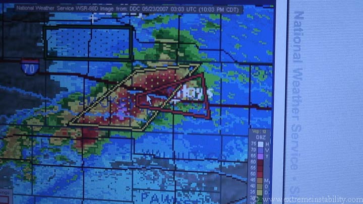
short distance to the Super 8 on the other side of I70. This is the radar
on my laptop at this time. I had been hearing some sort of siren while
shooting stills. Turns out the noise was from a firetruck driving around.
They were also on their loud speaker telling people standing outside
watching to take shelter. I go in to get my room and the desk people say
they are going to shelter. Great. Not wanting to sit around inside, I go
back out to my car and opt to watch/tape the storm hitting from there.
Judging by the appearance of the storm it seemed the torndo threat was
nil.
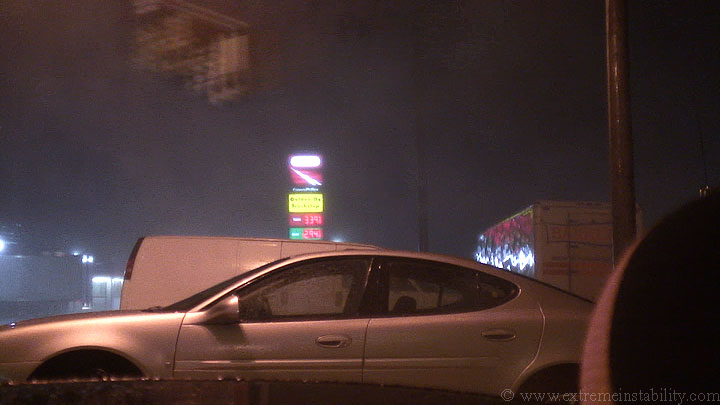
Here is where I was parked. To my south is that car and van. To my north is a pickup truck and other vehicles. Right behind me was the semi seen here as well as another directly behind my car. I was very much blocked in with no real view. Well it starts to rain harder, then the wind picks up some. During this the back of my car starts bouncing up and down a good bit. My theory now is that air was being forced under that semi and lifting out right below my car. The back end of Mustangs are rather light. It was just odd the winds didn't seem that bad yet, but my car was bouncing all around like they were.
Now to paint the picture a little better, there was also some velocity coupleting on radar with this storm. It wasn't moving around, but moving in an easterly line. This was certainly pretty high up in the storm as we're far from all the radars here, but it showed the updaft was rotating pretty good aloft. Then you have the firetrucks telling people to take shelter, something I've never seen before(though yeah it happens). All the chasers that were at that gas station had now left and/or went into the motel. Then all the sudden the shit hits the fan. I've still not figured out what the hell that is in the upper left of this grab from video, above here. It flew by like paper, which is what I thought it was till I slowed the video down.
Anyway, back to the explanation of this. I had just a smidge of warning from this different sound approaching. I started to hear it and said, "oh shit". Before I could finish that it hit. The suddeness of it sure woke me up. Seeing the fast motions past that semi in this image quickly made me wonder, just what exactly was hitting and coming. The video of this doesn't do it justice at all, mainly because I'm so blocked in and gaurded. It looked pretty bad at the time. It's hard to explain, but it's just the part where you aren't sure where exactly these gusts are headed to, that gets ya. The noise of it didn't help either. If I was at the head of a bow echo, I'd have been encouraging it to get even harder. But having that tornado warning in place, the fire department doing what they were doing, then having that give you a warning simply by the noise it was making, then bam it's on you.......well I was glad when the ramp up let off. It was the highest winds I've been in, I'm pretty sure, even if where I was was very much blocked from it.
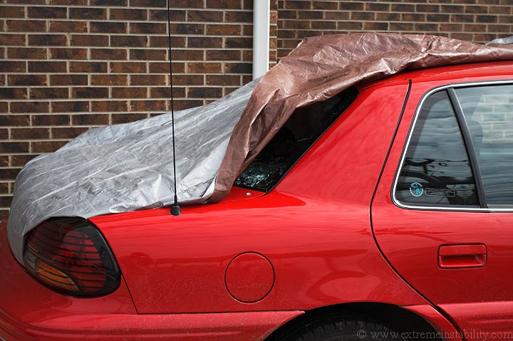
Here is a car in the same parking lot as me. The whole back window is gone. Hail never got large enough to even crack a windsheild, let alone take things out.
Here is another vehicle in the same parking lot. That drivers side back window was busted out.
Another unlucky car in the same parking lot. I'm glad I was parked behind these, near those two semis, or I could have very well had a window busted out too.
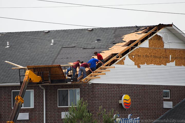
This is the Comfort Inn on the other side of I70 from me. Ouch. The super 8 I was at also lost their satellite dish. I found it in the parking lot of a nearby gas station. The gas station behind me on the west side of the highway had tin torn from the deal over the pumps. I guess some utility trailers were blown through the fence at the Home Depot right here as well. Some chasers reported at least one semi blown over on I70 as well as driving over some 2x4s in the road.


