December 10, 2007 Mound City Missouri Ice Storm Day 1
Well I think it is safe to say this has been my most time consuming chase to date. It was sort of a spur of the moment decision to head south and get a motel. I obviously don't chase winter events as much as spring/summer severe storms. I'll only go and actually chase them if they seem exceptional. So far I'm doing fairly well, since the three I've chased have panned out(November 27-29, 2005 wild blizzard, December 29-31, 2006 extreme ice storm in southern NE, and now this one). Just like spring, I hate wasting money on things that don't pan out. This one, like those others, seemed locked into something bad actually happening, for extreme nw MO, se NE, ne KS, sw IA this time....so I went.
The GFS model hit this one really well, constantly painting a heavy precip swath in this area. It didn't handle the surface temps all that well however, but that was somewhat expected. When I left home, there were several locations along I70 in KS at 30 to 32 degrees, ahead of the precip. The sun had poked out in a few areas though. I was concerned this was a bit warm for starting temps. But, se NE and sw IA were still well below 30. If I remember right, St. Joe was around 26 when I left, while KC was 30 or 31. Temps dropped a hair more in extreme se NE and sw IA. Also, all of KS down into OK was in that 30-32 degree area. So there seemed to be a pretty obvious area of colder air lined up from Between KC and St. Joe on north. I certainly wanted to be in that colder air, as points south of that line were not likely to be cold enough for extreme icing. At the same time I did not want to get too far into it and wind up with sleet, though sleet didn't appear too likely with this storm. Being stuck in just rain was the worst possible outcome, with sleet being a close second(both very boring). I settled on hedging north some, into the colder air just a hair, to Mound City Missouri. Since the strengthening low level jet was prog'd to veer to the ne along this boundary, it seemed likely the low level profile would remain nearly the same everywhere once it started. But, with heavy rain there'd be some warmer air brought down. So, I felt it best to be sure to be cold enough and hope for the "best".
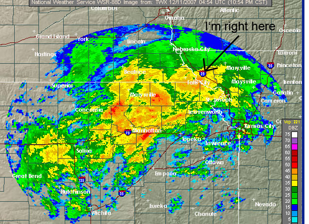
The "best" happened for this area, and I really don't think I could have picked a better spot(wasn't that difficult by the afternoon). I thought the storm was going to be a non-event for a while. The north edge of the advancing precip was really eroding. I was concerned it was going to setup just to my south. That was after I was concerned it was going to move on through and head north. Next thing I know, this advancing area of heavy freezing rain was starting to line up more sw-ne, where it would train. With the veered low level jet lined up in that orientation it wasn't surprising.
The above radar image was around 11pm, not that long after the rain began to fall in Mound City. It setup sw-ne like that, filled in, and rained all night long...into subfreezing air. It wasn't just subfreezing here, it started around 26-27 degrees(not warming to 30-31 till towards the end, the next day....after 2+ inches of rain....Falls City measured 1.98 inches and were not in the radar indicated max). I was like, oh crap, I'm really toast here! It was sort of intimidating seeing how that heavy freezing rain train was lining up.
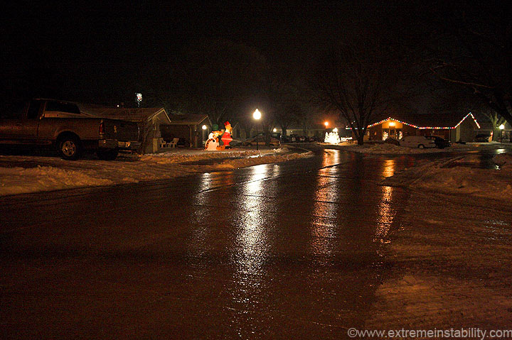
Above is the street next to the Super 8, at the onset of the rain. It was damn hard to walk on at this time. There's ice and then there's this kind of ice. That's the stuff if your street is curved at all, your vehicle will slide sideways to the curb.
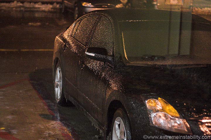
Someone's car out my window. It's pouring at this time.
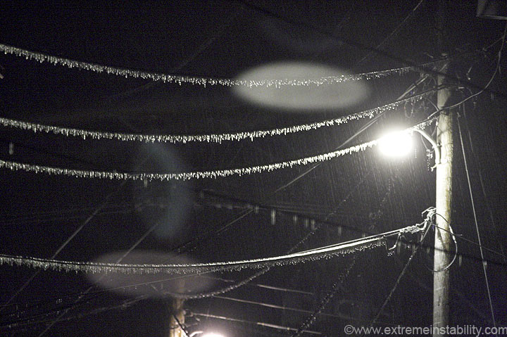
It was interesting at this point, you wonder what the hell is about to happen to this place. You know it is not good. It's a bit strange to see it rain so hard, well below freezing, and to know it's going to keep going for a long time. It's fairly hard to get a setup for freezing rain. It's harder to get that setup to stay put in one location for that long, and to have it be heavy for hours on end.
12:40 a.m.......power is already gone! Not already! This was only about 2 hours after it started. The above was a long exposure taken in the dark out my window(1-2 minutes, I forget). I can't sleep without a fan or some kind of noise. I quickly realized I'd forgotten a battery powered radio again. I was annoyed to hell during the blizzard in 05 when I didn't have power and no radio. To top it off you can put a 9 volt in the clock radio in the room.....if you have a 9 volt. Again, I was pissed something fierce I didn't have a simple thing like a battery. It would have made a world of difference, just having a bit of noise.
I watched it pour in the darkness until about 2 a.m....noticing lightning at times. Around 2 a.m. I attempted to sleep. By now you could hear trees breaking from time to time. The world outside was being destroyed by ice.
The silence drove me nuts, the snoring I could hear through the wall...even more-so. After a bit, the snoring stopped. I layed there, thinking away, my thoughts slowly creeping into a dream...only to be broken by crack..crack....crack....POW. Ugggg....repeat that till 5 a.m. There were times I'd hear 3 branches breaking in one minute. Then there'd be a long pause with none, teasing me and my idea of sleeping before the day begins....only to end with another sudden POW(sort of like a shotgun). All I did between 2 and 5 was what amounted to a small "study" on how dreams begin. It was sort of interesting, at times trying to trick my thoughts into actual dreams....only to have that idea ruined again, by the pow'ing destruction I happen to be chasing. What also didn't help matters was that fact, that I really wanted to watch things happen. I made several trips to the window to watch the power trucks trying to deal with the madness unfolding around them. If it wasn't the power trucks I was getting out of bed to observe, it was when I swore I saw lightning. Anyway, I would guess I heard around 50 branches break during this time, between 2 and 5.
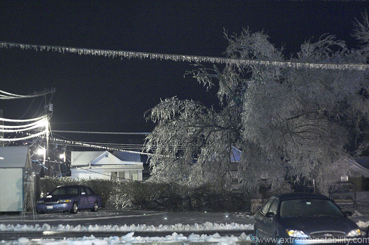
Sometime after 5, while laying there trying to manage some fashion of rest, even if it was an hour of sleep....the power comes back on! This shocked me. I thought for sure I'd be without power till at least the next day. As you can see, that tree is in a lot worse shape than it was earlier. It looked a lot better at the point I lost power(image before this one)....not that many hours ago.
When the power came on I finally said screw it, I'll just not sleep. An hour later and the power was gone again. 7 a.m. rolls around and I'm simply trying to stay awake now. I sat down on the bed for a minute and just about dozed off. I was like, well this is great, now I can't stay awake when I need to. Not long after this the power came back again! From here on out I had power most of the time. This amazed me, but I guess it being right off the interstate, maybe it wasn't far from the main supply.
December 11, 2007 Mound City Missouri Ice Storm Day 2
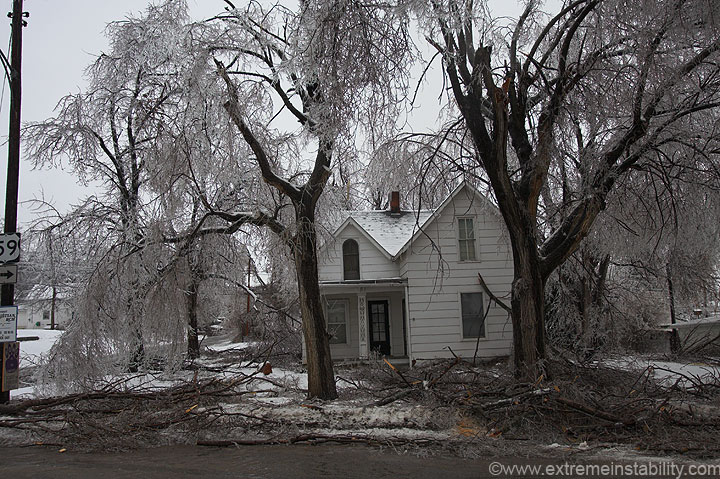
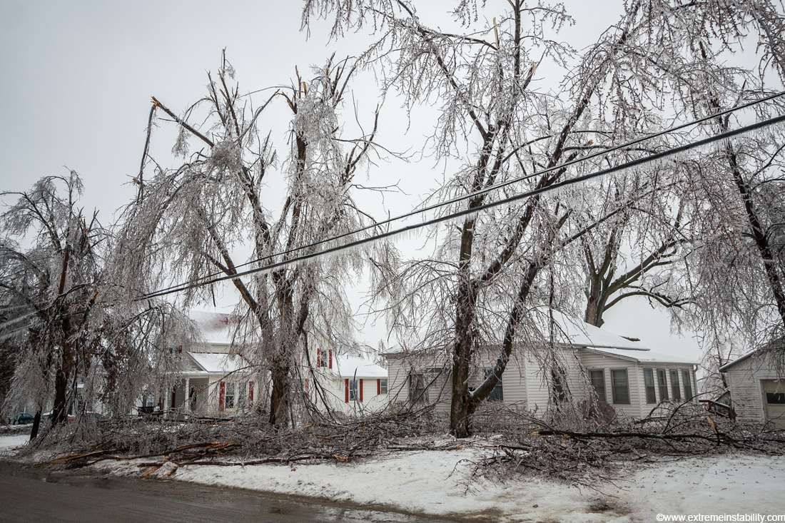
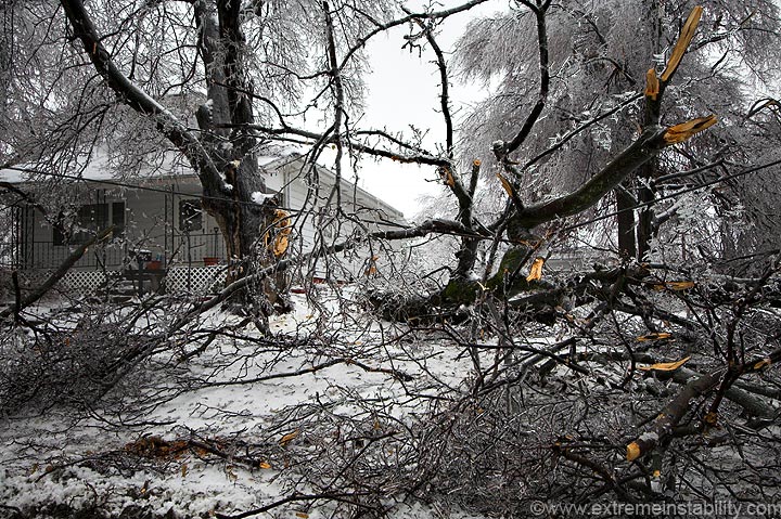
The tree between the motel and the gas station was a good indicator how bad things were screwed up overnight. 10 hours(or less) ago and this tree was fine. It's now trash, thanks to constant moderate to heavy rain for hours on end....at 28-30 degrees. I'm sure I heard each and every one of those branches when they broke.
I drove into town around 9 or 10, but found it rather hard to stay out of the way. There weren't all that many areas you'd feel safe parking a vehicle(things constantly falling all over the place). There were also lots and lots of locals out, looking at their now trashed town. So I made the trip short and went back to the motel for a while.
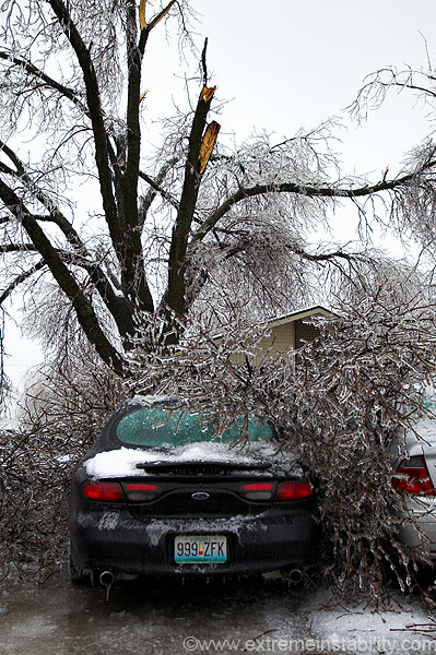
Before going to the motel I stopped in this residential area next to it. While in there shooting a bit, a tree branch crashes onto one of the roofs right next to me. I have a picture of that, but I also have a million other pictures....can't add them all. There were other cars with branches on them in here. One was nice enough to land in the back of someone's pickup, like it was all ready to be hauled off....sort of.

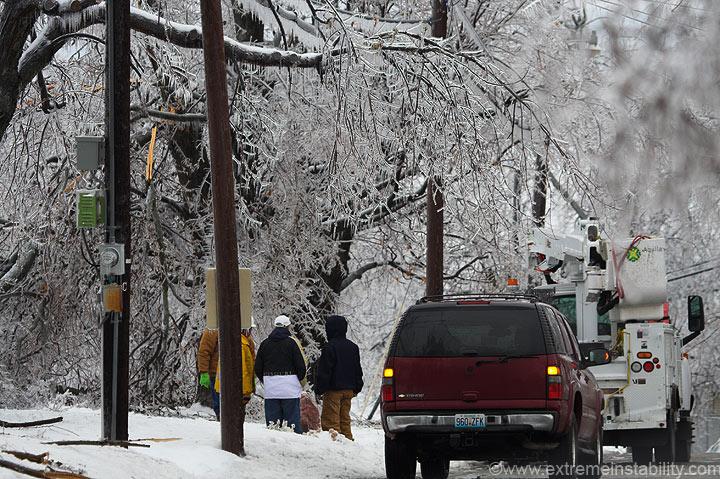
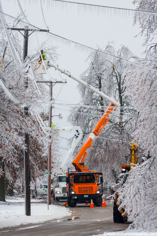
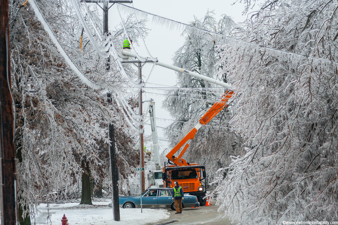
As I park at the motel I hear a loud, short duration "bzzzzzzzzzz" sound. I thought hmmmm, that's not good wherever that was. As I get out and walk I smell smoke, then see the smoke coming from a house down the street. There were already people from the house standing in the street(no stills of that as the camera was in my bag for the trip back in, I did shoot a bit of video though). I think the wire was laying on the roof burning or something. A couple minutes later and the fire dept shows up. I about missed this still of the fireman heading into the house. The image stabilization was not still yet, but I clicked anyway, as he'd soon be behind the tree.
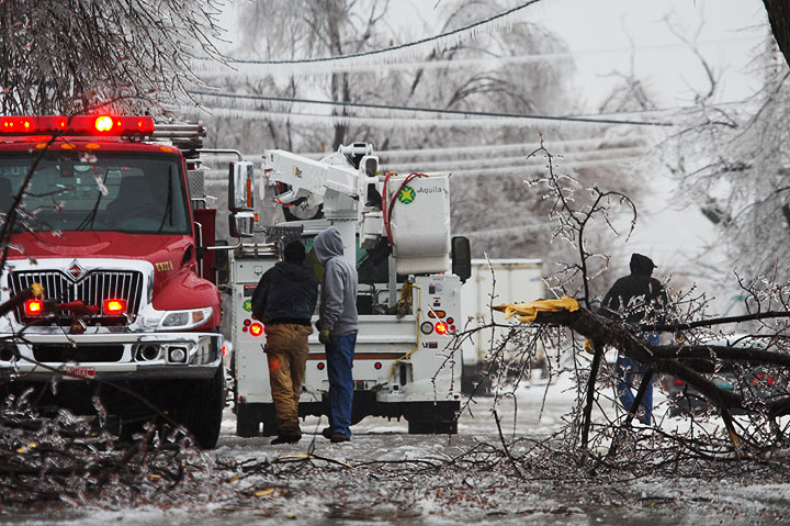
While taking stills of that scene a branch falls on the fire truck(falling branch not pictured). It was quickly becoming apparent just how dangerous the town was right now.
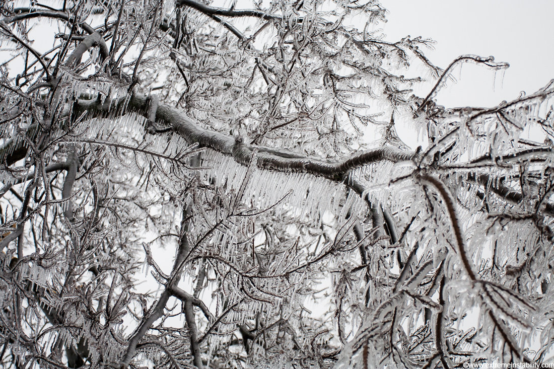
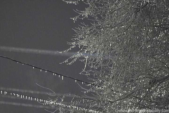
This was taken next to the motel. I've never seen ice formations like this. It's not hard to understand how they form a claw like that. When the branch is horizontal, the ice forms straight down from it. As the weight increases, the branch sags. As it sags, straight down changes in relation to the branch. So the tip of the growing ice curves to keep pointing down. Pretty coo! If it wasn't raining so heavily there'd be no icicles, you'd just have solid ice around the branch. This much in the way of icicle formation makes judging ice size rather difficult. If you could merge all that into one solid piece around the branch, there'd easily be over 1 inch of ice on things. Over 2 inches of rain fell here afterall.
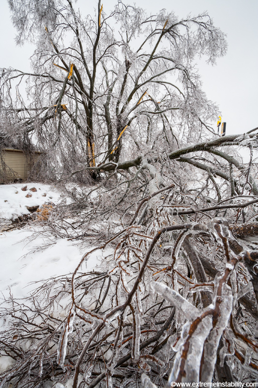
Look how thick the ice is on a couple of the branches towards the bottom of this image. Two branches broke as I was shooting this large tree. If something can be called lucky out of this, it is that there was hardly any wind for the whole thing. Toss a stiff breeze into this storm and things would have been worse than the very bad they already were.
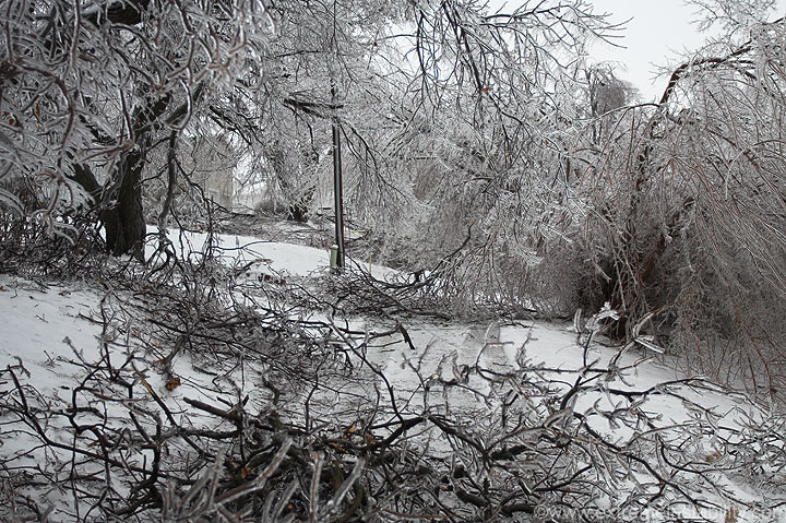
This was my second trip into town, later in the day. I'm looking down an alley between yards(follow the tracks in front of me). While out shooting here(everywhere for that matter) it was not uncommon to hear and see branches fall in the area.
Overtime.
Somewhere on the north side of town...near a church.
Across the street from the image before.
A dangerous job? I saw what was surely a worse one....the postal folks! Can't believe they were out in this. One would think, hey the rain let up, what's going to break has probably already broke. Wrong. It was amazing to me just how long and frequent the breaking continued(even into the following day).
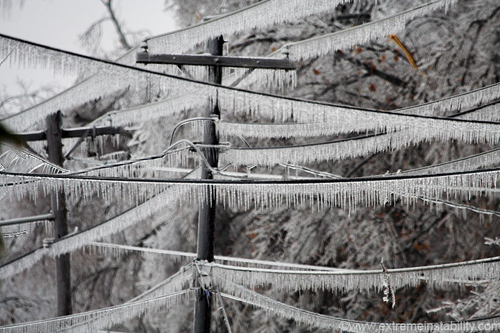
You see all the icicles hanging down from the wires and think, hey that's a lot of ice. Well it's hard to tell here, but don't forget there's also ice accumulated around the wire. The icicles really added the weight though. If you look close you can see all the icicle claws on the trees.

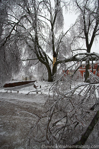
This was a park in the area. Just look at the ground in there.
This ends the images from December 11th. I went back to my room and fell asleep from 4-7 pm. I was doing something on the computer and simply could not stay awake. I hit the bed and could not stay awake if someone paid me to. I was going out no matter what. I then woke up at 7, noticed it was now dark out and figured it had to be early morning before sunrise. It never is when things go like this! I look at the clock......7pm ?!?!?! I hate that, really messes with your head for a bit.
I was staying at the motel a second night because I needed another day to shoot and to drive to other places. It was also still raining some(freezing rain) throughout the day. I don't remember when I went to bed the second time, probably around 1 a.m.
Continue to the next couple days here:
December 13, 2007 Mound City Missouri Ice Storm Day 3 and 4


