June 20, 2005 Junction City SD Supercell
I left around noon this day, with hopes of chasing around the Sioux Falls area. I got nw of there and watched some real garbage. The outflow was well ahead of these "storms". I didn't have high hopes to begin with but I wanted to get into something severe. The very high instability and boundaries in the area gave me some hopes of at least getting blasted by something. It took much more effort than I ever expected. After dealing with these and realizing they weren't going to make it, I started back towards home. I figured perhaps something to the east would get going yet, at the south end of the forming ling in MN. Well it did and I tried to catch it by racing east into nw IA. I got to about Cherokee before it was quite obvious I was not going to get ahead of it. Sigh, I could have been home by now.
So I go back west towards Sioux City and as I get closer convection starts going back where I had come from earlier, in extreme nw IA and portions of se SD. Figuring they'd be beat down and the pulse variety I try to blow them off. I headed south on I-29 and the second I do the one really pics up on xm. I keep going and the next scan is another good trend. I see that right after my last exit. So, after nearly 500 miles with nothing worth even getting the vid cam out on(not even close) I turn around and blast back north. If you give up on the day it will usually come back to haunt you. I gas up on the north side of Sioux City and note the now strong se winds there. Good news!
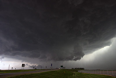
These images were shot near Junction City SD. On xm radar right now it looked like a tiny tiny intense bow forming, but was really one small hook and another larger hook getting ready to form west of that one. I never saw those on xm, but looked at archive radar images today. So I'm thinking bow and just wanting in the middle of it. I go back where I came from, to the Vermillion SD exit on I-29(Junction City). This is looking straight west. It is right in this time frame that it forms the strong/large hook and plows sw.
This lowering gets more and more pronounced, as does the structure. I'm thinking bow and seeing supercell structure forming out of this thing. I was like, what on Earth is going on here, as it isn't every day you see this linear mess rapidly forming into a supercell. It is pretty much a supercell now! You can see the lowering and rfd cut here.
I'm getting in intense winds at this time, with sand and dirt pelting the crap out of the north side of my car(as I am pointed east). Parking at a city maintenance thingy with sand piles likely wasn't the smartest thing to do.
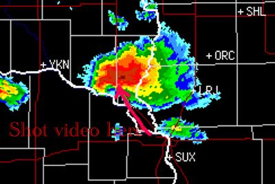
Radar during this timeframe.
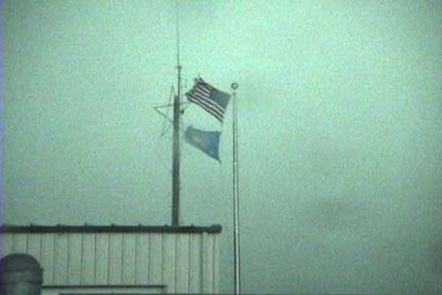
Flags ripping in the wind. The winds were more or less from the due ne.
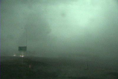
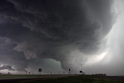
This is looking west again, torwards Vermillion, as the dirt is now off the ground going to the sw fast. There was no hail or rain yet.
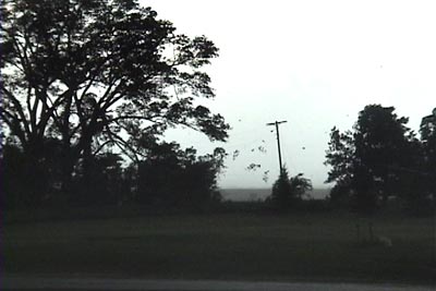
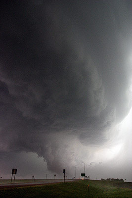
Here is the biggest regret of the day. Rain is now mixed in with the dirt and getting harder and harder. Between the dirt and rain I wasn't able to mount my vid cam to my window. I wanted to take a couple of the stills you see abov,e so I had no choice but to set the camcorder down. Right when I do this those trees start shredding badly. I grabbed it as quickly as I could but miss the best part. That whole area on either side of the phone pole and twice as high as the pole was filled with tree debris. I was like, "holy cow!!!!". I say that too many times on video. I probably got 6 minutes of high wind and meso shots from this location, some pretty cool. The first really high gust that was shredding those trees was easily over 70mph.

I thought it would go more south now and never stopped to think maybe it'd go sw. I wish I would have because I spend the next 2 hours trying to get back infront of what was left of it. I should have just stopped off the interstate and took some stills of it at this point. I'm driving south on I-29 in this image.
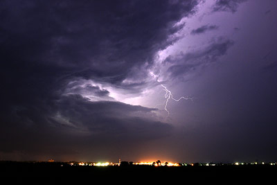
Still severe nw of Wayne. The lightning was very frequent but mostly blocked by these lower clouds. I noted many anvil zits on the drive sw.


