July 12, 2004 Bartlett, NE Tornadoes
Tornado warned supercell on the NE/SD border north of Spencer. It's dropping baseballs at this time. I sat in this very spot, 2 miles nw of Spencer NE, for at least 30 minutes.
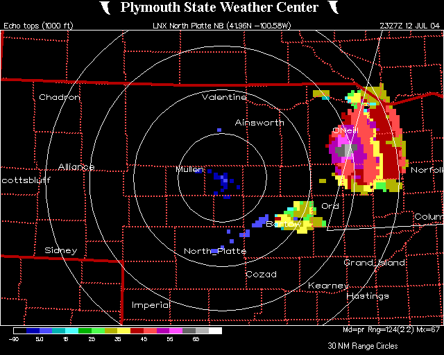
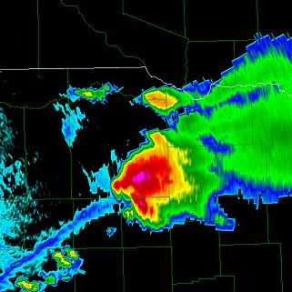
You can see the storm I've been on in the upper right of this radar grab and the new convection near O'Neill to the south. I'm on my way south to O'Neill at this time.
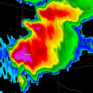
Now there are three due to the left split off the O'Neill storm. The split flies northeast into the storm I was on. I beat the core of this split, but just barely. I also beat the core of the O'Neill storm, but it was even closer.
I'm now driving southeast of O'Neill not knowing what the O'Neill storm wanted to do yet, as it just formed. Notice the split has now merged with the storm I had just left.
I beat a nasty core with the O'Neill storm. It was dropping baseballs the second it went up it seemed. I had no idea which way it was to move, and had to assume se like the north one...wrong. 1 hour later I get back closer to it, after messing around on gravel roads in no mans land.
Convection south of it was concerning me. But looking back at the O'Neill storm you could see it was a flat out bomb of an updraft. The winds aloft were not supposed to be very strong this far south but it really didn't matter when it started to ride this boundary ssw.
This is now much later, after my 'road trip' through the sandhills. This is the new updraft just south of the big O'Neill storm. The north storm was really looking good yet, with a ground dragging tail cloud. The views flat out sucked during that hour or so drive to get back west and south. I should have went south in O'Neill, but ah well. When I get to this view I have lost all views of the northern storm. It was really close to this storm and they basically merge here.
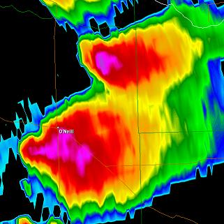
You can see the very first storm is now gone and the O'Neill one is growing, as it's latched onto this boundary.
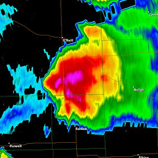
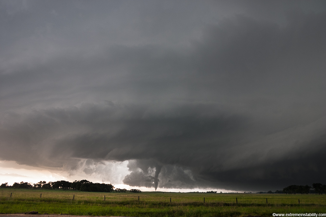
See this tiny hook to the south here? That is the new tower which produces the Bartlett tornado. The O'Neill storm is merging with it as this happens.
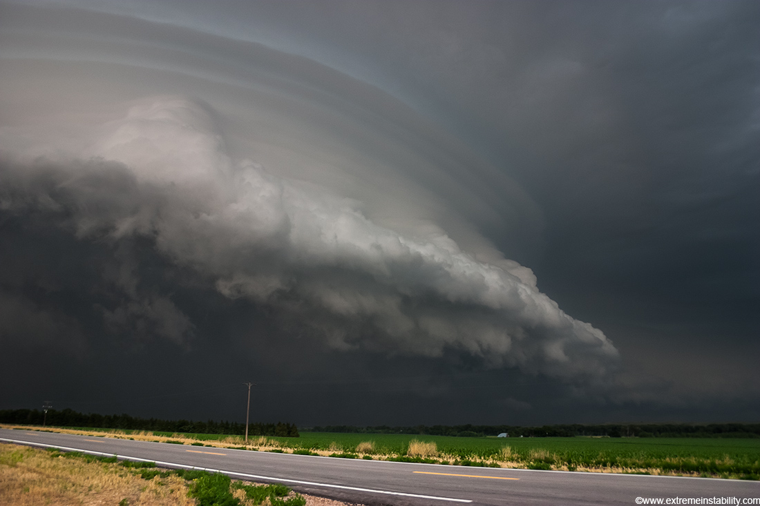
This is just north of Bartlett on highway 81, south of where it meets highway 70, looking wnw. This new southern updraft basically eats the storm north of it. Well I guess you could say it chokes the north one off and the precip cooled air from the north helps enforce this e-w boundary on the new storm. Somewhere around this time frame the storm tops are reaching 65,000 to 70,000 feet.
It is nice to chase somthing that is barely moving.
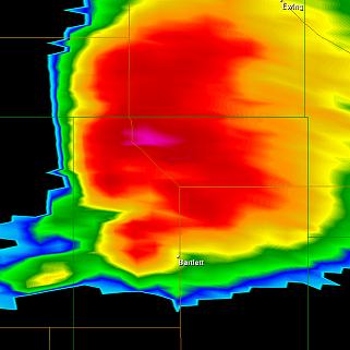
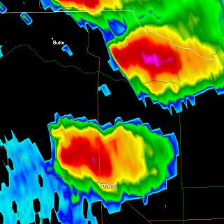
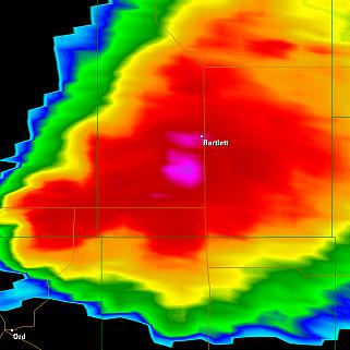
The time on the radar grab is 7:06.
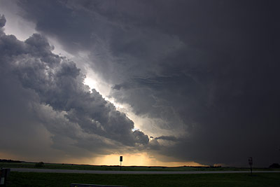
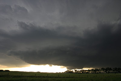
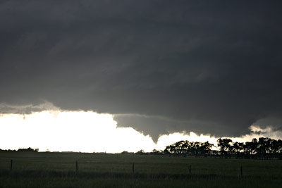
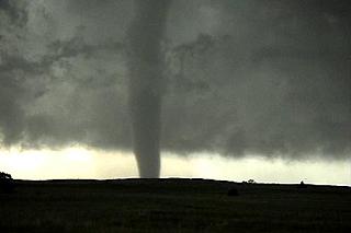
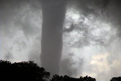
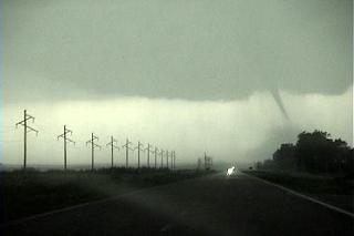
This is easily the best backlit tornado I've ever seen. Going to use a few video captures here.
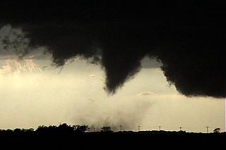
I think this was the first dust whirl. This is all shot from that one spot just south of 70 on 81.
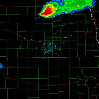
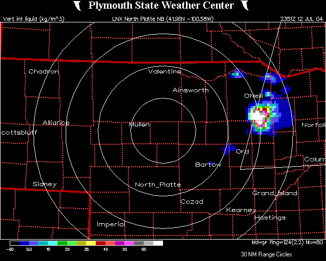
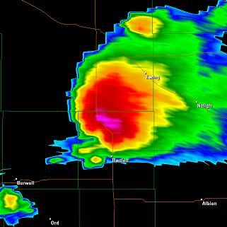
Just look how big this was on radar now!
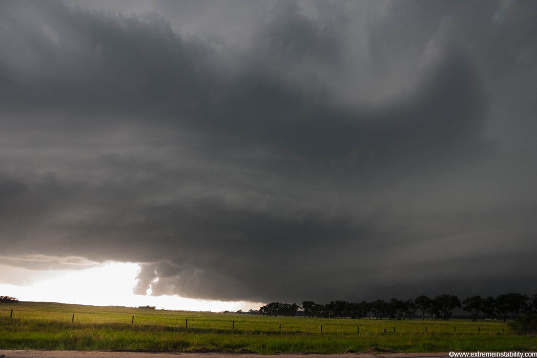
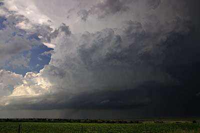
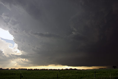
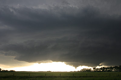
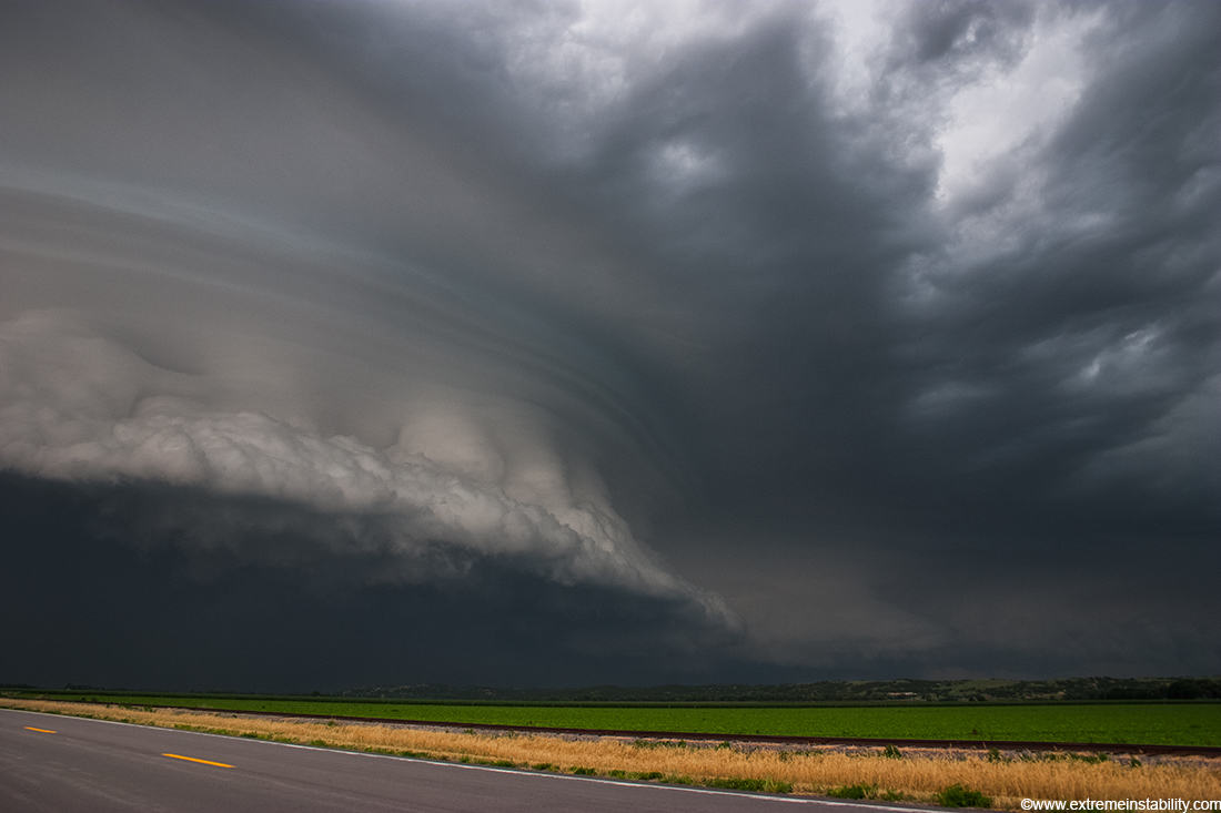
Most of these stills are at 18mm. Look how rounded the storm is with the wall of inflow stretching east of it. This e-w inflow area was crazy. It was this tall inflow mass running east of the storm. It was really a convective beaver tail.
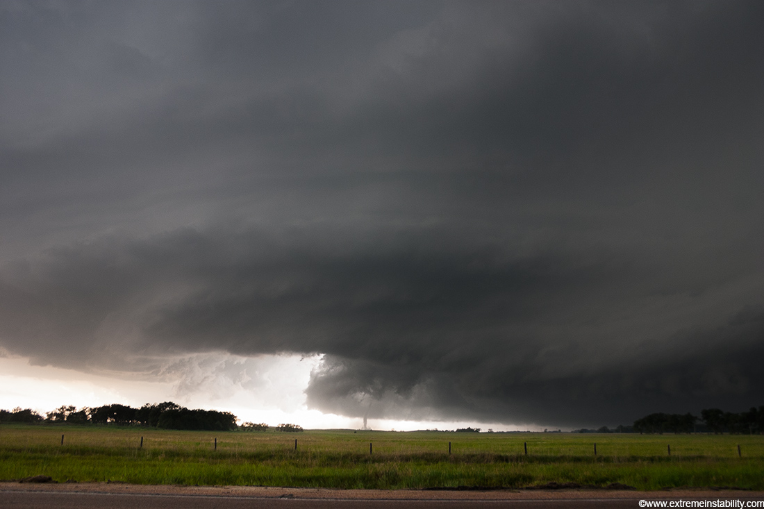
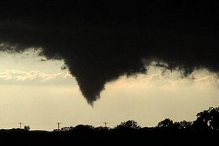
A snaky tornado forms rapidly. I have some pretty cool video of this from a more zoomed in perspective.
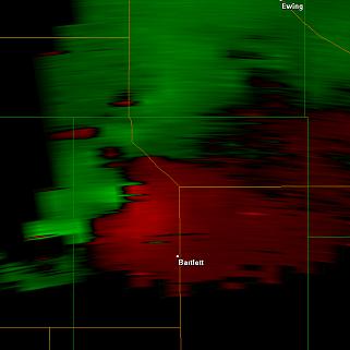
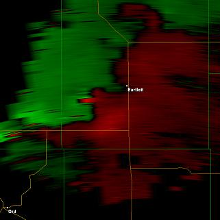
Velocity at 7:06, same time as the above radar grab. This is not very close to the radar and the lowest I could get was at about 14,000 feet.
Most of its life was in this state.
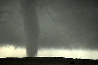
Cool lower vortex structure.
It starts to widen as I finally get some precip at my location. It was in this location just west like this for over 5 minutes, almost not moving at all.
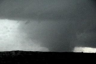
I leave after the rain kicks in and it turns into this very wide barrel. It is now moving a bit quicker and to the ssw or even sw. Somewhere in here it does take out 2 houses.
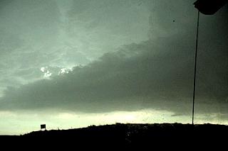
Same time frame as the above image. This storm was now amazingly large and has formed a strong infow tail pointint to the se.
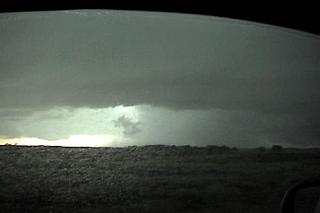
The tornado is likely still wrapped in there to the right of center. I turn west right about here and think I have a closer south option. The south option was not paved so I could either go back east into the rain-wrapped whatever or go further west.
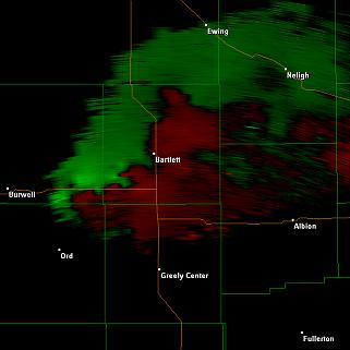
These two frames here are at the same time, 7:35. I can still only get down to around 14,000 feet but look at where the couplet is. It is very much surrounded by precip. This is at the same time that it was turning into the wedge and wrapping rain around itself.
I am pretty certain this is after I am south of it and going west. The weak couplet on the far left side of the image is likely the new tornado. It was getting interesting when I went west. I had put myself infront of the tornado in hopes to quickly drop south when I then see the new tornado to my west.

Time: 7:39
Time: 7:39
This tornado develops to my west and was going on at the same time as the large tornado, which was north of me now.
I'm now se of North Loup, and what a monster. It stopped its ssw direction and turns s, then se, then east now. I was not on it for a while wihle trying to change my course. I'm on it here and it was now racing se. I was doing 70 mph after I found the se highway and it was trying to pass me overhead.
Looking north as I have a chance to pull over finally.
Here is the view west from the same location. My stop here didn't last very long as it raced se.
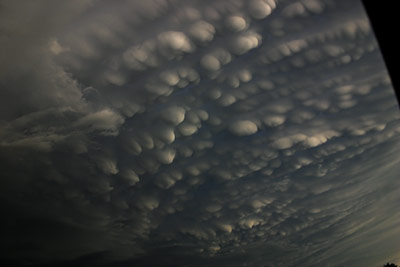
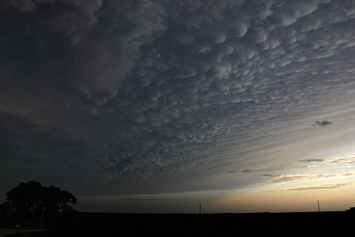
And to top it off, this was convering the entire sky.
NE usually has one of these southward moving supercells in July. It is hard to know which day it'll happen though. The conditions often don't seem very supportive but a storm goes and anchors on a n-s boundary and helps itself out shear wise. This storm only had 15-20 knots of westerly flow at 500mb. Had it not road this boundary ssw I imagine it would have never done all that it did.